Many of us participate in activities and sports that are at least somewhat dangerous. However, most of us also do not have a full appreciation of how risky these activities really are, especially compared to other things that we could be doing instead.
We just love our favorite pastime and facing up to its risks can be stressful because we also want to be safe while having fun. Psychologists call this type of stress “cognitive dissonance”, and we intuitively look for ways to remove the discomfort of our conflicting emotions, often by downplaying the risks to ourselves and to others.
E.g., when I became a glider pilot some 35 years ago, my instructors used to proclaim that “the most dangerous aspect of the sport is the drive to the airport”. This was a widely held belief at the time even though it could not have been further from the truth. And while the slogan was famously debunked by the prominent German pilot Bruno Gantenbrink in his speech “Safety comes first“, our instinct to downplay the risks to ourselves (and to others) has of course remained.
Given our natural inclination to deceive ourselves, it is not surprising that good data about the factual risks of many activities can be difficult to come by. And even if data are reported, they are often accompanied by statements that soften, blur, or contradict the facts, frequently through the use of misleading comparisons.
Here is just one such example from scuba diving in which the author asserts that scuba diving is safer than driving a car. She does this by comparing the statistic that 1 in 5,555 people were killed in a car accident in 2008 with the statistic that only 1 out of 212,000 dives ended deadly. Did you catch the fundamental flaw? The comparison would be ok only if each driver would drive just once a year. In reality, each driver makes on average 2 trips per day, i.e. 730 car trips per year, which means that the 5,555 drivers drove in aggregate about 4 million times (5555*730). I.e., 1 in 4,000,000 drives ended deadly vs 1 in 212,000 dives. By this – still not perfect, but definitely more comparable – measure diving isn’t safer than driving but instead about 19x more dangerous! No matter the sport or activity, you’ll quickly find similar examples of apples to oranges comparisons and a conscious or subconscious attempt to downplay the risks.
When I looked for data on risky sports and activities, I also found the other extreme: a Google search will return plenty of articles listing “the most dangerous sports in the world,” almost all of which try to make most sports sound insanely dangerous. However, more often than not these articles are just click-bait to generate ad revenue and lack any serious effort to get to the facts. Even the most well-intentioned ones that actually quote their sources tend to suffer from one of two major problems: either they lack a common denominator and therefore compare stats that are just not comparable; or they use a denominator that isn’t all that meaningful such as the general population while ignoring the differences in participation rates among different sports.
I wanted to know the honest truth and so I set out to do the research myself. The most important decision that I had to make at the outset was to select the most appropriate basis of comparison and hence, what denominator to use. I concluded that the most meaningful datapoint to me is the risk of dying (and the risk of getting injured) per hour of participating in a particular activity. There are two reasons I picked this risk per participation hour as the most sensible base of comparison: First, it allows me to compare different choices for my spare time, e.g., the risk of spending an afternoon riding a mountain bike vs the risk of spending the same afternoon flying a sailplane. Second, it gives me a sense of how serious the risk really is and therefore how carefully I should prepare to mitigate it.
The graphic that we’ll get to below shows what I came up with. To facilitate the readability of the comparison, I benchmarked all activities against traveling on commercial airlines, which happens to be one of the safest things you can do when you leave your home: only once in 10 million passenger hours (i.e., once in 1,141 years) will a passenger die when traveling on a commercial airline. In other words, the chance of a person dying within their next 1,000 participation hours is only 0.01%.
Other activities that I participate in regularly such as driving, cycling, skiing (on and off piste), or marathon running aren’t nearly as safe as traveling on an airliner but they are still quite safe.
Unfortunately, my favorite sport, flying sailplanes, aka soaring, is one of the more dangerous activities. There are no reliable participation data available for the US but I found quite solid information for Germany and France where soaring is much more practiced than in the US. In both countries the sport has a fatality rate of 1 in 50,000 participation hours; i.e., the risk of dying within the next 1,000 hours of participation is 2%, about twice as high as the risk involved in riding motorcycles. It also means that an active pilot, who flies about 100 hours per season, has a 1 in 50 chance of dying in the sport within the next decade, and it makes soaring about 200 times more dangerous as traveling on a commercial jet. Other air sports tend to have similar risks: flying powered airplanes is just a little bit safer whereas hang-gliding and paragliding are somewhat more dangerous.
Some of the data surprised me. E.g., I found driving, skiing, and cycling to be safer that I expected, whereas climbing the Tetons and especially Mt Everest is actually much more dangerous than I anticipated. Not surprising to me was the insanely high risk involved in Base Jumping, which is shown to be 480,000 times more dangerous than commercial aviation, with an expected death per 21 hours of participation, and practically no chance at all to survive the next 1,000 hours of flying through the air. If you’re a Base Jumper you are likely to complain that my methodology of counting only the short duration of the jump (and, e.g., not the time you spend climbing up the mountain) puts your sport into an unfair light. To that I say feel free to count differently if you want to convince yourself that jumping is safer than it really is. As I pointed out above, you certainly won’t be alone in your desire to deceive yourself.
Unfortunately, all the information in the chart below only refers to the risk of death and does not account for the risk of injuries. The reason is simply the fact that data about injuries are extremely unreliable since the great majority of sport injuries are never reported and/or accounted as such. (The omission of injury information also means that activities that tend to have a relatively high injury to death ratio (e.g. skiing, equestrian eventing, marathon running, riding motorcycles, hang gliding, paragliding, downhill mountain biking) might look relatively safer than they really are, and activities that have a relatively low injury to death ratio (e.g. general aviation, soaring, skydiving) might appear relatively more dangerous than they really are.)
Without further ado, here is the chart:
Another way to look at the same data is to compare them to the normal risk of dying (of any cause) at different life stages. Life insurance companies keep track of these risks as they seek to adjust their premiums based on the age of the insured. It should be intuitive that an 18 year old person has a much lower risk of dying within their next 1,000 life-hours than a 90 year old.
Below is a chart that shows how this normal risk of death increases as you get older. E.g, the odds that an average 18-year-old American male will die within their next 1,000 life-hours is about 0.01%. This happens to be exactly the same odds as traveling on a commercial airliner, once again illustrating how save commercial air travel has become. A 90-year-old male, by comparison, has a 1.9% chance of dying within their next 1,000 life hours. You can see how the slope of the curve remains fairly flat until the age of 50, and how it really steepens around 75. If someone manages to survive until the age of 119, their odds of dying within the next 1,000 life-hours will have risen to 10.2%.
(The source of this information is the US Social Security Administration. Note that they report the risk of dying within the next year, which I converted to the risk within the next 1,000 life hours, i.e. 41.7 days. Note also that the risk level tends to be slightly lower for females since their life expectancy is higher, but for our purposes the gender differences are negligible.)
So how do the risks of the various activities compare relative to the normal day-to-day risk of dying at different ages?
To illustrate this, I placed the activity icons onto the same chart (see below). Once again, you see that commercial air travel is the safest of these activities. Driving, skiing, cycling, back-country skiing, and marathon running are all along the relatively flat part of the curve. The risk of dying per hour when swimming in open waters or while participating in equestrian eventing is about 0.3%, equivalent to the risk that an average 71 year-old person faces in their day-to-day life.
As you move right and up along the curve, the risk level increases much more noticeably. Scuba diving is about as dangerous as being 80 years old, and motorcycling corresponds to the normal risk of being 85. Several air sports come next: general aviation, flying sailplanes, hang gliding, and paragliding. Each of these is about as risky as the normal lives of people aged 88 to 95. Downhill mountain biking also falls into this category.
As you continue further up the slope you can see two outliers: skydiving is about as dangerous as the normal life of a 107 year-old and climbing the Tetons is about as dangerous as being 119 yeas of age.
Three activities from the initial graphic above are still missing: Formula 1 racing, Climbing Mt. Everest, and Base Jumping. The dangers of these three sports are so great they are literally off the chart because the Social Security Administration does not compute death risk statistics for anyone older than 119. (You probably don’t know anyone of that age either.) Since Formula 1 racing is about 2x as dangerous as Climbing the Tetons and Climbing Everest is another 2x as dangerous, you can roughly imagine how high up the risk curve you have to go. With Base Jumping even that becomes impossible: it is more than 100x more dangerous than climbing Mt. Everest!
Why put all this information together? I believe we should all be fully aware of the risks that we take, and that we should let our awareness of these risks be an incentive to take the appropriate preparations and precautions to reduce these risks as much as possible. Most of the fatal accidents in sports are at least in part the result of human error and could have been avoided. If we close our eyes to the risks (as we are naturally inclined to do in order to remove this pesky thing called cognitive dissonance), we are also unlikely to do what it takes to keep the risks contained.
Commercial aviation is a great example that risk mitigation really works. After the invention of powered flight in 1903, flying was certainly one of the most dangerous things humans could possibly do. Gradually and over time, this risk has been reduced to such an extent that commercial air travel is now one of the safest things we participate in.
The concrete risks and the strategies for risk mitigation are obviously quite specific to each of the different activities and discussing them is beyond the scope of this article. But risk mitigation strategies do exist for all activities and deploying them deliberately and consistently can be very effective (for some activities probably more so than for others). If you do something that is objectively dangerous (and now you know that it is), learning about these strategies and taking them seriously can truly help you stay alive.
Before the arrival of the cold front: fantastic fall-thermal soaring conditions along the Front Range.
This past Wednesday was a great fall soaring day. Initially I struggled off tow for a while, but once I got up above the inversion I had a great and easy flight in strong convergence and thermal lift along the Front Range, covering 350km in about 3 hours. Cloud bases were around 20,000 feet and the best thermals produced climb rates of up to 10 kts average. Not bad for October!
This was before the cold front arrived. I had not expected it until late in the evening but luckily I could see it coming just as I was planning to return to Boulder: the wind had been blowing from the southwest all day when I noticed a wall of dust rapidly moving in the opposite direction. When I first spotted it, I was flying over the foothills west of the field, and the front was just north of Longmont heading south. I accelerated my descent and landed safely in completely calm conditions. 10 minutes later the wind kicked up sharply and the temperature began to plummet.
CX wasn’t so lucky. He arrived back in Boulder about 30 minutes after the front moved in. Strong gusty winds were blowing from the north. AWOS reported 20 kts on the ground, gusting to 31. Boulder only has an east-west runway so CX was faced with a cross-wind landing in very challenging conditions.
Here’s what it looked like from the ground:
This was perfectly executed. Well done! (The video quality is not great but it’s definitely worth watching.) Note how he pulled right to his normal parking position 🙂
I also downloaded CX’s flight trace and took a closer look at the landing pattern.
CX began the “downwind” leg at 8,500 feet. That is 3,200 AGL (!) (The typical altitude at this point is less than 1,000 AGL.) 3,000 AGL might seem excessively high but extreme sink in the pattern is always a possibility in these conditions and the extra height allows the pilot to fly a bigger pattern, align with the runway sooner, avoid turning close to the ground, and it provides more energy reserves to maintain a greater speed in order to deal with extreme turbulence and other potential hazards. CX chose to fly an approach to G26. This is the best option when the wind is from the north because it allows the pilot to avoid landing next to buildings and vegetation that are located along the western half of the runway and could cause additional turbulence. (Before entering the pattern, the pilot also pulled the straps as tightly as possible.)CX used the high altitude to fly a much wider pattern than usual and to maintain a much higher airspeed. The trace shows CX turning base to final about 2 miles east of the runway at an altitude of 6,100 feet (800 AGL). The ground speed is 120 kts (!), presumable reflecting an airspeed of about 80-90 kts and a tailwind of 30-40 kts. The turn looks much shallower than it actually was: the wind drift is very significant and a relatively steep bank angle was required during the final 90 degree turn.3,000 feet before the threshold, CX is aligned with runway at an altitude of 300 feet AGL and a groundspeed of 85 kts. The airspeed must be somewhat higher to compensate for the cross-wind. (This is about where the video begins.)CX reaches the runway threshold at 50-100 feet AGL. The ground speed is 70kts, the airspeed is still somewhat higher (presumably around 75-80 kts). The glider is still perfectly aligned with the runway. If you re-watch the video, you’ll also notice how CX is careful to always keep the right wing (on the windward side) slightly lower than the left wing. (This helps the pilot maintain direction and also prevents the wind from rolling the glider to the left.) The video also shows that the glider appears to be much more stable and easier to control as soon as it enters ground effect.CX flares perfectly and touches down just before the first buildings at a ground speed of 42 kts. The touch down location minimizes the risk of turbulence in the lee of buildings and vegetation along Independence Road. CX chose to land on the dirt runway to have more room to maneuver if necessary. Landing in the dirt may also reduce potential sideway forces at the point of touch-down.
PS: The pilot is one of the most experienced cross-country pilots in the United States. In the video, the landing looked almost like a non-event. This impression is amplified by the fact that he was able to roll right up to his normal parking spot, stopping precisely where he intended to (and where he always does). The flight trace, however, tells a very different story and illustrates very well how unusual and challenging the conditions were. Most importantly, it shows the mitigating actions that CX took to minimize the risks associated with these conditions (much higher pattern entry, much wider pattern, much higher airspeed, always keeping the upwind wing slightly lower, choice of runway and touchdown point).
So, here’s a quick wave flying refresher checklist:
Know how wave theory works – it’s imperative to have a solid mental model of the wave when you suddenly need to get out of 2500 fpm sink. Will you know where to point the nose?
Remember the lessons from hypoxia training. What are your first symptoms? Will you be able to recognize them? If you have not taken a training class, I highly recommend it.
Dress very, very warmly – it gets effing cold up there, even if the temps on the ground are nice. Look up the forecast temperatures at altitude.
Carefully study the weather that’s forecast throughout the day. Know the strength and direction of the wind at different altitudes. Know the moisture content of the air at different levels – will there be rotor/lenticular clouds? Know the projected location of the wave bars throughout the day and the strength of the projected lift and sink. Also know that reality can and probably will be different. Here’s an overview of weather forecasting tools for Boulder.
Avoid flying when the winds are too strong, for the turbulence can be too violent. Good climb rates can be found if winds are moderate – cruising speeds can then be even higher than in very strong winds as the necessary crab angle to stay in lift will be lower.
Know the rough air speed of your glider for the air in the rotor zone will be rough. Know where to expect rough air and slow down before you get there! Also, remember that rotor turbulence might suddenly surprise you even when you fly in laminar flow at high altitudes. (I have experienced rotor turbulence at 17,500 feet.)
Know Vne of your glider at high altitudes. (Remember, flutter is a function of TAS, not IAS, so your indicated airspeed limit gets lower as you climb higher). Also know the maximum air speed for deploying the spoilers and how to do it when flying fast (very carefully) – you may need them to avoid getting sucked up into Class A airspace.
Double check the oxygen system before you take off.
Practice slack line removal. Slack lines will form on tow and can be severe.
Pull all straps very tight and safely store all objects in the cockpit that could fly around (because they will). Do this again before exiting the laminar flow and returning to the rotor zone.
Remember that the flying technique to climb in rotor lift and in wave lift is completely different from flying in thermals. If you don’t know what it is, study the theory first, then apply it. The theory works!
Remember that wave bar transitions into the wind cost a lot of altitude (because they take much longer and you have to fly very fast). You can easily lose 6000 to 8000 feet in 3-4 minutes as you push into the wind. Be prepared for this. If possible, fly transitions where there are no clouds – the sink rate may be much lower. (Wave transitions with the wind are usually quick and the altitude loss is often a small fraction compared to upwind transitions.)
Know how to stay out of clouds. Depending on your crab angle and the strength of the wind you might be drifting backwards relative to the ground and clouds can suddenly engulf you from behind if you’re not careful. (Not only will you not see anything, the glider can also immediately take on a layer of ice.) Rotor clouds can form within seconds where none have been before. Clouds can also close up below you while you are flying above. Always, always pay very close attention to what is happening and descend before it is too late!
Reflect on the glide angle on final approach with spoilers fully open – then imagine what it would look like when the glide angle is twice as steep. This is about what to expect in 2000 fpm sink between wave bars. Keep this in mind when you consider the altitude necessary to reach a safe landing spot.
Here are some additional considerations specifically for Boulder:
When wave flying from Boulder, it’s useful to review typical Boulder wave routes. Since wave lift forms mainly in relation to the topography and the strength of the wind, it is usually found in the same places. Knowing where others have found lift before can be of help.
If you’re heading west over the foothills, e.g. when transitioning from the secondary to the primary wave bar (which tends to be anywhere between the Hogback and the Peak-to-Peak Highway), remember to maintain a safety altitude much (!) higher than what would be necessary in the same location during thermal soaring conditions.
Before you initiate an upwind wave bar transition it is imperative that you decide upfront how much altitude you are prepared to lose before you connect with lift again. I.e., you must decide upfront at what altitude you will turn around if you are not climbing again. It is impossible to know in advance how much height you will lose during the transition and therefore you must calculate and decide your turnaround altitude in advance as necessary to always keep a safe landing place within reach! I repeat: you must do this before you begin the transition! Once you are pushing forward you may be losing 2000-3000 ft per minute, and the ground, which seemed so far below a minute earlier, will be approaching very quickly. This is not a good time to do math! Treat your predetermined altitude as a “hard deck”, in other words, once you are down to your preset decision altitude, you will turn around and not continue to push forward! This particular flight, where I lost 6,000 feet (from 17,500 to 11,500) at a maximum sink rate of 29 kts (2,900 fpm) during a 3 minute long upwind transition flown at 85 kts IAS in a Schweitzer 1-34 into a 40+ kt headwind, provides a good illustration of this concept.
This chart shows the trace of this particular flight. The glider icon is in the middle of the wave transition as I pushed west into a 40 kt headwind to get from the secondary wave bar to the primary which was located over the lower foothills. The altitude graph below shows the 6000 ft of altitude lost during this 3-minute long transition.
Even on strong wave days the air at the airport in Boulder is often calm in the morning due to a strong ground inversion. This often allows for uneventful takeoffs in easterly direction. Around noon, sometimes later in the day, sometimes never, the winds turn west at the surface. Westwind takeoffs in rotor conditions can be dangerous and are definitely not for the faint of heart. Landing into westerly winds is usually ok but it is imperative to arrive at the pattern with plenty of altitude and to maintain extra airspeed throughout the pattern to deal with wind shear and turbulence. If rotors touch down near the field there can be extreme sink in the pattern. Fly a close pattern and a steep final approach so you always have extra energy available. If there is a northerly crosswind component, it is good to touch down before MHG to minimize the risk of additional turbulence from buildings and vegetation along Independence Road.
Remember that there are no good places to land over the foothills, i.e. maintaining a safe escape route towards Boulder (or another safe landing area) must be the number one priority. However, if you made a mistake and have no choice but to land in the foothills, it is always good to know the few emergency fields that do exist. These may not be good enough for you and your glider to remain unscathed but they should be good enough to safe your life. Last week I checked out one of these fields that is directly along the Peak to Peak Highway between Nederland and Boulder (see pictures below).
South Sourdough Trailhead Field. The field gets occasionally mowed. During my last visit only a small area to the east was freshly mowed. The grass on the rest of the field was about 10 inches tall. The field slopes slightly up towards the northwest – landing is best in this direction, wind permitting. In west wind conditions there may be hazardous turbulence along the line of tall trees. There is an access road from the Parking Lot on the west side of the Peak to Peak Highway.Screenshot from Google Maps. The field is about 1300 feet long and is located 2.5 miles southeast of Niwot Ridge directly along the Peak to Peak Highway between Ward and Nederland. Route 116 is a spur road from the Peak to Peak Highway to the South Sourdough Trailhead, hence the name.
Yesterday was my sixth attempt to complete a Diamond Distance task. The basic requirement is a pre-declared 500km task with up to three turn-points. My strategy for setting these types of tasks has improved over time. I now adhere to the following principles:
Select a task area that provides the best soaring weather over the course of the day. Some parts of the task area might work best in the morning and other parts might work best in the afternoon. Thermal height and depth, thermal strength, convergence lines, development of cumulus clouds, over-development risk, wind direction and speed at different altitudes, buoyancy/shear – all of these things matter, and I try to account for all of these factors. I predominantly rely on Skysight for providing the forecast because it makes it easy to examine all factors for the entire task area throughout the day.
Place the first and second turn point furthest away from Boulder and place the third turn-point closer to home such that the last part of the flight can be flown within glide range of Boulder. This drastically reduces the likelihood of having to land out when the day might die towards the end.
Pick accessible turn-points. I.e., avoid turn points that might be difficult to reach, such as high mountain peaks. Each turn point should also be in an area of forecast lift at the approximate time or rounding it.
Ensure accessible landing places along each task leg. The spacing of these is most critical early and late in the day. The part of the task that lies during the best part of the soaring day (approx. between 1pm to 4pm) can be the most challenging.
Yesterday’s task adhered to these principles.
The task line is shown in blue and the turn points are marked in red by 45 degree sectors.
The Start point was at Nugget Ridge as I planned to take a northwest tow and Nugget Ridge is right on the typical tow route in the morning. Putting the start to the north while my first TP was in the south would also ensure that I would be in close proximity to the airport as I would try to get underway. Thanks to Pedja Bogdanovich for this tip!
I set my first TP at Woodland Park, a few miles north of Pikes Peak. Skysight forecast a convergence line to the south in the morning along the foothills, and the first cumuli were projected along that line. Cloud bases – which were generally a bit lower than I liked – were forecast to be higher to the south than to the north. Also, the south was projected to be less windy. (Strong winds can shear off the thermals, making it harder to climb.) Perry Park was my go-to landing spot on the southbound leg.
My second TP was at Toponas, due west of Boulder. This would make for a challenging second leg across some difficult terrain but the route was supported by the forecast and my fall back plan was to go back north along the convergence before heading west. Potential landing spots were Perry Park, Henderson Ranch (in the nw corner of South Park – thanks to Tom Z), some fields north of Silverthorne, the airport in Kremmling, as well as some fields near Toponas. While the second leg was the longest, it would not increase my distance from Boulder.
My third TP was Squaw Mountain, located south of Idaho Springs on the ridge that extends from Mt. Evans towards the northeast. I have often found lift in this area even in west wind conditions (however, you do not want to get any closer to Mt. Evans on the lee side on west wind days). Kremmling and Granby would be easy-to-reach landing spots west of the divide on this leg should a land out become inevitable. Squaw Mountain is already relatively close to Boulder and 13k feet would put me in glide range.
I set my Finish at Kenny Mountain, east of the Twin Sisters. This ensured that my entire last leg could be flown within glide range of Boulder. (I would have to round Kenny at 11k+ feet to have Boulder in final glide. Having the finish point away from the airport (but within final glide) has the side benefit that rounding it would invariably ensure compliance with SSA rules for Diamond Distance tasks. These rules require that the finish altitude is not more than 1000m below start altitude.)
Total task distance was 312.1 miles or 502.2 km (plus the final return to Boulder).
First Leg
Fortunately the day started early and there was no need for a big mountain tow. I took off at 11:12 am, released at 11:21 and flew across the Start line at 11:30, at an altitude of 11,000 feet.
Having my first leg pass the airport meant I could get going on course without first having to climb up high.
I released right above the entrance to Left Hand Canyon. After a few turns I flew across the Start Line on Nugget Ridge and headed out south.
There was good lift along much of the first leg even though I chose to fly in thermals several miles west of the convergence line because the cloud bases were significantly higher than along the convergence. Following the convergence might have been a bit faster but keeping a good altitude was more important to me along this stretch because there are very few landing options and the only good one is the private airfield of Perry Park.
It was nice having (unplanned) company on this first leg. 5K was heading to Pikes Peak and both of us left Boulder at about the same time. Flying side by side at times helped to see as to who had the better line.
My flight trace is shown in red. 5K is shown in light blue. We parted ways south of Deckers when I left the lift line to round my turn point at Woodland Park while 5K stopped to climb, heading to Pikes Peak.
I averaged 81kph on this 128 km leg and rounded Woodland Park at 12:56pm.
Turning Woodland Park.
Second Leg
Looking ahead after turning Woodland Park the second leg seemed daunting. The distance to Toponas was almost 200 km, much of it across challenging terrain and tall mountains. The cloud bases were still relatively low, around 16,000 feet. This may seem quite high for those used to flying at lower altitudes, but it really isn’t when considering that much of my direct route ahead led over unlandable terrain between 10,000 and 13,000 feet.
The area north of Woodland Park is a bit lower but that makes it all the more insidious. There are no places to land and there is an elevated ridge to the east (and to the west). It is imperative to maintain an altitude that allows clearing the eastern ridge to glide out to Perry Park. The further west one flies, the higher one has to be. I scared myself once before in this area and was determined not to let it happen again.
This screenshot captures my flight trace north of Deckers as I am trying to stay on course. You may notice my erratic-looking flight trace with a hook to the right (east) at the top. The ridge to the east is between 9000 and 10000 feet tall and being able to clear it at all times is essential to staying safe. You can see why following the course line takes you further away from the plains and requires additional altitude. My altitude dropped below 14,000 and in response I turned east to get closer to the plains. This is why cloud bases of 16,000 in this area should be considered relatively “low”.
I quickly found some good climbs back to cloud base and got myself back on course, passing Mount Evans on the west side.
Passing Mt. Evans and heading towards Silverthorne (Evans is the tall mountain to the right of the flight trace. Silverthorne lies in the valley ahead.) It is easy to see that cloud bases of 16k are uncomfortably low in this area.
Unfortunately, the cloud bases had still not risen much beyond 16k feet. I made it to the ridge south of Keystone Mountain and then stopped, milling around in middling lift unsure what to do. There were some clouds ahead but they did not look reliable. I could definitely glide ahead towards Silverthorne but I was concerned that I might get stuck in the valley.
Circling near Keystone Mountain east of Breckenridge. The western flank of Mount Evans is center right in the background. A glimpse of the Flatirons, 45 miles away, is visible on the horizon in the distance on the left.
I also wondered about the impact that Dillon Reservoir would have on the thermals. Ironically, the best looking cloud seemed to be right above the lake. I was not willing to trust it. There was a 12-16kt southwesterly wind at my altitude so I figured I might be able to ridge soar along the south-west facing slopes of the Ptarmigan Range north of Silverthorne if I could get there close to the top of the ridge line. Which seemed possible, although by no means certain. I also considered the potential impact of Eagle’s Nest Ridge, upwind of the Ptarmigan Range. This ridge was even higher and I figured it might mess with the wind direction. It could also mean lee side turbulence and sink. The more I thought about it, the more uncomfortable I became.
Dillon Reservoir is in the upper left. The valley beyond the reservoir in the distance leads directly to Kremmling.
So after a lot of hesitation, evaluation, and considering my options, caution prevailed and I decided to return to the east of the Front Range. I remembered what I learned in Austria: when flying in big mountains, especially ones that one is not intimately familiar with, it is always best to stay well above the ridges. I was not certain that I could do that. Maybe cloud bases of 16k were simply not enough for my first trip to the west…
Returning to the Front Range. Georgetown along I-70 is in the valley below. The Front Range is straight ahead. Longs Peak is visible in the distance.
I crossed over Mt Bierstadt and Mount Evans, heading north towards the Divide. Just before I got to Winter Park, I spotted my opportunity: a line of clouds had developed in westerly direction. I had just climbed to almost 17,000 ft, i.e., cloud bases were finally rising. The airport of Granby was within glide range. No mountain ridges were in the way. I had wasted some time but it was still early enough in the day. There were no more excuses. And with that I resolved to jump to the west.
The moment I decided to make the jump to the west. The divide is still a few miles ahead. Granby is at the bottom of the valley towards the right.
Crossing the Divide was a big moment. It felt daunting and liberating at the same time with the former gradually giving way to the latter. I reached full acceptance once the distance to the divide had increased to the point where gliding right back was no longer possible without gaining altitude first. At that point I just focused on one thing: progressing forward and not run out of time.
Whenever you fly over new terrain your inclination – rightfully so – is to stay high. But staying high also comes at the cost of being somewhat slow. Centering thermals takes time. Centering and climbing in weak thermals takes even more time. Centering and climbing in weak thermals while going into a headwind is even worse. I was wondering: how high is the working band? How low can I afford to get without having to spend even more time digging myself out. These were questions that had no answers for me. So whenever I found reasonable-seeming lift I turned at least to test it.
Fortunately the terrain between the Divide and Kremmling looks a lot more hospitable than the terrain over the foothills. If the clouds are high enough you can easily keep an airport (first Granby, then Kremmling) in glide. And even in the worst case of hitting massive sink – which actually seems a lot less likely given that the terrain is more mellow – there are often some farmers’ fields around where putting the glider down safely seems possible.
I managed to stay high enough to never get out of glide range of an airport. This saved me a lot of stress albeit at the cost of speed. One hour after crossing the Divide I finally got my turn point in view, still 15 miles away. I had expected a little town but all I could make out from the distance was a road intersection.
The immediate issue at hand was that I had almost reached the end of the clouds before a significant blue hole above the lower terrain to the west. I tried each of the last remaining three little clouds and finally found a good climb to cloud base under the last one allowing me to head out into the blue, round the turn point and stay within easy glide of Kremmling the whole time.
Rounding Toponas
I rounded Toponas at 4:16 PM. The Divide looked very far away. But the sky ahead looked great, considerably better than on the outbound leg. I was hoping it would stay this way for a while for I had a lot of ground to cover. Looking at the clouds I was pondering which of the two most promising lines to take.
A few minutes after rounding Toponas. Very nice looking clouds beckon ahead, promising quick progress on the return. Kremmling (not visible) is in the valley beyond the hills in the foreground. The Continental Divide is far away, barely visible on the horizon.
The southerly line (the one to the right of the nose in the picture above) was better aligned with my 3rd turn point but it would keep me on the west side of the Divide for longer. The northerly line (the one to the left of the nose) went directly towards Granby and the nearest point on the Divide. My number one goal at this point was to make it back over the Divide, my number two goal was to complete my task. I chose the northerly line.
The town of Kremmling is below, surrounding the airport. The Divide is now better visible on the horizon. The scenery was just beautiful.
A dark flat-bottomed cloud slightly north of Kremmling promised compelling lift. I figured it would be worthy of a small detour.
The cloud that promised delivered. If every climb had been like this, I would have been around the course in half the time!
Thanks to lift like this and the wind in my back, progress on the return was blazingly fast. Even despite little mistakes like the one in the picture below.
As I followed the line in front I could readily see that the cloud straight ahead was decaying. I should have detoured around it via the cloud to it’s right. Instead I held course and was rewarded with substantial sink under the dying cumulus.
Only 40 minutes after rounding Toponas I was already approaching the Continental Divide.
Close to cloud base it is often not easy to see the direction of the cloud streets. But the cloud shadows can be a dead giveaway like in this prime example. It was easy to see which way would get me over the Divide the fastest.The town of Granby and the airport are below on the right. Lake Granby features prominently in the center. Longs Peak is towering right behind.
These clouds were the best of the day. I barely had to stop for a circle or two. Most of the time I could just dolphin up in lift and then drop the nose to bridge the short gap to the next cloud.
Beautiful view of the Divide from the west in late afternoon sunshine. Longs Peak is on the horizon to the left.
Approaching the Divide was a non-event and although it was already 5:15 pm, the day was still looking great. Now my mind could start to focus on something else: was it still possible to complete the task? I had another 110 kilometers to go.
A big blue hole greeted me as I crossed the Divide via Mt. Neva. The air on the east was very turbulent and I hit massive lee-side sink. I pushed the nose down, accelerated to 90+ kts and headed straight to the nearest spot along a long cloud street that seemed to stretch from Longmont towards Berthoud Pass but then turned away from the Divide towards Idaho Springs and continued in south easterly direction beyond.
As I approached the line I could readily see that it was generated by a convergence of different air masses. I connected with the line southwest of Rollinsville and immediately found myself in strong lift. After a few turns in turbulent rising air I continued southbound along the line.
This line seemed like a present from the powers to be: it was perfectly aligned to curve around towards my third turn point at Squaw Mountain.
Rounding Squaw Mountain, my third turn point.
I turned Squaw Mountain at 5:33 pm with another 70 kilometers to go to the Finish at Kenny Mountain.
Instead of heading straight to my goal in the north, I backtracked along the line I had just come from. This required an almost 40 degree deviation from the direct course line (see flight trace above) but it was most certainly the fastest route.
Without a single turn I continued to climb along the line, which allowed me to make rapid progress.
Cruising in straight flight along the powerful convergence line. Here I am on the final (northbound) leg south-west of Nederland. Barker Reservoir is about 8 miles ahead 15 degrees to the right of the nose.
I continued in straight flight along the line until I reached 16,000 feet near Gross Reservoir. I had 35 kilometers to go to my Finish Point at Kenny Mountain and from there another 20 kilometers to get back to Boulder. Barring some extreme sink event, I had more than enough altitude to complete the rest of my flight in a single glide and arrive back in Boulder with height to spare.
Flying past the Indian Peaks as the evening sun breaks through decaying cumulus clouds while I head north towards my finish point.
I told myself that it was still too early to get excited. My route would take me into the lee of the Twin Sisters. I still could not be certain.
Approaching Kenny Mountain – part of the rocky area right below the nose. Estes Park is further ahead.
The big sink did not come. At 3 minutes past 6pm I rounded my Finish Point with an altitude of 12,000 feet – 1,000 feet above my start altitude, and 1,500 feet higher than I needed to safely make it back to Boulder. It was a great moment.
Rounding Kenny Mountain: the 500km task is complete.
After five failed attempts, I finally had made my 500 km Diamond Distance. And it was in good style with my first excursion to the west of the Continental Divide.
There was still some lift as I’m returning to Boulder.
I hit a good line on the return to Boulder and had enough altitude to spare for a celebratory fly-by of the Flatirons before returning to the airport where I landed at 6:24 pm after 7 hours and 12 minutes in the air (my longest flight duration thus far).
My OLC flight distance based on optimized six legs was 564 km with an embedded FAI triangle of 439 km (also my biggest yet). One day later I also noticed that the flight was the highest scoring flight for the day worldwide with 651 points on OLC plus. The flight track is here.
Unexpectedly, my flight turned out to be the highest scoring flight for the day on OLC Plus worldwide. Granted it was a weekday with far reduced competition and I clearly benefited from outstanding soaring weather.
Lessons Learned
Don’t Give Up. It took me six attempts to make Diamond Distance. It’s eminently doable without taking any risks but it requires a really good day and a bit of luck. (My bit of luck was the perfectly aligned convergence line at the end of the day that allowed me to cruise to TP 3 and the Finish without turning.)
Yay to the West. The Continental Divide can be intimidating because it can get in your way on the return to Boulder. But flying in the west certainly isn’t any harder than it is in the east. And the terrain towards Kremmling is much more hospitable with better landing options and good low-traffic airports within easy reach. If you pick the right day – you want high cloud bases, good thermals, modest winds, and a low risk of over-development – then you’re set for a lot of flying fun.
The Height of the Cloud Bases Matters a Lot. Obviously this isn’t a new lesson but this flight really drove it home. You must always factor this into your flight planning.
Stay Above the Ridges. This is one of the main principles of early mountain flying that I was taught in Austria. Thermal lift is almost always best above the ridge lines. Ridge lift will work best at ridge top level but you have to be sure about the strength and direction of the wind. This is not a given because often the wind aligns with the direction of the valleys looking for the path of least resistance. Being on top of the ridges also gives you the best view, the smallest chance to get lost, and the widest choice of thermals to pick from. So in short, especially when flying across unfamiliar terrain, it is always best to stay well above the ridges.
Carefully Examine the Forecast for Good Lines and Select Lines Over Hospitable Terrain. Skysight correctly predicted the energy line to the west across Granby, Kremmling, and beyond. The line extended much further than I could even see. I’m pretty sure I could have kept going west for another 50 to 100 miles. (I just would have run out of day coming back). Lines that run over landable terrain with good airports are the best! The easiest starting point to find good energy lines in Skysight is by looking at projected XC speeds throughout the soaring day. This combines the forecast for thermal and convergence lift. You will then want to validate your choice by looking at cloud bases, thermal strength and a low Buoyancy/Shear ratio (indicated by “stipple” on the thermal strength chart).
My Flight Planning Strategy Worked (summarized at the beginning of this post). After five failed attempts I had learned from prior mistakes. If you plan your first long flights I recommend you adopt a similar approach to planning your route.
Fly Around Decaying Clouds. Expect to find sink underneath. A slight detour can be a better option, especially one that takes you across an actively developing cumulus.
Cloud Shadows Indicate Clouds Streets. When flying close to cloud base it can be impossible to see the direction of the street ahead. But the shadows on the ground are a great marker.
More Field Walking Is Required. On my next drive out west along I-70 I will want to check out a few fields north of Silverthorne. It was tempting to try soaring the ridge along the Ptarmigan Mountain but without having seen the fields at the bottom of that valley this was clearly a no-no. (I have researched several fields in this area via Google Maps but my degree of confidence in a field improves hugely after seeing it on the ground.)
How Do I Determine the Height of the Working Band? I could have flown much faster, especially on my leg to the west into the headwind, had I been more choosey about the thermals I picked. But this would have meant being comfortable getting lower before picking a thermal to climb in. Without experience in the area that I was flying in, I had no idea how low I could let myself get before having to worry about climbing back up. I still don’t know. If you have any tips, please let me know!
I’ve had a few days to ponder another failed Diamond Distance attempt on August 6 and reflect on what prompted me to abandon my task very early on a promising looking day.
The weather forecast was strong, particularly to the northwest, and I had set an ambitious task with the first turn point at Bridger Peak, 40 miles south of Rawlins WY, and halfway between the airports of Saratoga, WY and Dixon, WY. To get there I would have to cross the Continental Divide into North Park, fly across North Park and then continue along the next mountain range to the northwest. The direct air distance from Boulder is 125 miles. The road distance is more than twice that, and driving there takes about 5 1/2 hours.
Declared Task. The turn point on the upper left is Bridger Peak.
I had a good and early start after releasing from tow south of Coal Creek Canyon (between Boulder and Golden). I then climbed to 16,000 feet over the Flatirons, quickly crossed my start line and headed in north-westerly direction. It was still early in the day with few clouds. My immediate objective was to find a good spot to climb up to the Divide and then cross it at a location that would give me a safe passage into North Park. The best area for that seemed to be northwest of Estes Park.
A few miles to the east of the Twin Sisters I found a strong 6-7 kt climb to cloud base at 16,400 ft and headed west from there towards the Divide. Although the cloud bases were still relatively low, my last few climbs had been good and I felt fairly confident that I would find good lift as soon as I would reach the Divide. So far everything had been quite easy.
East of the Twin Sisters I found a strong climb that took me to cloud base at 16,400. This seemed sufficient to approach the divide. I was hoping for additional lift above the Twin Sisters and along the northern flank of Mt. Meeker and Longs Peak.
That’s when my troubles began. The 12 mile push through the lee cost me more altitude than I had expected and when I reached the Divide above Flattop Mountain my altitude had dropped by more than 3,000 feet. I was down to 13,200, which put me at only 900 feet above the ridge. I remember thinking, “there has to be a climb here” and, “what do I do if there isn’t”?
Flight track approaching the Divide. On this 12 miles stretch above high terrain I expected good air but only found sink. The glider icon is above Flattop Mountain, directly at the Divide, at 13,000 feet – 3,400 feet lower than I had been just 10 minutes earlier.
The airport of Granby was in glide range. But the conditions in the Granby Valley, which I could now see for the first time, looked unsoarable and cloud bases there were very low, probably well below 12,000 feet. I felt almost certain that diverting towards Granby would mean accepting a retrieve.
3D screen shot from the same position over Flattop Mountain at 13,000 MSL (900 ft AGL), looking towards Grand Lake and Lake Granby. Granby Airport is at 8,200 feet MSL – a fairly safe looking glide from this position (20 miles away).
The direction towards North Park looked much better but I first needed a good climb to get there.
Except for the escape route to Granby, 13,000 feet was not a comfortable altitude at my location. The nearest airport to the east was Vance Brand, 30 miles away and there was a lot of high terrain in the way. Fort Collins was 35 miles away, also with high terrain to clear east of Estes Park. I had to decide quickly what to do if I didn’t find a climb fast: turn west, which would almost certainly end with a landing in Granby, or turn back east, find lift or risk having to land in a field near Estes Park.
3D view towards Estes Park from above Flattop Mountain. You can see the high terrain east of Estes Park towards Fort Collins. The odds of clearing this terrain in straight glide from my position were fairly low and definitely not something to count on.
I still had a high degree of confidence in the thermal conditions to the east. And, very recently I walked a field at the base of Lumpy Ridge, less than 2 miles north of the town center of Estes Park. While I was not thrilled about the prospects of potentially having to end my flight there, I felt reasonably confident that I would be able land in that field without damaging the plane (or myself) if I really had to.
2D view of my position above Flattop Mountain. You can see the location of my emergency land-out field just north of the town of Estes Park.
All this went through my mind in the one minute that I flew along the ridge looking for lift. Lift did not come and I ran out of time. A decision had to be made: turn left to Granby and land or turn right towards Estes Park and look for a climb? I turned right.
I still remember vividly the moment when I had to make that decision. Was it a risky choice? Subjectively it felt that way. Objectively, it probably wasn’t. I was at 13,000 feet. The field in Estes is at 8,000 feet. That meant I had about 4,000 feet of altitude to work with before I would have to decide to land. 4,000 feet gave me about 20 minutes to look for lift, maybe more. I had found strong lift several times that morning already and the conditions in Estes did not look any worse than the ones I had been soaring in for the last hour. And I now had a plan B, i.e I knew where I would land if I had to.
I followed a sun-facing ridge line towards Estes and, fortunately, I only needed a little more than one minute of my 20 minute lift-searching-allowance before I found the climb I was looking for.
It only took 1 minute and 20 seconds from the moment I turned east to finding a climb right above the ridge that runs east from Flattop Mountain. Note the oddly shaped trace during the climb. The lower part shows wind drift from west to east and this changes about half-way through. This is a sign of strong wind-shear and ultimately explained why I would continue to struggle climbing near the Divide.
Eight minutes later I had climbed back to 14,800 feet and the world was once again a better place. But the climb had been odd: between 12,400 and 14,100 the wind drift had been from west to east, and from 14,100 to 14,800 I had to push west to stay in lift and the climb became very uneven. That also meant the average climb rate was only 3 kt, the worst of the day thus far.
I quickly put that aside, given that I could not be choosey in picking this climb and pushed west again. Determined not to get so low again, I tried to take the next climb but it was very windblown and difficult to center. This time, I only managed to average 2 kts but managed to climb to 15,700.
A few miles further west, I once again only found very poor lift, taking me from 15,000 to 15,600 and the climb rate was less than 1.5 kts. Then, another few miles further west, an even weaker climb topped out at 16,100. That was the highest I could go.
This 3D trace shows the sequence of weak, uneven and windblown thermals as I tried to gain enough altitude to comfortably push northwest into North Park. The last climb was more of a holding pattern as I tried to make up my mind whether I should continue or abandon the task.
I was clearly high enough to push into North Park and there were clouds on route but I hesitated. And hesitated. I could get there but would the lift be any better than my last 4 climbs, which were extremely poor and got worse as I moved west?
View into North Park from my position above Trail Ridge Road after my long slog to reach 16k. There seemed to be good clouds all across North Park but would they work better than the weak climbs I had just experienced? If I look at them now in retrospect I can only think, “of course they would have worked!” Clearly my judgment at the time of making the decision was clouded by “recency bias”.
The top of the Divide can be very windy and the thermals there are often weak and uneven. Maybe, even probably, the conditions would be better if I went on. But I did not know that. Would the clouds work? I wanted to try it and then return if they didn’t work as well as I hoped. But maybe I wouldn’t even be able to come back? In which case I would likely be landing in Walden.
On the horizon, exactly in the direction of my first turn point, I could now see a towering cumulonimbus cloud billowing up. It was only 12:30pm. That seemed like an early indication of potentially massive overdevelopment in the afternoon. The forecast had not projected any storms but what about this cloud? It certainly looked threatening. Forecasts have been wrong before.
This is a segment of the same picture as above. But now I had spotted the rose-colored cb at the far side of North Park, above the snow capped peak in the distance that were directly on route. In retrospect, I think my mind was trying to do some mental gymnastics looking for reasons that would provide a justification for not to go on…
Circle by circle I was going back and forth in my mind. Should I push on or should I return? I already had my dose of adrenalin earlier when I got low above the ridge. The probability of completing the task seemed like a coin-toss. Maybe it would work, maybe not. Another circle of indecision. Then another. And another.
Circling above Trail Ridge Road below, as I was trying to make up my mind.
I looked towards Granby again where conditions had markedly improved in the last 20 minutes but the bases were still lower than to the east and northwest and the cloud bottoms still weren’t particularly promising.
View towards Grand Lake and Lake Granby from Trail Ridge Road at close to 16k feet. The cloud base was clearly rising but the clouds still didn’t look compelling. (Flattop Mountain, where I was low earlier in the flight, is the level high ground at the left side of the picture above the wing.)
My mind had finally found enough reasons “against” pushing across. In the next circle, I exited towards the south, having abandoned my task.
After abandoning the task I flew along the west side of Longs Peak before crossing back to the east. The clouds in the distance towards the Flatirons (at the right edge of the picture) still looked very welcoming and that is also where I would find very good climbs again.
I went on and had a good flight on the east side of the Divide, but for the rest of the day I kept second guessing my decision. I watched the day improve. Cloud bases rose as one would expect. The weather never overdeveloped except for a few localized virga and showers. In hindsight, I am almost certain that completion of the task would have been possible. But you have to make these decision in the moment and with information available at the time.
To be clear, the decision to abandon the task was not due to a real or perceived safety risk. There was no question in my mind that I could reach the airport in Walden or at least another safe landing place. So the risk I was not willing to take was a sporting risk, not a safety risk. It was one of potential inconvenience: finding myself sitting on the ground in Walden, having to wait for a retrieve, if things didn’t work out.
The real question is of course: what will I do next time when completion seems uncertain? How confident do I have to be in my ability to complete my task? I must be honest: there will never be 100% certainty. Does it make sense to push on if the chance of completing the task is only 25%? Probably not. If the chance is 75%? Probably. If it is 50%? I still don’t know.
13k MSL Can Be Really Low. It always depends on where you are relative to safe landing places and any terrain in between. 13k above the Divide west of Estes Park is too low for comfort. I should not let this happen again.
Walking Fields Pays Off. Having walked the field at the bottom of Lumpy Ridge, I knew where to find it and how to fly an approach if I needed to. This gave me the confidence to look for lift where I was almost sure to find it, and the clarity of thought to look for it without stressing out over whether or not I would be able to glide out to the prairie. Had I not known this field, diverting to Granby would have been my only viable choice.
Don’t Ever Get Into a Marginal Situation without a Pre-Decided Plan B. When I approached the Divide I was so confident that I would find lift on top that I had not pre-decided what I would do if I that did not materialize. So I only had one minute to consider my options. This felt too short and too stressful. It’s best to make a Plan B while you still have a lot of options so you just have to execute what you already decided. (This is no different to the decision of what to do in case of a rope break or any other emergency situation. Don’t wait to decide what to do when it happens. You must know what to do in advance.)
Don’t let your most recent experience in a small area cloud your judgement (recency bias). The day started very strong with solid, reliable climbs along the foothills. When the small area immediately next to the Divide did not work well, I lost confidence in the conditions across the divide as well. Similarly, I did not anticipate that the Divide would not work because I had found such great lift over the foothills. I must try to avoid falling victim of recency bias.
Learn to better differentiate between safety risks and sporting risks. These are very different things. Never take safety risks.
Pre-declare (to yourself) the level of sporting risk you are willing to take. Landing back at home is never 100% certain on a XC flight. It may be useful to pre-declare before the flight the land-out probability you are willing to take. E.g., “Today I am willing to accept a 30% land-out probability.” Then you can reflect during the flight what you believe the odds of landing out are if you continue on task. It might make it easier to decide whether to go on.
Pre-arrange a retrieve in case you need it. There is huge peace of mind knowing that someone will come and get you if you have to land away from the home field. In fact, unless this is pre-arranged it’s really difficult to accept a significant land-out risk.
Rocky: You see, flying takes three things: Hard work, perseverance and… hard work.
Fowler: You said “hard work” twice.
Rocky: That’s because it takes twice as much work as perseverance.
(from the movie “Chicken Run” by Aardman Animations)
Yesterday the Soaring Society of Boulder held its annual “Workfest” – a club event to clean and wax the club ships and get all other equipment in top shape. It was also the best soaring day of the week and one of the last remaining OLC Speed League weekends, so the plan was to start work as early as 7am so we could finish early and fly as soon as the bulk of the work would be finished.
My alarm was set for 5:15 am and by 6:30 I was among the first to arrive at the field. I figured it might be one of the last chances of the year to attempt a Diamond Distance Task (a pre-declared 500km flight with no more than 3 turn points). I wanted to get the work going as soon as possible so we could get in the air. In addition, I wanted to secure an early slot on the tow list – essential to have enough time to complete my soaring task.
I had planned my task based on the following considerations: higher cloud bases to the north (17+k) than to the south (~15k). Stay east of the divide due to multiple areas of expected OD in the afternoon in the west that might make a return over the mountains impossible. Light winds, including in the Laramie valley (which is usually quite windy). Strong late afternoon conditions over the prairie up to Ft. Collins. The task was:
Start: Bighorn Mountain (14km west of Boulder). TP1: Roger Canyon (ne of Laramie). TP2: Bergen Peak (sw of Golden). TP3: Horsetooth Reservoir. Finish: Rocky Flats. Task Distance: 311.2 miles = 500.8 km.
By 12:30 pm we were more or less done with the essential chores and I was ready to go. While the valley was still inverted, the tow distance was fortunately more reasonable than on July 19, and I was able to release in the first good lift above Nugget Ridge. After a short climb I rounded my start point above Bighorn Mountain (just inside the OLC start cylinder), returned to Nugget Ridge and stair-stepped my way back west toward the clouds with short successive climbs above Gold Lake, Ward, and the Brainard Lake Winter Parking Lot. From there I headed towards a nice looking cloud 10 miles north, fed by the NE ridge of Mount Meeker, which took me to cloud base.
Circling above the north-east ridge of Mount Meeker, where I connected with the clouds.
(Note for those new to flying from Boulder: stair-stepping (i.e. taking several short climbs above one of the ridges with pushes to the west in-between) is a frequently required technique to get into better lift close to the Continental Divide, where the depth and strength of the thermals is usually much greater than over the lower foothills.)
Soaring always feels best when you’re connected to the clouds, and when a whole row of good looking clouds marks a viable path forward. To quote Bob Caldwell, “the fastest way from point A to point B is rarely a straight line”. In my case, the best line ahead seemed to be a westerly route through Rocky Mountains National Park, crossing the Mummy Range near Ypsilon Mountain and from there directly north via Kinikinik towards the Laramie Basin.
The northern part of Rocky Mountains National Park, between Mummy Range and the Never Summer Mountains is a tricky area where you definitely do not want to get low. The only ways out from there are to the south via La Poudre Pass ( 10,200 ft) towards some fields near Grand Lake or to the west via Cameron Pass (10,300 ft) towards a landout field near Gould. The airports and fields on the eastern side of the foothills are 30 miles away and probably not reachable once you’re low. I only feel comfortable flying in this area when I have enough altitude to be able to glide over the mountain ridge to the west into North Park. Hence, I was careful not to drop below 15,000 feet. You can take a closer look at this area by examining my Boulder 250 Soaring Map.
Be particularly cautious when flying over the area circled in red between the Never Summer Mountains in the west and the Mummy Range in the east. There are no places to land in this area and it may be impossible to get out if you get low.
Fortunately, all the clouds worked without fail and I was making good progress heading north. As I crossed into Wyoming I was able to connect with a convergence line marked by a massive step in the height of the cloud bases (about 3,000-4,000 feet difference). I followed the line on the higher west side, which took me across US 287 and I-80 towards the higher ground east of Laramie.
There I had to leave the convergence and head north into a blue area with another 13 miles to go to reach my turnpoint at Roger Canyon. Two small emerging clouds gave me some extra boost and then I jumped into the blue.
A blue hole as I headed north towards my first turn point. The town of Laramie is to the left of the plane (not visible in the picture)
Laramie airport was to my left and in easy glide range. I closely watched the sky as I headed north and saw a new cloud appearing to the southwest of my turnpoint. I dashed for my turnpoint, rounded it at 1:50pm, and headed straight to the newly formed cloud. It wasn’t as good as I had expected it to be but in combination with the next climb it got me back to cloud base.
As I circled I had time to plan my southbound route. The convergence line had moved further west under a sky that already showed early signs of overdevelopment. Following it would represent a detour that would once again lead me across the same high and unlandable terrain that I had crossed earlier. The alternative was a more direct route below the lower clouds further east but it looked less convincing. If in doubt I have no problem to opt for the higher, if longer, westerly route. I just had to be careful to keep landable places in easy reach at all times.
On my southbound return as I’m crossing I-80 southeast of Laramie. You can see the convergence line ahead with lower cloud bases on the left and higher cloud bases straight ahead in front of the nose. The snow capped peaks in the distance are the Never Summer Mountains. The direct route to TP2 would have been below the clouds 15 degrees to the left of the nose. I opted to go straight under the higher cloud bases, and over the higher terrain .
It proved to be the right choice. The convergence worked even better than before and all the darkening clouds provided good lift even as light snow-virga started to fall. I made great time and was getting more and more optimistic that I would be able to complete my task despite the relatively late start.
A noteworthy moment came as I approached the Mummy Range from the north. My last climb had been mediocre and I had abandoned it in favor of a great looking cloud above Comanche Peak. I was getting a bit low, approaching 14,000 feet and a lot depended on the cloud working. If it didn’t I would not be able to maintain my southerly route but would instead have to divert eastwards along the ridge towards Loveland. Scraping over the Mummy Ridge and flying straight into the Estes Park basin at considerably less that 14,000 feet would not be a good idea… I had a clear escape path towards Loveland but going there would considerably hurt my progress.
I tugged under the cloud above Comanche Peak and to my great relief hooked a solid 7 kt climb, one of my strongest ascents of the day, taking me right back to cloud base at 16,000 feet. I distinctly remember saying out loud, “Wow, today is really good!” My confidence of completing the task had just received another huge boost.
Minutes later I crossed the Mummy Ridge into the Estes Park basin. And what I saw was astonishing: the sky ahead had turned completely blue. I had flown under such dark skies for the last 45 minutes that this came totally unexpected. A small lonesome cloud sat above the Twin Sisters but even it disappeared as I headed towards it.
A quote from Daniel Sazhin, a current US representative at the Junior World’s Championships came to my mind, “Soaring is a manic depressive sport.” One minute you feel great, like it’s the best day ever, then, one minute later, you are down in the dumps.
Well, to be honest, I wasn’t quite down in the dumps, at least not yet. I was still at more than 14,000 feet, I had past Estes Park, and Boulder was already well within glide range. But my hope to complete the task was eroding quickly. I got on the radio and asked other pilots nearby how they were fairing and quickly got confirmation that the conditions east of the divide had become very soft.
There were still good-looking cloud streets on the west side of the Divide. But following them would take me away from my next turn point, not towards it. I briefly considered abandoning my task and just following the lift lines but then I thought, “if I want to learn something new, I just have to stick with my task and see how far I can get.”
As soon as I made that decision, new hope started to form in my head. All of the foothills were now in the sun. Surely, the blue sky was just the consequence of a down-cycle, perhaps overdevelopment had preceded it while I was in the north. Now that the sun was heating the ground again, it was just a matter of time for new thermals to form and new clouds to appear.
I convinced myself that this is what would happen and my task now was to play for time while trying to continue to inch southwards. As I continued on course, I dialed my speed down to minimum sink and tried to just float along. There was some wind from the south east, maybe I could stay up in ridge lift? I tried the south eastern flank of Mount Meeker where I had found good lift in the morning but now there was no thermal to be found and the ridge definitely did not work either.
I looked for other terrain features that might work considering the angle of the sun and the direction of the wind. Meadow Mountain, south of Allenspark, looked promising, but again, nothing. I dropped below 12,000 feet. I had to find something soon otherwise I would have to head back out towards Boulder and I was concerned that the further east I would get, the more challenging it would be to climb back out.
Then some wisps appeared to be coming off a hill south-east of Meadow Mountain. To my surprise the wind had picked up to 16 kts and the rising bubbles provided very narrow and uneven lift. Slowly I gained more than 2,000 feet. Deep in the foothills it makes a huge difference whether you’re at 12,000 or at 14,000 ft.
The only remaining clouds looked to be just west of the Divide. If I could get there, maybe I could climb back to cloud base. I had just enough altitude to fly over Mt. Audubon and follow the Continental Divide south from there. Weak and completely wind-blown thermals were coming off Niwot Ridge and the Arapaho Ridge. I was surprised that I could not find any ridge lift right above the steep east-facing cliffs along the divide even though the wind was blowing directly towards the ridge line.
In the meantime the clouds had moved further west and there was no reason to hang out at the Divide which didn’t work anyway. With that I continued to inch towards my 2nd turn point looking for lift in the blue above any promising terrain feature. Weak climbs near Eldora and Rollinsville topped out at 12,000 feet, just enough to stay on course and keep Boulder in glide range.
Northwest of Blackhawk I was down to 11,500 ft. I had just enough altitude to approach the top of a hill, vouching to fly out towards Eldora Canyon (and Boulder) if I could not find any climb. Once again, I found lift at the last minute and managed to rise back up to 14,800 ft, the highest I had been in 1 1/2 hours!
This was the climb I needed to round Bergen Peak, my second turnpoint. I made Bergen at 13,100 ft. It was 5:45 pm and there was still no cloud in the sky. It was clear that the day would soon be coming to an end. I had little hope left in being able to complete my task but I still I felt compelled to see how far I could get. Maybe I would be surprised by a “glass off” evening effect over the prairie that would propel me forward?
On the other hand, it still seemed a bit too early to head out over the plains, and I had just enough altitude that I would be able to reach and fly along the top of Thorodin Mountain. That was my best hope for another climb to a higher altitude. At the north end of Thorodin I did indeed find some lift. However, instead of the boost I had secretly hoped for, it topped out at 12,500 ft.
I continued past the Flatirons to Bighorn Mountain to close whatever small triangle there was to score and kept going past Bald Mountain (nothing) towards Lyons. Just as I considered returning to Boulder I found another climb over the hogback. This one was different from the ones before. The air was smooth and the thermal was wide and even. For a moment I found one last glimmer of hope against my better judgement. In 3kt lift I climbed in perfect circles to … 10,800 ft.
At the same time high clouds moved in putting everything to the north into complete overcast. I knew then that the day was finally over. Although I kept going further north to see how far I could get, I put Boulder into my flight computer to ensure that I would stay within glide.
As expected, I didn’t get very far… Half way to Carter Reservoir and still 18 miles shy of my final turn point I finally had to face the fact that completion of my task wasn’t to be. When I reached a projected arrival altitude of 1,500 AGL at Boulder at MC3 I made a 180 degree turn towards the airport where I landed in glassy smooth conditions at 7:36 pm.
I flew 445 km in 5 3/4 hours. The first 2 1/2 hours were reasonably fast. The rest was very slow. My flight track is here.
Lessons Learned
Don’t give up, even if it looks hard. After the sudden deterioration of the soaring conditions on course, it seemed almost inconceivable that I would make it to the second turn point. And several times I found a climb – just before I had to change course – allowing me to continue. Bit by bit I made it to TP2. I only quit when there was no question in my mind that continuing would result in landing out.
Expect the unexpected and hang on. -The conditions can literally change from one minute to the next. I just came out of my fastest stretch and my strongest climb of the day when suddenly the route ahead was almost dead. If conditions can turn off quickly, they can also turn on quickly. So hang in there if you can.
Gear-shifting is really a thing. I read a lot about this but it was never so apparent to me than today that you may have to shift from one minute to the next to adapt your flying style to the conditions ahead.
Always know your escape paths. I was glad that I had done my homework when crossing the unlandable high terrain between the Mummy Range and the Never Summer Mountains. I knew how high I had to be and I knew where to go if things went sour unexpectedly.
Decisions can provide hope and focus your mind. This is more a psychological point than anything else. I already learned that waffling is not a good thing because it can make you do pointless things. But today I experienced the positive effects when I firmly stuck to my objective.
Sometimes the thermals cycle – and sometimes they don’t. Several times I have seen very rapid up and down cycles of thermal conditions. Today they just cycled down and did not come back. That can happen, too.
A long marginal flight is hard work and the necessary concentration is exhausting. I was pretty spent after getting up at 5:15 am, working on ship maintenance all morning, and then flying for six hours with the last 3 1/2 hours in marginal conditions, requiring my full attention.
In addition to these lessons, I have also collected a few questions to which I have found no solid answer. If anyone can contribute to my understanding, please let me know.
Unanswered Questions
Why was there no ridge lift? My flight computer showed 15-18 kts of easterly winds (sometimes straight from the east, sometimes from the south-east) as I was flying at about 13,500 feet above the steep east-facing ridge of the Continental Divide that was just a few hundred feet lower. The direction of the wind is also confirmed by the wind drift when I tried to thermal in that area. Why was the ridge not working? Is it possible that the wind only blew at my altitude but not (or much weaker) lower to the ground? I have not been able to figure this out although I have speculated about it below.
When can I expect the “glass-off” phenomenon at the end of the day? And when not? Several times I have experienced the amazing phenomenon of the entire prairie lifting at the end of a soaring day. Yesterday this did not happen. I suspect this had to do with the winds. On days when it happens, the wind over the foothills tends to shift westerly in the evenings as a result of cooling over the hills as the sun angle there becomes very flat. The cooling air streams down towards the prairie, meeting the air over the plains and causing a weak but wide-spread convergence that lifts the air over the plains. Yesterday, the wind remained easterly all across the foothills (e.g. see my last climb near Lyons), i.e. there was no convergence over the plains. Which would explain why this phenomenon did not occur. I might just have answered my question. But is this right?
What caused the sudden collapse of the thermals in the afternoon?And why was there suddenly so much wind from the east? Are these two observations related? Why did the thermals not come back with all the afternoon sunshine? The only possible explanation I could come up with is the inflow of warm air from the east at a level of about 13k feet. This would explain the easterly wind at that altitude, it would explain why the thermals above the ridges near the divide were so wind-blown and turbulent, why they topped out at 13k feet, and it would even explain why there was no workable lift at ridge top level along the divide (because there was no or not much wind below moving up the slope – the wind may have just been at ridge top level, blowing across the ridge but not blowing up along the slope… All this seems a bit speculative. Anyway, does this seem true and does anyone know if this is an exceptional phenomenon or if it happens more often? (I had not experienced it before.)
Virga and rain lines near Eldora Ski Area just before the end of my 3rd leg, two thirds into the flight.
We’ve not had a ton of luck with the soaring weather on recent OLC weekends and, as a result, our club, the Soaring Society of Boulder, has been losing ground against Moriarty, which is now comfortably leading in the US Gold League.
Unfortunately, this weekend didn’t look much better. A cold front was projected to move in on Saturday bringing thunderstorms and heavy rains to the Front Range.
Based on a detailed review of the forecast from Skysight, I estimated that there would be a narrow soaring window ahead of the front, from about 11am to 2pm, to get some miles under our wings and some points onto the score sheet. The best location to fly would be – once again – on the west side of the classic convergence line that would form parallel to the mountains, this time pretty far in the west: about half-way between the Peak-to-Peak Highway and the Continental Divide.
Getting there would almost certainly require a deep mountain tow as the morning thermals above the eastern foothills were projected to top out at about 1,000 – 2,000 ft AGL – too low for comfort when it comes to pushing all the way back towards the mountains, well beyond the Peak-to-Peak Highway.
When I got to the airport at 10am, some clouds had already started to form southwest of the Flatirons, consistent with the forecast, which projected that area to overdevelop first. They looked reasonably close to me and so I decided to get the Discus prepared as quickly as possible. Ay 10:45am I was ready to launch.
I asked John Lewis in the Pawnee for a tow to the south. Except for one or two weak bubbles directly above the ridge line of the Flatirons, the air was completely still for a long, long time. As we crossed Thorodin Mountain we reached the eastern edge of the first cloud, but the air still gave no hint of any movement. We reached Central City and I asked John to continue further west. We were already above 12,000 ft and I was determined not to go off tow until we hit lift somewhere. Otherwise, I would have no choice but to glide right back all the way to Boulder…
I had convinced myself that lift would come as soon as we got to the western edge of the clouds as this would mark the location of the convergence. We crossed Bald Mountain, 3 miles northwest of Idaho Springs, and the edge of the cloud was finally getting close. My hand had been on the release knob for a while but now it had to come … any second now … and – whoosh, the vario pegged solid at plus 10kts. One second, two seconds, three seconds, the lift is still there, and click, I’m finally off. 13,000 feet. My longest and highest tow so far by a wide margin.
I rolled into a tight circle and the averager shot right away to 10.5kts. Wow – now we’re getting somewhere! I noticed that I was drifting east – a great sign, for it meant I was definitely on the right (i.e. west) side of the convergence line. A few more circles and the lift weakened. I shifted a few miles north where the clouds looked even more promising and I connected again with a 10 knotter. Just two or three minutes later I climbed through 17,000 ft and was perfectly connected with the convergence line.
The only problem was that I had been on tow forever, well beyond the OLC start cylinder. I.e., until I got back within 15 km of Boulder I wouldn’t get any points for the flight! Only then did it sink in how far I had towed. I was 40km away from Boulder. The nearest point within the start cylinder was Gross Reservoir, still 25 km away!
There was only one thing I could do about that: put the nose down, head towards Gross Reservoir, “dip” into the cylinder, turn around, and come right back to the convergence. I was at 17,500 feet so I definitely had the altitude to do it.
With the wind in my back, it took me just over 7 minutes to cover the 25 km to Gross Reservoir, and another 9 minutes to get back, heading into the wind. The round trip had cost me 4,300 feet of altitude that I had to gain back. I climbed 2,000 feet circling above the Eldora Ski Area before continuing south, flying slowly to climb in straight flight.
The convergence line took me straight over the Continental Divide, across James Peak, Mt. Eva, Mt. Flora, and Colorado Mines Peak. The sky was already overdeveloped in this area so I decided to turn around and continue northbound along the convergence.
I covered the next 67km without a single turn and without losing altitude at an average speed of over 150 kph, the fastest segment of my flight. West of Estes Park, I decided to once again change directions and head south again. Conditions softened somewhat and I ran into a few patches of sink near Longs Peak that required some thermalling to not fall out of the working band.
The sky ahead rapidly darkened and I could see several flashes of lightning near Mt Evans. Intense virga and rain lines started to appear and when the lightning got within about 10 miles of my position I decided to once again change directions.
Conditions were still very strong and they looked even better on the west side of the divide. However, I did not want to push further west as I had no interest in landing out. My main focus was now to watch the development of the sky and to leave the Continental Divide in time before any of the storms would impede my return route or get close to Boulder.
This is when I noticed a very interesting transformation in the looks of the clouds ahead. Where there had been typical cumulus clouds with high cloud bases to the west and low hanging curtain clouds to the east, marking the convergence line, the cumulus clouds ahead started to take on the form of lenticular clouds with very smooth forms on their western edge.
Soaring along the convergence on too of the divide. Note that some of the clouds ahead have smooth western edges, just like lenticular clouds.
Granby was to my left, in easy glide range and clear of clouds, offering a safe escape route if necessary. I simply had to explore this phenomenon ahead of me. I continued to fly along the convergence, only now I tried to stay just to the west side of the edge of the clouds, flying in the blue.
Only the area on the east side of the divide was overdeveloped at this point. The sky to the west of the divide looked nice with higher cloud bases, no cumulonimbi, and excellent visibility. Grand Lake is below on the right.
And, just as I had hoped, I suddenly noticed the air going completely still while I was still climbing. I had entered a laminar air flow on the west side of the convergence line. It had all the characteristics of weak wave lift. I noticed that the winds, which had been around 10 kts or less for most of the flight so far, had picked up to 20 kts from the west. This was fascinating and felt surreal.
It clearly wasn’t classic mountain wave. I was right above the divide. There was no way that the air had descended on the back side and was pushed up again as a result of rapid warming in the lee of the mountains as would be typical for wave. I also wasn’t in ridge lift from the Divide for the line of lift followed the shape of the clouds, not the shape of the ridge.
Another look at the “lenticular-looking” western edge of some of the clouds ahead. There was indeed laminar lift up along the western edge of these clouds.
My flight track was akin to ridge flying at the “slopes” of the clouds but the lift was not like ridge lift at all. Ridge tends to be rough and uneven. This lift was smooth and laminar. The vertical component was small, approx. 2-3kts netto, which translated to a climb rate of approx. 1 kts at minimum sink speed. But climbing in glassy air along the edge of the clouds was amazing.
I enjoyed this for a while but at the same time kept wondering about my flight path back to Boulder. Surfing along the clouds, I could not see the sky to the east. 10 minutes earlier I had observed more and more low clouds forming out in the prairie. I was aware of the virga and rain lines from the overdeveloped area to the south gradually moving east north east. I was also aware of OD to the north, though none of it was visible from my position. The only reassuring thing was the blue sky above Granby.
More cloud surfing along the western edge of the clouds, now heading southbound in wondering what the sky towards Boulder really looked like. The visibility was great to the west, not so much to the east.
I still did not want to land in Granby. AWOS of Boulder indicated good conditions on the ground with light winds and good visibility. So I resolved to descend to get a better view of the sky below the clouds to the east. When I could finally see that I still had a safe and unobstructed path back to Boulder I did not hesitate and started my return.
View of the Continental Divide from north of Golden on my return. I’m down to about 10,000 feet but still above some very low hanging clouds.
I could even add a few more OLC points by closing my triangle over Gross Reservoir and heading towards Golden before returning to the airport for a safe and uneventful landing in calm conditions 10 minutes before 2pm. I even had just enough time to pack up and secure the plane without getting wet, leaving the airport just as the rain reached the field.
This flight was expensive (due to the high tow) but fascinating and I’m glad I took the opportunity to go up today.
293 OLC points in 2 hours 23 minutes. Average speed 113 kph. However, only 1 hour and 47 minutes counted for the speed league. So, therefore only 72 speed league points for the flight. Those who didn’t connect with the convergence today had a much more difficult time and had to contend with thermal lift under low ceilings and modest climbs. My flight track is here.
Lessons Learned:
OLC Speed League Scoring is Tricky. The basic rules are relatively straightforward: Maximum 4 legs, the fastest 2 1/2 hours count. You must pass through the 15 km start cylinder after release from tow and you must pass through it again before landing (which always happens unless you land somewhere else or you switch on an engine). But you also have to keep in mind that the end of the 4th segment cannot be lower than the beginning of the 1st segment. And this rule was particularly difficult for me today: I had to fly through the start at a fairly high altitude because I had to get all the way back to the divide again afterwards to connect with lift. Even my low point there still had to be fairly high. And that meant that a good portion of my flight towards the end did not count because it was flown at lower altitudes than my initial low point. It also would not have helped had I added on more miles at the end out in the prairie because the ceilings there were around 9-11k feet, much lower than my low point after the start. The safest thing is to remember your low point after the start and make sure to climb back up to the same altitude at the end of the fourth fast leg. (Today that was impossible because there were no climbs to those kind of altitudes available once I left the convergence line.)
Skysight Hit A Home Run. The forecast for today was uncannily accurate: the timing of the soaring window, the position of the convergence, the location of the areas that would overdevelop first, the timing and spreading of the rain and thundershowers, the attainable thermal heights, the ceiling of the cumulus clouds over the mountains, foothills, and prairie, pretty much everything was spot on. I can’t even think of anything that may not have been accurate. It’s not always like that. But this was pretty amazing.
Safe Decision Making. I am happy with the way that I handled my decisions today. I never got closer to lightning than about 10-15 miles and I did not hesitate at all and turned around when it looked like it might be getting closer. I realized that wave surfing the convergence had the potential to cut off my route to the east but I always and deliberately maintained easy and safe access to an alternative airport (Granby). I also deliberately decided to cut my flight short, knowing that I would get penalized in terms of speed league points because my flight would score for considerably less than 2 1/2 hours. This was also the correct decision to make.
“Wave” flying in laminar flow along a convergence line was a new experience for me. I’ll have to try this again when conditions look like this might be possible. It’s very cool! Calling it “wave” is probably wrong, as Alfonso Ossorio rightfully pointed out to me after the flight. Wave would suggest at least some repetition of an up and down airflow downstream. There is no evidence of that in this situation: there is only one convergence line and the laminar flow was just ahead of the upwind edge of the convergence, but it most likely did not propagate into an up and down motion further downwind. Also, the convergence line is not a classic wave trigger: the upwind motion isn’t caused by air getting pushed down (and heating up) prior to it moving up (and cooling down). It is most likely simply caused by the fact that the updraft along the convergence (which formed massive clouds today), is a massive obstacle for the prevailing winds aloft and they get rerouted above the obstacle that the convergence line poses. The flow is rougher down below the clouds (just like below rotor clouds), but it turns laminar in front of the convergence clouds (also just like it turns into laminar wave flow on the upwind side of rotor clouds.) Here’s a sketch of how I envision today’s scenario:
The easterly and westerly winds converged close to the top of the divide. Classic convergence lift was found at the western edge of these clouds. Smooth, wave-like laminar airflow could be found ahead of these clouds on the western side.
Thanks to my club, the Soaring Society of Boulder, I was able to fly from June 26 to July 6 in Nephi, UT at the 2019 OLC camp organized by Bruno Vassel and the Utah Soaring Organization. Five club members, Al Godman, Jack Knopinski, Andy Wereley, Gregg Davis, and myself, shared two club gliders: our two-seat DG 505 “SSB”, and one of our club’s Disci, “SG”. Several additional club members attended with their own private ships. Including the pre-camp practice day, I was able to fly on seven days for a total of 31 hours in the air. Not bad! Three of my flights were in “SG” and the other four in “SSB”.
Towplane “JOY” taking off with “SSB” in tow.
A lot happened over the course of the camp, and for my trip report I want to specifically focus on things that I learned during the entire experience.
SSB’s Andy Wereley preparing the club’s Discus “SG” for takeoff.
What It’s Like to Fly At a Big Organized Event
This was the first time that I participated at an organized soaring event of this scale. Bruno and his team did an outstanding job. About 60 gliders came to fly at Nephi. Each had their own marked tie-down spot along the taxiway with access to water for ballasting if desired. At 9 am each morning, pilots came together in a large hangar for the daily briefing. This included a safety talk from one of the participants, a detailed weather briefing, and, on most days, the presentation of a suggested task for the day. (Pilots were free to fly the suggested task, plan their own task, or simply follow the best lift lines to maximize OLC points.) On some days, guest speakers came to talk about important aspects of flying in Utah. E.g., a team of air traffic controllers in charge of the nearby Military Operations Area explained how to stay safe in the vicinity of military aircraft.
SSB’s Albert Türtscher in his DG-303 “AT”, ready for launch.
At the end of each pilot’s meeting a grid time was announced and grid numbers were handed out. These determined the order of takeoff. (Pilots could decide if they wanted to be in Group 1 or in Group 2 and the launch order within each group was determined at random.) The airport was closed for all non-glider traffic at 10 am each morning to allow the sailplanes to be staged along both sides of the runway. Staging had to be completed at least 30 minutes before the first launch. At that time “compression” would start, i.e. all gliders were moved onto the runway and pushed back towards the end to allow for maximum takeoff distance. As soon as this was accomplished, the pilots at the front of the grid would ready their gliders, complete their pre-takeoff checks, and get into their ships, set for launch.
Bill Kaewert in his Ventus 2bx “kW” on final approach.
Even with five towplanes, it takes some time to get 60 gliders up into the air. To avoid slowing the operation down, it was imperative that pilots had all checks completed before their gliders reached the front of the line. This way a tow plane could pull up, the tow rope hooked up, and the launch commence without delay.
SSB’s Armand Charbonneau at the grid in his Ventus 2c “WAY”.
At the end of the day, each pilot had to check back in with the “Retrieve Desk” to make sure everyone was accounted for. A retrieve party would be sent on it’s way to pick anyone up who might have landed in a field. This only happened once during the week. A few pilots landed at nearby airports from where an aero-tow retrieve could be arranged. The majority of pilots came without a dedicated crew and signed up to help retrieve anyone else who would land out.
SSB’s Alfonso Ossorio on the grid before getting into his Nimbus 2 “AO”
Attending this camp gave me a great idea what it would be like to fly at an official contest as most of the operational processes are identical. As such, this camp is an ideal way to become familiar with the concept of contest flying but without the psychological pressure of a competition. I imagine that the main difference at an official contest is the mandatory nature of the daily tasks and the aggregation of the daily scores into an overall contest performance.
SSB’s Charlie Gillespie in his JS1 Revelation “CG” ready to go.
Nephi Airport
Nephi’s airport is impressive and extremely well suited to host big glider events. The runway is 6,000 foot long and 100 foot wide and is in immaculate condition. The main problem seems to be that pilots can underestimate its size and land short. A very nice problem to have! A turn to final close to mid-field was perfectly adequate as you didn’t want to touch down until about 1,500 feet before the end of the runway. In addition to the main runway, gliders could also land in the grass next to it or on a cross-wind strip at the north-end of the field. It greatly helps that there is a lot of space when several gliders return at more or less the same time at the end of their flight. The normal procedure during the event was to land long on the main runway and stop at the very end where your vehicle and tow-out gear was already waiting thanks to half a dozen volunteers who helped keep the operation running like clockwork. Oftentimes one of the volunteers would catch your wing at the end of the rollout while another was ready with the tail dolly. Seconds after you climbed out of the cockpit the ship was already off the runway.
Al Godman (backseat) and myself (front) in SSB’s DG505.
In addition to several gliders from the Utah Soaring Association, the airport is home to a skydiving operation and a few powered aircraft. Compared to Boulder there is hardly any air traffic. A few miles to the west is an east-facing ridge, about 1,500 ft tall, which basks in the morning sun and serves as a great release point. The prevailing winds in the morning are south-westerly, which puts the foot of the ridge in the wind shadow, and thus it was able to spawn very reliable morning thermals. On most days, a 2,000 ft AGL release height was sufficient to get into lift and climb out.
Host Bruno Vassel IV with his ASW 27 “B4”.
Terrain of Southern Utah
The soaring terrain to the south, east, and south-west of Nephi is outstanding. The only real limitations are to the north and north-west due to the busy Class B Airspace of Salt Lake City International. There is also an area of Restricted Airspace 20 miles or so to the west-north-west that is also off-limits to gliders. Several factors make the terrain so attractive: first, it is extremely varied: there are big mountains to the east and north-east including the Wasatch Plateau and the Uintas, and of course, Mount Nebo, the local mountain, just a few miles north-east of the field. There are several lower mountain ranges to the south; and there is the vast dry desert to the southwest, stretching into Nevada. Second, the scenery is simply stunning to watch from the air. Wooded mountain slopes give way to the famous red rocks of the south-west starting just a few miles south of the airport ultimately culminating in the famous National Parks that are within reach on good soaring days: Capitol Reef, Bryce Canyon, Zion Canyon, and even Grand Canyon further south. The desert boasts sand dunes (“Little Sahara”), several lower mountain ranges, and (mostly) dry salt lakes. Third, between the mountain ranges to the south lie fertile valleys that are not only home to several small airports, but also provide plenty of large cultivated fields should a land-out become necessary.
Mount Nebo, just a few miles east of the Nephi airport.
The varied terrain provides excellent soaring opportunities: there are strong thermals with typically high cloud bases in the summer, there is good ridge lift, especially in west-wind conditions, and there can also be usable wave lift in the lee of the mountains. Strong convergence lines tend to form over the mountain ranges or parallel to them over the valleys, helping to organize the lift into long energy lines. Particularly strong lift lines seem to form along the edges of the Wasatch Plateau where the moister mountain air mass above the plateau meets the drier desert air masses on either side. On days with low moisture content, clouds still tend to form over the Wasatch Plateau even when the sky everywhere else is blue. If the moisture content is high, the mountains are prone to overdevelopment but the dry desert will often still produce excellent soaring conditions.
SSB’s Discus “SG” taking off behind “OSU”
Camp Weather
Apparently the weather was less ideal than what would be typical at this time of year. This was my first time in Nephi and so I couldn’t tell. Soaring flights of 500 or more kilometers were possible on the majority of days so what’s not to like? Of 10 days, only one was declared a rain day. Several days were characterized by a moderately strong wind from south to southwest, which caused thermals to be somewhat narrow, windblown and challenging to center. Thermal tops were mostly in the 13-17k foot range. Certainly good enough for XC flights even though many had hoped for 18k+. Several days had blue conditions although the Wasatch Plateau was almost always topped by nice cumuli. The most challenging day was one that followed the arrival of a cold front with northerly winds that brought cool air from the Great Salt Lake basin and made getting away in the morning quite challenging. Nevertheless, good thermals could be found on all soaring days. Ridge soaring was fun, especially when the wind had a significant westerly component. Good convergence lines could be found if you knew where to look. Even entry into wave was possible on one or two days. Some pilots achieved flights of more than 750km. Obviously this meant that the conditions were strong enough to support it. Maybe the weather wasn’t typical, ideal or easy but it certainly wasn’t bad and I was not disappointed.
Preparing “SG” for launch.
My Flights
My first flight was late in the afternoon on the pre-camp practice day (June 26) after we had assembled our gliders. Gregg Davis and I went up in the club’s DG 505, call sign “SSB”. We had no trouble climbing off tow, crossing the valley to Mount Nebo, flying south along the San Pitch Mountains, climbing to 17,000 feet, and exploring the area towards the south-west, which we imagined would be a typical final glide route in the evenings. Getting as high as we did gave us a very nice overview of the entire terrain with sweeping views across the various mountain ranges and the western desert. Forming a mental picture of the terrain, and the locations of nearby airports and land-out fields, was a good way to get prepared for the days ahead.
View of Nephi Valley from the south. Yuba Lake is on the left. Mount Nebo is on the far right. Nephi airport is at it’s base in the valley. The rocks below on the right are the foothills of the San Pitch Mountains.
The first camp day (June 27) illustrated the benefits of our orientation flight. I was flying our club’s Discus “SG”. Strong winds caused thermals to be windblown and difficult to center, and capped at about 13k feet, which isn’t particularly high for the American West. Lenticular clouds aloft indicated the presence of wave. I later found out that one pilot actually managed to connect with it. For the first time I was able to fly with a downloaded weather forecast from Skysight on my flight computer (an Oudie IGC). This showed me the predicted location of the convergence lines and made me go to places I would not have otherwise chosen, such as the middle of the valley between the San Pitch Mountains and the Wasatch Plateau. The convergence wasn’t very strong but it was definitely there and helped me cover more miles than I would otherwise have been able to. The best part of my flight came at the end when the wind, which had been blowing from the south, turned a little more westerly and allowed me to ridge soar along the San Pitch Mountains and Mount Nebo. When I uploaded my flight to OLC, I was quite surprised to discover that my 326 km were farther that anyone else had flown that day.
Approaching the ridges along Mount Nebo, southbound.
After serving as crew on June 28, my next flight was on June 29. Once again I flew with Gregg Davis in the DG 505. The sky looked better with cumulus clouds indicating lift but the soaring wasn’t any easier. We wanted to fly the day’s task with the first turn point (Browns Peak) located on the Wasatch Plateau. Strong winds limited the attainable climb altitude and for a long time we struggled to climb much above the top of Mount Nebo – too low for comfort to cross the valley in it’s lee and get onto the Plateau. When we finally were able to reach 15,000 feet, almost two hours into our flight, a line of virga had moved between us and the first turn-point and firmly put an end to our efforts to complete the task. Our accomplishment of the day was a great fly-by along the top of Mount Nebo where a professional photographer took pictures of the various gliders. We managed to get into an optimal position for a high-speed pass right at mountain top level. The reward is a series of great pictures of “SSB” for our club.
Gregg Davis and myself in the DG505 “SSB” on our fly-by of Mount Nebo.
June 30 turned out to be overcast with some rain showers and was declared a rest day and July 1 was another crew day for me. My next flying day was on July 2. It looked to be a promising day and I declared a 500km task around three turn points in an attempt to fly the Discus to Diamond distance. Unfortunately, I completely botched the start and fell out of the sky. For about an hour I scratched around in the vicinity of the airport. Just when I decided that I would come back for a relight I was able to pull off a low save directly next to the airport and finally got going. I had lost so much time that it was already 4:30pm when I reached Monroe Peak, my southern turn point. Unfortunately, by then the route on task had turned completely blue and I realized that I had squandered my opportunity. Lift had become very scarce and it took all my efforts to make it back to Nephi. Ridge lift helped me climb Mount Nebo and I ultimately added a fun excursion to the west where I found smooth lift over the desert in the beautiful evening light. I ended up flying for 6.5 hours but wasn’t able to complete my task.
Hills to the west of Nephi in the evening sun. The San Pitch Mountains are on the far side of the valley and the Wasatch Plateau is visible on the horizon.
After crewing again on July 3 my next planned flight was with Al Godman on Independence Day in the DG505. We had completed our flight checks and were ready to launch when the launch crew noticed that the main tire of our ship had gone flat. We moved the glider off the runway and spent the next two hours replacing the tube and tire – not an easy thing to do! Just as the bulk of pilots were starting to return from their flights we decided to give the task a late attempt. We made the first turn point but then decided to scratch the next leg to the west due to a cold front moving in from the north. The winds on the ground picked up to 30kts with gusts to 38. We hung out over the airport for about an hour, waiting for the winds to calm down. This didn’t really happen and we had to land anyway. Fortunately the wind was blowing straight down the runway. The final approach was exciting and turbulent but the landing ultimately safe and uneventful. The flight track is here.
“SSB” above Mount Nebo
Al and I got another chance to fly together the next day, July 5. It was quite a difficult day as effects of the cold front from the prior day were still lingering around. Winds at takeoff were from the north – not a good sign at Nephi because northerly winds bring cool air from the Great Salt Lake into the Nephi Valley and suppress thermal development. The air was inverted and a large percentage of gliders were unable to stay up and came back to land. We fought for over an hour in the vicinity of the airport before the inversion had sufficiently burned off and were finally able to climb and head out south. However, the thermals remained exceedingly narrow and often required 50+ degrees of bank to stay centered in lift. This is hard work in the DG505, which is not the most nimble of gliders. Lots of g-force in tight turns made for a tiring day and massive sink between the climbs quickly evaporated the hard-earned gains. Only towards the end of the day were we able to locate a nice convergence line (once again with help from Skysight on my Oudie) and climb in straight flight along the edge where the dry and warmer desert air met the cooler air from the Salt Lake basin.
Hilly terrain west of Nephi seperating Nephi valley from the desert to the west.
July 6 was the last camp day and I had another opportunity to fly the Discus and declare a Diamond Distance attempt. My first turnpoint was Delano Peak, the tallest point of the Tushar Mountains, followed by Tintic Mountain to the northwest of Nephi, and Tracks, a turnpoint in the Military Operations Area out in the western desert. I picked this westerly task based on forecast energy lines and due to projected overdevelopment above the Wasatch Plateau. I had a great start with a 7-8 kt climb right off tow and was able to get on task right away. Nice clouds showed the way and I was determined to make speed and not run out of time again.
Red rock canyons with shadows cast by cumulus clouds
Unfortunately, my initial climb and the alluring cloud street ahead had made me greedy and over-confident. I passed up one or two perfectly good 5-6 kt climbs, convinced that I could do better. And then I reached the end of the cloud street and there was no climb to be had at all. This forced me to backtrack and watch other gliders, who I thought I had left behind, cruise ahead well above. Painful! Eventually I found a climb and got back on course only to once again run into trouble near Richfield when three clouds in a row did not work. For a while I was torn and waffled: there were great looking clouds right on course to the south but I wasn’t sure if I had sufficient altitude to connect. If that didn’t work I would have to backtrack again and a land-out in Richfield was going to be likely. There were a few other, less attractive looking, clouds near Richfield that were 90 degrees off track but seemed a safer bet. What to do? My inability to make a clear decision and stick with it was painful and obvious to me even in the moment, and yet I was unable to commit one way or another. For a few, very long, minutes I was flying around almost aimlessly, squandering altitude and not going anywhere. This only made me angry with myself and did not put me in the best frame of mind. Clarity only came when I was finally so low that the direct route to the south was obviously no longer an option, and my mind focused on finding a climb while staying within glide range to Richfield. The red rocks west of Richfield are very beautiful and had basked in the sun all morning. They simply had to produce some thermals. It took me a while to find it but clearly they did and I was able to climb out and gain sufficient altitude to head to Delano.
I was too preoccupied on this flight to take pictures. Here’s a shot of “SSB” above Mount Nebo against the backdrop of Mount Timpanogas.
Right at the turn point above the peak I was rewarded with the strongest climb of the day, catapulting me to cloud base at just under 18,000 feet. I realized it had taken me almost three hours to cover the 150 km to get there and I would have to dramatically increase my cruising speed if I stood any chance of completing my task. But now the wind was in my back and I was firmly connected with the clouds. The next leg was going to be fast! And it was: one hour and 20 minutes later I had covered another 160 km and was back past Nephi, rounding Tintic Mountain, my second turnpoint. But it was already 5:30pm. My next leg would be once again into the wind and the clouds were all gone. There was also no sign of the predicted convergence line. My only hope was that I would find some good climbs in the blue, most likely above the high terrain that lay on course. Two strong climbs to 17,000 feet would be enough. The desert had worked well late in the afternoons on prior days. Would it deliver again? All I could do was try. Unfortunately, the head wind picked up to 25 kts, compounding the challenge, and I had to put the nose down and fly fast. I found a climb but it was only 2-3 kts and I was quickly drifting backwards. Not good enough. I pushed on. I found another one but it delivered only 1-2kts. Onwards! Finally: 6kts. If I could get above 17,000 feet it might be enough to complete the task. I had to try.
View towards Mount Nebo from the northwest. Mount Tintic is below.
I made every effort to keep the thermal perfectly centered, knowing I was not just flying against the wind but also against the end of the day. This might be the last opportunity. Unfortunately the climb topped out at 14,000 feet. Enough to reach the last turn point and most likely enough to get back from there to the airport in Delta, but nowhere near enough to get back to Nephi. It was the last night of the camp. Everyone wanted to pack up and get on the road the next morning. I did not want to land in Delta. And so, painful as it was, I decided to turn around and fly back to Nephi, which I comfortably had in final glide. Making the decision was agonizing. But once it was made, I felt relieved. There would be plenty of other opportunities to complete my 500k. And they would probably be a easier than this one had been. For me it was a worthy attempt and a good end to the camp. The flight trace is here.
Pretty view of the Great Salt Lake basin to the north.
A Word about Nephi, the Town
Nephi is located about 80 miles south of Salt Lake City and about 40 miles south of Provo. It is a small country town with a population of just under 6,000 people. The local economy seems to be mainly based on two legs: farming and the location along I-15. Nephi has no fewer than three exits along the Interstate, and there are several motels, gas stations, and truck stops predominantly catering to overnight visitors. The pilots attending Bruno’s annual gliding events seem to be the only group of visitors who stay for an extended period of time. You will spend a lot of your time at the airport. The Internet is faster than anywhere else and every other night there is a catered dinner for pilots and crew members in the hangar. On the other nights you will find yourself alternating among the handful restaurants in town that serve inexpensive comfort food. I found JC Mickelson (good burgers) and El Dorado (authentic Mexican) to be the relatively best options. If you like a beer with your meal, head to Lisa’s Country Kitchen, it is probably the only place in town with an alcohol license. That shouldn’t be a concern as you’re better off skipping the alcohol anyway it you’re flying the next day. The area around Nephi is very scenic and offers good opportunities for hiking and trail running so you won’t get bored if there are any rest days.
Andy Wereley on final approach in Discus “SG”.
In Memoriam of John Weber and Tom Bjork
As difficult as it still is, I must acknowledge the tragic accident of John Weber and Tom Bjork on July 1 while participating in this event. Both pilots died when John Weber’s Arcus M impacted terrain near Ephraim. The cause of the accident is not known at this point and the NTSB is investigating. But it is fair to remind myself and anyone else that soaring is an inherently dangerous activity, albeit one where pilots have a high degree of control over how much risk they are prepared to assume. Gliders are very well built and sturdy and it is extremely rare that mechanical issues are the direct cause of an accident. In mountain flying, accidents frequently happen when pilots fly – perhaps too slowly – in close proximity to terrain and mother nature throws something at them that they did not anticipate. This could be a gust from behind that causes a stall and sudden loss of altitude; it could be a thermal breaking off from a rock face below that lifts one wing and turns the glider into terrain; it could be lee-side sink, rotor turbulence above a plateau, or a sudden gust that pushes the glider closer to the rocks than expected. It could also be a second of inattention, or an unintentional pull-up that causes the glider to stall and spin-in. I don’t know what caused this particular accident, and it is possible that there was no human error involved at all. Maybe we will find out based on the flight log, and maybe we won’t. But irrespective of the actual cause in this particular case, the key lesson for me is crystal clear: whenever you fly in proximity to terrain, you must keep enough distance and enough airspeed to prevent an impact with the ground no matter what mother nature might throw at you. It is also helpful to remember Habituated Action Theory. This theory tells us that engaging in high-risk behavior many times without a negative outcome often decreases the perceived risk associated with this behavior and makes us more likely to assume the risky behavior again. We must avoid this fallacy: just because nothing bad happened previously when flying close (and slow) to terrain does in no way mean that it won’t happen in the future! The only way to stay safe is to not do it. May John and Tom rest in peace.
SSB’s Jack Knopinski landing the Discus “SG”
Lessons Learned
Be prepared. If you plan on attending an organized soaring event, make sure you are well prepared before you get there. Here are a few things that are really important to do in advance: (1) Know how to use your flight computer and make sure you have all the necessary airspace and waypoint files installed. Your flight computer is much more important when you fly in unfamiliar terrain. (2) Make sure that your glider and its trailer are in great shape and that everything is working before you leave from home. E.g., we discovered that the batteries for the DG 505 were in bad shape. We got lucky and one of the camp’s attendees had one for sale. Bring a spare tire and tube – we needed it! (3) Have a pee system and know how to use it. (4) Familiarize yourself with the terrain you will be flying in. Look up flights from local pilots on OLC. What routes do they fly? Where are the go-to thermals? Where do they find ridge lift? If you have Condor, fly in a local scenery and use tasks from past events at that location. This helped me tremendously.
Weather in the cockpit is nice. This was the first time I had Skysight’s forecast on my Oudie. This was really handy, especially with respect to convergence lines. But forecasts can be wrong and soaring is not a computer game. If there are clouds, they still rule!
Flying into a strong headwind makes you slow. There can be a lot of wind and I underestimated how long it would take me to penetrate upwind. I also noticed that ballasted gliders had a big advantage. I must really learn to fly with water ballast.
Be careful in gaggles. And don’t rely on others following the rules. E.g., one rule in Nephi was to only use left turns within 5 miles of the airport. Not everyone will remember. I just got established in a thermal off tow when another glider released in the same thermal 300 feet below and started to turn to the right. Not cool! Also, don’t follow another glider so closely that they can’t see you. It is super irritating (and dangerous) if you know someone is right behind you, at more or less the same altitude, and you can’t see them at all. Don’t be the pilot that irritates others or puts them in danger. Practicing gaggle flying in Condor multi-player races is super helpful as well.
Practice final glides using the flight computer. Don’t blindly rely on your flight computer to calculate final glides. Know the impact of your MC setting and experiment at your home airfield where you are more familiar with the land-out options.
Practice Turn Area Tasks using the flight computer. TATs are the most common tasks at soaring events and you really have to know how to use your flight computer to fly them effectively. There’s a great tutorial to set up the Oudie for Turn Area Tasks and it was super helpful having practiced this with Condor.
Stay safe and have fun. Do not take excessive risks. It is not worth it.
Gregg Davis and myself approaching Mount Nebo in “SSB”
In my previous post I explained why – on some days – cross-country flights from Boulder are only possible by locating and connecting with the prevalent convergence line that often runs parallel to the Front Range of the Rocky Mountains.
Beautiful view of Boulder from Gross Reservoir. Note the low hanging clouds east of the convergence.
Yesterday was another “line-day” even though the line wasn’t nearly as pronounced or critical as on April 27.
Thankfully the line was much further east than on April 27, just a few miles into the foothills, and it was possible to tow right into it. The day provides a great example of why good XC speeds can only be achieved by recognizing and following the best energy lines.
A dense cloud layer sat on top of the divide all day. This was indicative of the westerly flow that pushed humid air up on the west side of the mountains. On the east side (i.e. the near side of the mountains), a largely cloud-free zone formed. This is most likely the result of air warming up as it descended in the lee of the mountains, forming a Föhn gap just like on typical wave days. The small scraggly looking clouds above the peak-to-peak highway were most likely rotor induced.
This, of course, is not a new insight. 20x world-champion, Sebastian Kawa, said in his recent interview with Bruno Vassel that “where you fly, i.e., the line you choose, is the most important factor to winning”. In a recent webinar, former US team captain, John Good, compared soaring to running through the woods: “the fastest way is to follow the path” instead of “crushing through the undergrowth”.
Being a trail runner myself, I love John’s example, but I would also say that a runner’s paths through the woods are usually a lot easier to locate than the energy lines through the sky. Successful cross-country soaring therefore often comes down to the art of recognizing and following these paths.
Unlike a well-trodden hiking trail, the path through the sky is – by itself – always invisible. However, on many days clouds can provide excellent markers that, akin to trail blazes, help you find the route even if the trail itself is completely snowed in. And just like trail markers, the identifying cloud markers can sometimes be spaced close together, and sometimes they can be far apart, making it easy to get lost. And sometimes there are no markers at all. Such blue days are the hardest because you are left to using your analysis of the wind, the sun angle, and the terrain, and your imagination of what is happening in the sky, to figure out where the energy lines would most likely be. (However, it’s important to recognize that – unless the air is completely still – they are almost always there.)
Clouds are like trail blazes that help you find the path through the sky even if the trail is completely invisible. How would you know where to go if it weren’t for this marker?
But back to yesterday’s soaring. The screenshot below shows the flight traces of the four Boulder pilots who posted their flights on the OLC web site. The first thing you’ll notice is that each of them tried to follow the energy lines that set up parallel to the Front Range due to westerly winds coming over the mountains and a weaker easterly flow near the ground over the plains. Where these flows came together, i.e. converged, the energy line(s) set up.
Flight traces from the 4 Boulder flights posted to OLC yesterday. Finding and following the energy line(s) was critical to good XC speeds. My trace is shown in green.
I’m using the plural because there wasn’t only one line. You can see this in the northern half of the chart where there was more than one line that provided lift. I believe that this is due to a weak wave motion of the westerly flow aloft which tends to result in lift lines underneath each wave bar. Consider the drawing in my prior post. I think it is the most likely explanation for this phenomenon. In the southern half of yesterday’s soaring area the line was most distinct and you can see that all pilots flew within the same narrow lift band. (The traces are basically overlapping.) The small east-west variation of the flight tracks here is most likely the result of the line shifting slightly over time and each of the pilots flying there at somewhat different times of the afternoon.
There were a lot of clouds yesterday and for the most part finding and following the line was relatively easy. The most tell-tale sign was the dramatically different height of the cloud bases. Cloud bases to the moister east of the main energy line were much lower than on the drier west side. Curtain clouds were a frequent occurrence marking the edge of the line. It was always critical to stay west – on the dry side – of the curtain. (You can also take a look at this flight from last year for more pictures and narrative about following the convergence.)
Cockpit view of the convergence line near Button Rock Reservoir heading south. Disregard the reflections on the wind shield and notice the difference in the cloud bases and the scraggly looking curtain clouds to the left. The best lift tended to be along the clouds with the highest bases and the flattest bottoms, usually below the western part of these clouds, often just along their western edges. The lift could be very strong, frequently topping 10kts. (The highest reading on my vario showed 18kts of lift!)
The line was at times quite narrow. I.e., you could find very strong lift following along the line but it wasn’t always possible to circle within the lift without falling out of it on one side of the circle. The best strategy was to just slow down to minimum sink speed when flying in strong lift, and to push the nose down wherever the line was broken.
Intense sunshine hitting the foothills in the afternoon also caused clouds to form further west of the main energy line and this could be quite confusing. It was as if some prankster had put up a few erroneous markers in the woods to the side of the trail. If you were tempted to follow such a side trail (as I was two or three times) you would still find lift but it was much weaker than along the main energy line. But even worse, eventually the side trail would end and you would have to fly back to the main energy line. And there you would be punished by having to cross severe sink causing a tremendous loss of height, i.e. potential energy. (This was just like the time lost by a runner who erroneously followed a random animal track and then has to bush-whack their way back to the real path.) Very clearly, the pilots who avoided such temptations and stayed right on the line posted the highest speeds.
You can see that during some portions of my flight I did this better than at other times by looking at the average speeds for each of my four flight segments.
On my first leg my average speed was 110 kph. I did a pretty good job following the line but had started off conservatively and flew at modest airspeeds. I also gained 4,000 feet on this leg so this was a pretty respectable start. I then did a little worse on my second leg. The speed is almost identical but without a net gain in altitude. However, I was now flying into a headwind component. A close look at my flight trace shows one erroneous route deviation where I followed a side track that led me a few miles too far west and eventually caused me to loose more than 2,000 feet to return to the main line. The third leg was my fastest with an average speed of almost 135 kph even with a slight net gain in altitude, showing that the day had great potential. I don’t think there were any blunders during that leg. And then came a disappointing 4th leg with an average speed of only 78kph. Once again I flew a route a little too far west when I lost almost 3,000 feet and was forced to take a rough and uneven climb, only to be tempted once again to try out another line further west, which did not work either. (At this point I should have had learned my lesson!) Without these mistakes I could have posted an average speed of well over 120 kph for the entire flight. PB and CX demonstrated that this was clearly possible.
After completing the 4 speed-league legs and before coming to land, the best line had shifted further east and demonstrated the potential for even higher speeds later in the day when I flew from Lyons to Eldorado Springs, a distance of 30 kilometers, at an average speed of 182 kph while only losing 1,000 feet of altitude. (Unfortunately this leg did not count for the speed league because my altitude was too low.)
View from Gross Reservoir towards Barker Reservoir and Eldora ski area towards the end of the flight. The cloud in the foreground is a regular cumulus. (It is a few miles west of the convergence line and likely provided only moderate lift.) Behind is a a row of small rotor clouds (which provided no usable lift). The cap cloud over the divide seemed to have separated from the peaks, possibly by air drying out and some thermal lifting as the sun came through. There may have still been some wave motion aloft (responsible for the rotor formation), but probably streaming at higher altitudes and inaccessible by glider. [Note: this is a somewhat speculative interpretation. Please let me know if you think that it’s not correct.]The flight track is here.
Lessons Learned
If you can recognize the line, stick with it. Don’t be tempted by clouds that make you deviate from the main line. They may just lead into a cul-de-sac and you may have to “bush-whack” your way back to the main path, losing a lot of altitude in the process.
The line can be narrow. On a few occasions when I tried to circle in 10+ kt lift I found that the line was too narrow to stay in good lift throughout an entire turn.
Circle as little as possible, ideally not at all. This flows from the above and it requires the following.
Fly a precise line. Kawa emphasized this in his interview with Bruno Vassel. Especially when the best lift band is narrow, it is extremely important to fly in the right place and not 500 feet too far left or too far right. (You would not want to run through the woods 5 feet to either side of the trail either.) Of course, that is much easier said than done. Observe throughout the flight where the best lift is relative to the clouds and plan/adjust your flight path accordingly for the clouds ahead. If you hit strong sink between clouds (or if there are no clouds), chances are that you are too far left or too far right and need to change direction. Don’t just hold the course and hope for the best. If in doubt, try upwind first, then go downwind.
Fly at the right speed. Maximize your time in the best lift to fill up the altitude tank as much as possible, and then push through stretches where the line may be broken. This means looking ahead and planning to fly just above stall speed through stretches of best lift, and accelerating before likely stretches of sink.
Remember the altitude rule for the speed league. After a particularly fast stretch of flight, you must climb back up to altitudes earlier in the flight to make the segment count.
Yesterday, CX scored 350 km in 2.5 hrs for the OLC Speed League, commenting, “today was probably the best cross country day out of Boulder since last September. The convergence was strong and well defined to the North and workable to the South. Unfortunately there was only one flight posted for League scoring.”
I had a fun flight too, but it was all down low and in terms of league scoring? – Nothing! And it’s not that I didn’t try. So I thought I’d try to look at my flight versus CX’s and find out what happened.
First, let’s recap the conditions. There were very strong westerly winds coming across the Continental Divide. And there was a weaker easterly flow approaching the mountains from the plains. (You could see it at the airport in the morning: there were low clouds moving westwards and building up a stratus layer that later burned off. A few thousand feet higher were rotor clouds that were rapidly moving east with obviously significant wind-shear between the two layers.
These conditions are very frequent at Boulder so it’s important to try to form a mental picture of what was going on. The following is a simplified illustration of how I see it. (This could be wrong but it pretty much matches my still limited experience.)
In Boulder there is a frequent easterly flow at the surface. (After all, we typically launch to the east). The depth of this flow varies between just a few hundred feet and a few thousand feet. As thermals kick off over the foothills by mid-morning, this flow can further intensify during the day as air is pulled in from the plains to the foothills to replace the air that rises up. At altitude, west of the Continental Divide, there is a prevailing westerly flow streaming over the mountains. The air coming across the mountains is pushed down in the lee. At some point the westerly air flow and the easterly air flow have to meet, i.e. they converge. This means that there is basically a surplus of air that has to go somewhere. Since it can’t go into the ground, it must go up. (Note that this effect can even be enhanced by strong thermals breaking away in the convergence zone: where the easterly and the westerly flow meet on the ground and the air is pushed up, the surface winds are usually only mild. That means, the sun has a lot of opportunity to heat the ground because the warm air doesn’t get blown away.) The geographic location of the convergence line varies based on the strength and depth of the easterly and westerly flows. Most often the line is somewhere between the lower foothills and a few miles west of the Peak-to-Peak Highway but there are instances when it can be out in the plains east of Boulder, and there are instances when it can be even to the west of the Continental Divide. (There are of course also days when there is no convergence at all.)
The trick to high XC-speeds is to find the place where the easterly and the westerly flow converge, i.e. the air is pushed up, and then to follow this line as you fly north or south, usually somewhat parallel to the mountains.
Fast XC speeds aren’t the only reason to look for the convergence line. The air on the west side of the convergence is almost always dryer and clearer (less hazy). This means the ground can heat better, the thermals will be stronger, they will develop earlier, and they will reach higher. Soaring on the west side is almost always better than soaring on the east side, especially in the morning when there is often a ground inversion in the valley that has to burn off before thermals can develop at all.
The differences in air quality to either side of the convergence also mean that clouds will look different. Most notable is the difference in cloud bases – they tend to be noticeably higher on the west side. So if you see a step in the cloud base, always try to stay underneath the higher base to the west. You may also see scraggly looking curtain clouds along the convergence line. Stay just to the west of these clouds and you should be in the area of good lift.
Back to yesterday’s flight. I knew there was a strong convergence line but I didn’t get into it. Why?
To find the answer I closely compared the early stage of CX’s flight path and of my own flight path to find out where CX was able to connect with the line, and why I missed it. CX’s flight trace is shown in light blue, and my flight trace, SG, is shown in red.
The following screenshots from SeeYou tell and illustrate the story.
CX turned the engine off right on the inside of the 15km OLC ring, above Sugarloaf mountain, at 11,200 MSL.I released a little further north and just 300 ft lower at 10,900 MSL.CX immediately pushed west and tried to find lift just north of Barker Reservoir. CX was down to 10,200 MSL and just able to maintain altitude.I also pushed a little further west before I attempted my first climb. With the same result. I was also able to maintain altitude but unable to climb. At this point I was at 10,400 MSL.CX pushed further west and finds lift next to the Peak to Peak Highway. The first few turns are rough with a mix of strong lift and strong sink, but then the climb rate improves. Good lift after 3 turns and now back at 10,300 MSL.Instead of pushing another 1-2 miles further west while I still had just enough altitude to do it, I hesitated and went for the west side of a small rotor cloud to the south. This rotor did not work and this one decision probably cost me the connection with the convergence.After another 2 turns, CX has made it. Although he’s still only at 11,500 MSL, he is already confident that he can commence a straight flight along the line.I am only 2 miles NE of where CX found the connection with the convergence. But the air is rough with lots of gusts and no climb. I am down to 9,800 MSL and do not feel confident that I can push further west without additional safety margin.CX has clearly made it and is rapidly climbing in straight flight north, already up at 13,500 MSL.I am desperately trying to claw back a few hundred feet to make an attempt at getting further west. I’m back at 10,100 MSL but also 1 mile further east, and don’t consider my altitude sufficient.CX has climbed away in straight flight to 16,900 MSL and is now ready for a speed run at altitude.I’m working hard to maintain altitude but continue to shift east. The further east I get, the more altitude I need for a push westwards.Eventually I give up on the idea of connecting with the convergence line and aim for the Flatirons instead. After a patch of sink, I’m down to 9,300 MSL and it’s definitely game over for getting back west.The easterly flow is moving up along the slope of the flatirons. It’s pretty weak at about 6-8 kts but just sufficient to maintain altitude at ridge top level and say hi to the hikers on top of Bear Peak.
After this I continued my flight for a while thermaling over the lower foothills west of the Boulder airport. The thermals were wind-blown and inconsistent and didn’t reach higher than about 8,700 MSL where they were stopped by the wind shear layer between the lower easterly flow and the rapidly moving westerly wind aloft.
So what did I do wrong?
1- I underestimated from the outset how hard it would be to reach the convergence. In particular I did not appreciate that the strong westerly winds aloft would cap the thermal height such that I would not be able to gain the necessary altitude to head west.
2- Because of #1 I also did not have a clear plan for where to tow or how high. On tow I was flying in considerable sink as we approached the 15km ring. Had I released inside the ring, I would have released in strong sink. So I stayed on beyond the sink and released at the first sign of weak lift. That was a mistake because I was just a little too low to comfortably head straight west to get to the convergence. Had I continued on to about 12,000 feet, it would have most likely been sufficient.
3 – I might have had one chance to get far enough west. This was after my first climb off tow when I made it to 10,600 MSL 1 and one mile east of Gold Lake. Had I tried to push another mile west from there it might have just worked and I would have had just enough altitude to do it. Instead, I flew south from there, and at that point my chances to connect without taking undue risks were probably already over.
A very strong westerly wind aloft and the associated wind-shear is likely to cap the height of the thermals east of the convergence. The low thermal tops can make it impossible to get the necessary altitude to fly far enough west to reach the convergence (depending on the position of the line).
In conditions like these it is necessary to tow high enough to have the necessary altitude to fly west and connect with the convergence before running out of safety margin and having to turn back east. (Per launch you might have only one chance to get the line and very little time to connect (perhaps even less than a minute). Seize it when you see it. A few hundred feet of altitude can make all the difference.)
On OLC Speed League days in these type of conditions (when you can’t get high enough in thermals to penetrate west) there are two alternative strategies to connect with the convergence line and get a valid OLC start: 1) tow to about 12,000-13,000 just at the edge (but inside) of the 15km ring, release, and then head west; or 2) tow further west until you’re confident that you can reach the convergence, connect and gain enough altitude to come back out and dip into the 15km ring, and head back west (and connect again). It is important to consider these alternatives before takeoff and communicate with the tow pilot accordingly.
Post Scriptum
I received several comments via email about this post. Thanks to everyone who read it and took the time to reply. Most comments were about SG’s lack of an engine compared to CX. Here are a few excerpts about what commentators said.
“Big difference you don’t have an engine!”
“Never compare or try to fly with a motor glider!”
“Sometimes it is better to be safe and soar again another day. (The Discus doesn’t have a motor if you get in trouble.) I wonder how that affects personal minimums?”
“If there was sink all the way to just east of Gold Lake I think I would have difficulty deciding to push much toward the divide when off tow. I guess after thinking about it from the back seat, in sink conditions I think I ‘d want to get into some substantial lift before getting off back there.”
Again, thank you for your comments! Here’s what I would say in response:
In my opinion, the engine factor should not make a difference in a pilot’s judgement (after all you cannot rely on the engine starting when you need it and there are many examples when it doesn’t) but (the limited) empirical evidence suggest that it does influence a pilot’s behavior: a study of all gliding accidents in France over a period of three years showed that the fatality rate in motor glider accidents was almost 3 times higher than the fatality rate in pure glider accidents. The data set is small but it would suggest that pilots of motor gliders are more likely to take higher risks (e.g. fly low over unlandable terrain) assuming that the engine can bail them out if necessary. But when the engine does not start when really needed, an accident is often inevitable and more likely fatal. (BTW – if this is true, it is a classic examples of risk compensation theory – i.e. individuals tend to assume riskier behavior if you add a safety device; frequently cited examples are that motorists drive faster when driving a car with anti-lock brakes; bicyclists cycle faster when wearing a helmet; and skydivers take more risks as their equipment gets safer.)
I do not think that I should have pushed further west to connect from the altitude that I was at. I think I had an adequate safety margin where I was but my instincts told me not to push any further west and I firmly believe I made the right decision. I do not want to encourage myself or anyone else to take on undue risks.
I cannot speak for CX but here are a few considerations: In addition to having an engine, CX is a higher performance glider with flaps that enable higher speed penetration through sink, and, most important, the pilot is a lot more experienced than I am. In addition, CX found lift right next to Caribou Ranch, one of the few landable fields in the foothills. (For me it’s just an emergency field, i.e. I would never rely on it, but a much more experienced pilot will probably have no problem landing there.)
In hindsight, my main mistake on the flight was releasing too early and at the first sign of lift which turned out to be too inconsistent and narrow to climb in. While this decision did not put me in any danger whatsoever (I believe I always had plenty of altitude to come back safely), it ultimately did prevent me from pushing far enough west to reach the convergence line.
For the avoidance of doubt, I do not at all regret that I did not push further west with the altitude that was available to me. And I most certainly do not want to encourage anyone (myself or others) to take more risk!
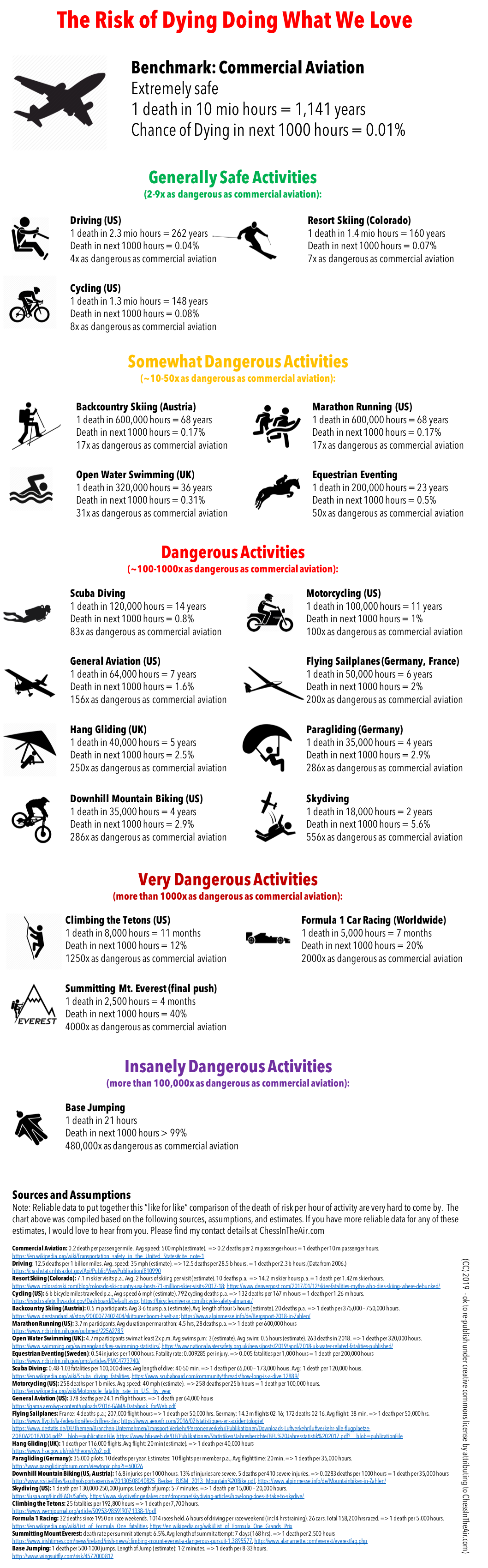
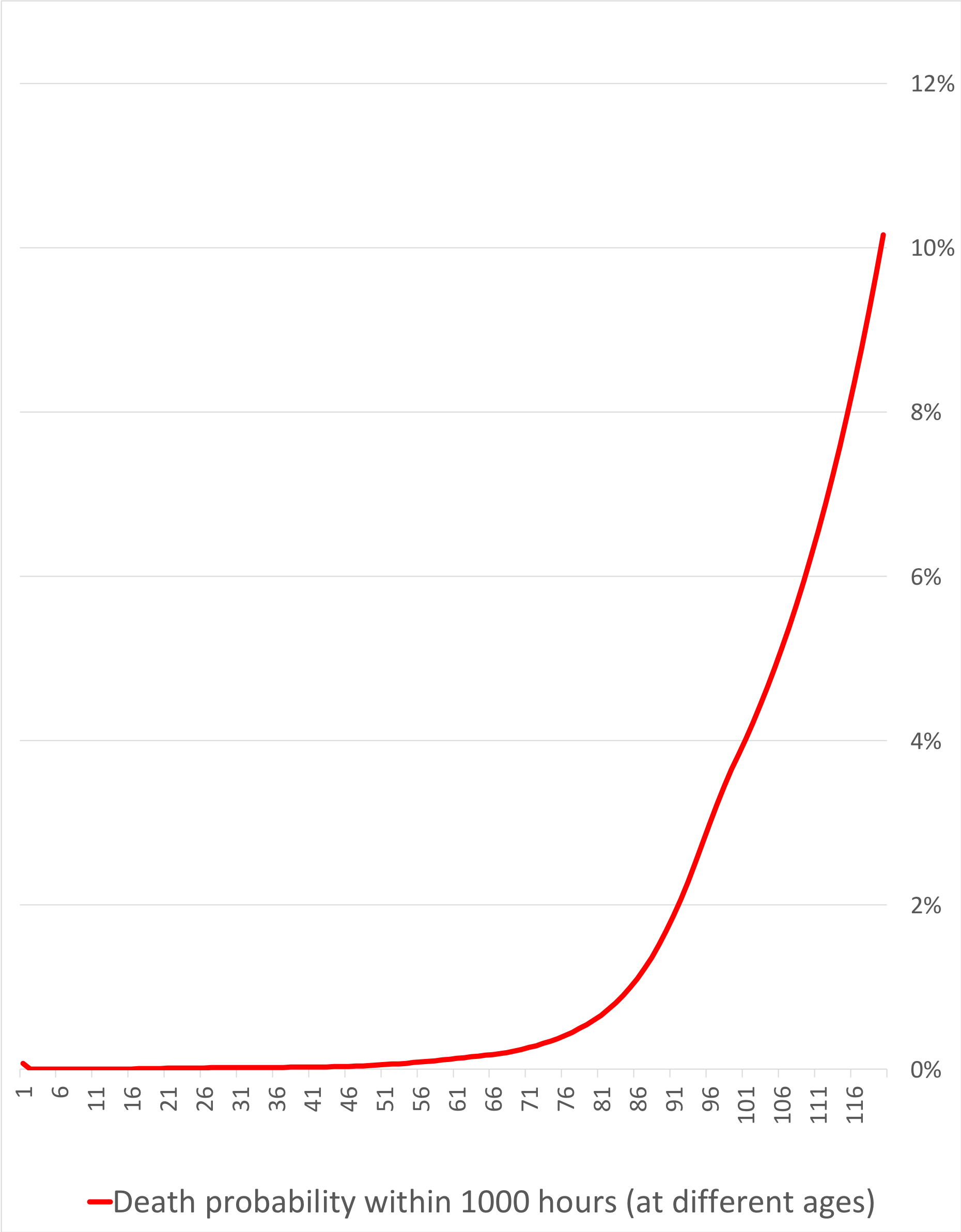
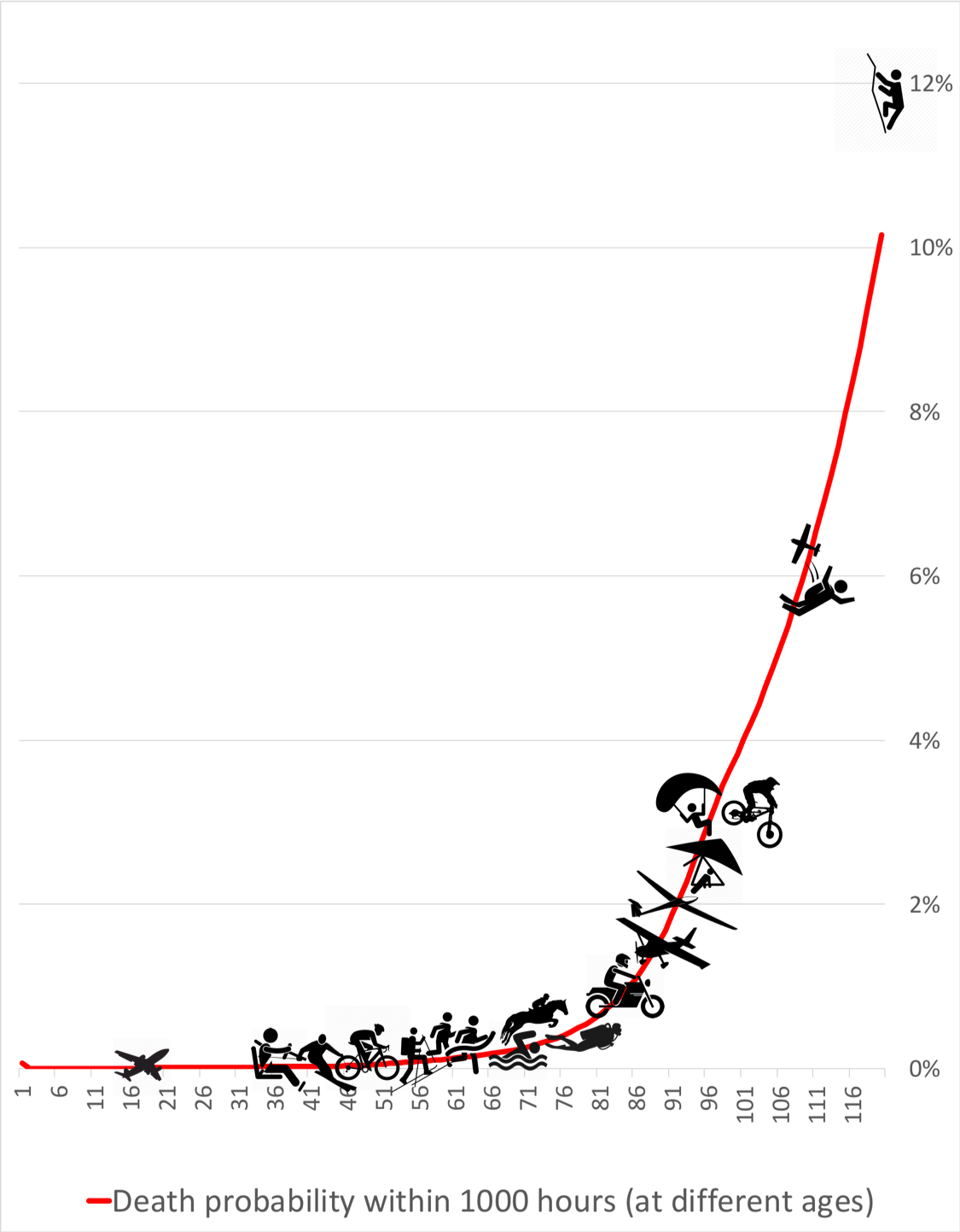
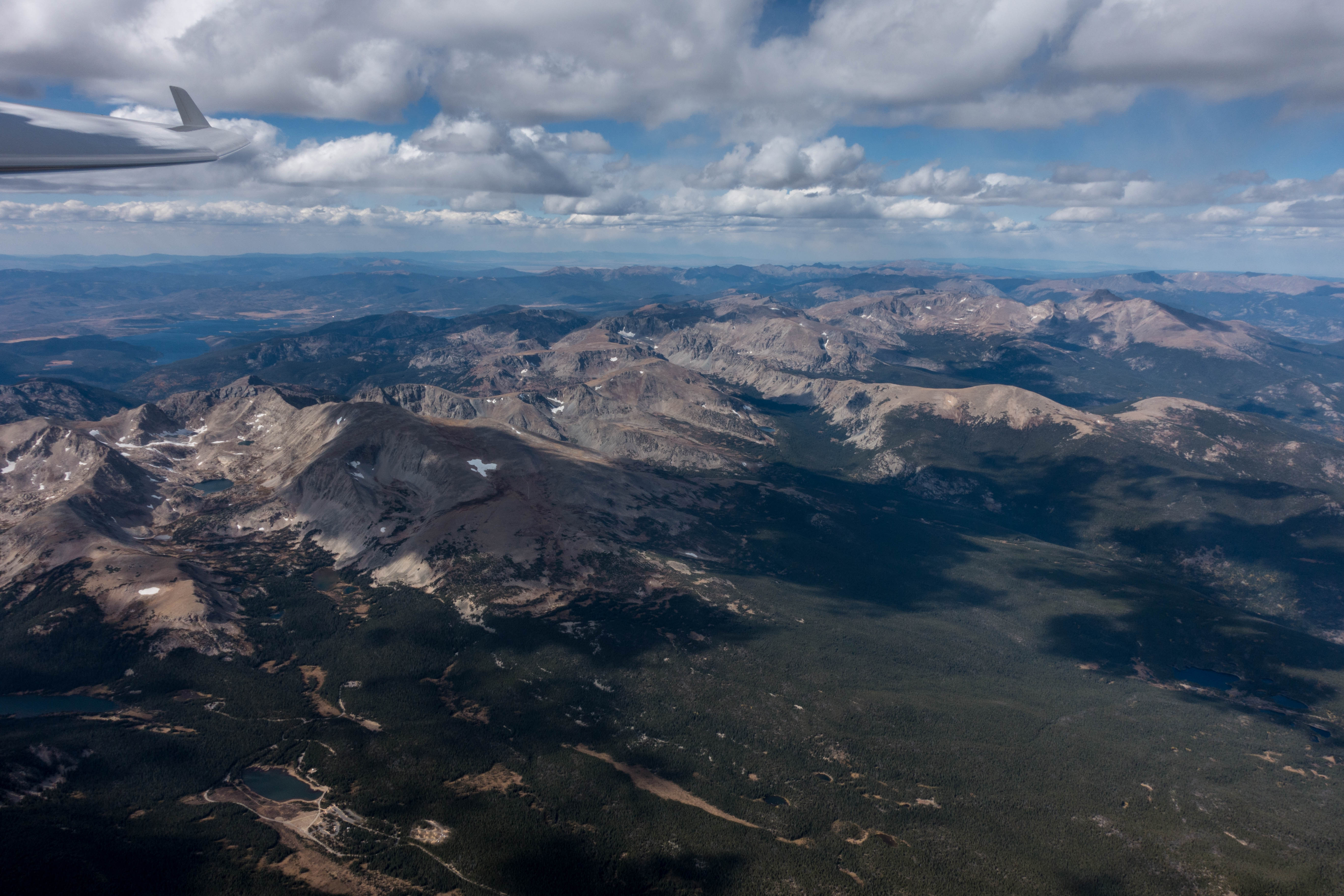
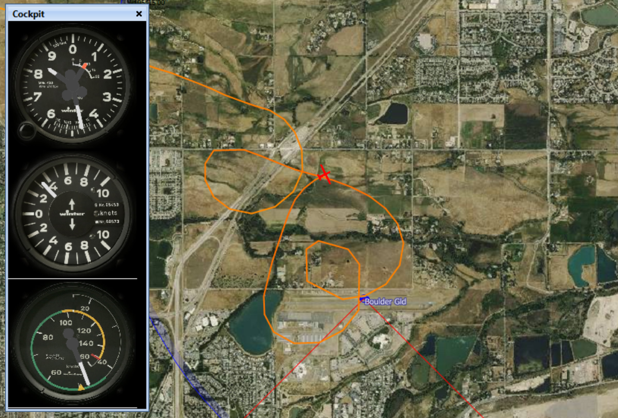
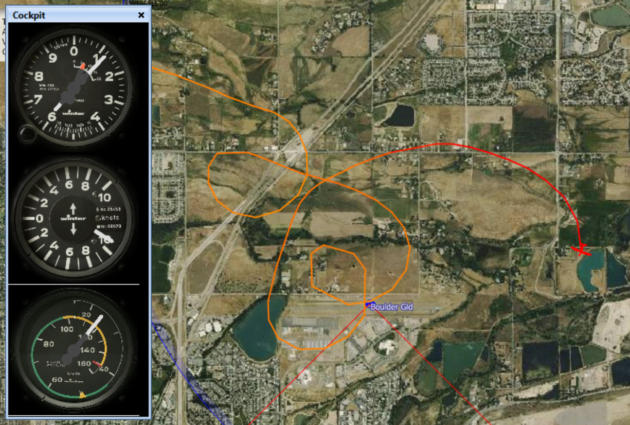


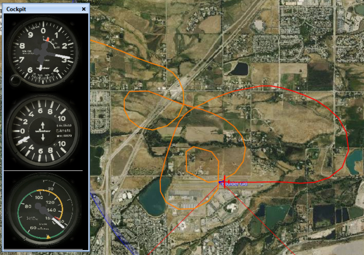
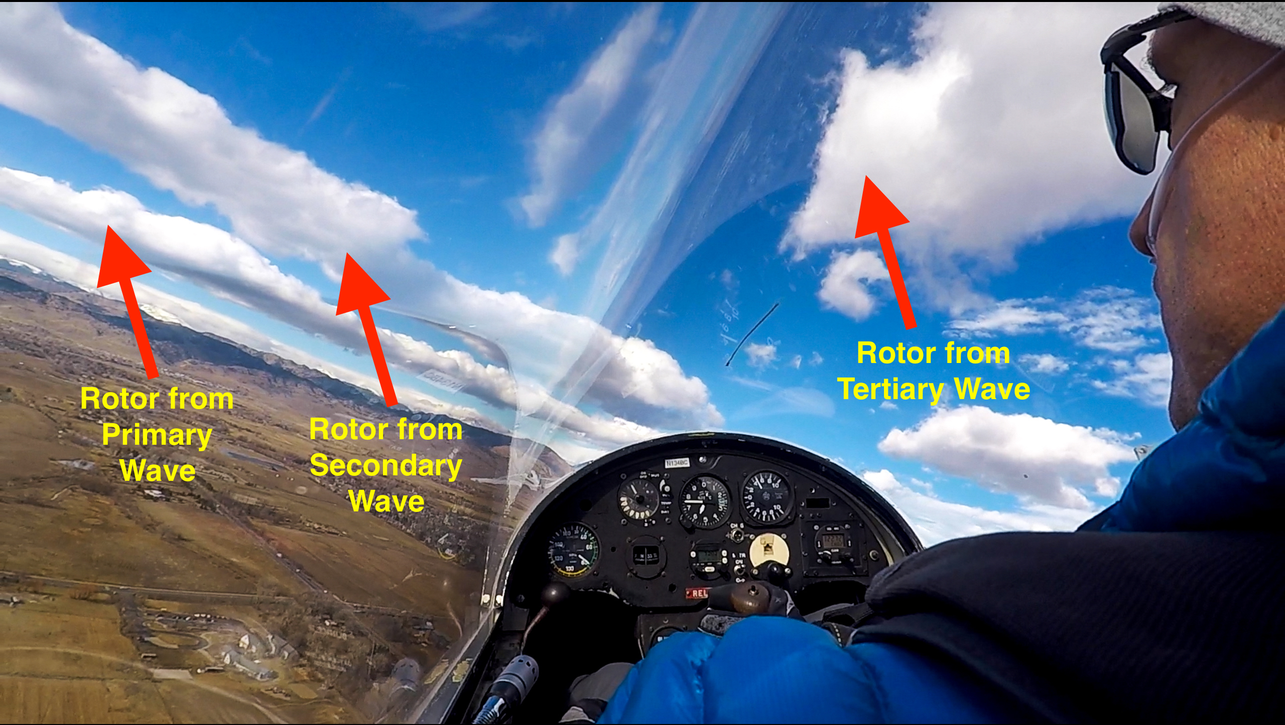
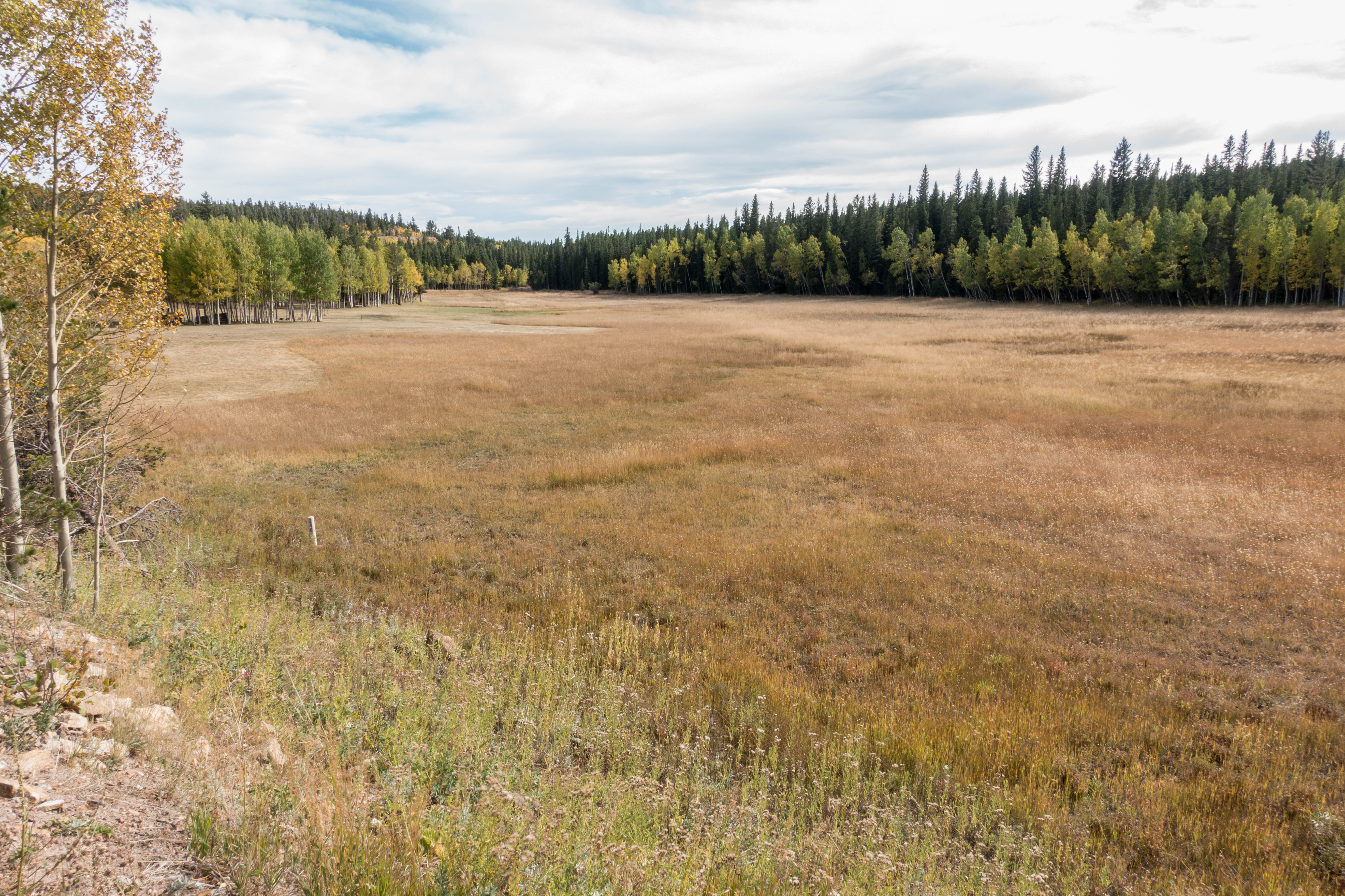
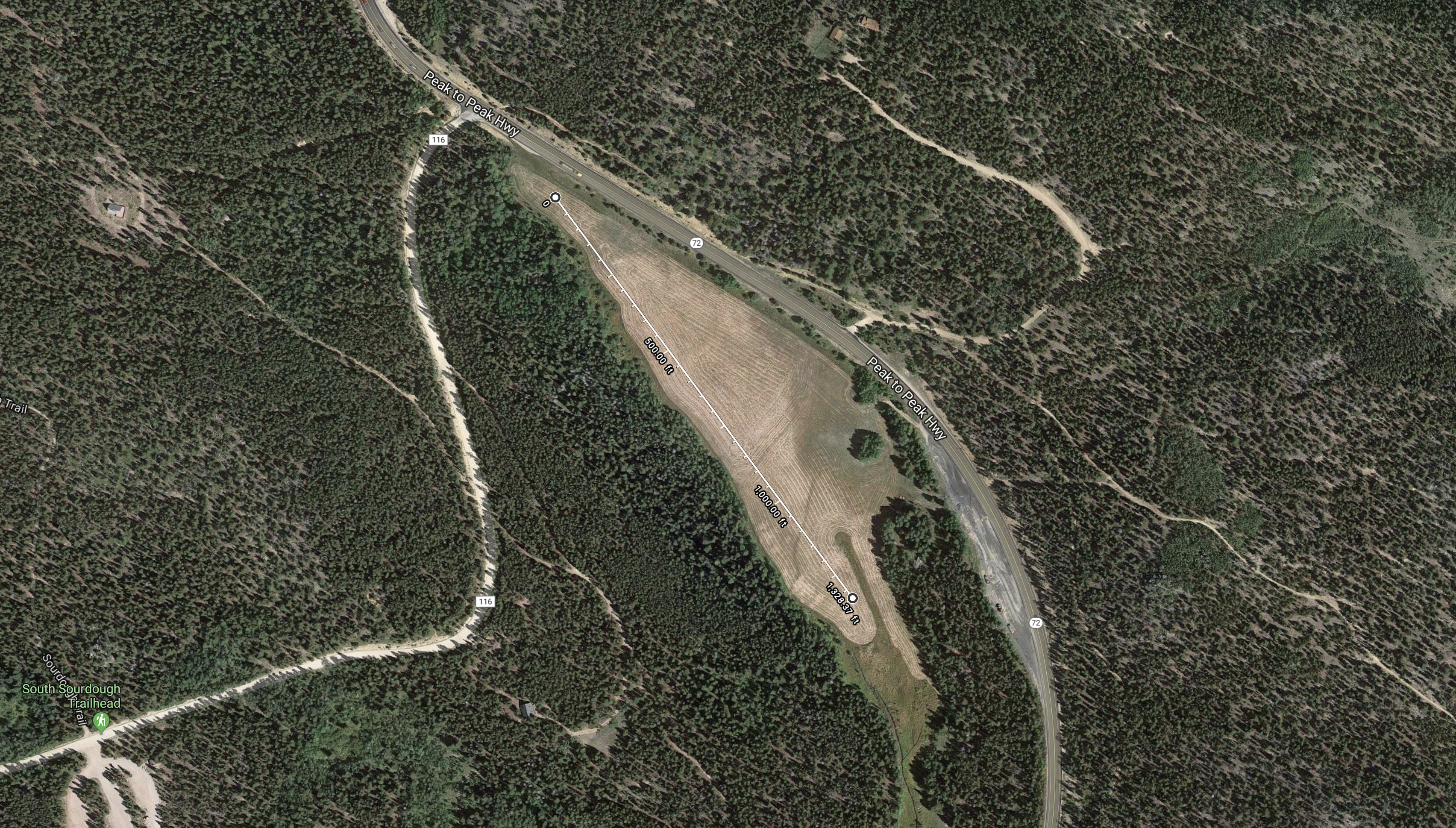
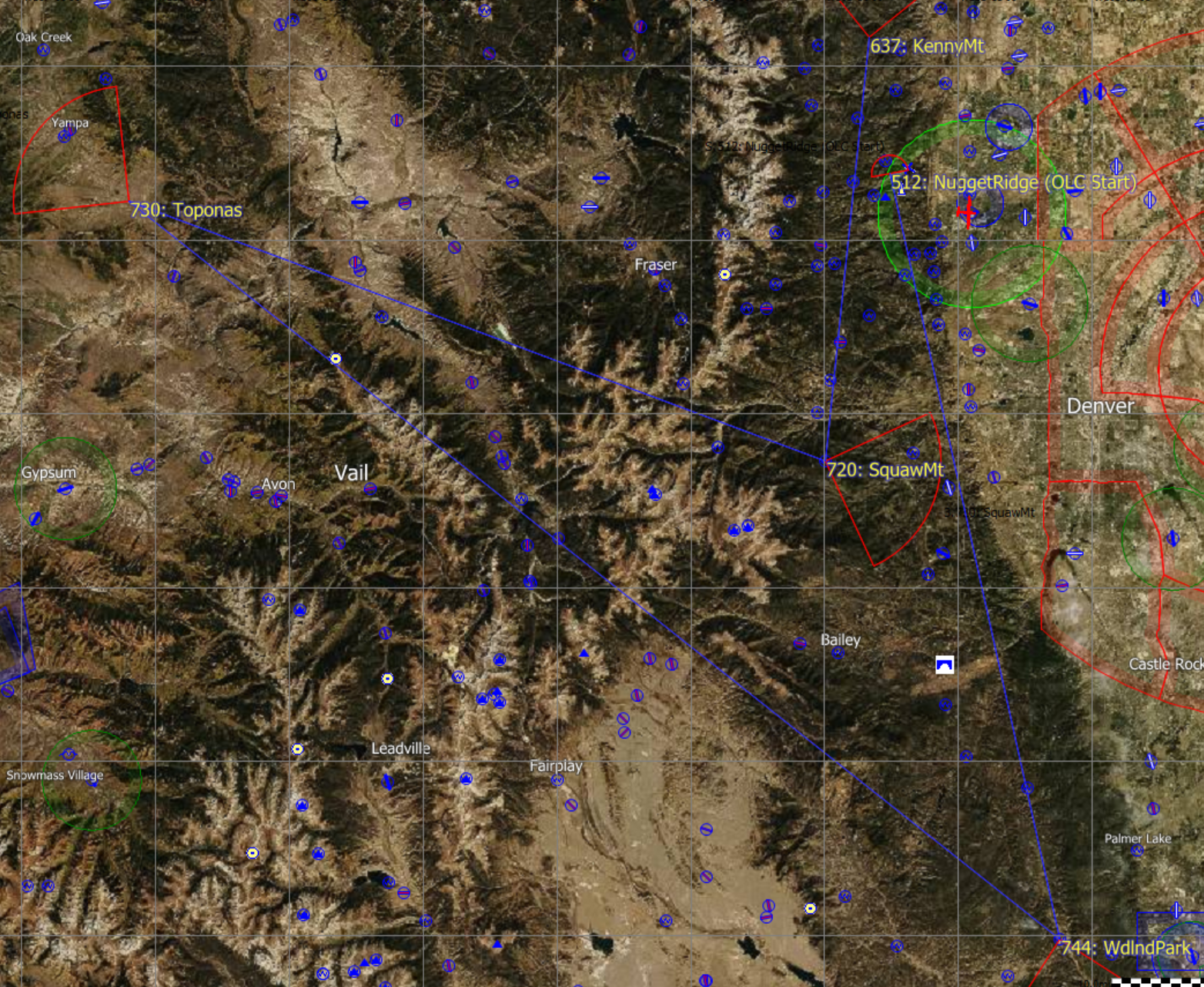
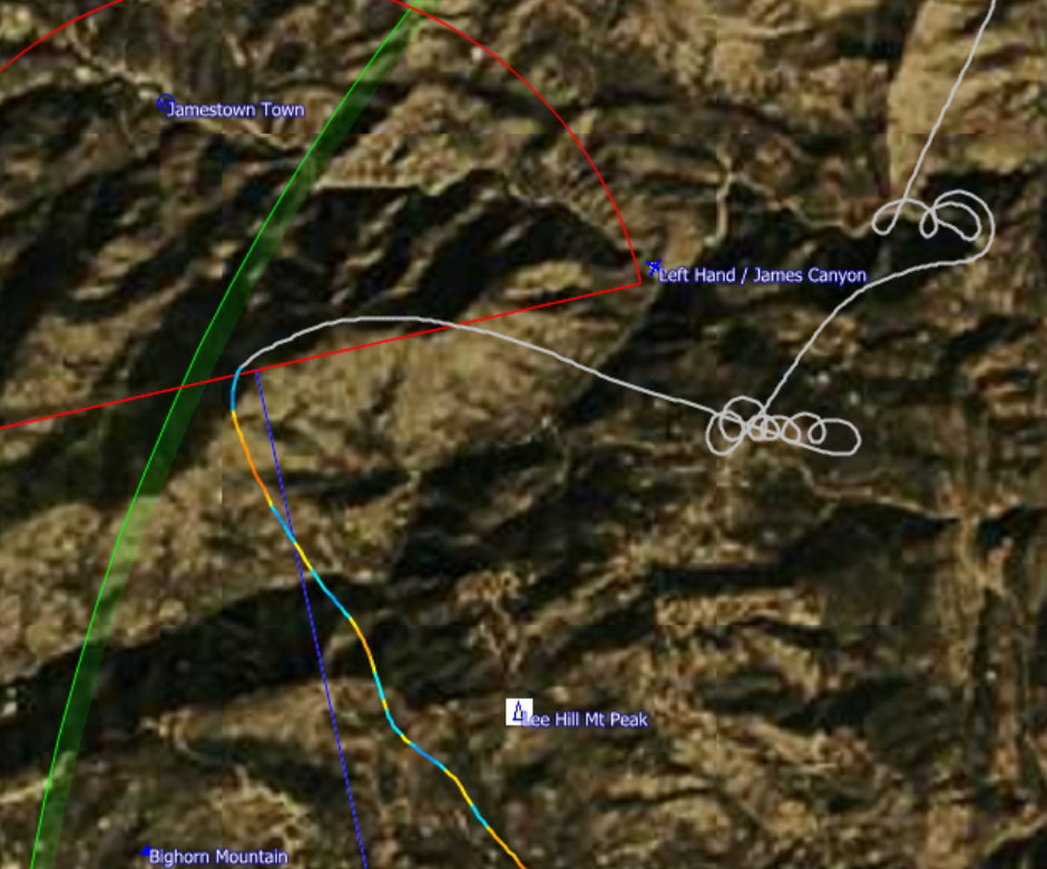
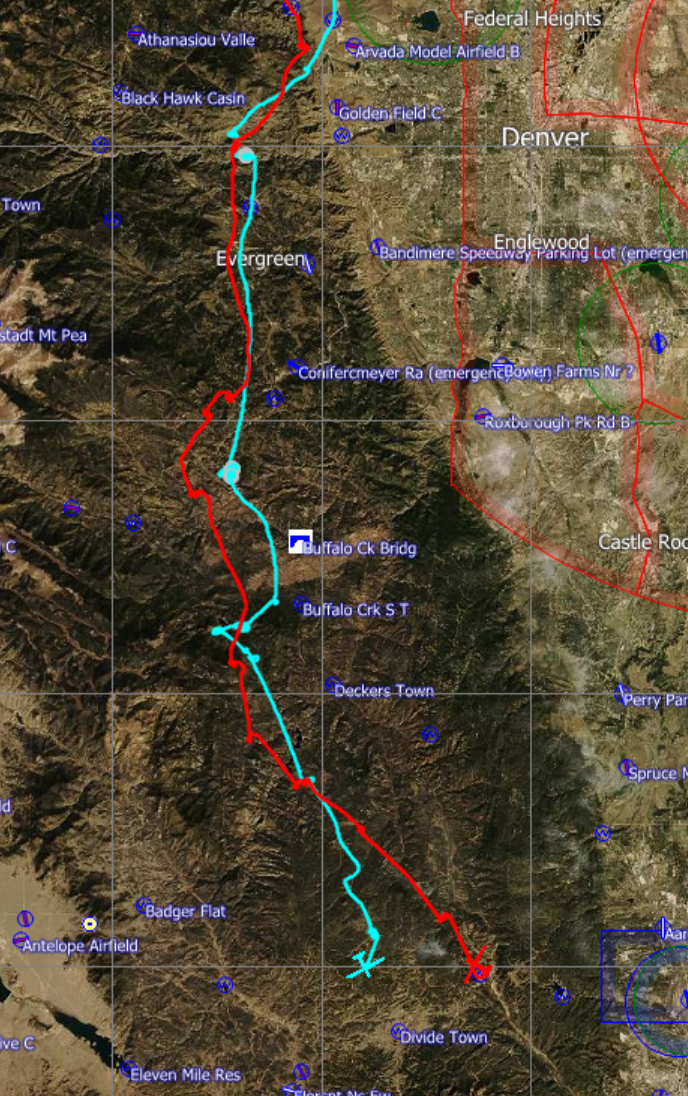
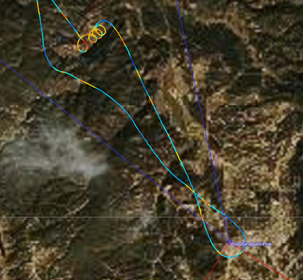

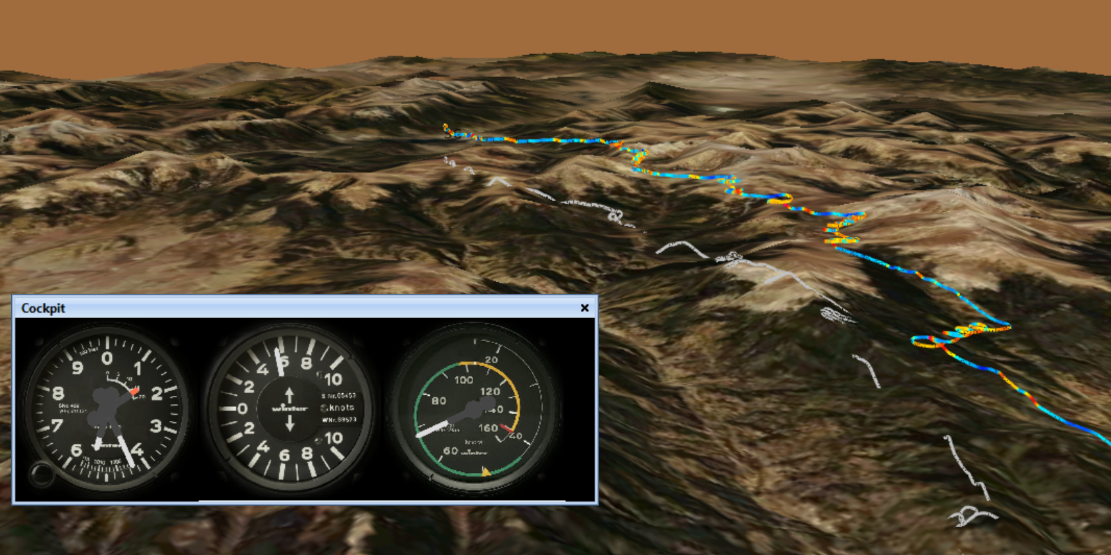
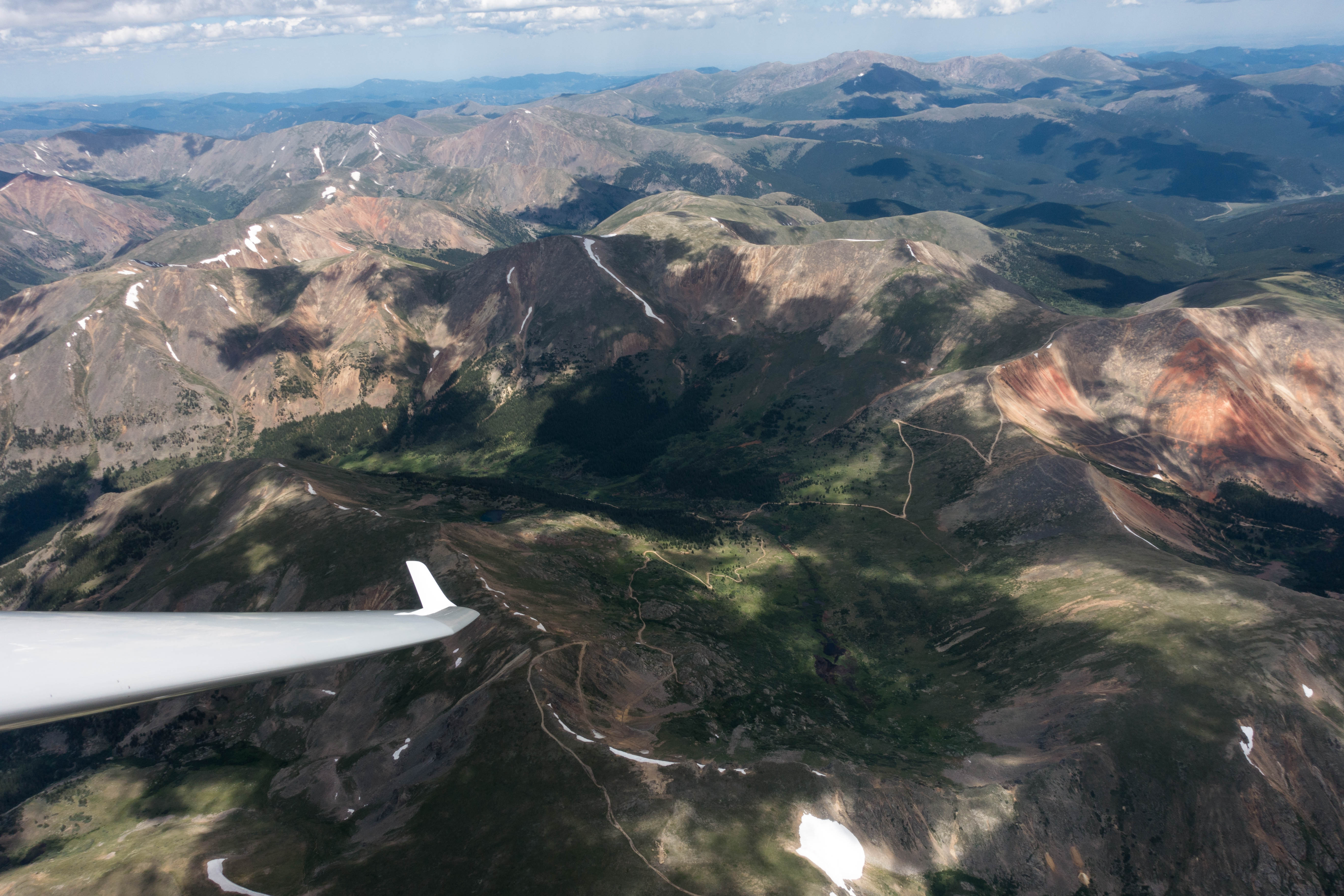


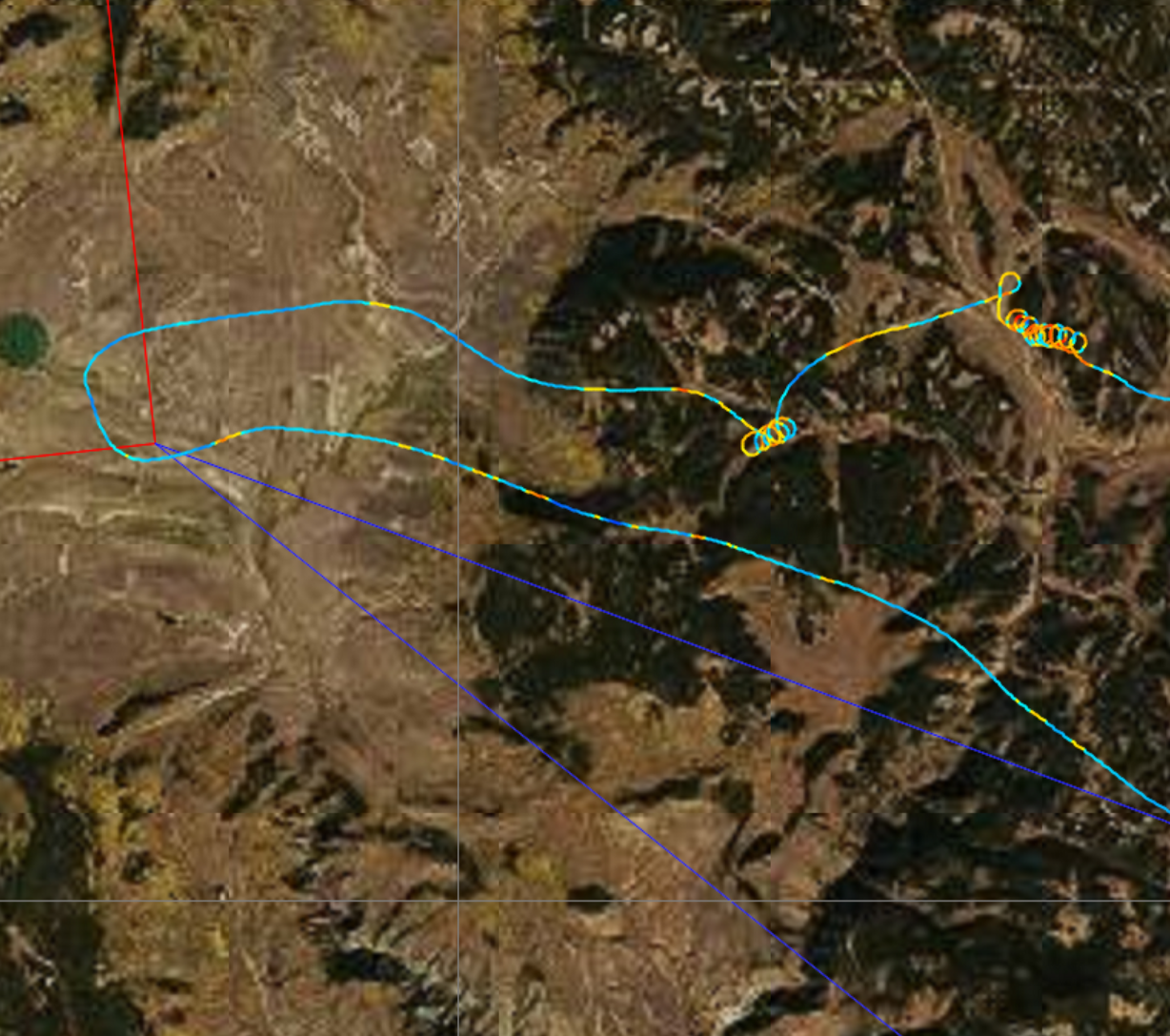
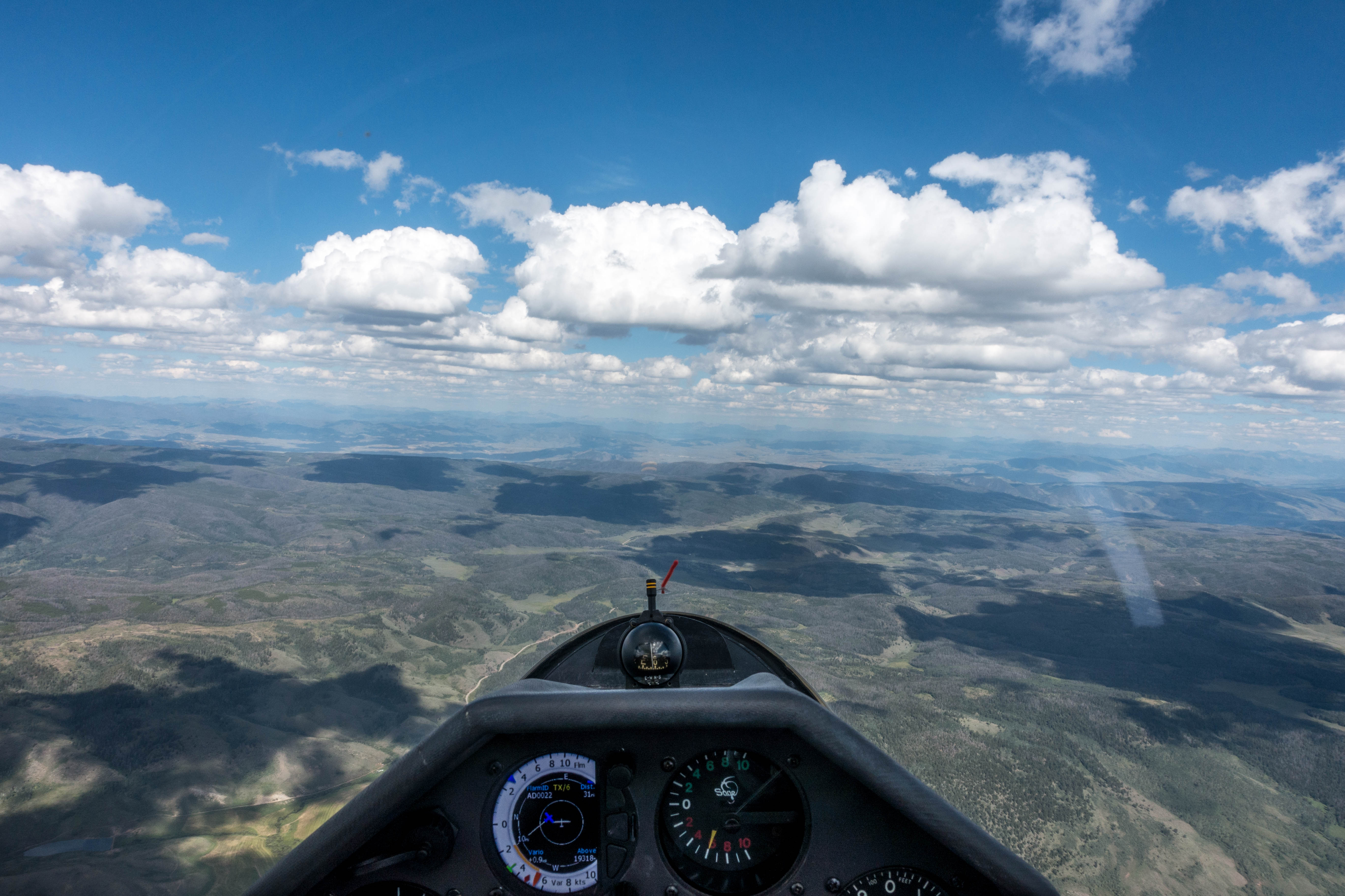
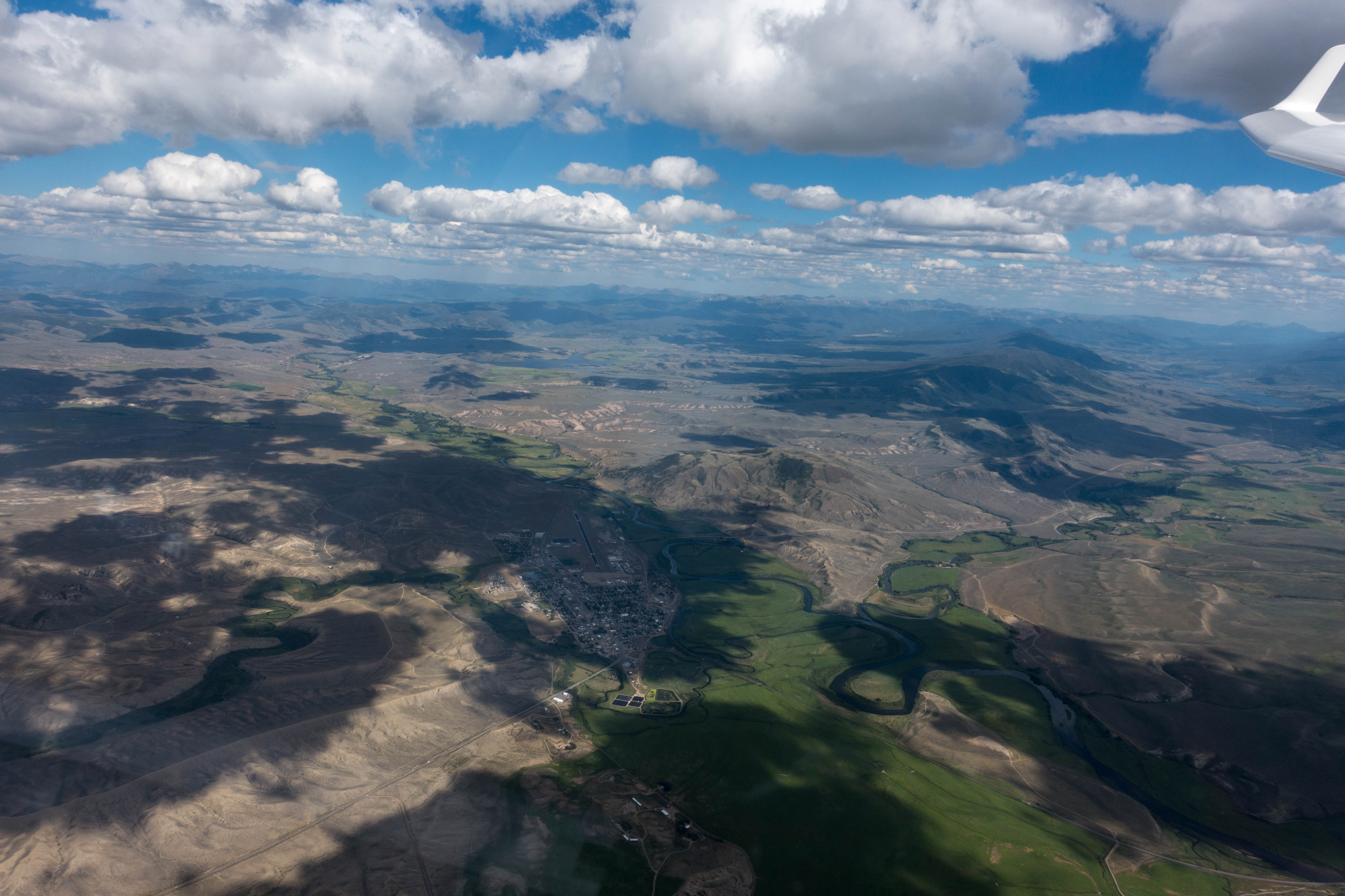
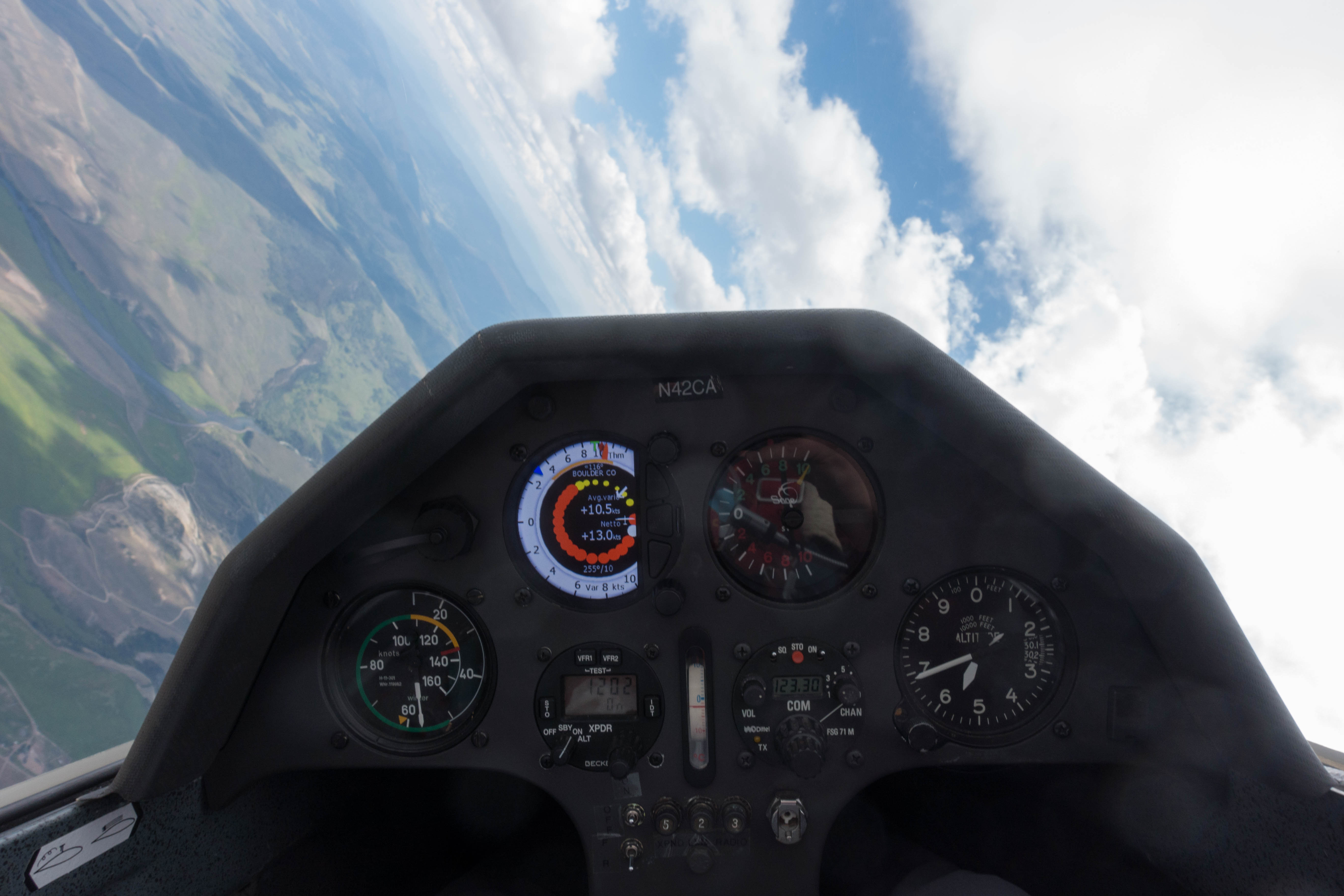
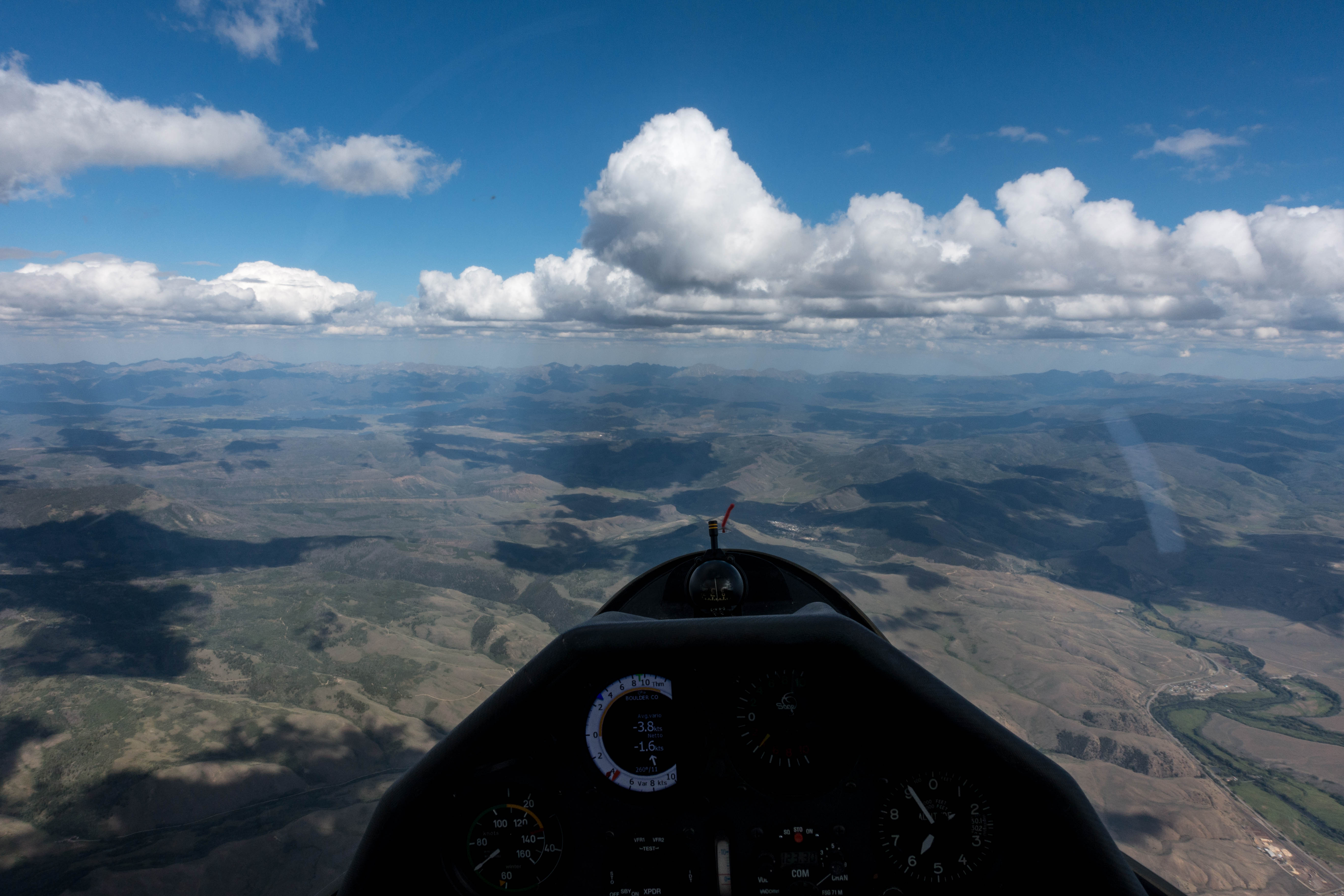
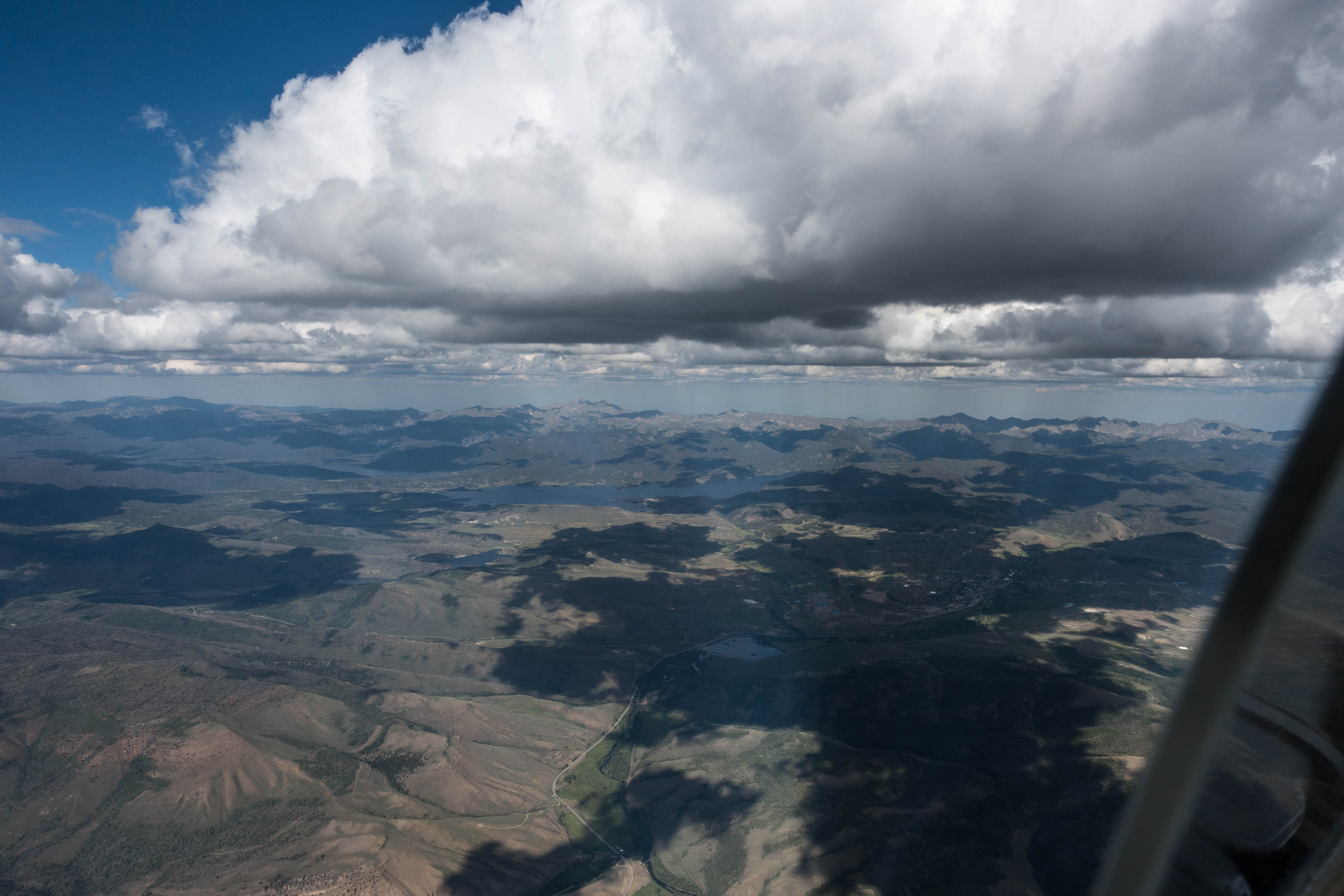
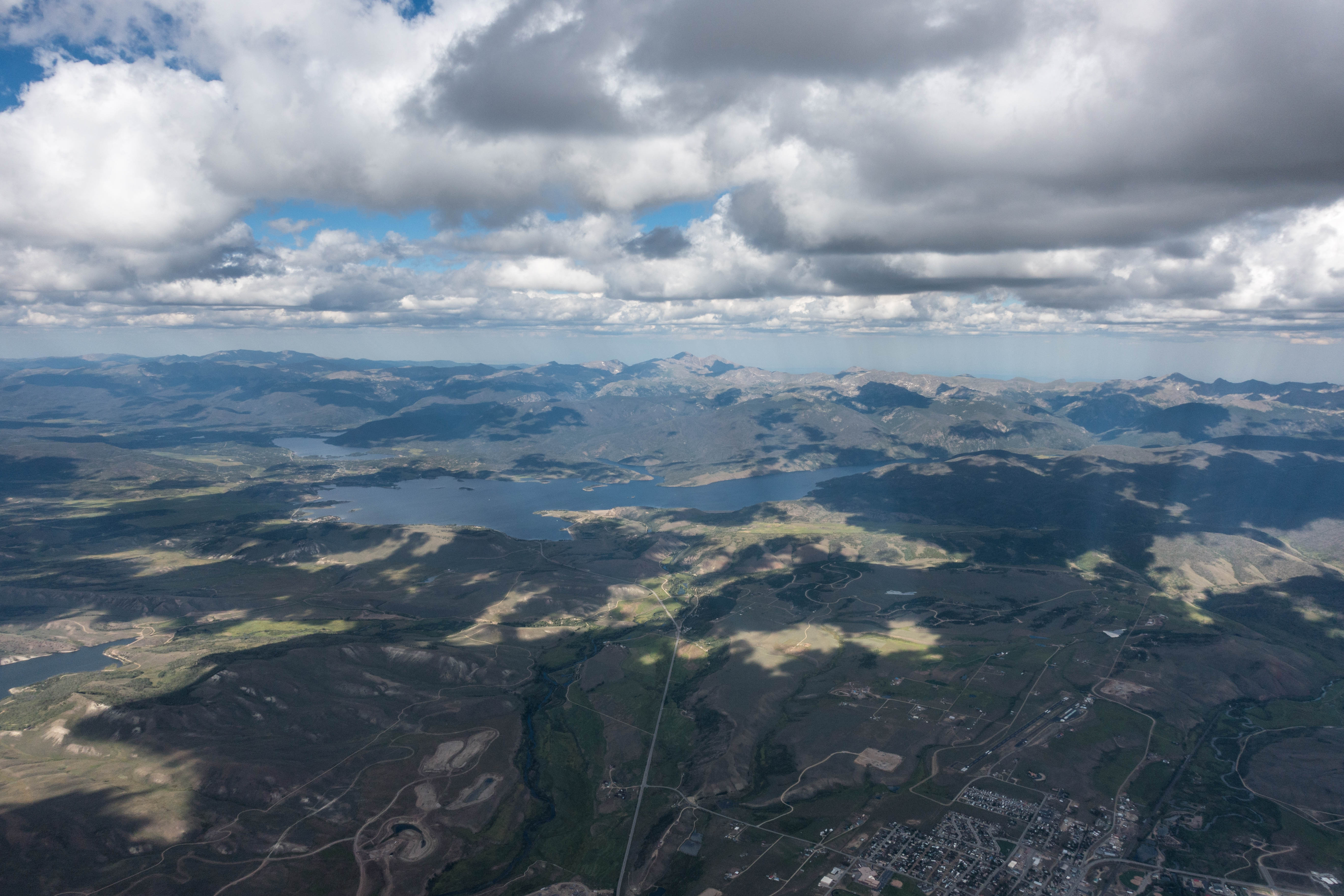
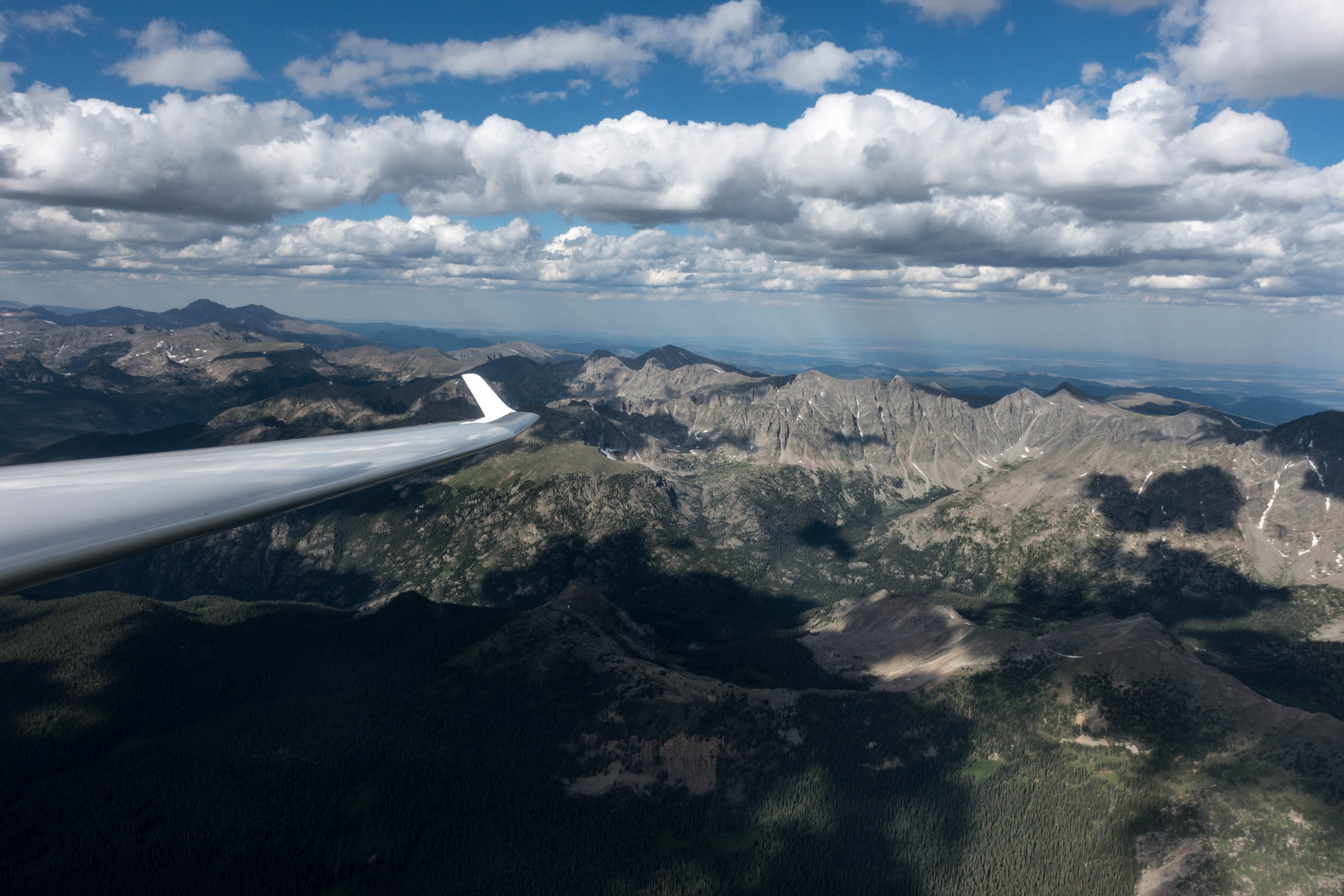
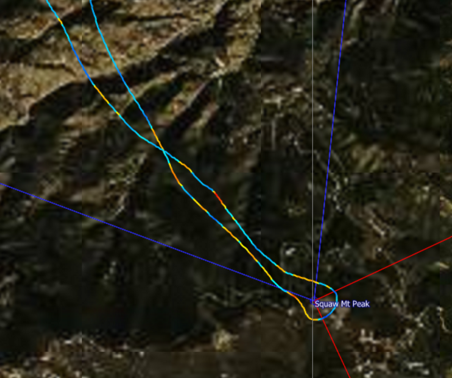
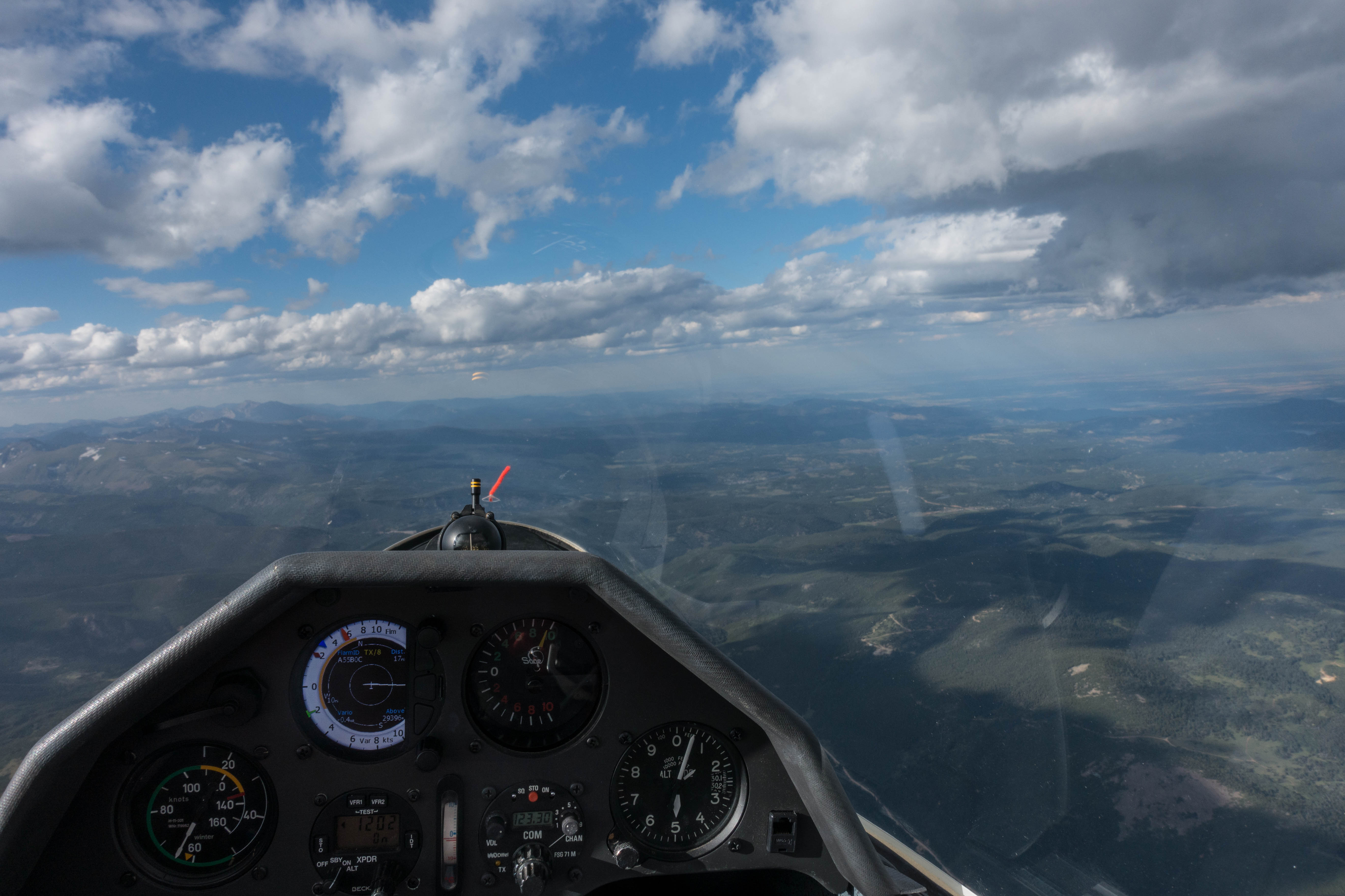
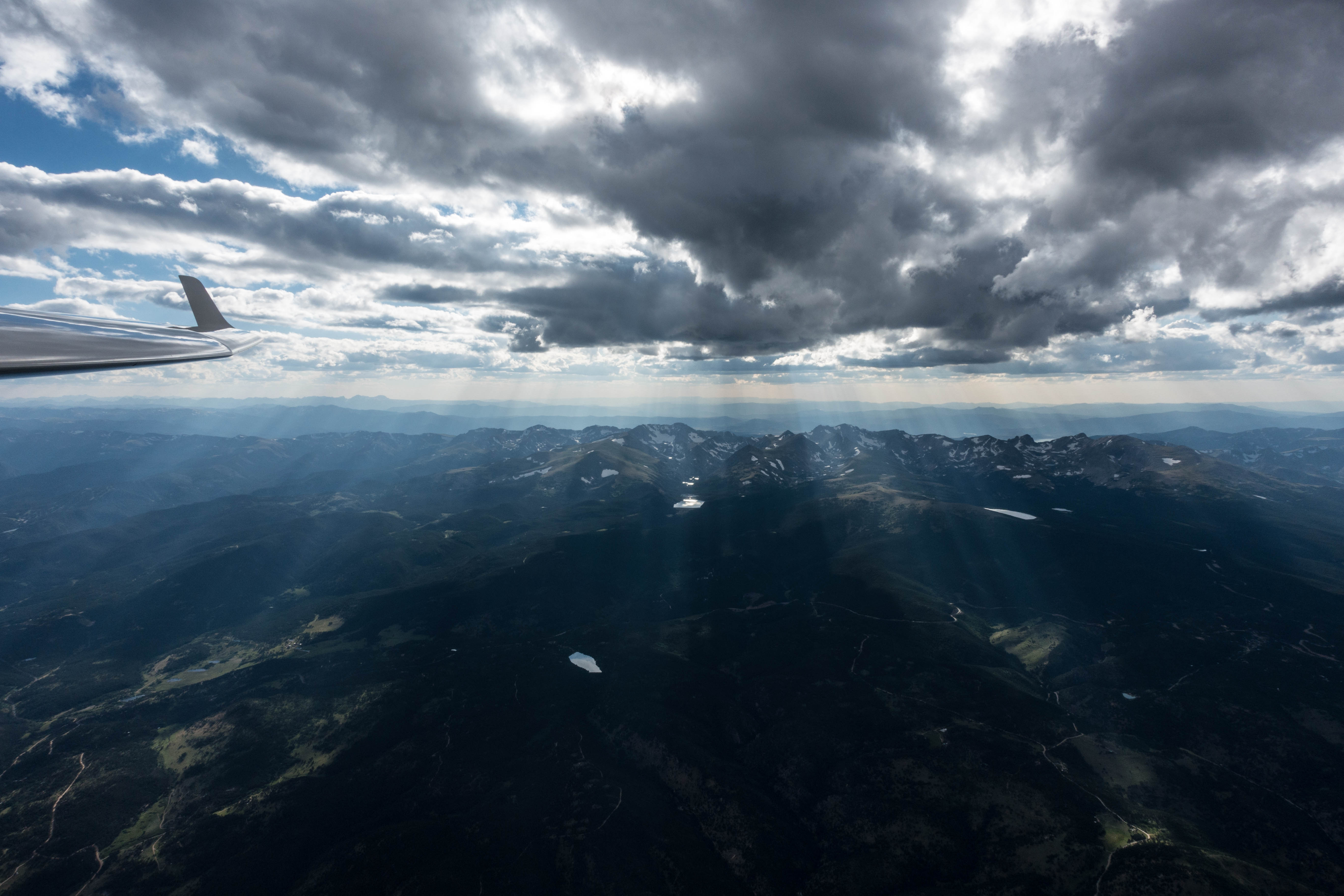
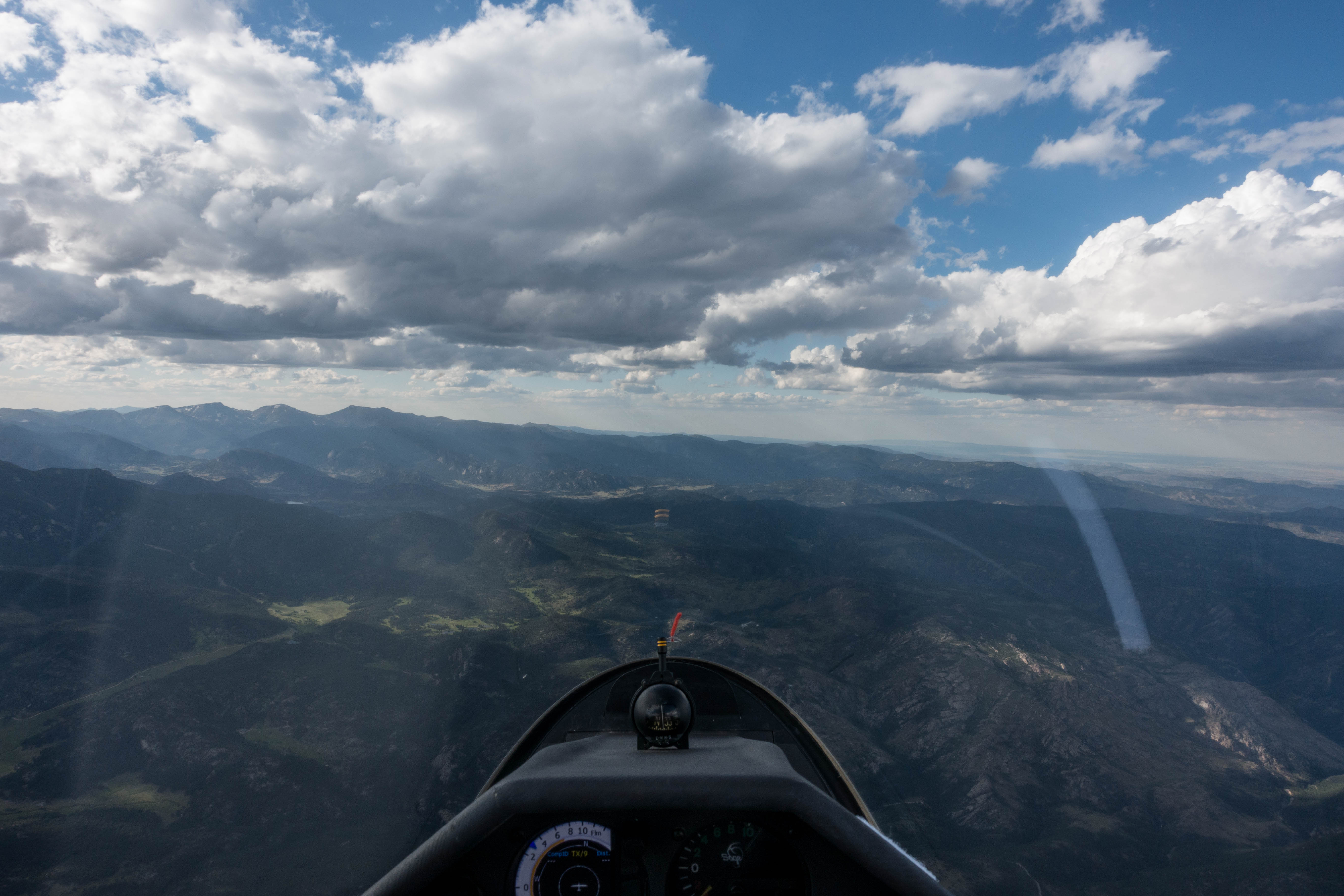
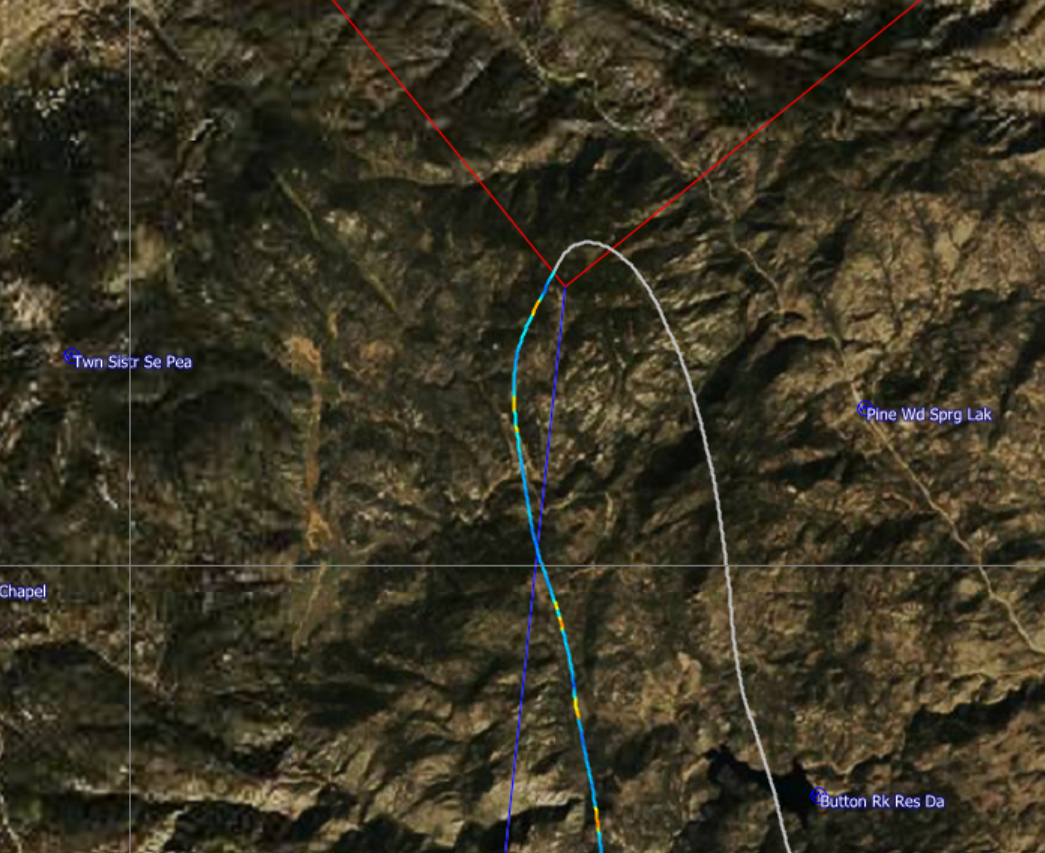

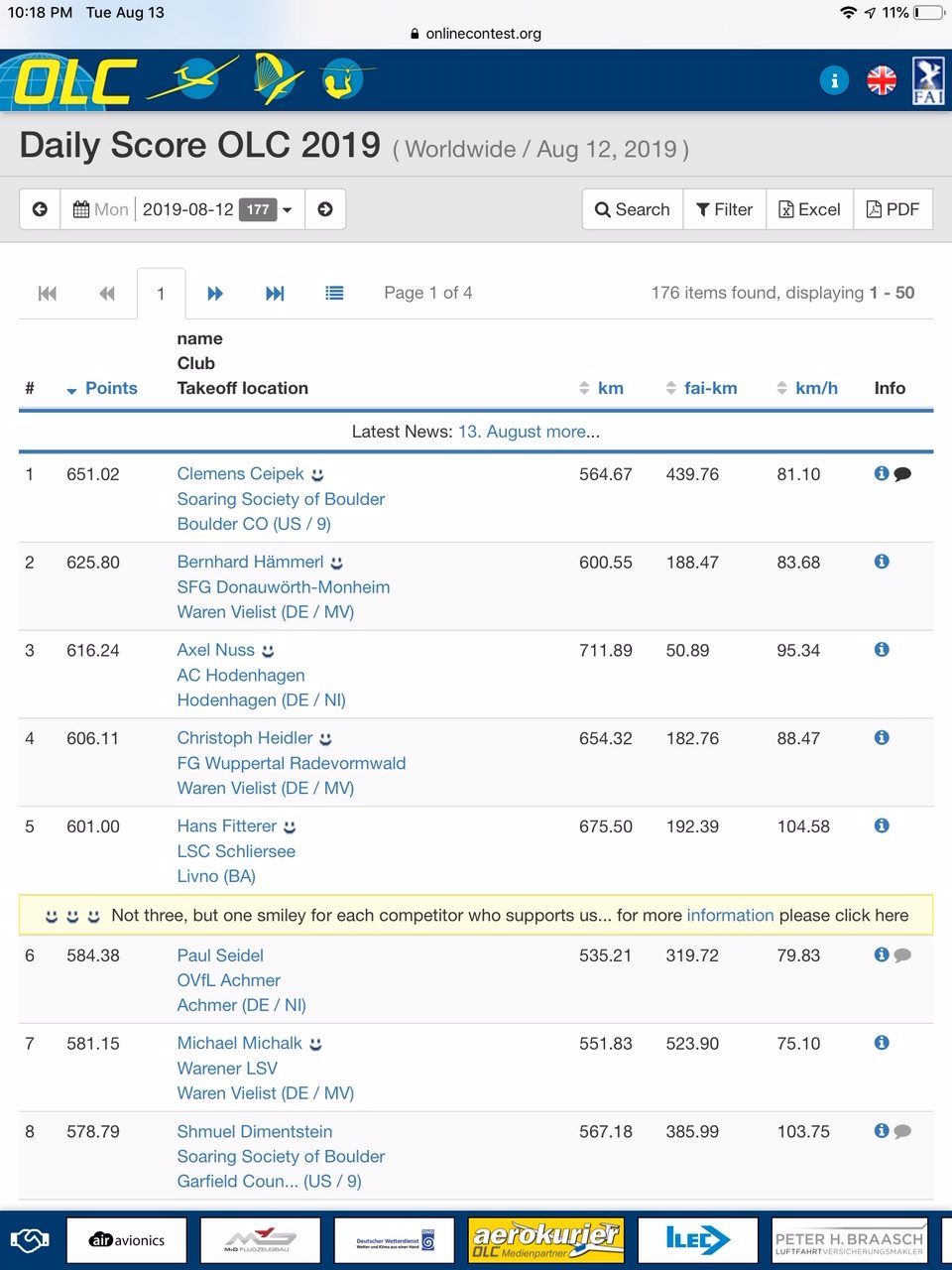


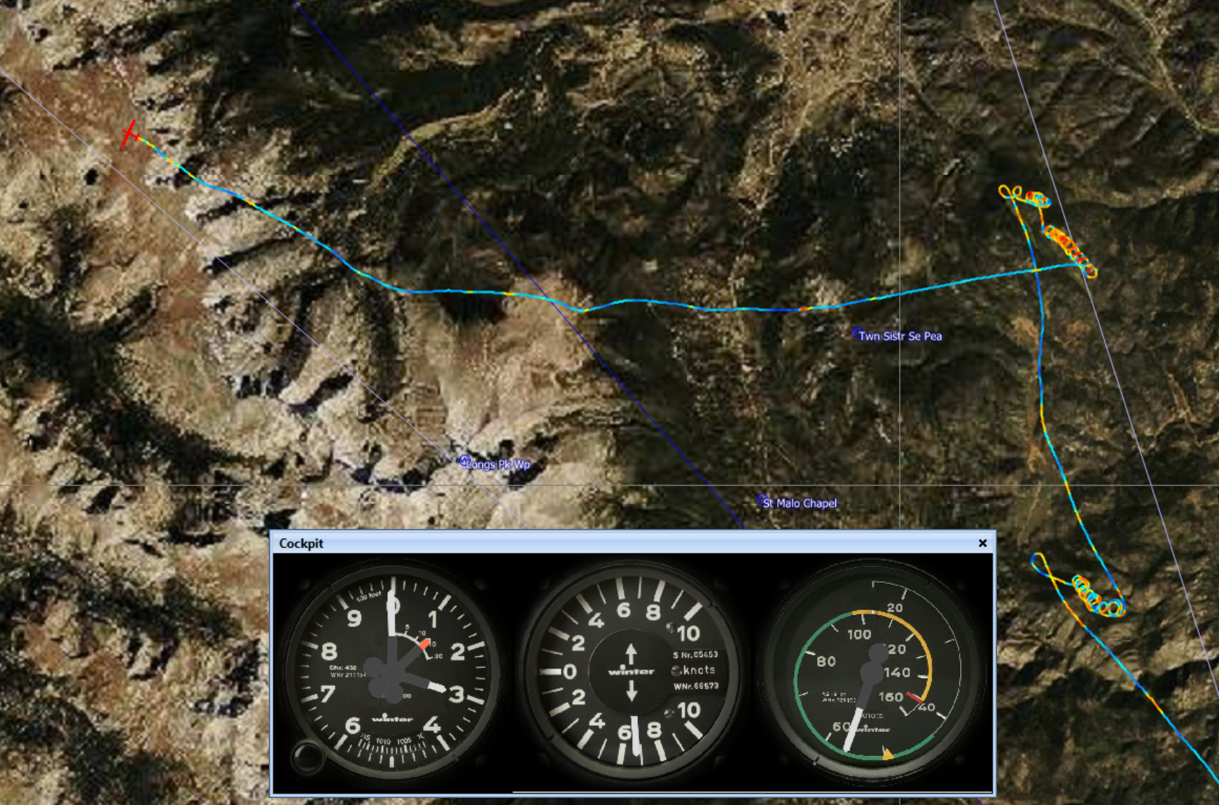


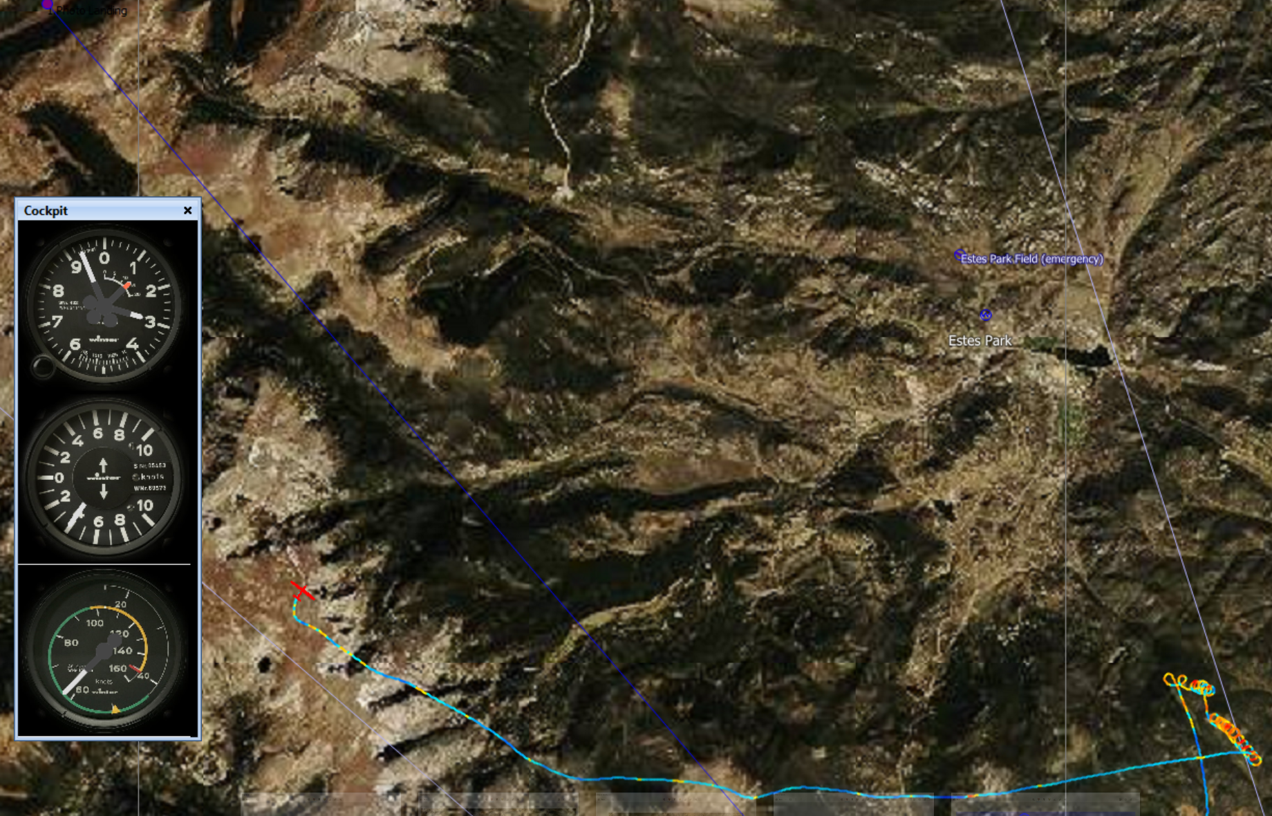
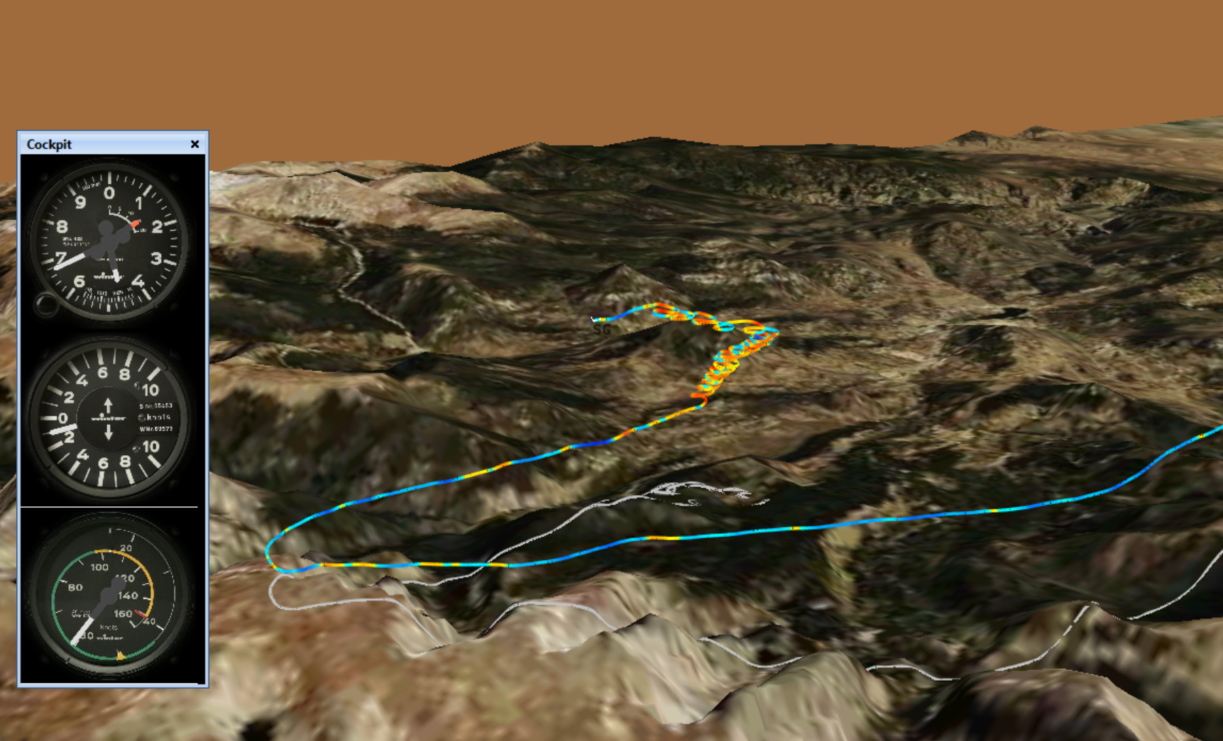
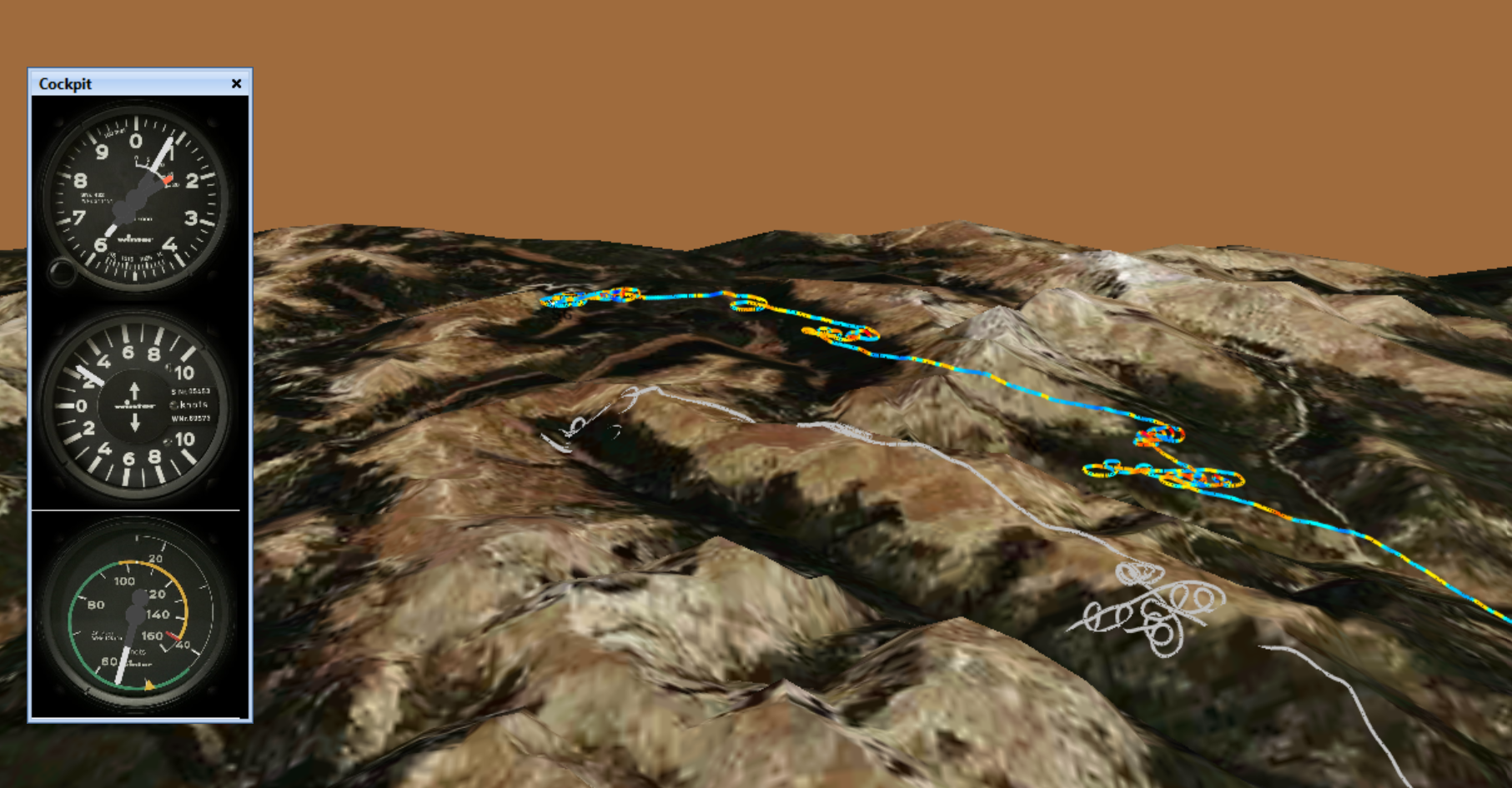
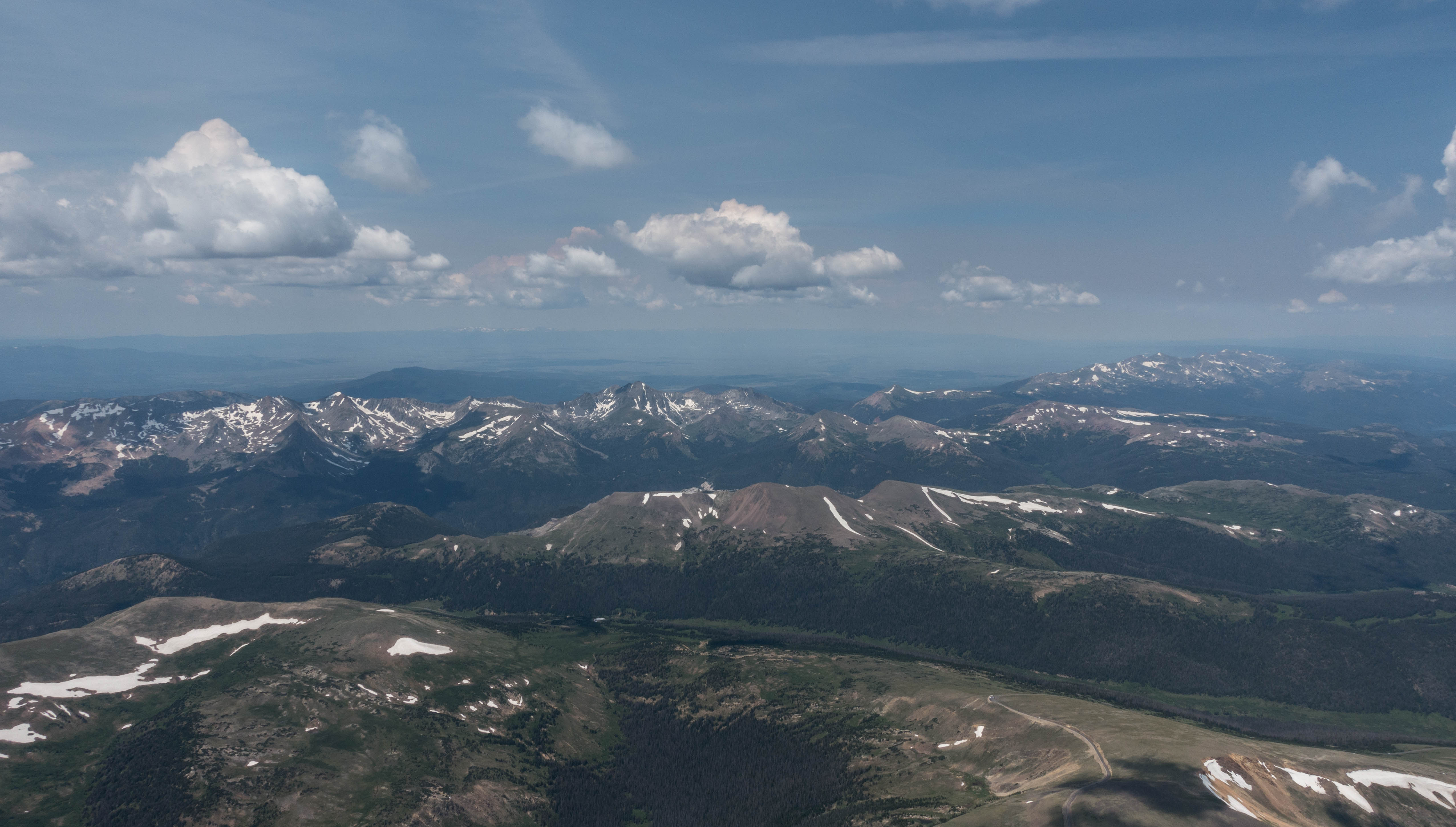
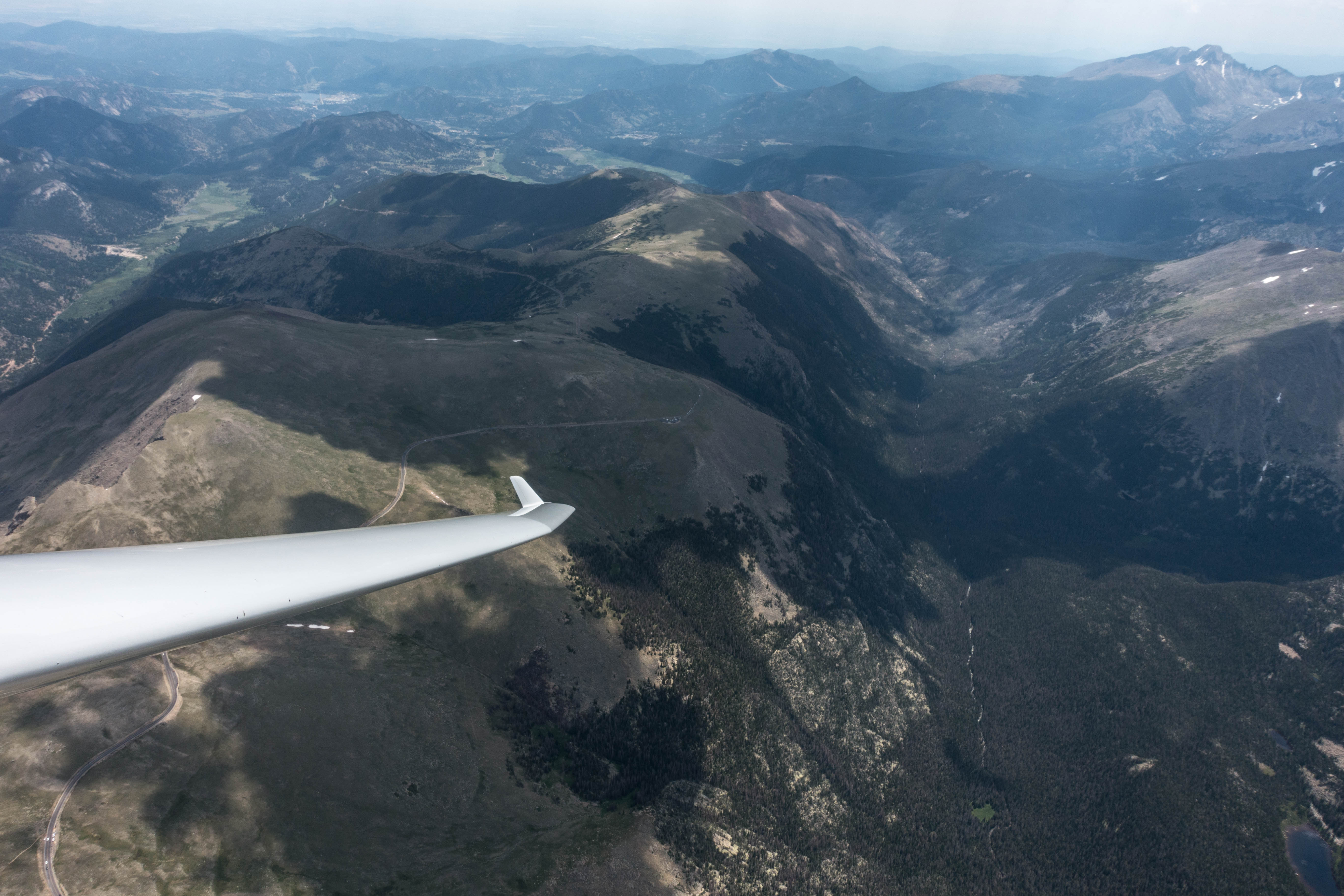
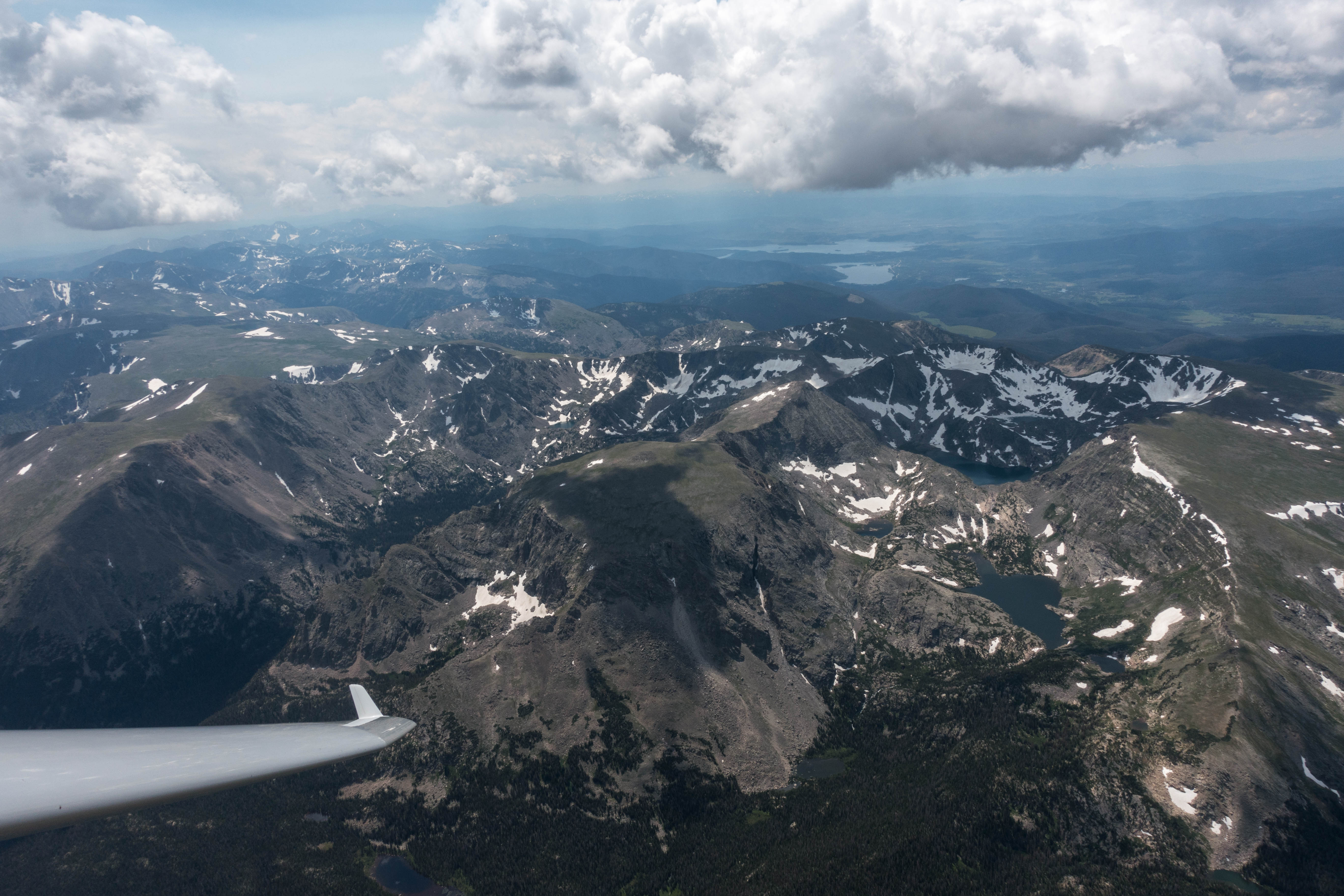
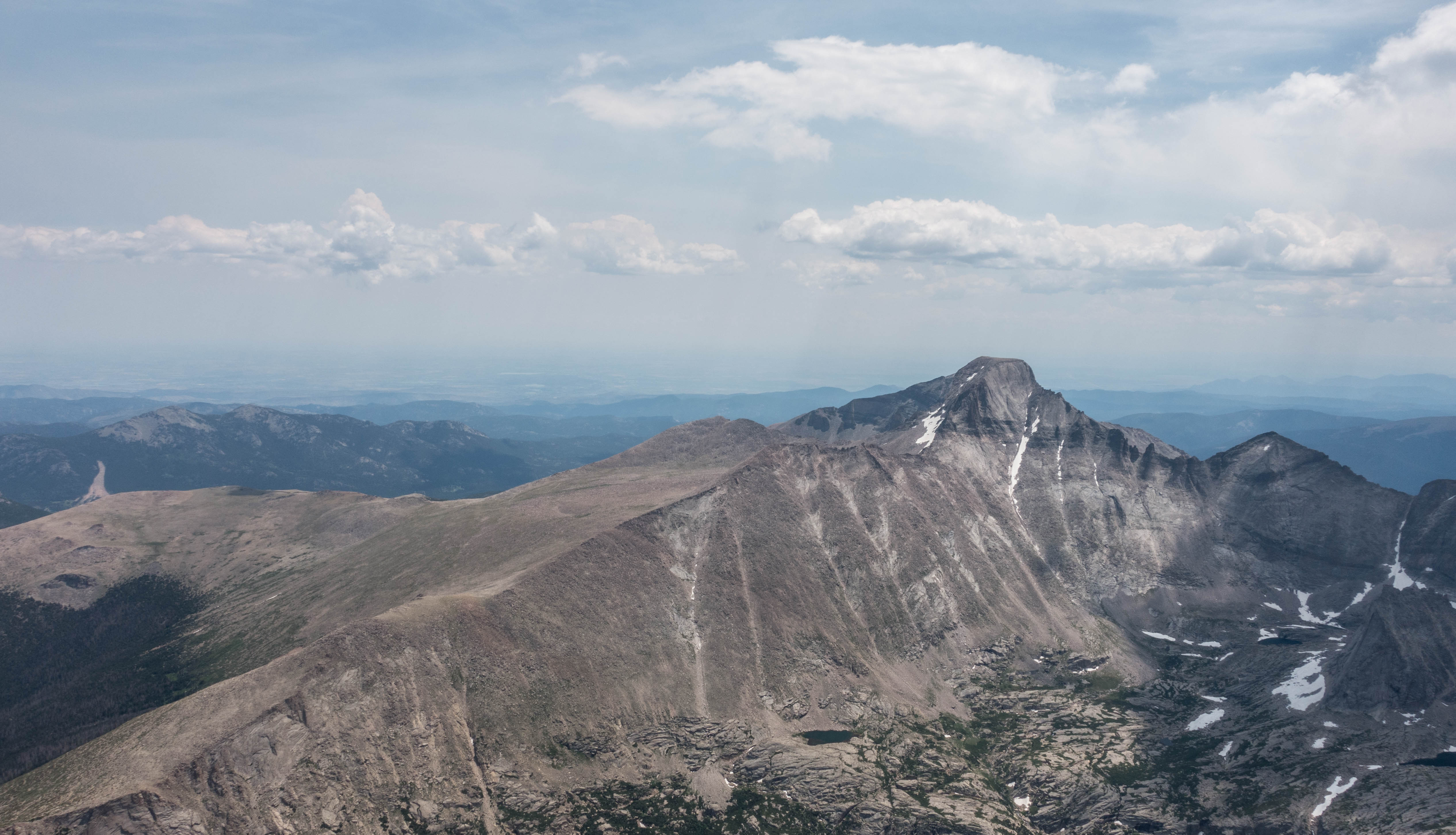

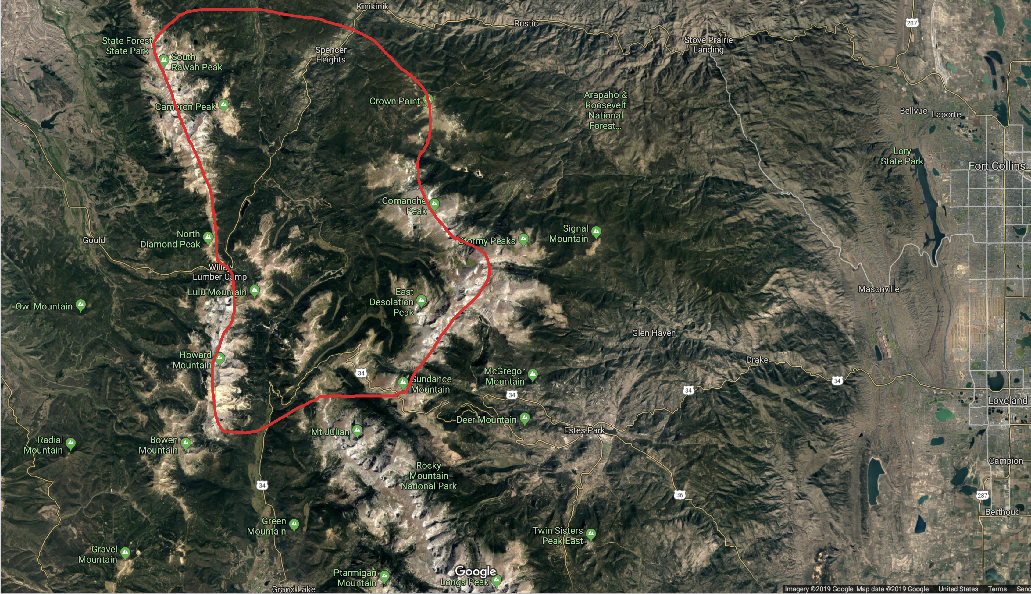
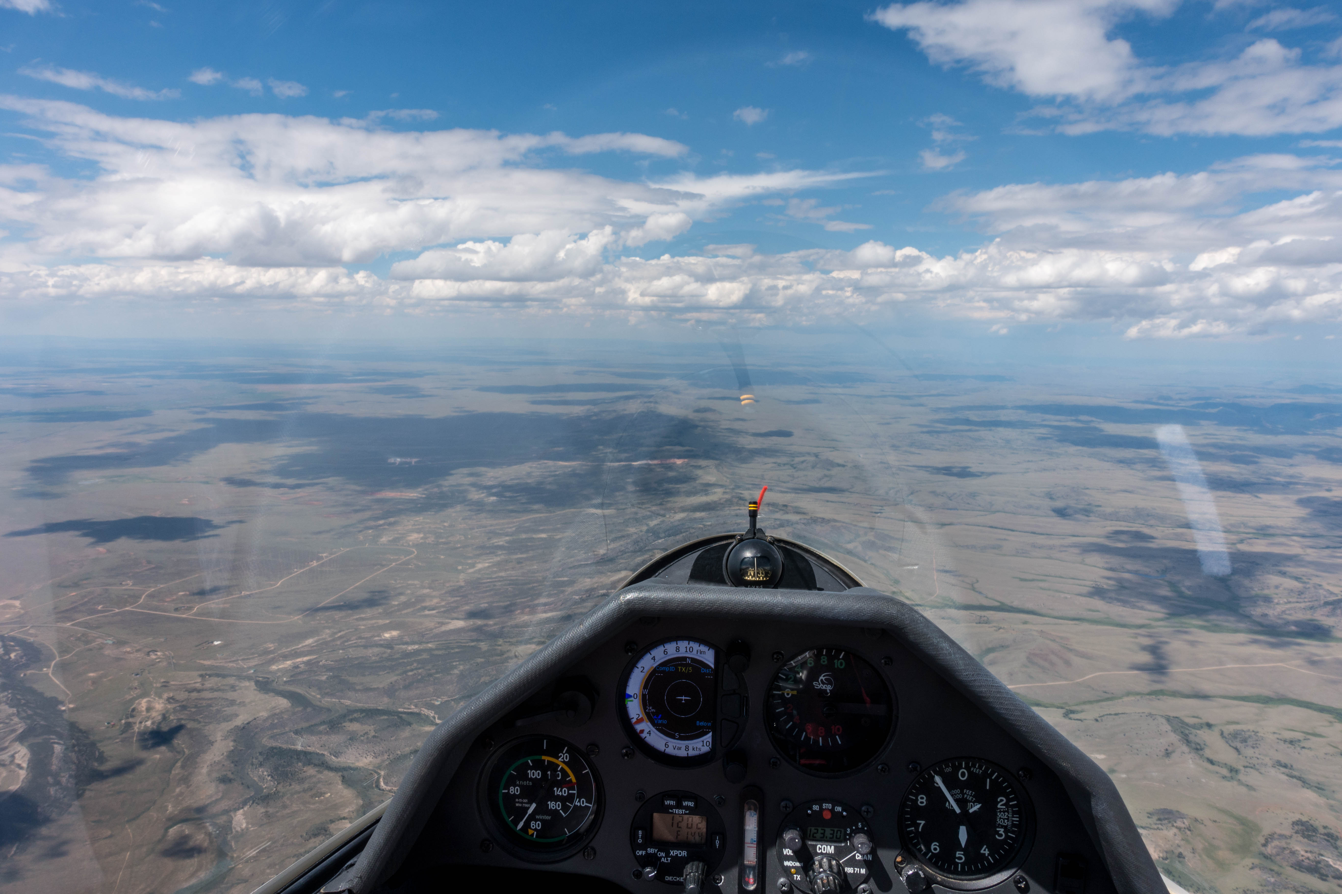
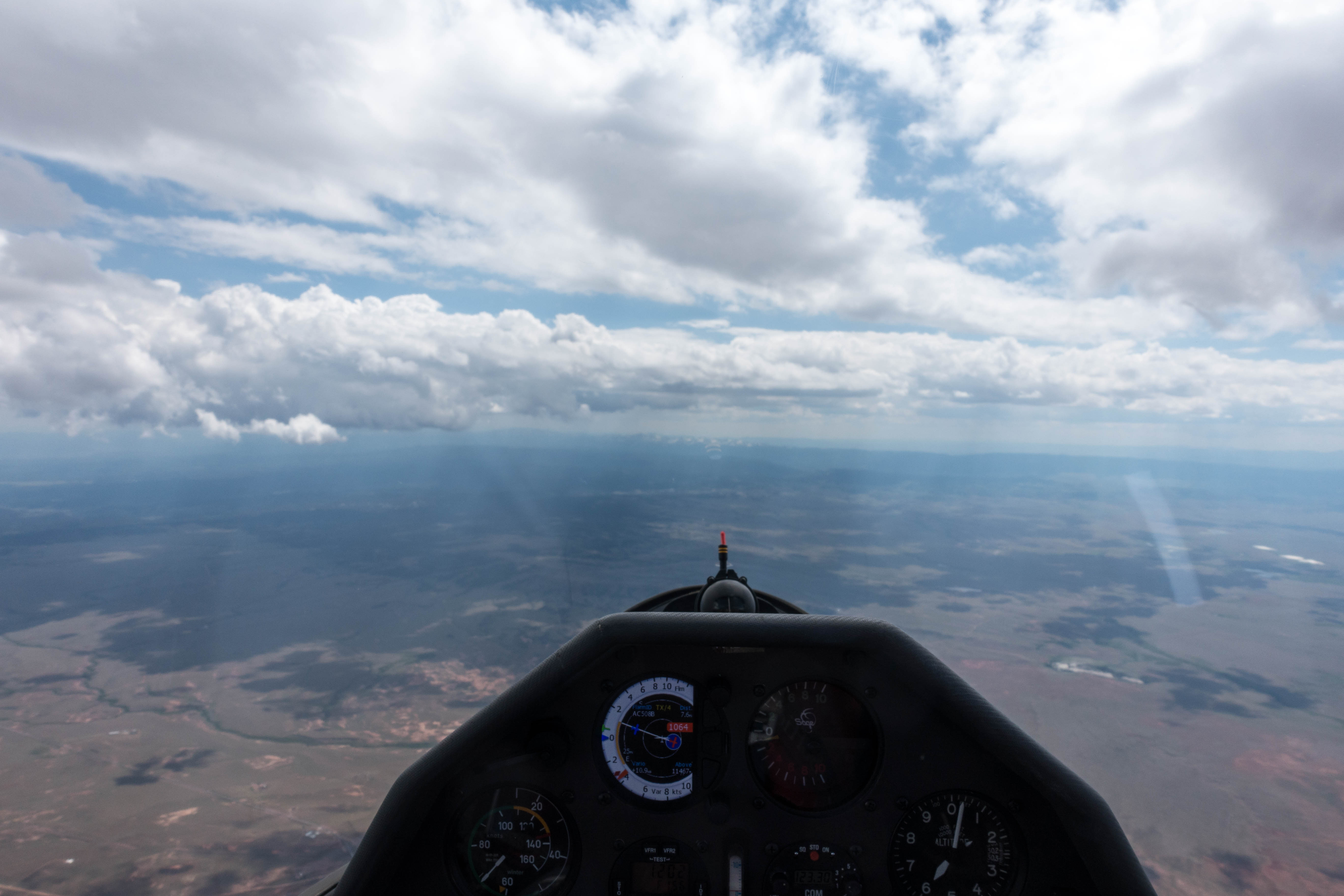

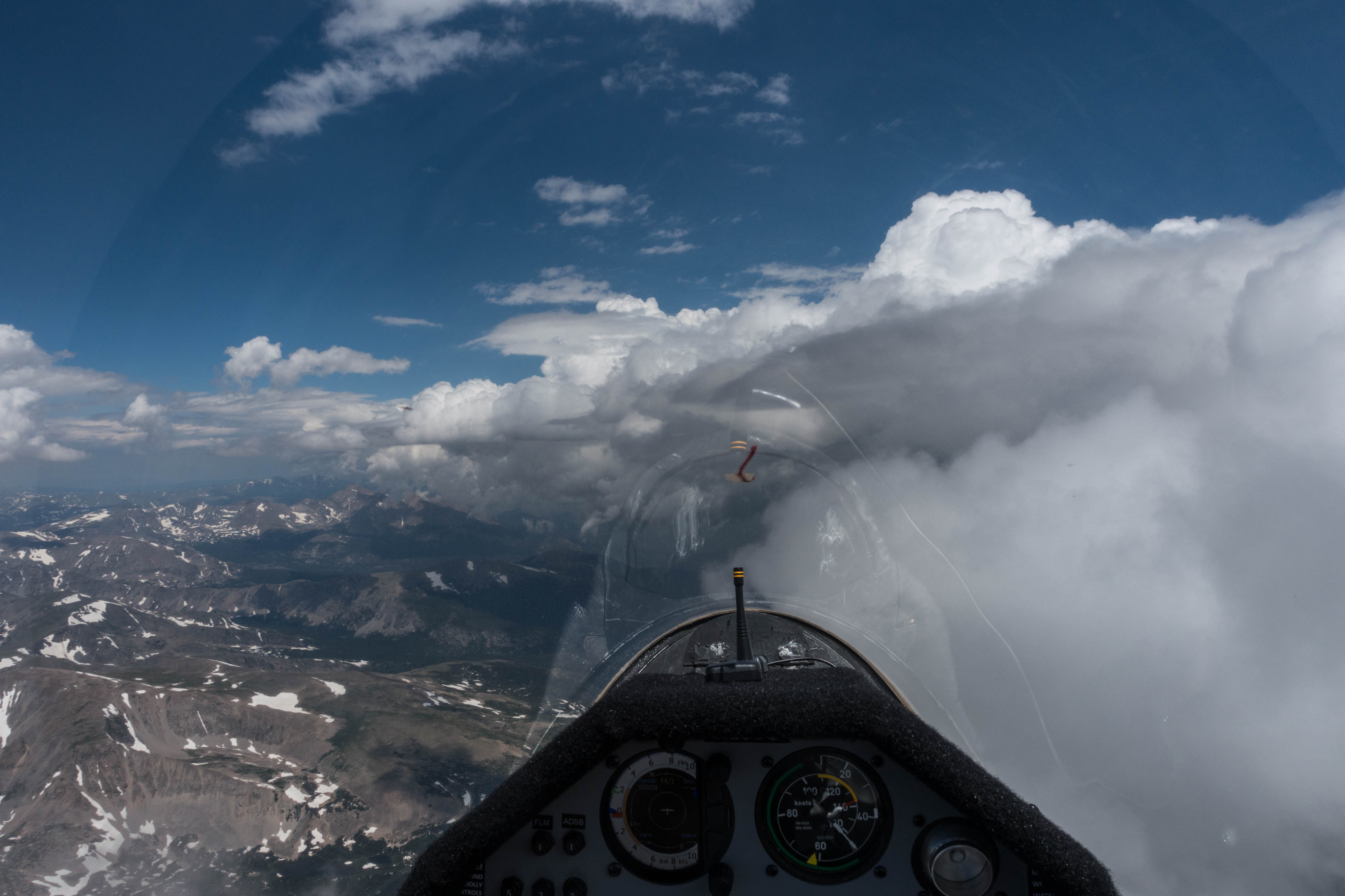
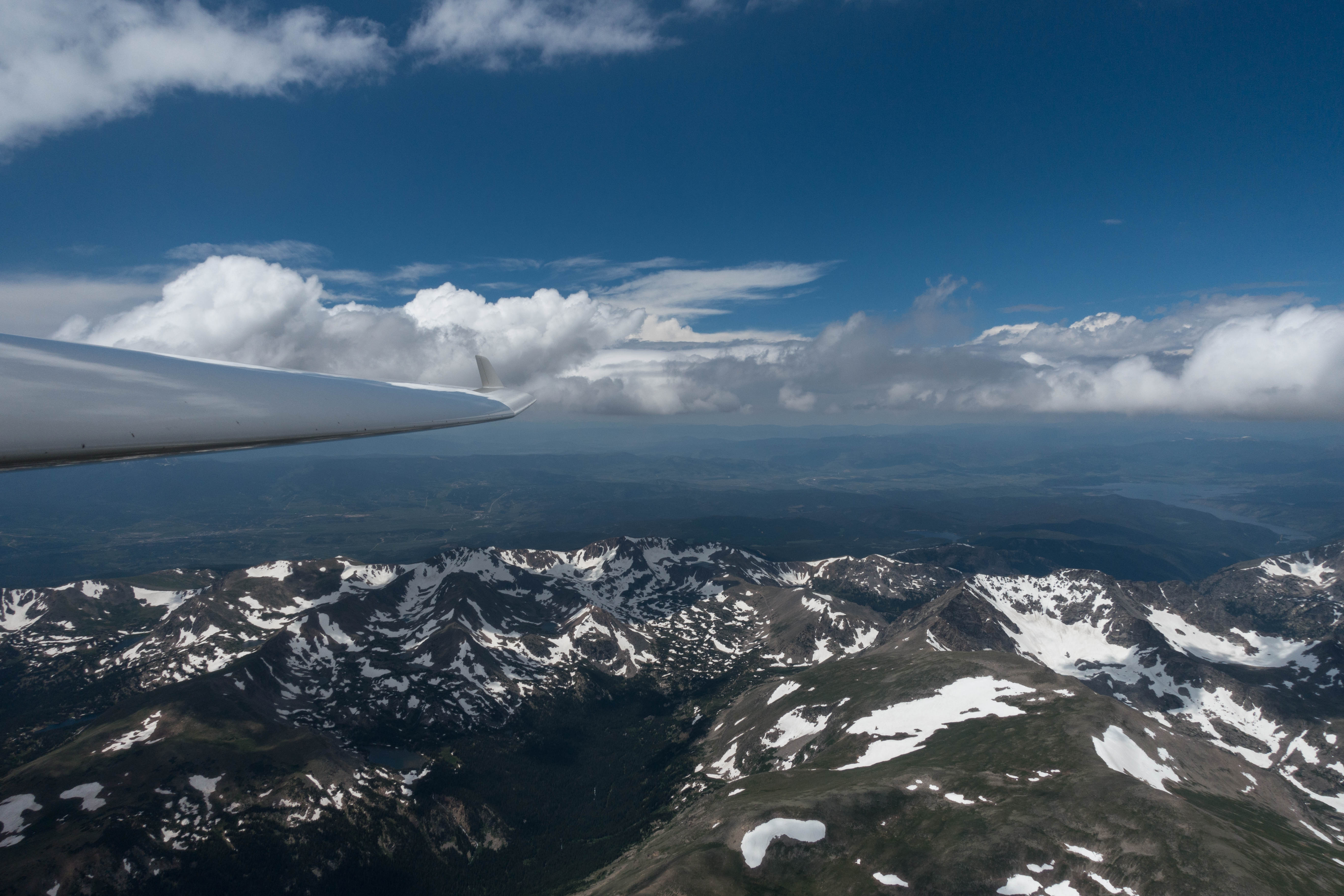
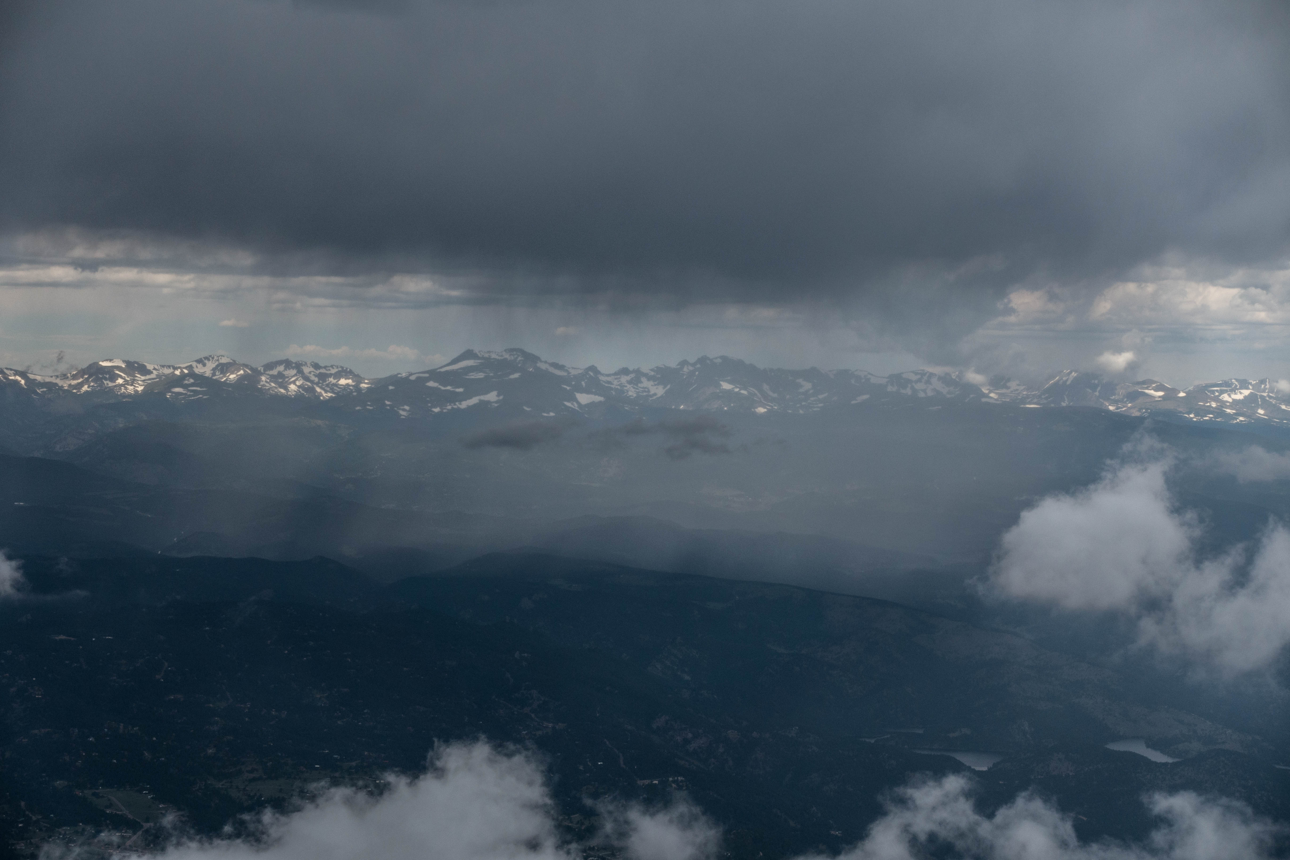
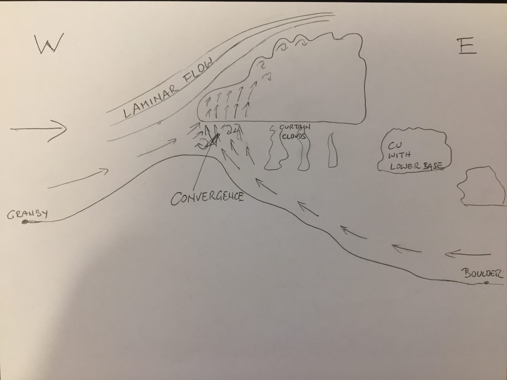
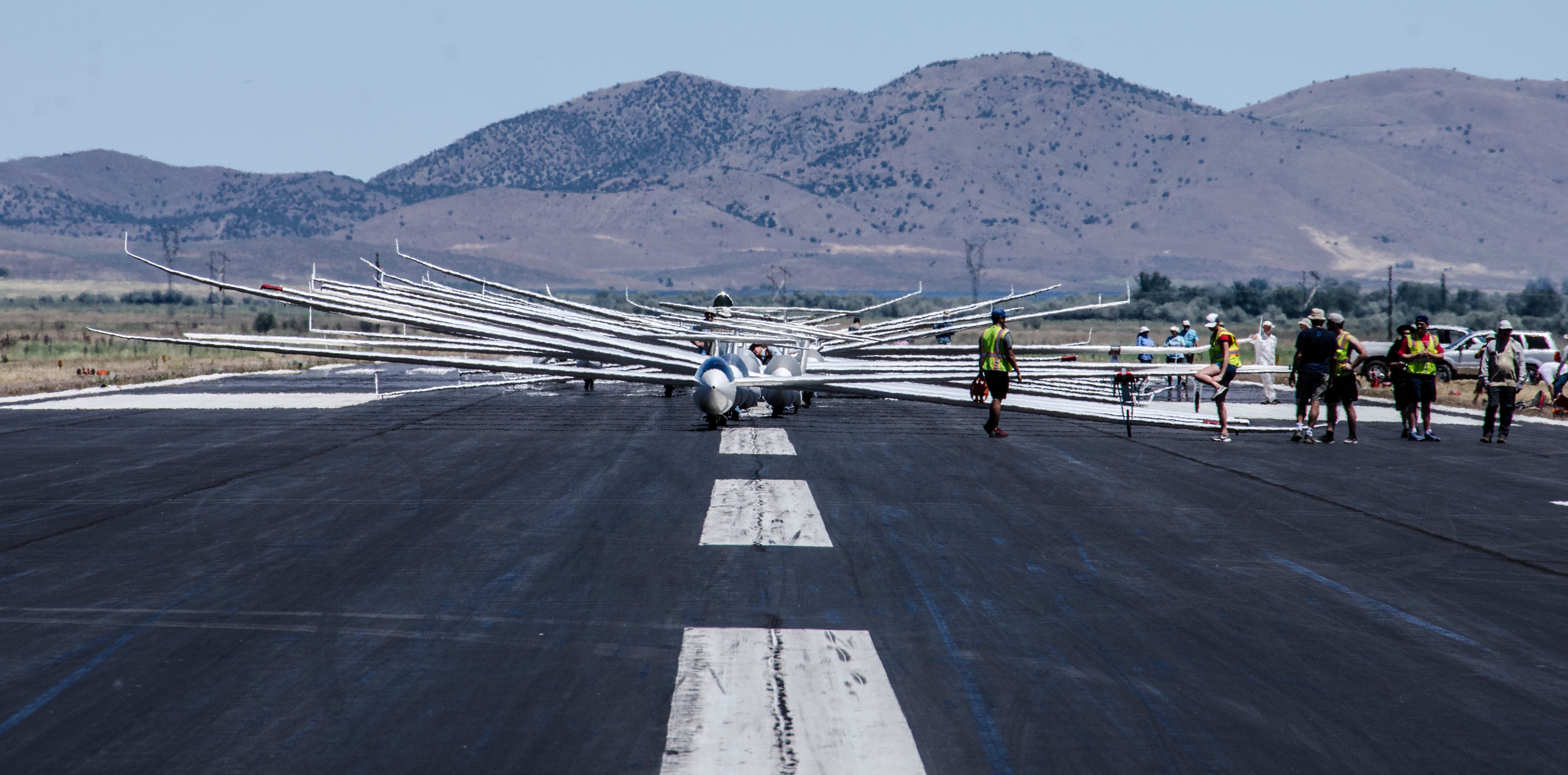
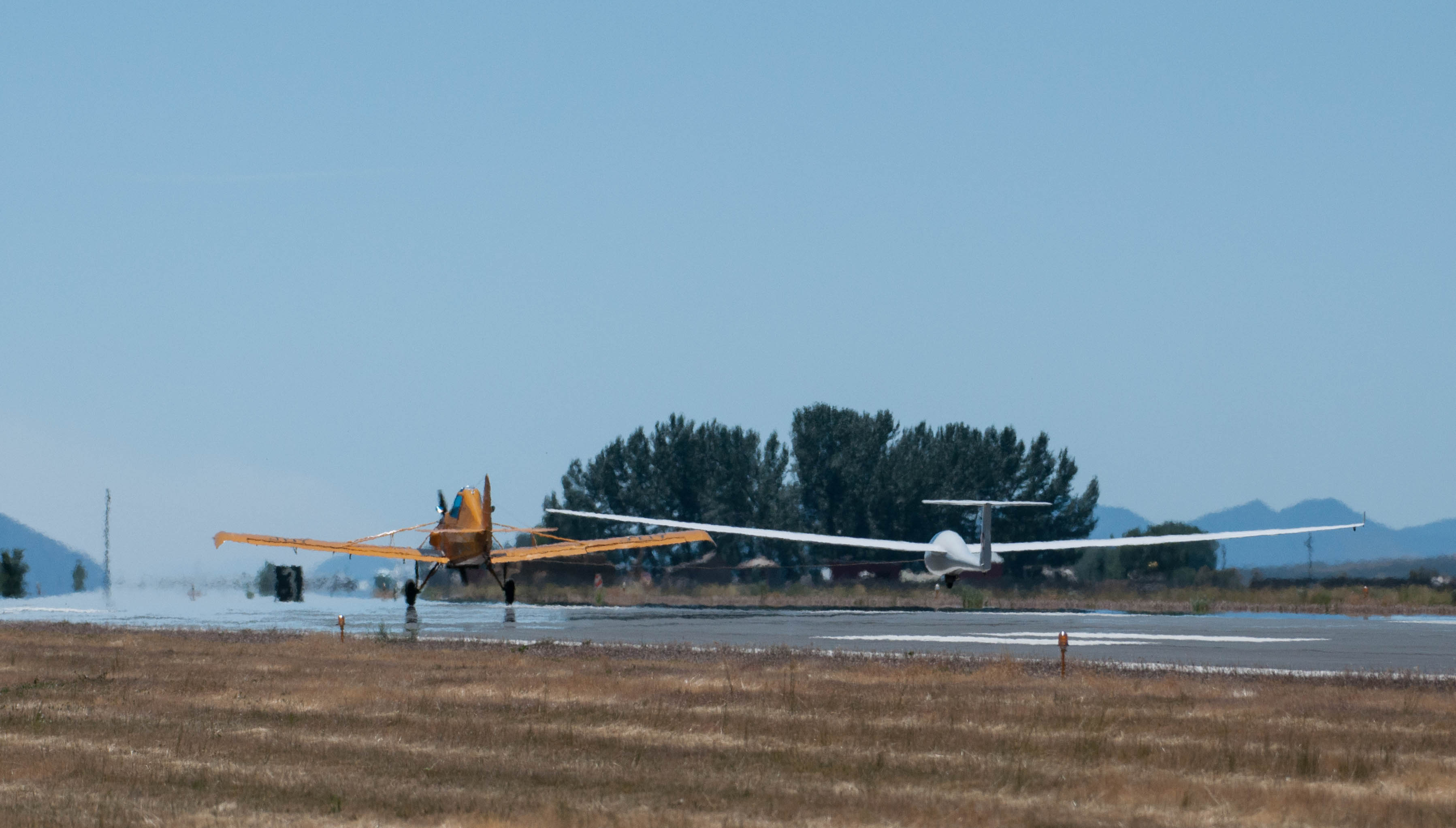


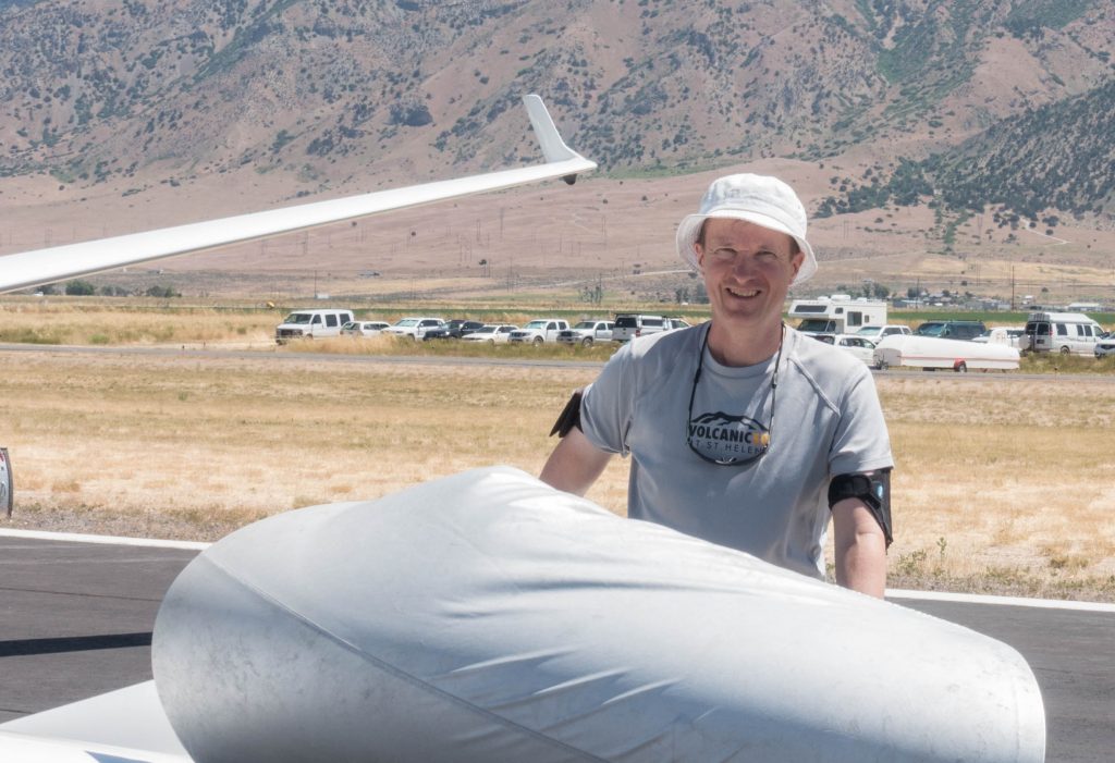
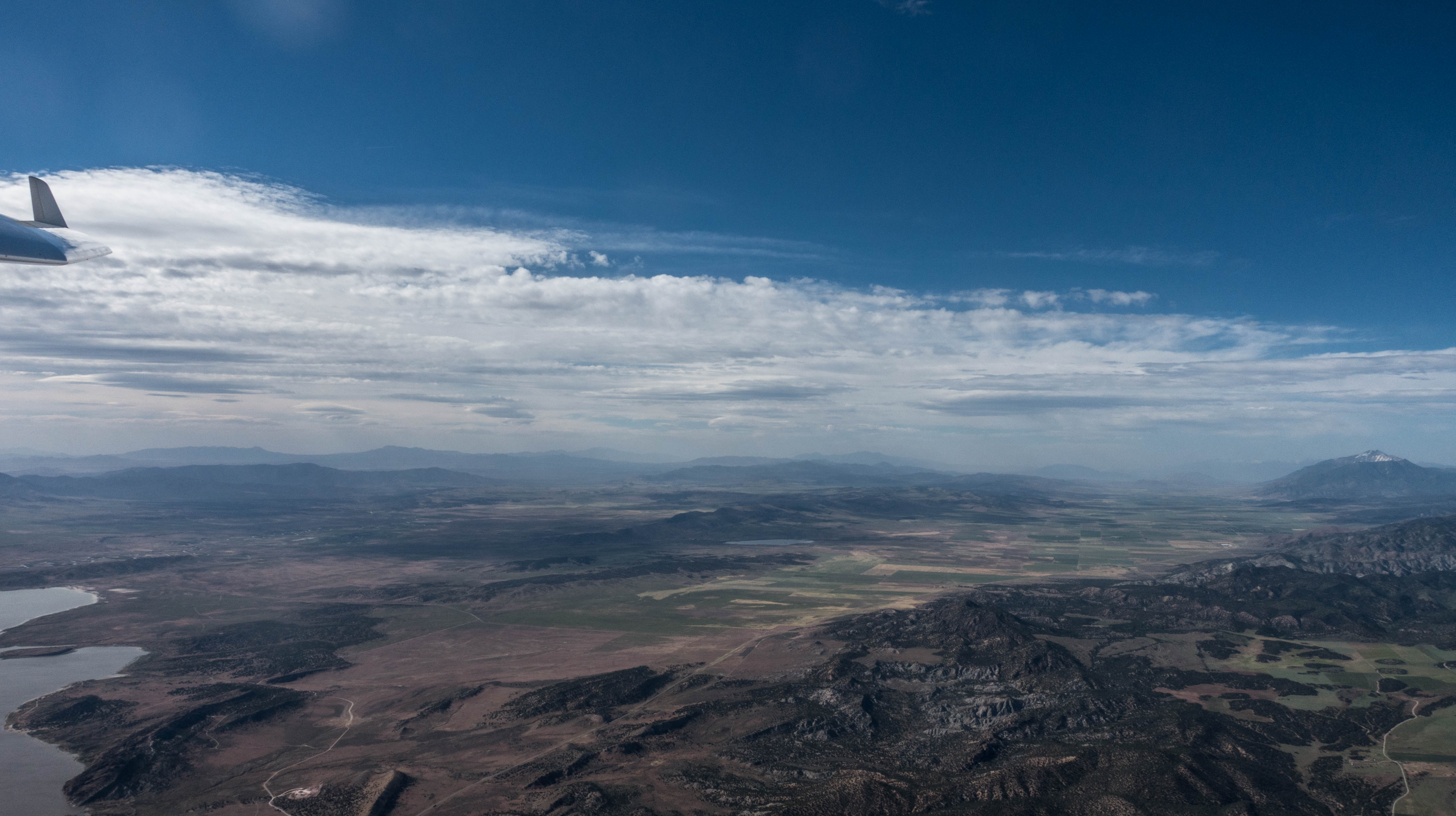
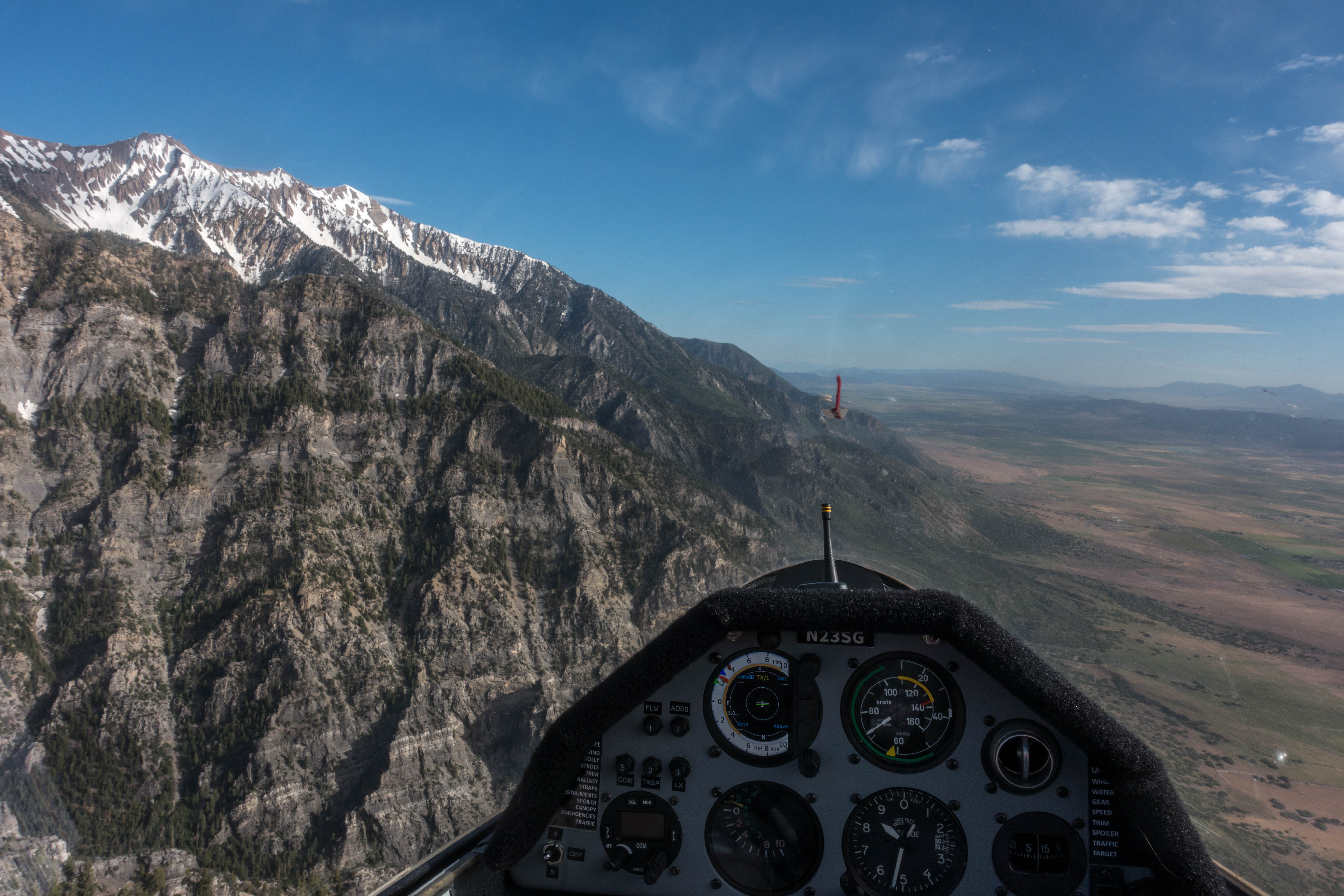
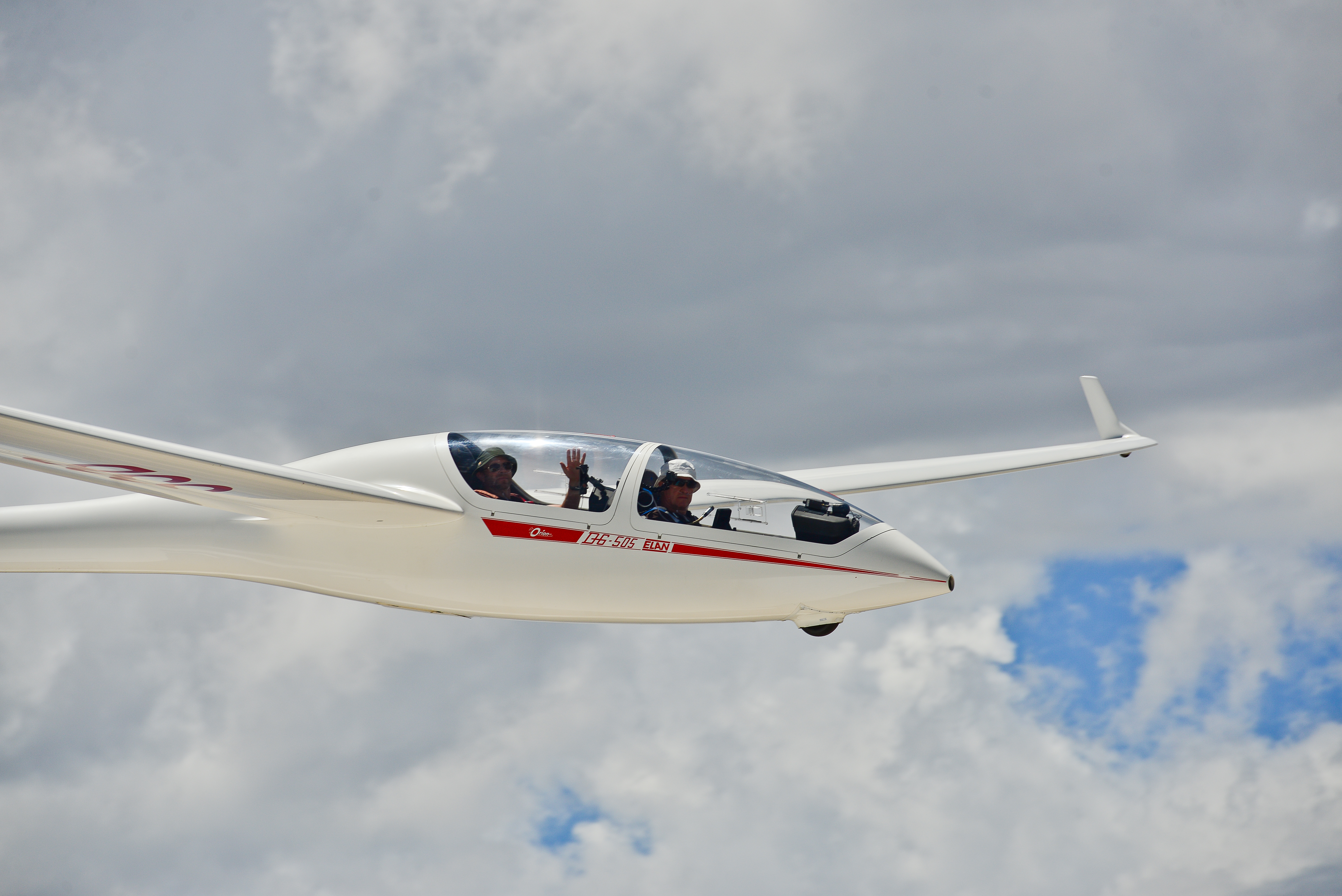

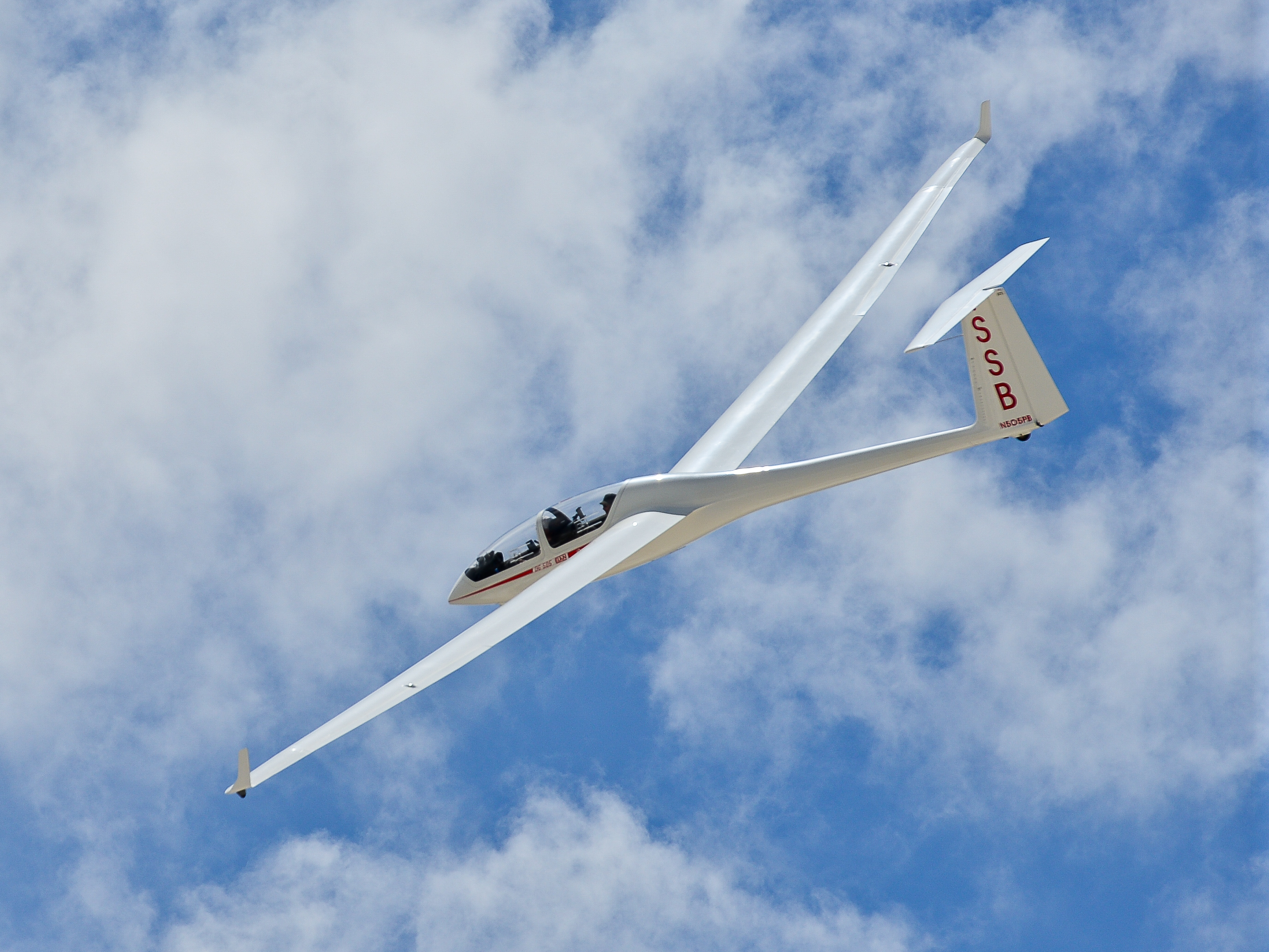
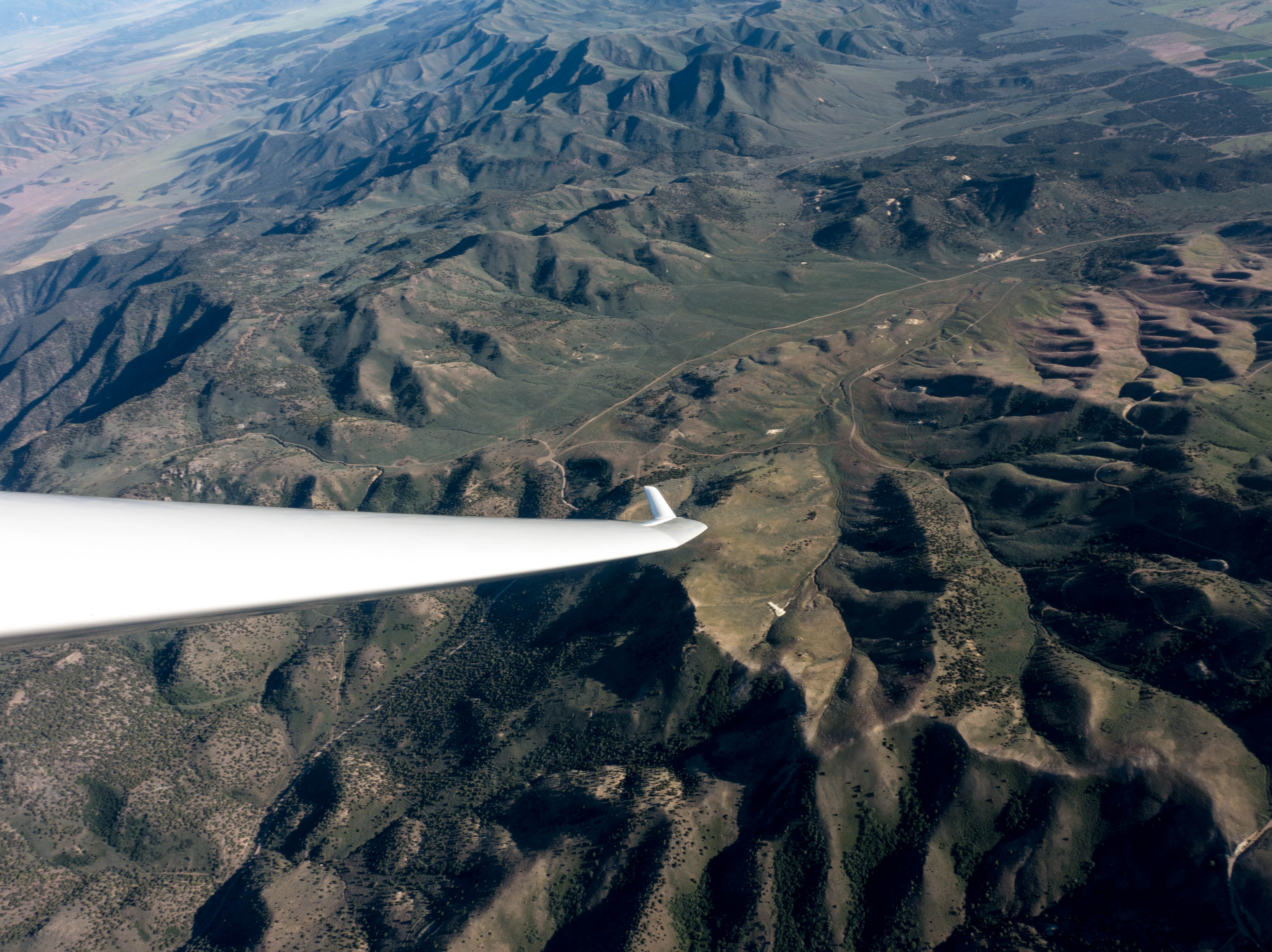
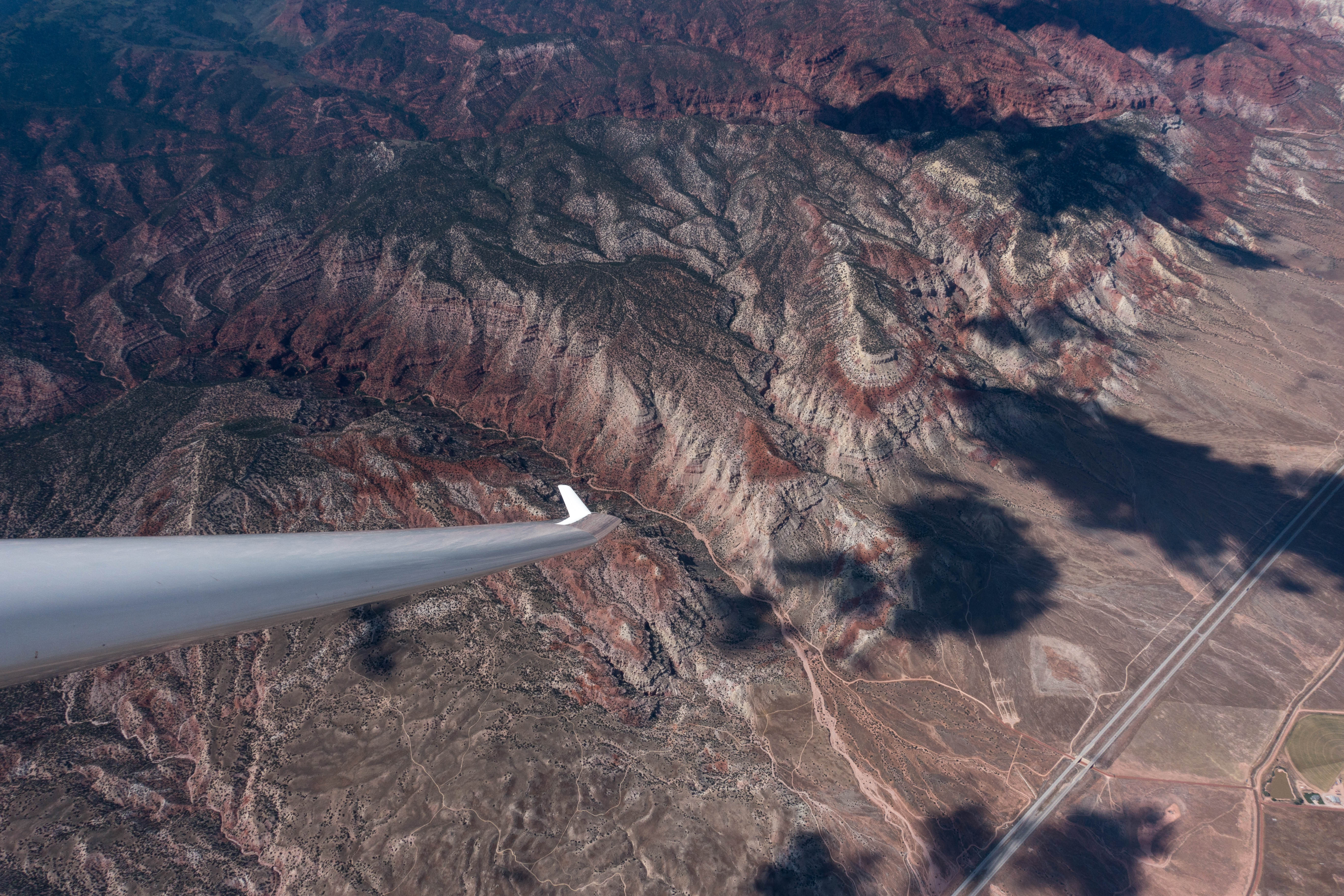
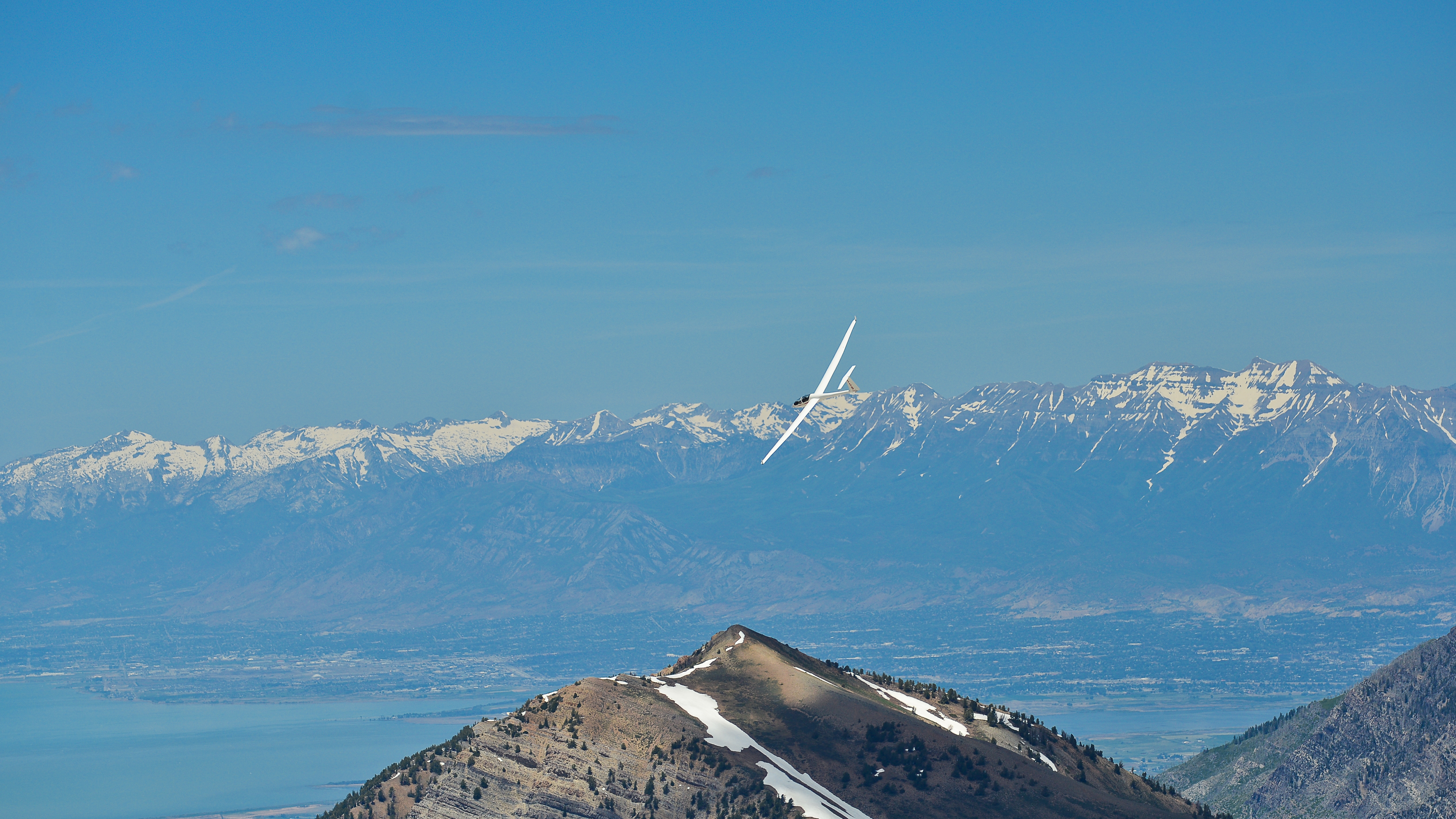
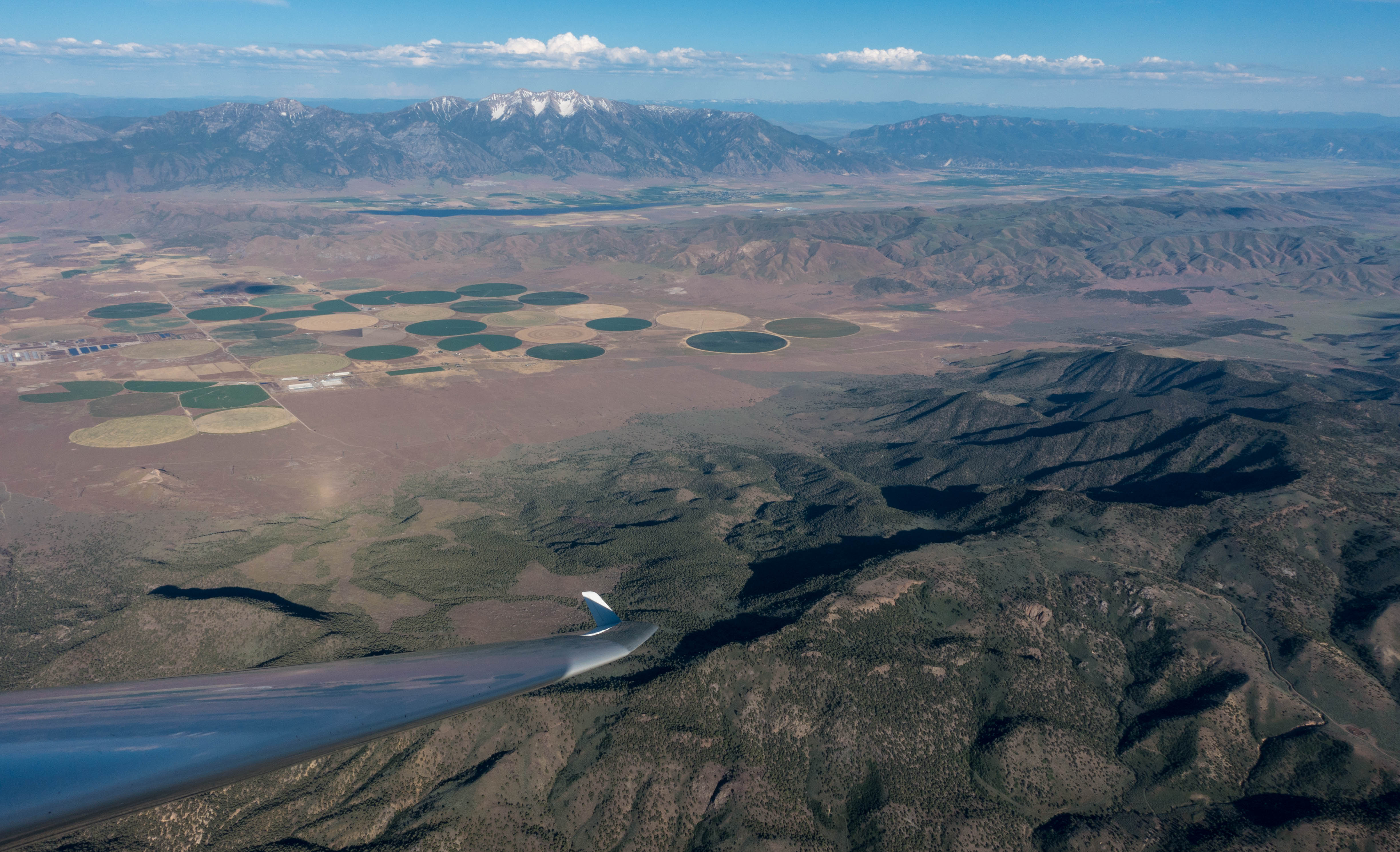
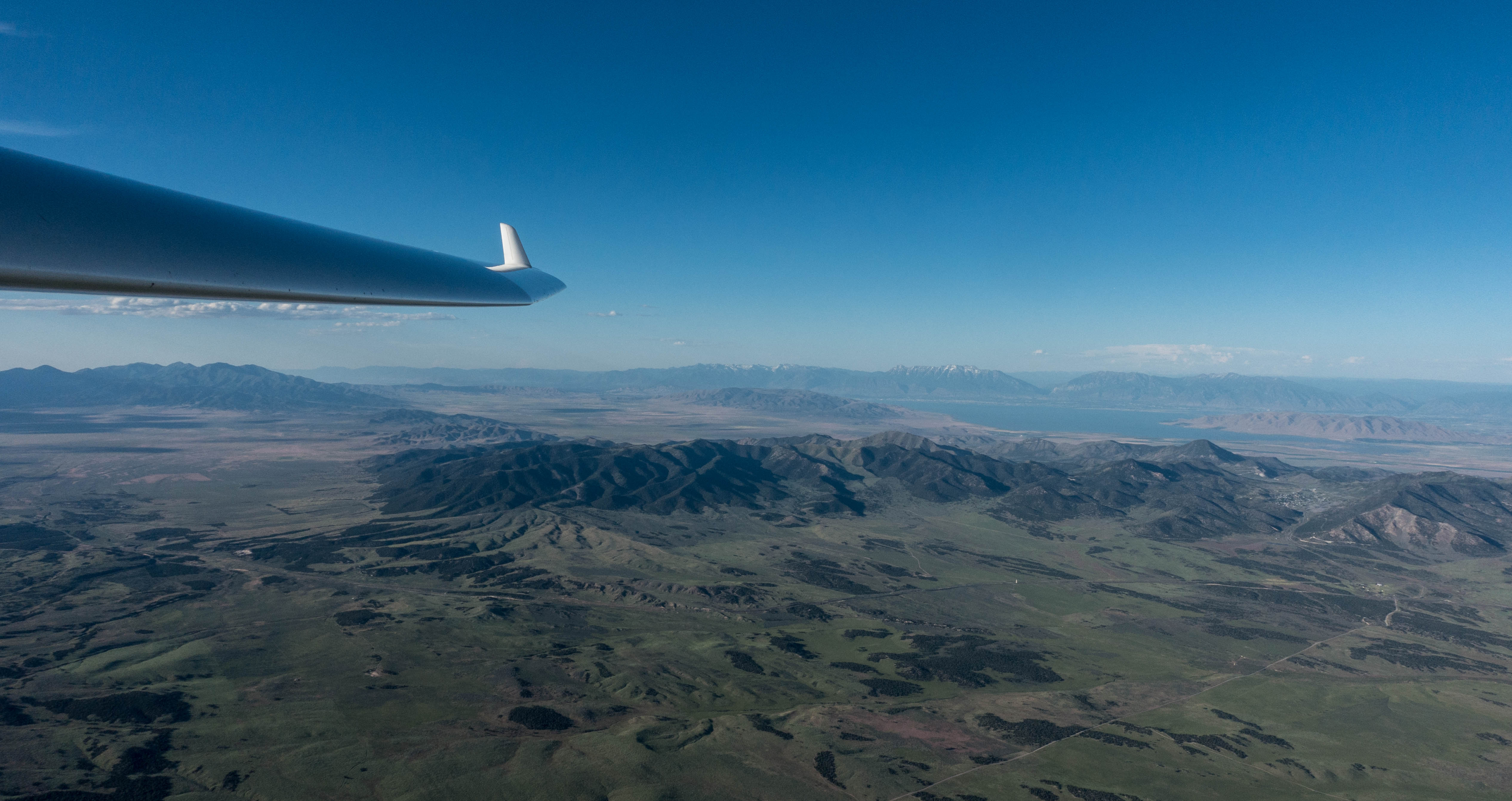
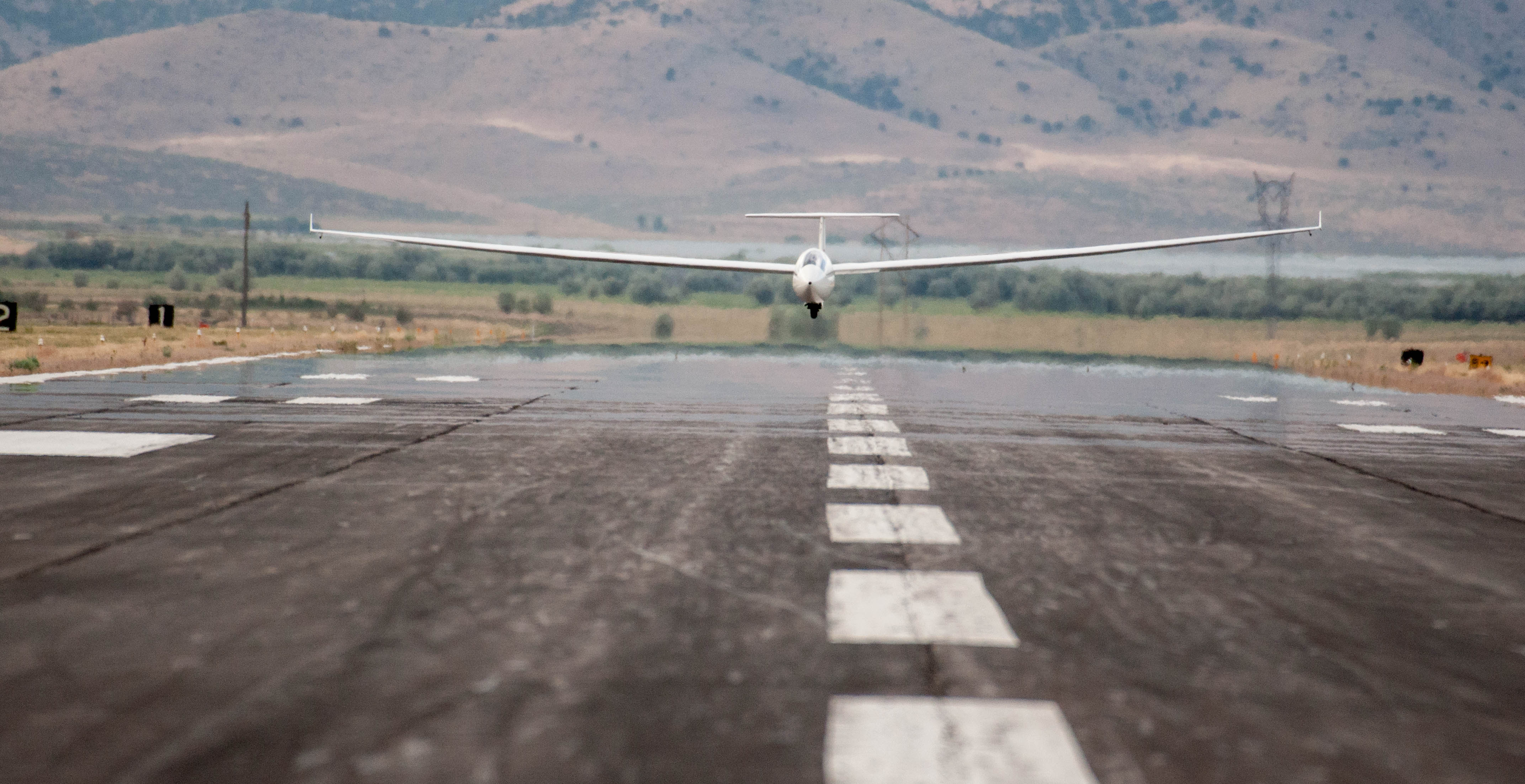
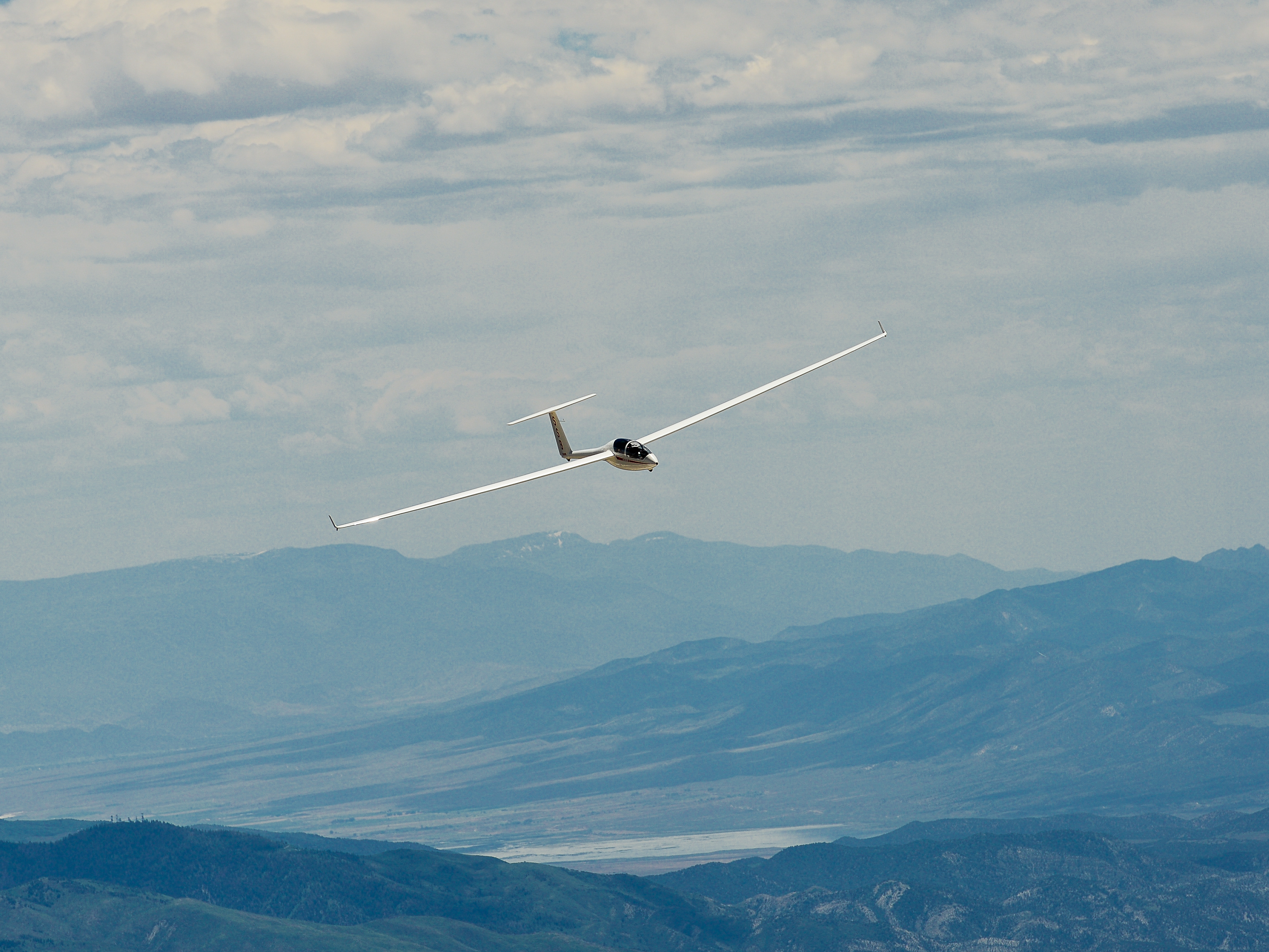
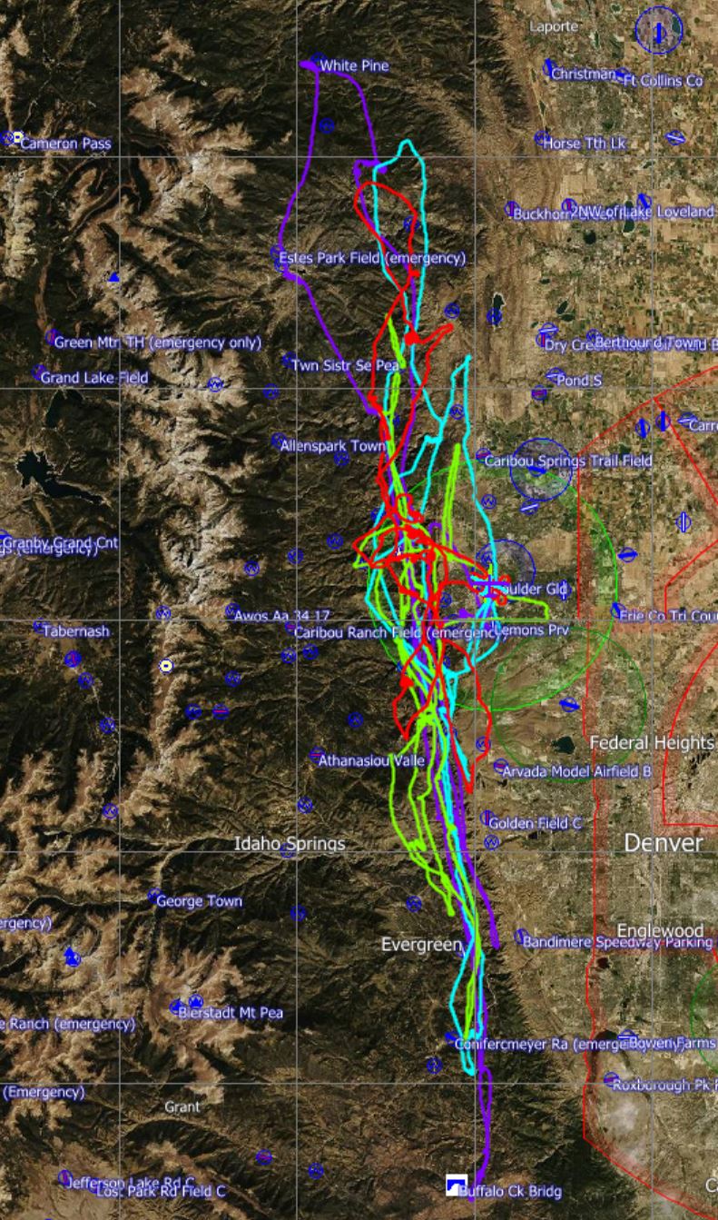


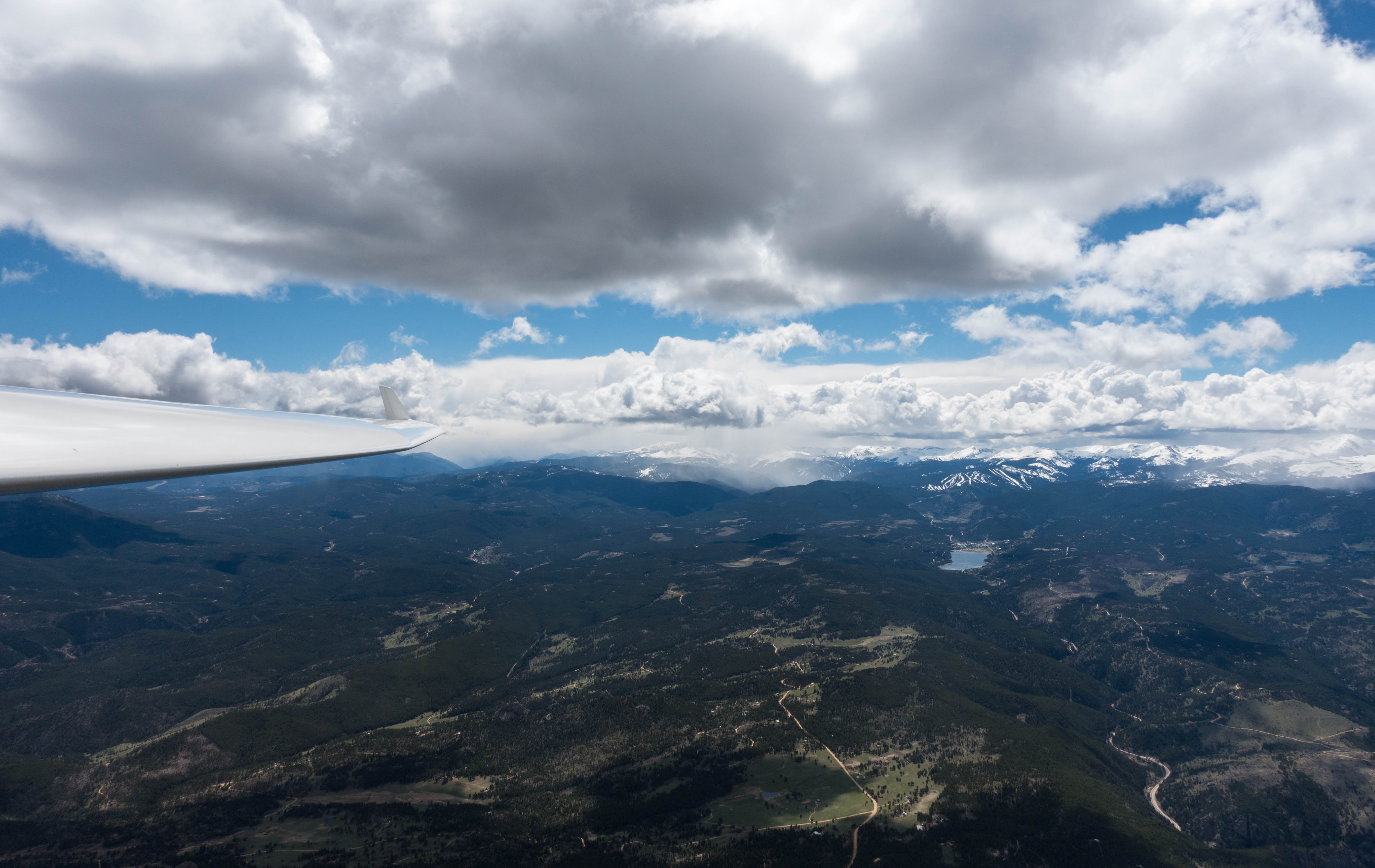
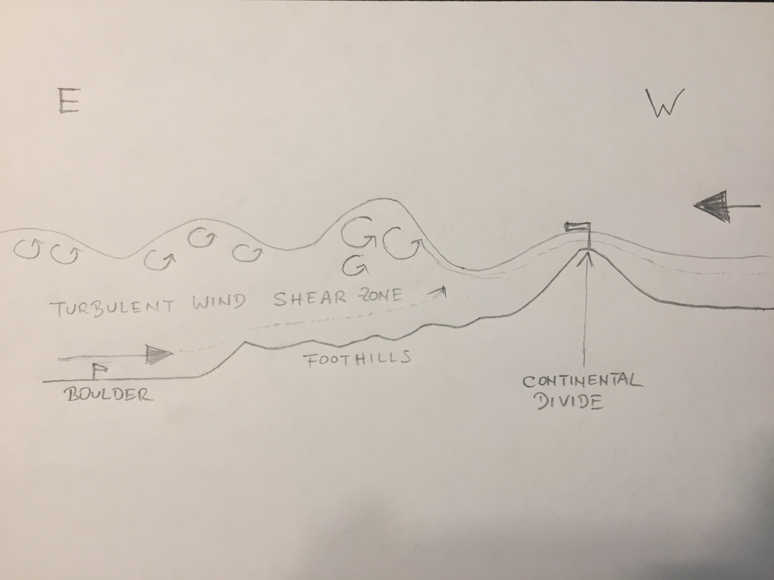
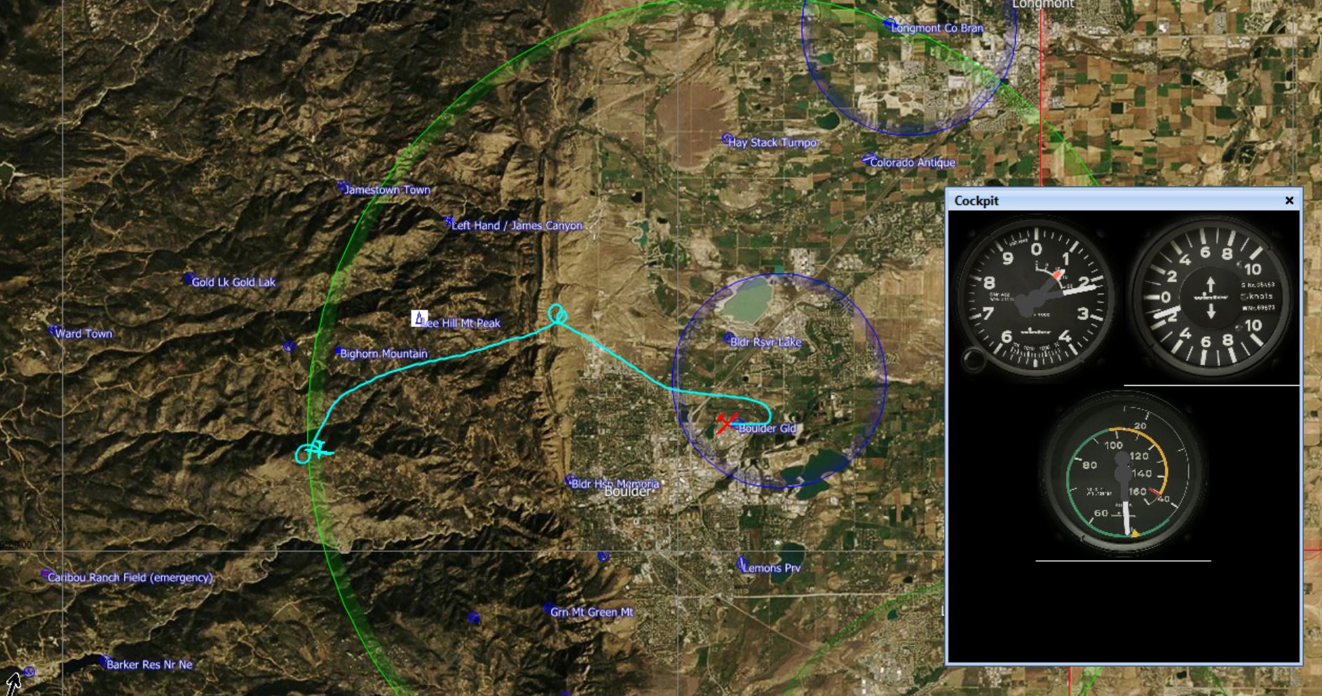
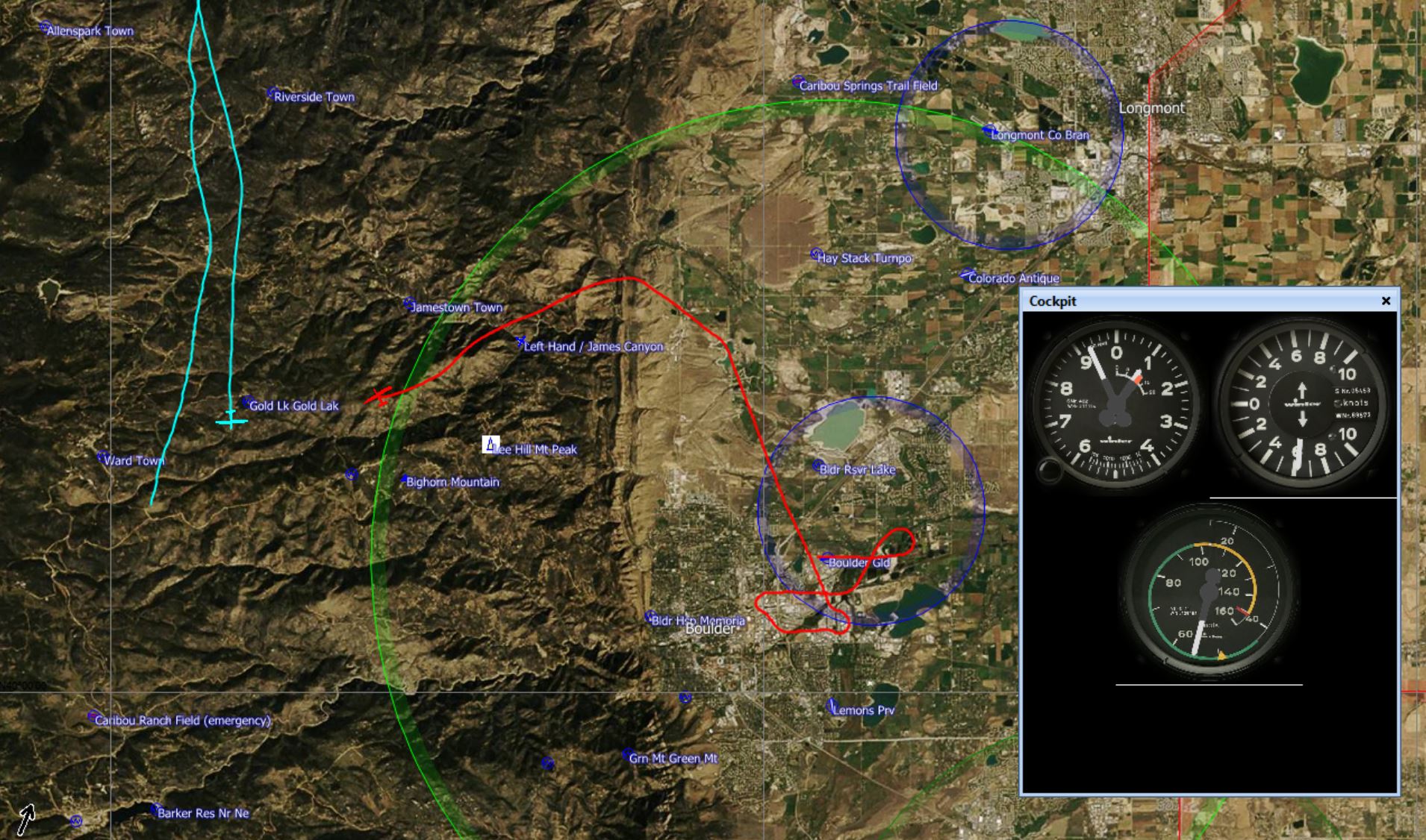

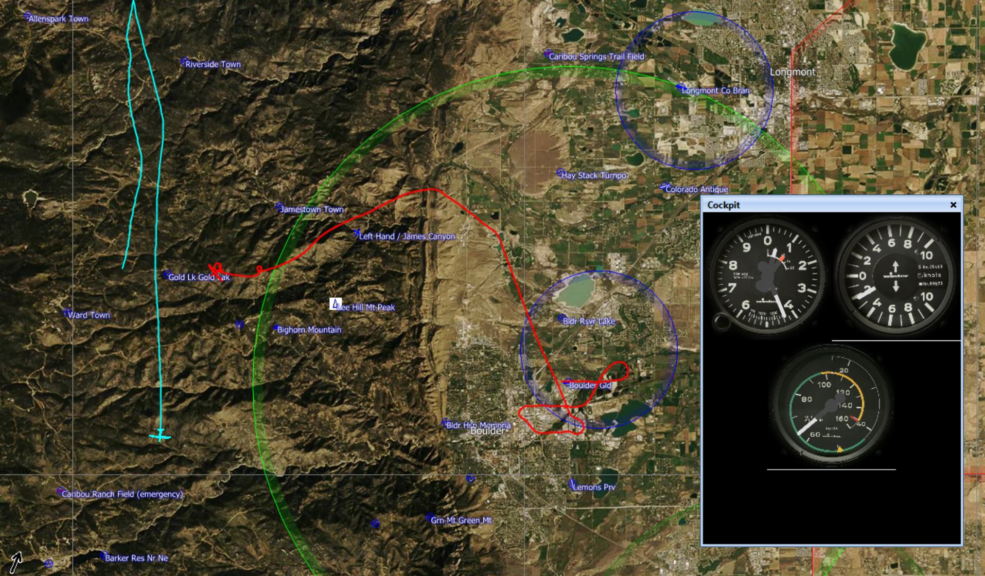
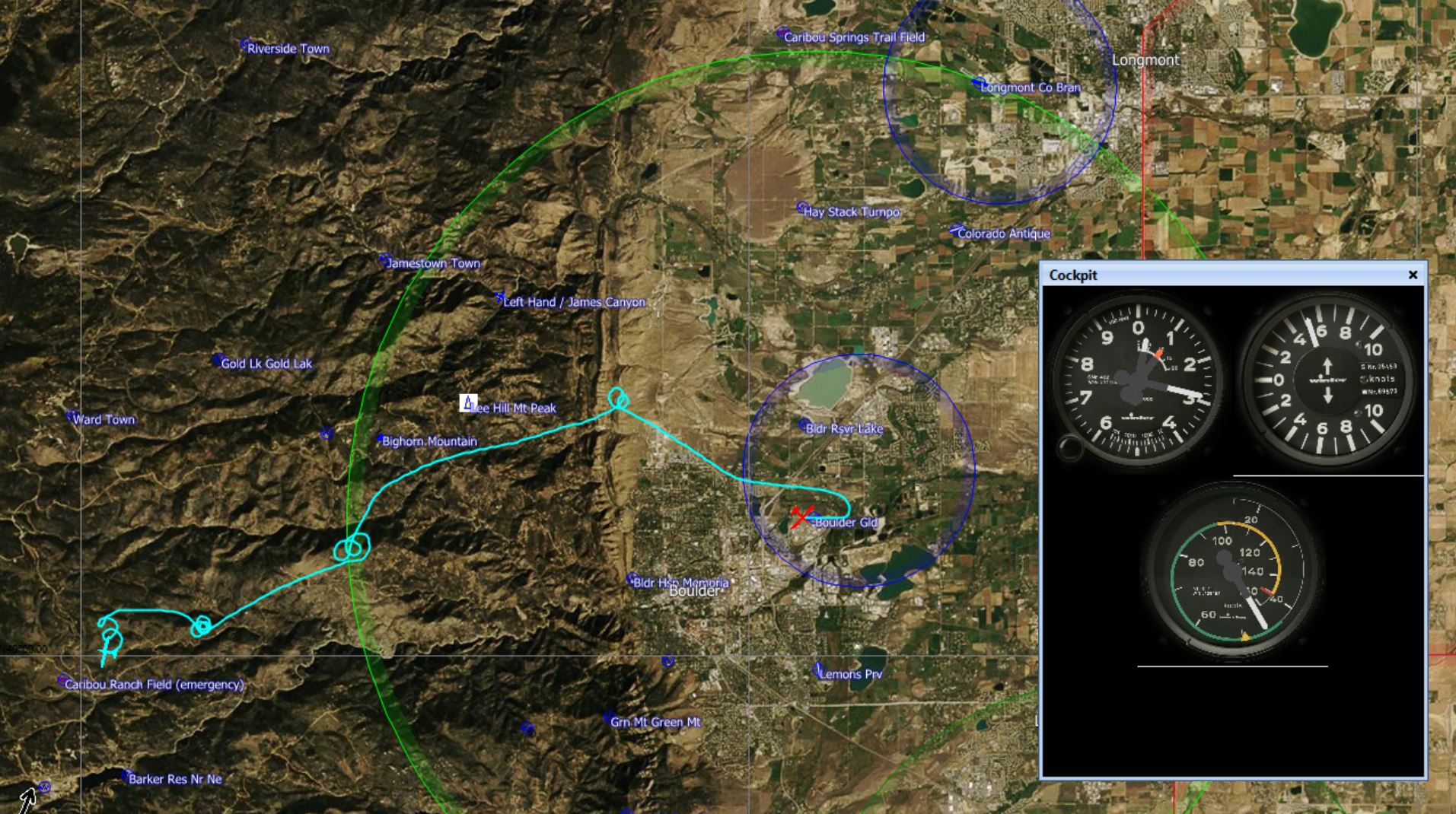
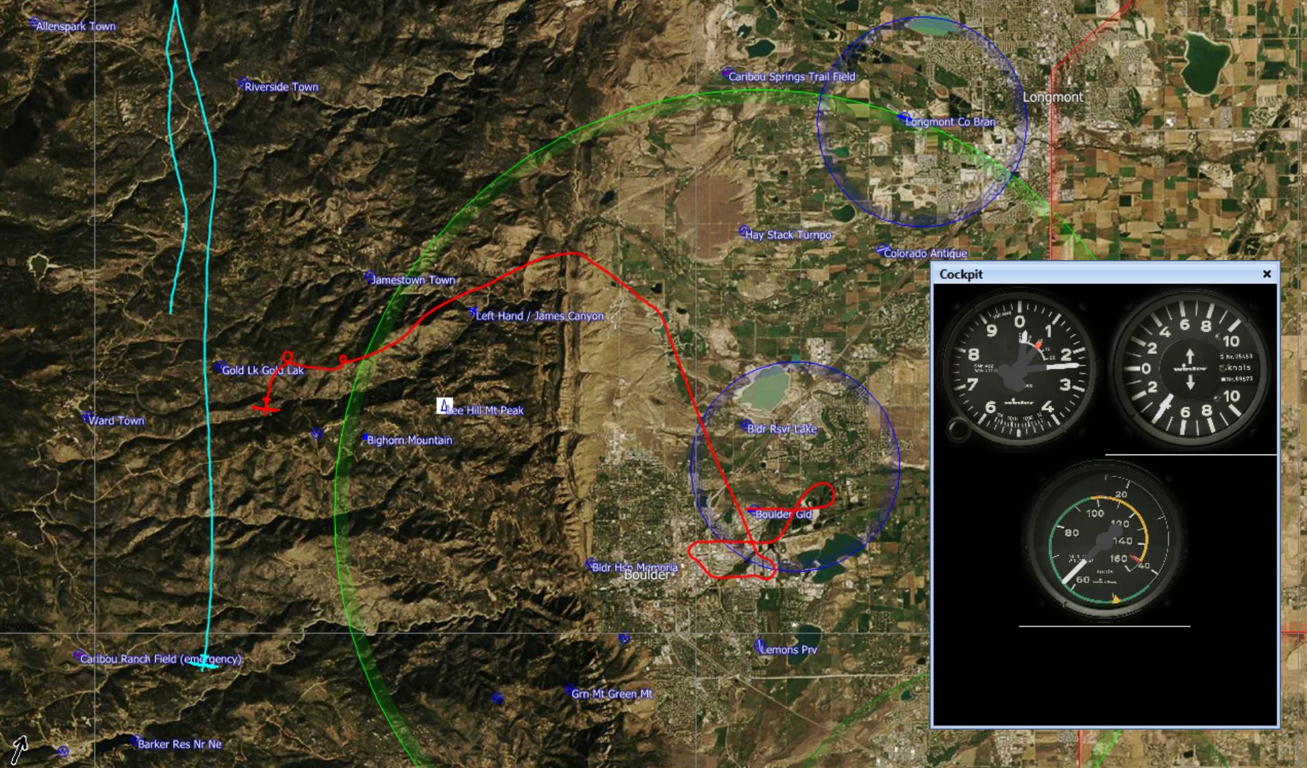
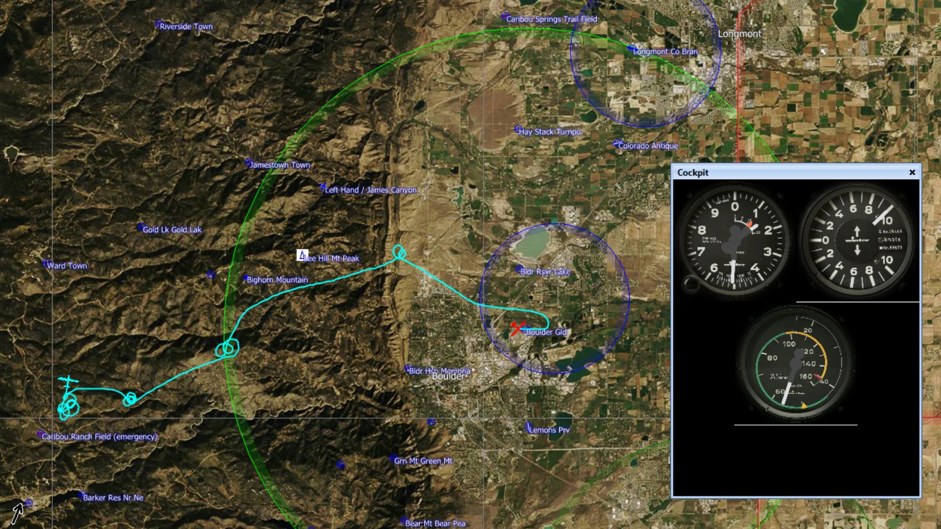
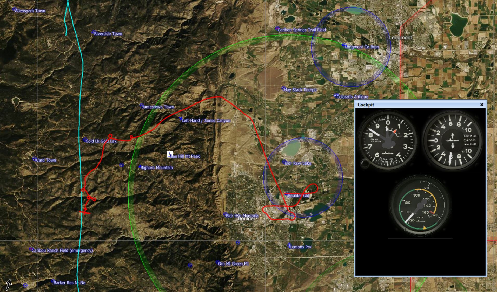
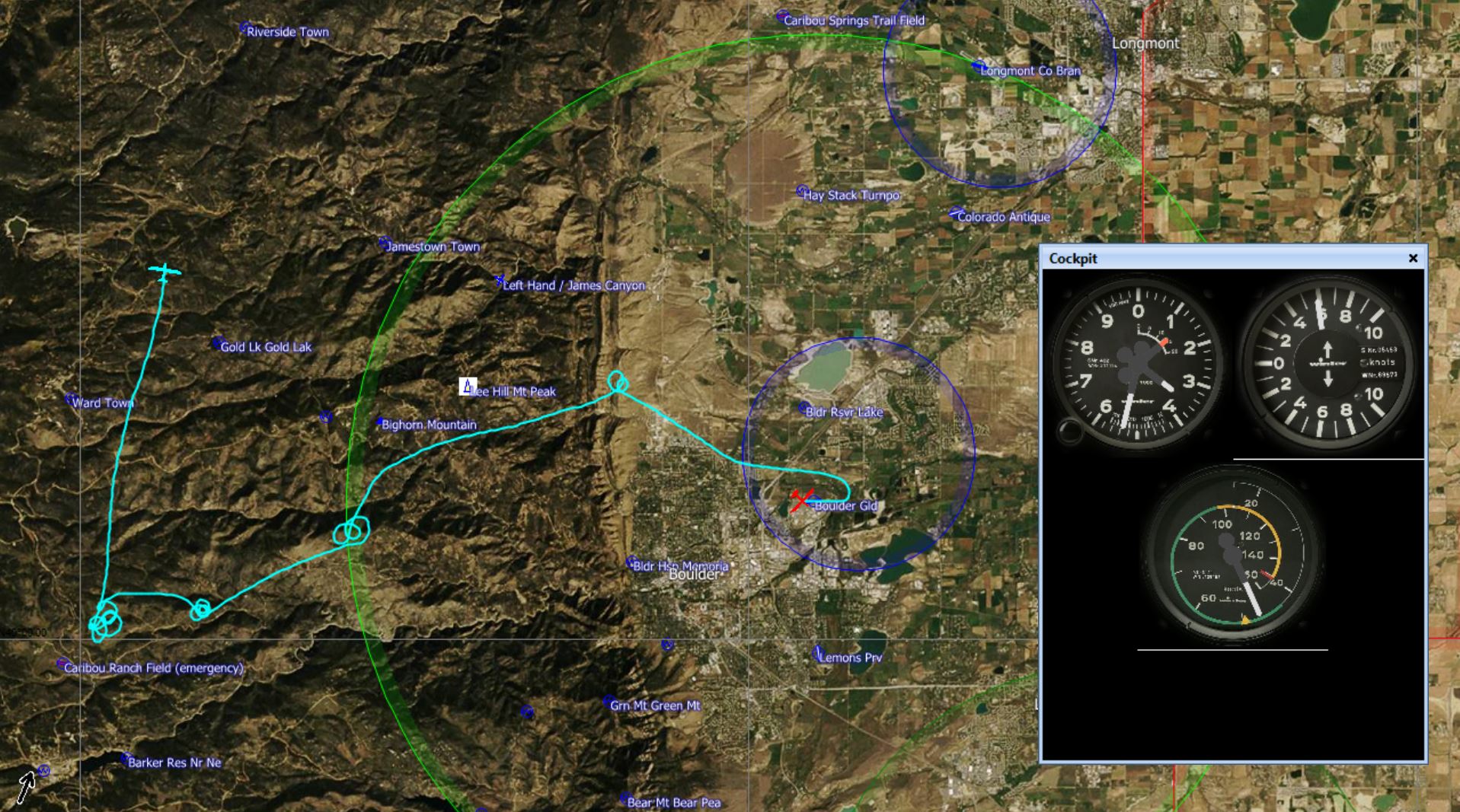
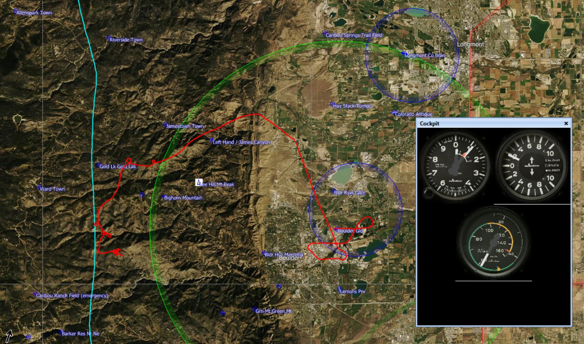
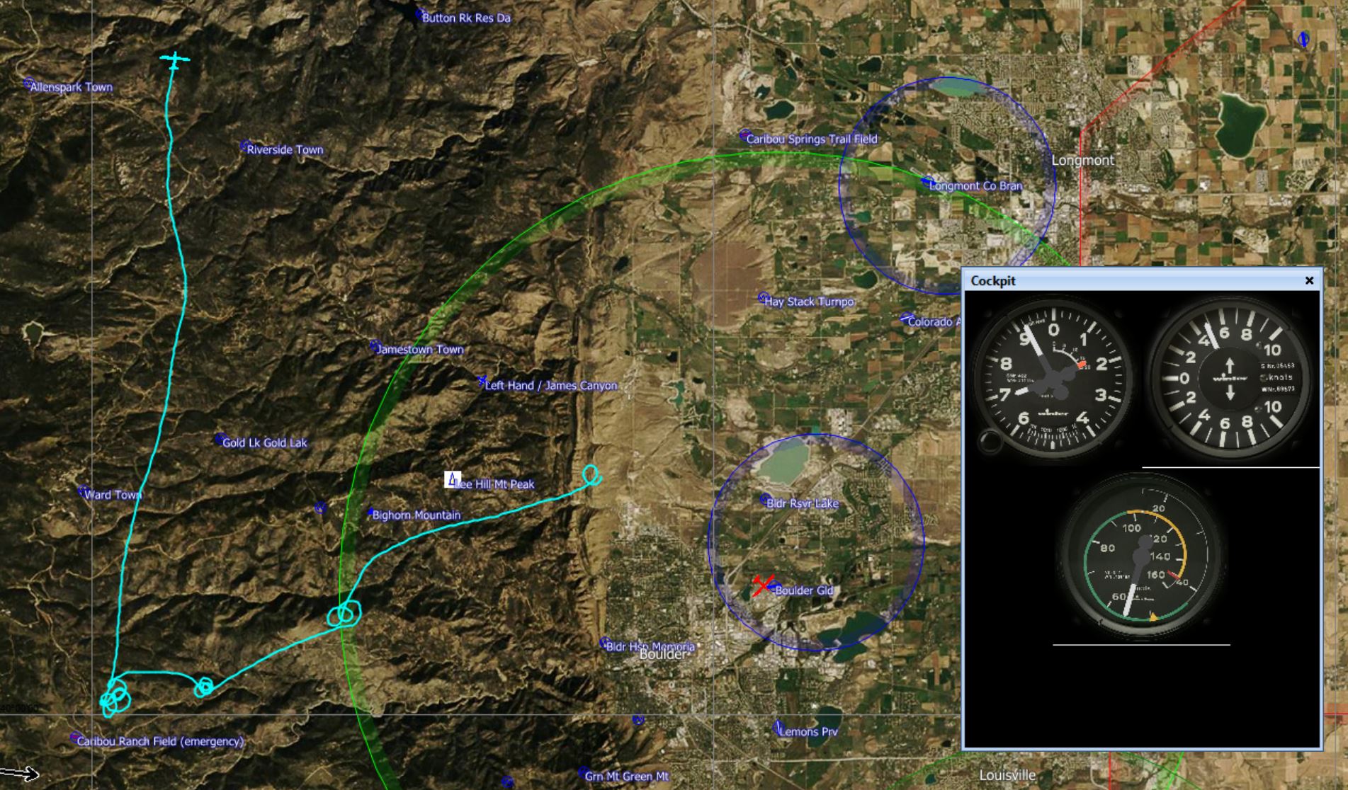

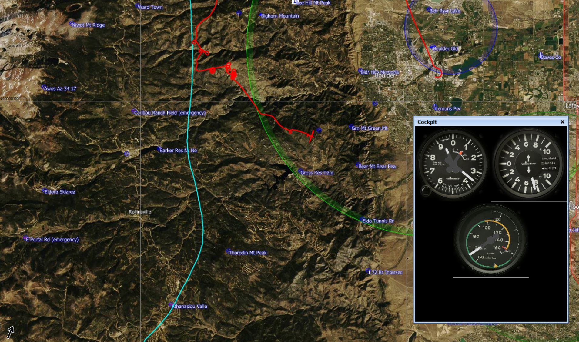
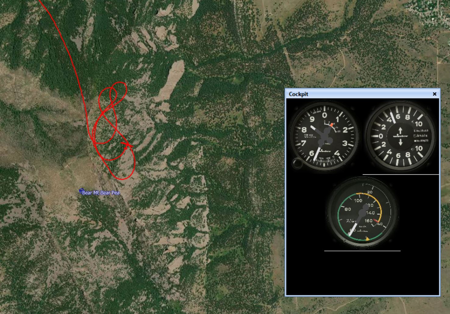