Skip to content
Soaring – Chess in the Air
A Glider Pilot Learns to Play Mother Nature
Menu
Home
Locations
Boulder, Colorado
Flight Preparation
Colorado Soaring Area Map
Colorado Waypoint Files
Boulder GlidePlan Map 1:27
Launching from Boulder
Standard Tasks and Badges
Groundbreaking Flights
Boulder Triangles
Colorado 1000+ km Flights
Colorado Outlanding Fields
Fields Overview
Field Evaluation Criteria
Caribou Springs Trail
Yellowstone Road
E of Dry Creek Reservoir
Lazy W (Pvt)
2 NW of Lake Loveland
Christman Field (Pvt)
Horse Farm
Buckeye Fields
Cherokee Park Road / 287
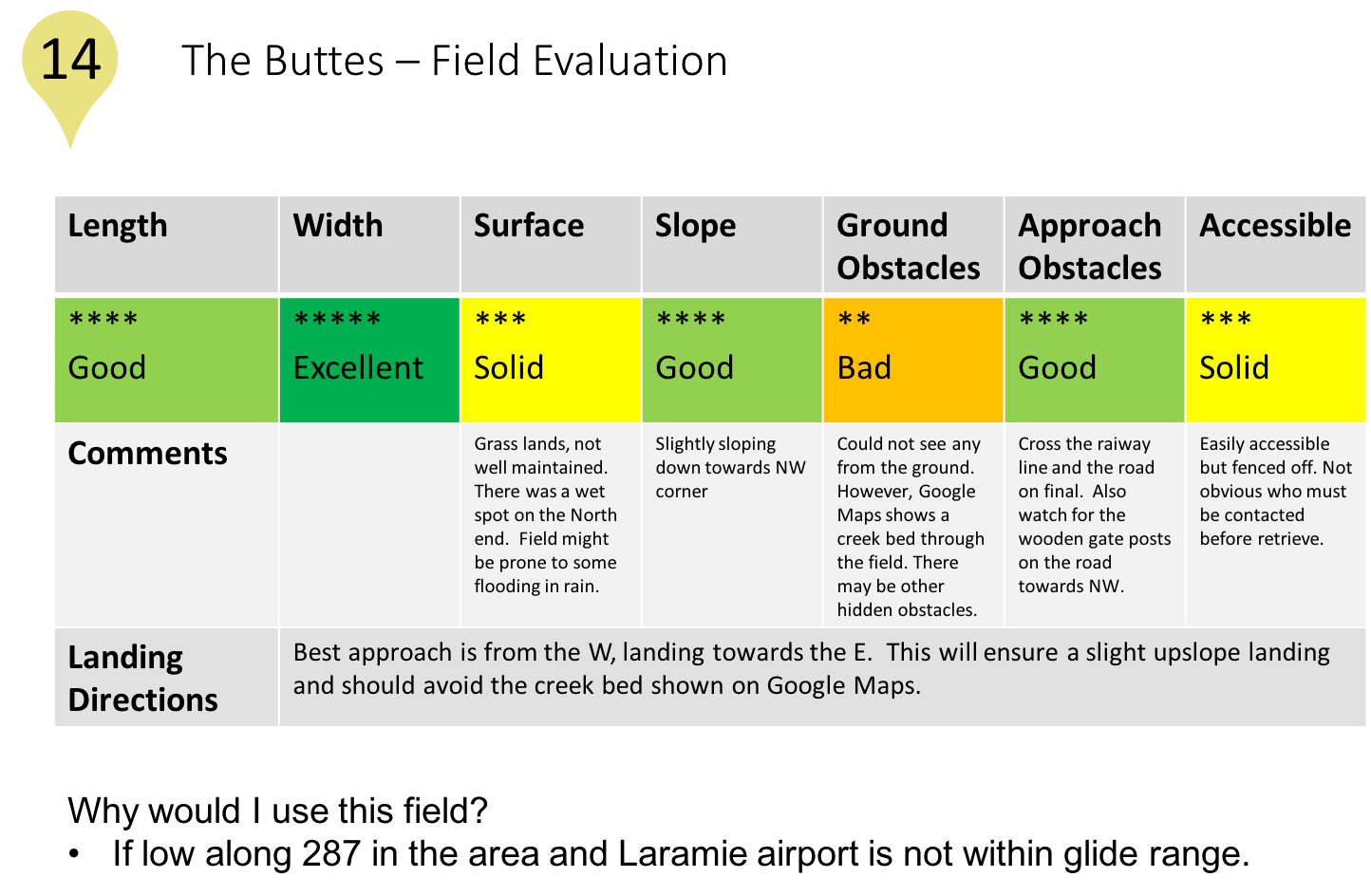
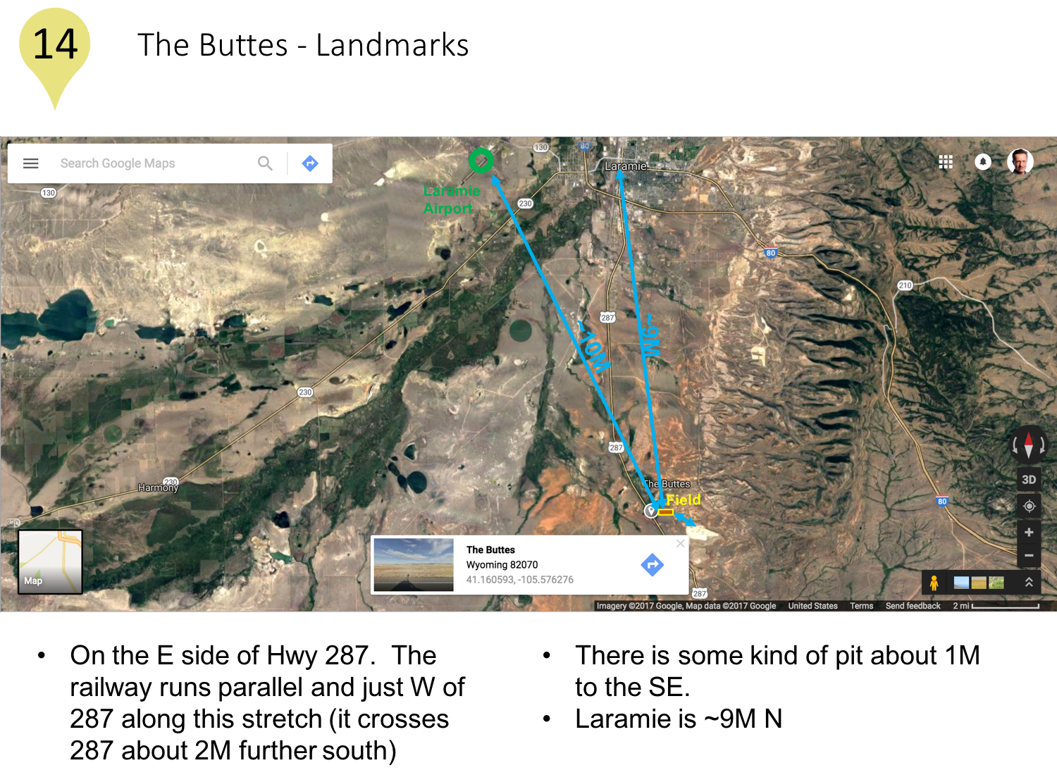
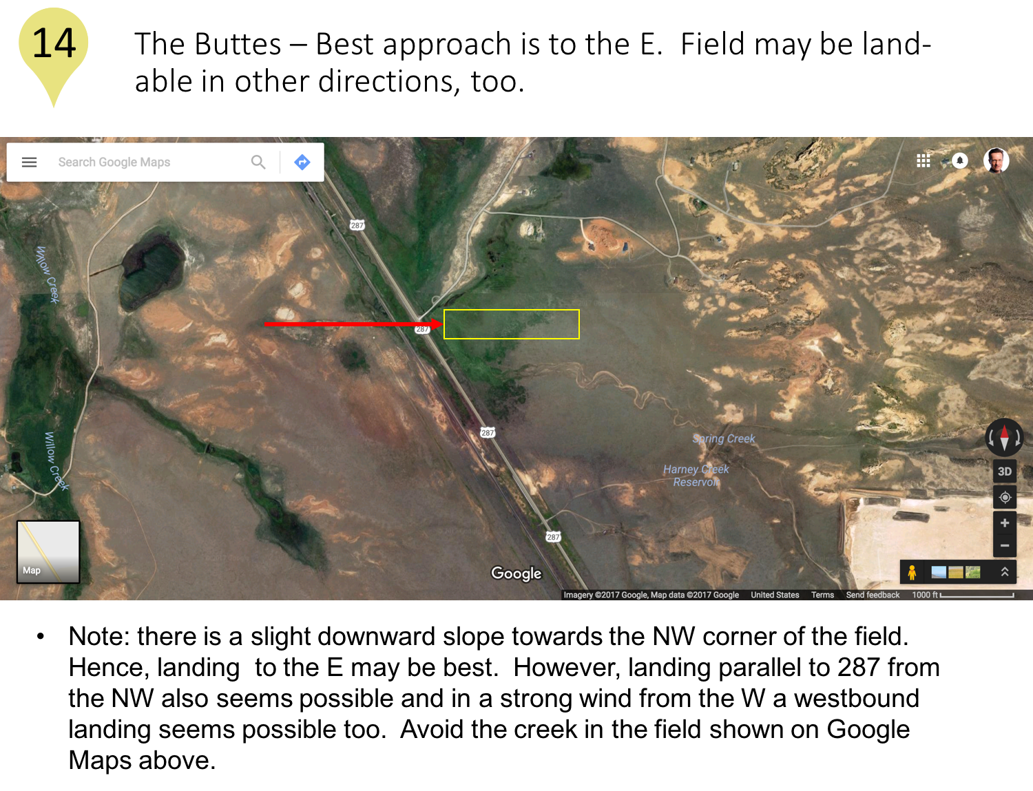
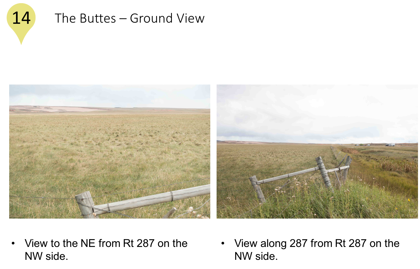
The Buttes
Pahlow Field
Brubaker Lane
Sand Creek Road
Laramie River Valley Farm
The Colorado Fourteener Challenge – One Of Soaring’s Greatest Adventures
Condor Exercises
Albert Lea, MN
Montague, CA
Parowan, Utah
Nephi, Utah
Niederoeblarn, Austria
St. Auban, France
Lift Sources
Ridge
What Is Ridge Lift?
What Conditions Produce Good Ridge Lift?
Why Is There Wind Anyway?
Direction And Strength Of The Wind
How Do I Fly In Ridge Lift?
X-Country In Ridge Lift
Risks And Risk Mitigation
Forecasting Ridge Conditions
Thermals
Convergence
Wave
What is Wave?
What Triggers Waves?
How Can I “See” Wave?
How Do Wave and Thermals Interfere?
How Do I Get Into Wave?
How Do I Fly in Wave?
How Do I Fly XC in Wave?
What Are The Risks?
How Can I Forecast Wave?
Safety
Soaring Risks and Risk Mitigation
Passenger Briefing
Emergency and Land-Out Equipment
Landing Out
Other Pilots
More To Learn
Inspiration – Videos That Will Get You Hooked
Soaring Basics
Soaring Podcasts and Other Stories
Book Reviews
Tips for Clubs
XC and Contest Flying
Other Information
About Me
My Flights
My Videos
My Presentations
My Tools
My Professional Bio
My Colorado 14ers
Aircraft Flown
Live Tracking
Contact Me
The Buttes
Loading Comments...
Write a Comment...
Email (Required)
Name (Required)
Website