
Colorado is a fantastic place to fly gliders but the terrain is complex and unforgiving. For any cross-country flight it is critical to be familiar with the topography and safe places to land. This article explains why.
I have created the following maps to help in my flight preparations. They do not replace a sectional map but they are based on satellite imagery, include important data for soaring flights such as Restricted Airspace, MOAs, and Class B, C, and D airspace information, and provide a visually appealing view of the topography with labels for major mountain ranges. They also include all data from my personal Colorado Waypoint Files that you can find here. That means I can see public and private airports, waypoints, and my landout fields as I prepare for flights.
(If you’re having trouble downloading the files from the links below, you can also try to download them from this Google Drive folder instead. )
1) Colorado Soaring Area
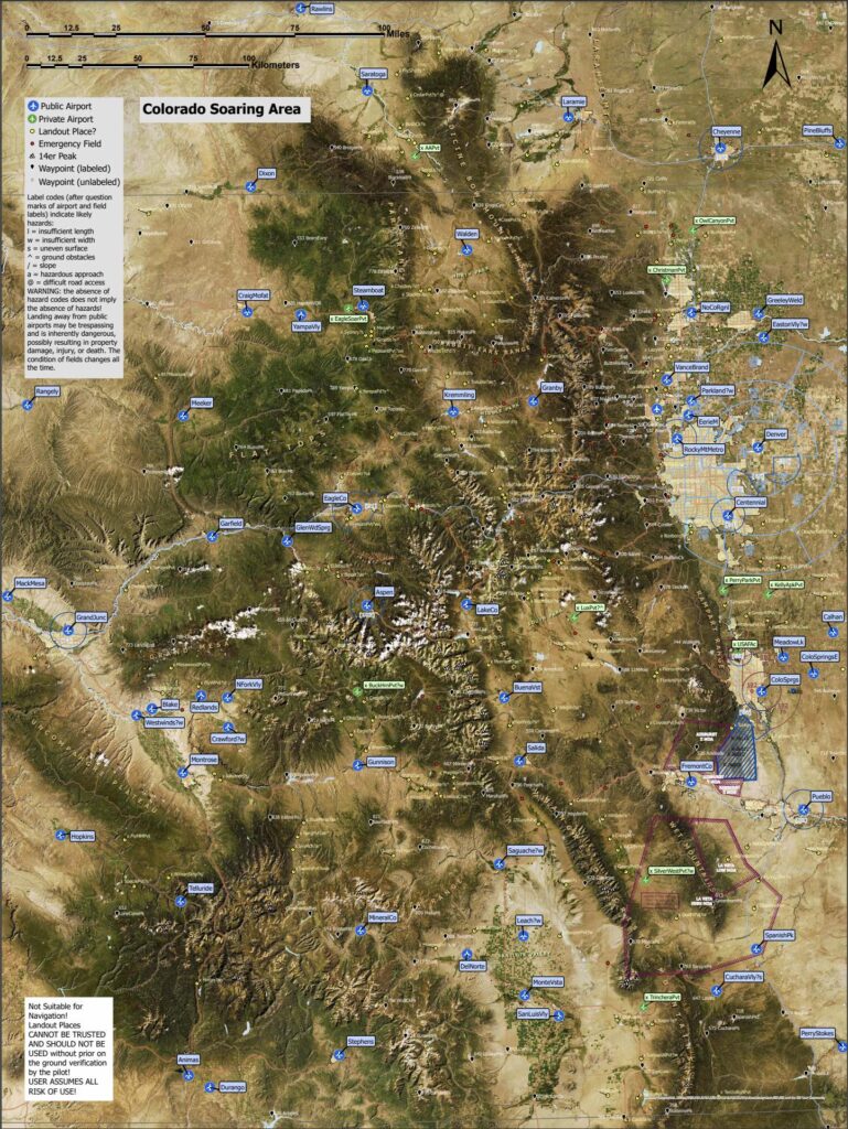
This map is available for download and printing in high resolution in two different versions:
-
- It can be printed as a 30×40 inch poster in its entirety. In this case the scale is 1:500,000. It contains the location of public and private airports, major waypoints, all 14 er peaks, as well as potential landout and emergency fields (which are not verified and require prior on-the ground verification by the pilot in command – USE AT YOUR OWN RISK!). Click here to download. (Downloading may take some time – this is a big file so be patient.)
- A smaller version comes in two parts (north and south) at a scale of 1:850,000 so it can be printed on 18×12 inch paper, which I can fold and take with me in the cockpit. Here are the links to download the high resolution files: North and South. (Again, be patient, the files are big so they print well.)
2) Front Range Soaring Area
This is a more detailed map just for the Front Range that includes even more waypoints and detailed labels. (This is essentially the area where it is possible to keep Boulder in glide in a high performance glider provided that cloud bases are above 18,000 feet.) The distance from north to south is still well over 100 miles. It is possible to complete all distance badges (including Diamond) within this area. Look at this article for task recommendations.
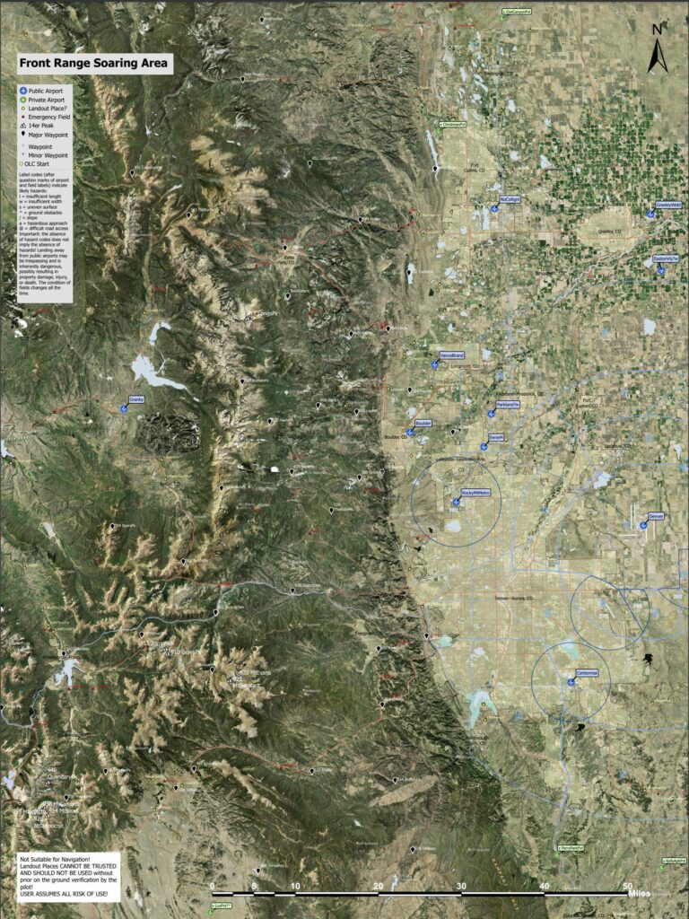
This map is also available for download and printing in high resolution as a 30×40 inch poster or as an 18x 12 inch map as follows:
-
- When printed in poster size (30×40 inch) the map is at a scale of 1:175,000. It can be downloaded here. (Once again, it may take a minute or two to download the file.)
- A smaller version can be downloaded for printing on 18×12 inch paper. In that case the map’s scale is 1:300,000. It can be downloaded here.