Rocky:
You see, flying takes three things: Hard work, perseverance and… hard work.
Fowler:
You said “hard work” twice.
Rocky:
That’s because it takes twice as much work as perseverance.
(from the movie “Chicken Run” by Aardman Animations)
Yesterday the Soaring Society of Boulder held its annual “Workfest” – a club event to clean and wax the club ships and get all other equipment in top shape. It was also the best soaring day of the week and one of the last remaining OLC Speed League weekends, so the plan was to start work as early as 7am so we could finish early and fly as soon as the bulk of the work would be finished.
My alarm was set for 5:15 am and by 6:30 I was among the first to arrive at the field. I figured it might be one of the last chances of the year to attempt a Diamond Distance Task (a pre-declared 500km flight with no more than 3 turn points). I wanted to get the work going as soon as possible so we could get in the air. In addition, I wanted to secure an early slot on the tow list – essential to have enough time to complete my soaring task.
I had planned my task based on the following considerations: higher cloud bases to the north (17+k) than to the south (~15k). Stay east of the divide due to multiple areas of expected OD in the afternoon in the west that might make a return over the mountains impossible. Light winds, including in the Laramie valley (which is usually quite windy). Strong late afternoon conditions over the prairie up to Ft. Collins. The task was:
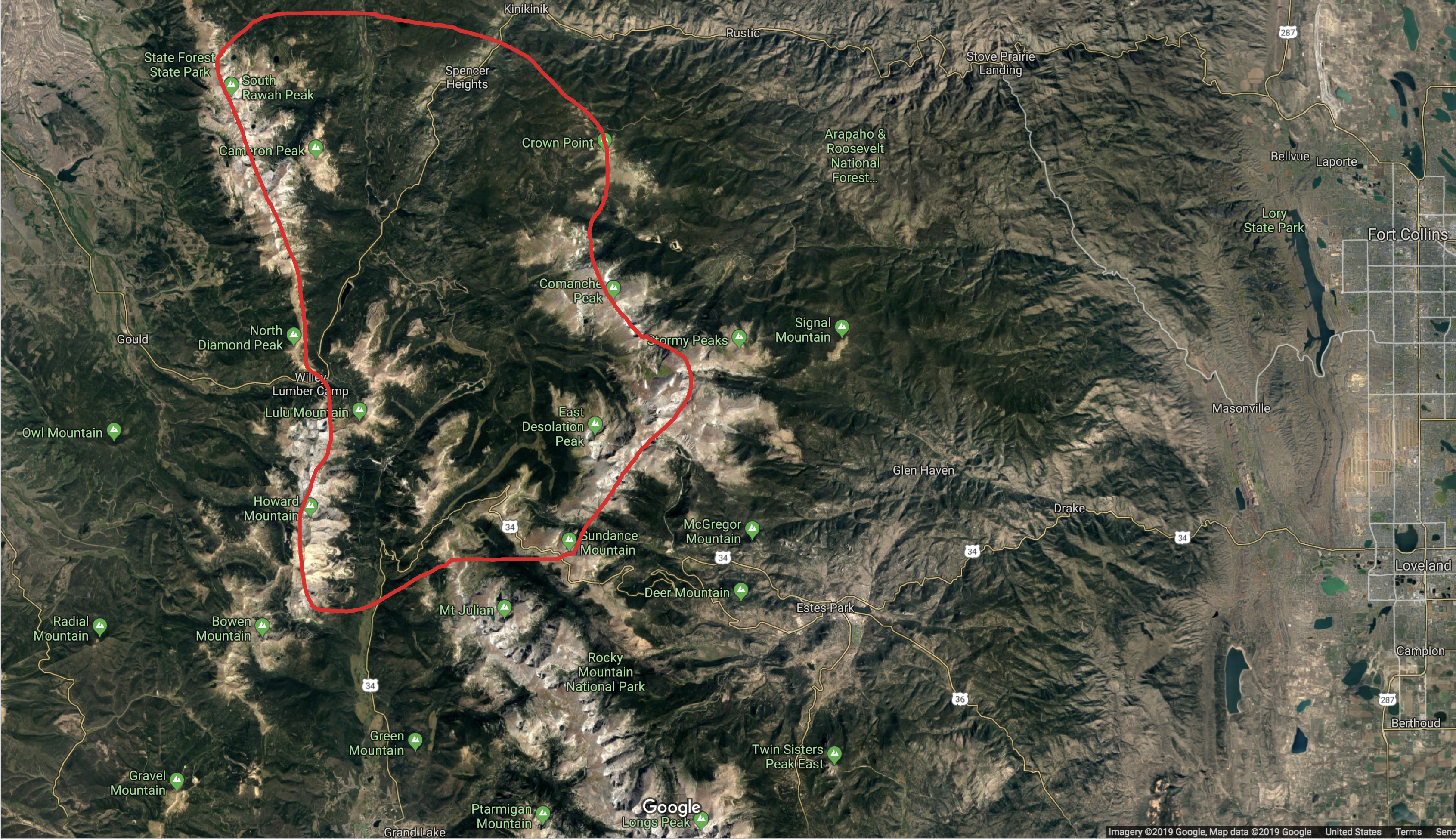
Start: Bighorn Mountain (14km west of Boulder). TP1: Roger Canyon (ne of Laramie). TP2: Bergen Peak (sw of Golden). TP3: Horsetooth Reservoir. Finish: Rocky Flats. Task Distance: 311.2 miles = 500.8 km.
By 12:30 pm we were more or less done with the essential chores and I was ready to go. While the valley was still inverted, the tow distance was fortunately more reasonable than on July 19, and I was able to release in the first good lift above Nugget Ridge. After a short climb I rounded my start point above Bighorn Mountain (just inside the OLC start cylinder), returned to Nugget Ridge and stair-stepped my way back west toward the clouds with short successive climbs above Gold Lake, Ward, and the Brainard Lake Winter Parking Lot. From there I headed towards a nice looking cloud 10 miles north, fed by the NE ridge of Mount Meeker, which took me to cloud base.

(Note for those new to flying from Boulder: stair-stepping (i.e. taking several short climbs above one of the ridges with pushes to the west in-between) is a frequently required technique to get into better lift close to the Continental Divide, where the depth and strength of the thermals is usually much greater than over the lower foothills.)
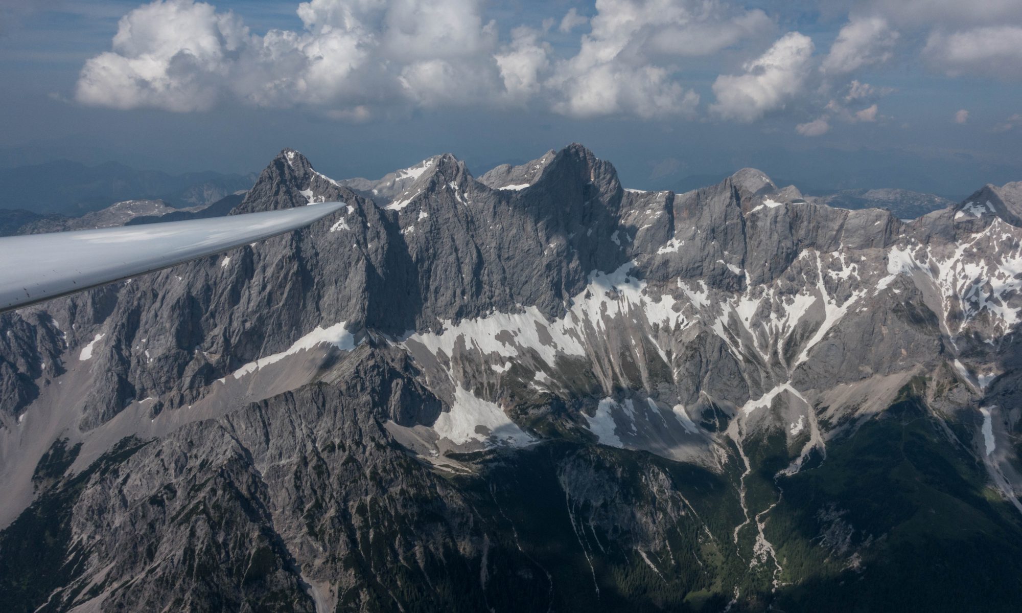
Soaring always feels best when you’re connected to the clouds, and when a whole row of good looking clouds marks a viable path forward. To quote Bob Caldwell, “the fastest way from point A to point B is rarely a straight line”. In my case, the best line ahead seemed to be a westerly route through Rocky Mountains National Park, crossing the Mummy Range near Ypsilon Mountain and from there directly north via Kinikinik towards the Laramie Basin.
The northern part of Rocky Mountains National Park, between Mummy Range and the Never Summer Mountains is a tricky area where you definitely do not want to get low. The only ways out from there are to the south via La Poudre Pass ( 10,200 ft) towards some fields near Grand Lake or to the west via Cameron Pass (10,300 ft) towards a landout field near Gould. The airports and fields on the eastern side of the foothills are 30 miles away and probably not reachable once you’re low. I only feel comfortable flying in this area when I have enough altitude to be able to glide over the mountain ridge to the west into North Park. Hence, I was careful not to drop below 15,000 feet. You can take a closer look at this area by examining my Boulder 250 Soaring Map.
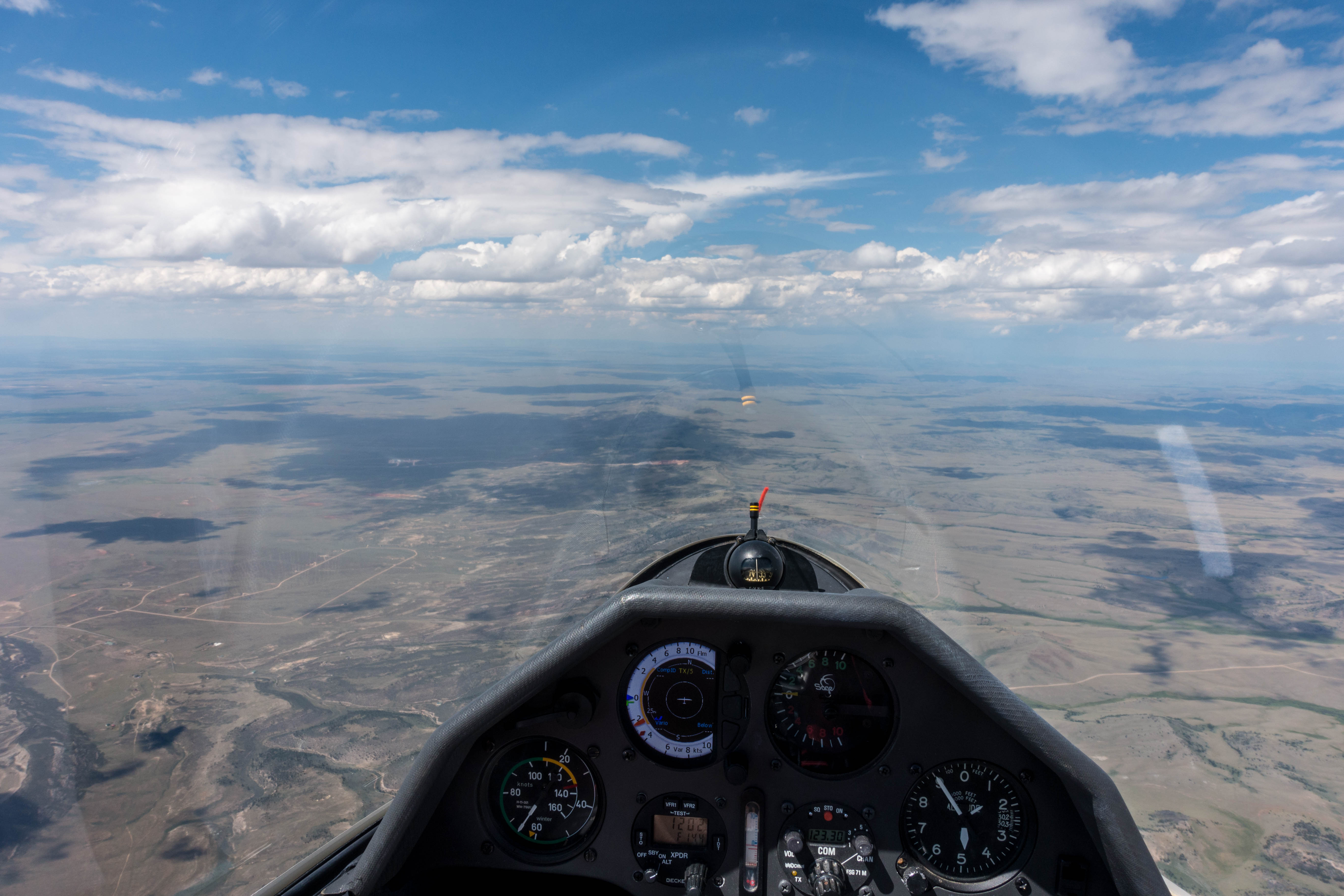
Fortunately, all the clouds worked without fail and I was making good progress heading north. As I crossed into Wyoming I was able to connect with a convergence line marked by a massive step in the height of the cloud bases (about 3,000-4,000 feet difference). I followed the line on the higher west side, which took me across US 287 and I-80 towards the higher ground east of Laramie.
There I had to leave the convergence and head north into a blue area with another 13 miles to go to reach my turnpoint at Roger Canyon. Two small emerging clouds gave me some extra boost and then I jumped into the blue.
Laramie airport was to my left and in easy glide range. I closely watched the sky as I headed north and saw a new cloud appearing to the southwest of my turnpoint. I dashed for my turnpoint, rounded it at 1:50pm, and headed straight to the newly formed cloud. It wasn’t as good as I had expected it to be but in combination with the next climb it got me back to cloud base.
As I circled I had time to plan my southbound route. The convergence line had moved further west under a sky that already showed early signs of overdevelopment. Following it would represent a detour that would once again lead me across the same high and unlandable terrain that I had crossed earlier. The alternative was a more direct route below the lower clouds further east but it looked less convincing. If in doubt I have no problem to opt for the higher, if longer, westerly route. I just had to be careful to keep landable places in easy reach at all times.
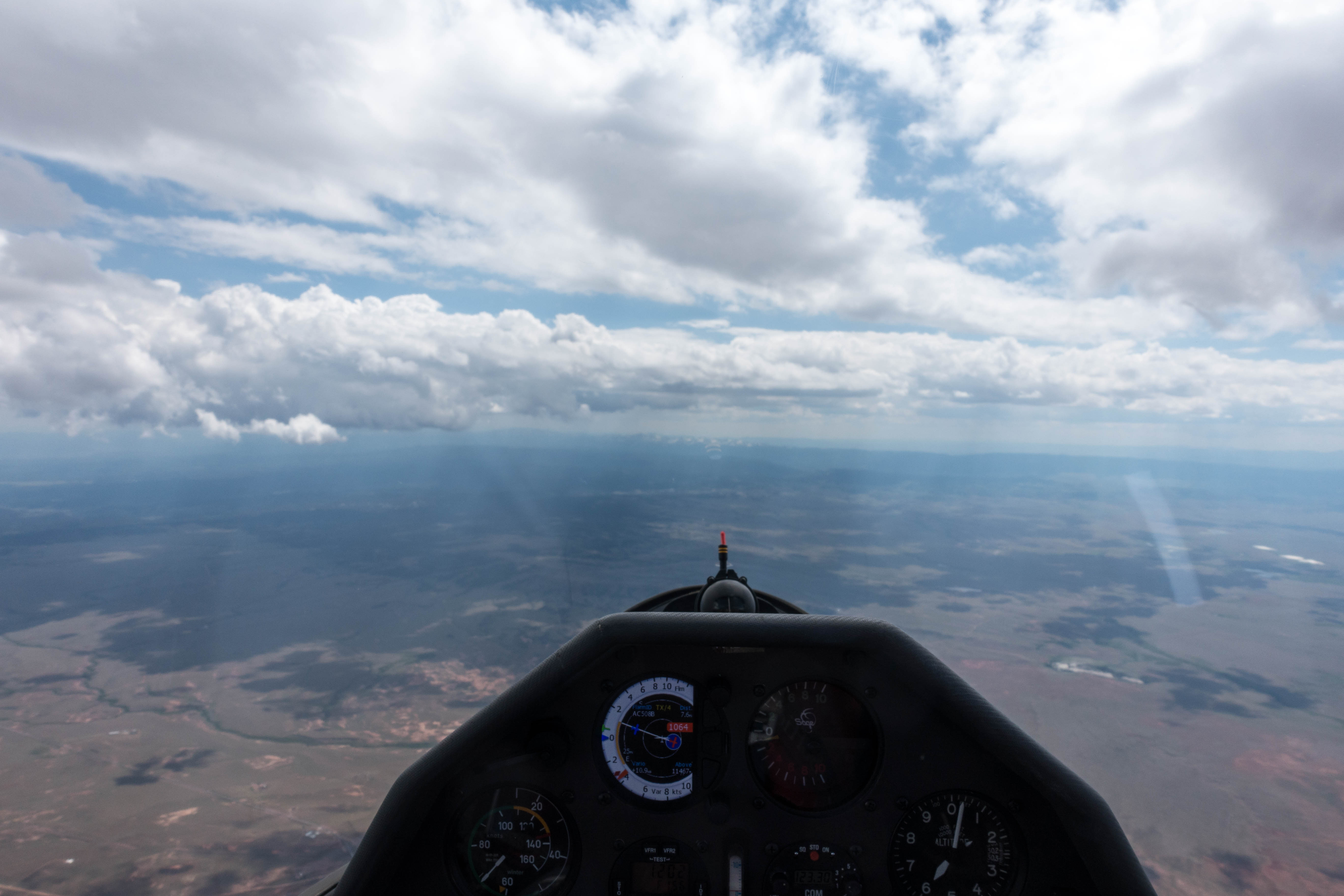
It proved to be the right choice. The convergence worked even better than before and all the darkening clouds provided good lift even as light snow-virga started to fall. I made great time and was getting more and more optimistic that I would be able to complete my task despite the relatively late start.
A noteworthy moment came as I approached the Mummy Range from the north. My last climb had been mediocre and I had abandoned it in favor of a great looking cloud above Comanche Peak. I was getting a bit low, approaching 14,000 feet and a lot depended on the cloud working. If it didn’t I would not be able to maintain my southerly route but would instead have to divert eastwards along the ridge towards Loveland. Scraping over the Mummy Ridge and flying straight into the Estes Park basin at considerably less that 14,000 feet would not be a good idea… I had a clear escape path towards Loveland but going there would considerably hurt my progress.
I tugged under the cloud above Comanche Peak and to my great relief hooked a solid 7 kt climb, one of my strongest ascents of the day, taking me right back to cloud base at 16,000 feet. I distinctly remember saying out loud, “Wow, today is really good!” My confidence of completing the task had just received another huge boost.
Minutes later I crossed the Mummy Ridge into the Estes Park basin. And what I saw was astonishing: the sky ahead had turned completely blue. I had flown under such dark skies for the last 45 minutes that this came totally unexpected. A small lonesome cloud sat above the Twin Sisters but even it disappeared as I headed towards it.
A quote from Daniel Sazhin, a current US representative at the Junior World’s Championships came to my mind, “Soaring is a manic depressive sport.” One minute you feel great, like it’s the best day ever, then, one minute later, you are down in the dumps.
Well, to be honest, I wasn’t quite down in the dumps, at least not yet. I was still at more than 14,000 feet, I had past Estes Park, and Boulder was already well within glide range. But my hope to complete the task was eroding quickly. I got on the radio and asked other pilots nearby how they were fairing and quickly got confirmation that the conditions east of the divide had become very soft.
There were still good-looking cloud streets on the west side of the Divide. But following them would take me away from my next turn point, not towards it. I briefly considered abandoning my task and just following the lift lines but then I thought, “if I want to learn something new, I just have to stick with my task and see how far I can get.”
As soon as I made that decision, new hope started to form in my head. All of the foothills were now in the sun. Surely, the blue sky was just the consequence of a down-cycle, perhaps overdevelopment had preceded it while I was in the north. Now that the sun was heating the ground again, it was just a matter of time for new thermals to form and new clouds to appear.
I convinced myself that this is what would happen and my task now was to play for time while trying to continue to inch southwards. As I continued on course, I dialed my speed down to minimum sink and tried to just float along. There was some wind from the south east, maybe I could stay up in ridge lift? I tried the south eastern flank of Mount Meeker where I had found good lift in the morning but now there was no thermal to be found and the ridge definitely did not work either.
I looked for other terrain features that might work considering the angle of the sun and the direction of the wind. Meadow Mountain, south of Allenspark, looked promising, but again, nothing. I dropped below 12,000 feet. I had to find something soon otherwise I would have to head back out towards Boulder and I was concerned that the further east I would get, the more challenging it would be to climb back out.
Then some wisps appeared to be coming off a hill south-east of Meadow Mountain. To my surprise the wind had picked up to 16 kts and the rising bubbles provided very narrow and uneven lift. Slowly I gained more than 2,000 feet. Deep in the foothills it makes a huge difference whether you’re at 12,000 or at 14,000 ft.
The only remaining clouds looked to be just west of the Divide. If I could get there, maybe I could climb back to cloud base. I had just enough altitude to fly over Mt. Audubon and follow the Continental Divide south from there. Weak and completely wind-blown thermals were coming off Niwot Ridge and the Arapaho Ridge. I was surprised that I could not find any ridge lift right above the steep east-facing cliffs along the divide even though the wind was blowing directly towards the ridge line.
In the meantime the clouds had moved further west and there was no reason to hang out at the Divide which didn’t work anyway. With that I continued to inch towards my 2nd turn point looking for lift in the blue above any promising terrain feature. Weak climbs near Eldora and Rollinsville topped out at 12,000 feet, just enough to stay on course and keep Boulder in glide range.
Northwest of Blackhawk I was down to 11,500 ft. I had just enough altitude to approach the top of a hill, vouching to fly out towards Eldora Canyon (and Boulder) if I could not find any climb. Once again, I found lift at the last minute and managed to rise back up to 14,800 ft, the highest I had been in 1 1/2 hours!
This was the climb I needed to round Bergen Peak, my second turnpoint. I made Bergen at 13,100 ft. It was 5:45 pm and there was still no cloud in the sky. It was clear that the day would soon be coming to an end. I had little hope left in being able to complete my task but I still I felt compelled to see how far I could get. Maybe I would be surprised by a “glass off” evening effect over the prairie that would propel me forward?
On the other hand, it still seemed a bit too early to head out over the plains, and I had just enough altitude that I would be able to reach and fly along the top of Thorodin Mountain. That was my best hope for another climb to a higher altitude. At the north end of Thorodin I did indeed find some lift. However, instead of the boost I had secretly hoped for, it topped out at 12,500 ft.
I continued past the Flatirons to Bighorn Mountain to close whatever small triangle there was to score and kept going past Bald Mountain (nothing) towards Lyons. Just as I considered returning to Boulder I found another climb over the hogback. This one was different from the ones before. The air was smooth and the thermal was wide and even. For a moment I found one last glimmer of hope against my better judgement. In 3kt lift I climbed in perfect circles to … 10,800 ft.
At the same time high clouds moved in putting everything to the north into complete overcast. I knew then that the day was finally over. Although I kept going further north to see how far I could get, I put Boulder into my flight computer to ensure that I would stay within glide.
As expected, I didn’t get very far… Half way to Carter Reservoir and still 18 miles shy of my final turn point I finally had to face the fact that completion of my task wasn’t to be. When I reached a projected arrival altitude of 1,500 AGL at Boulder at MC3 I made a 180 degree turn towards the airport where I landed in glassy smooth conditions at 7:36 pm.
I flew 445 km in 5 3/4 hours. The first 2 1/2 hours were reasonably fast. The rest was very slow. My flight track is here.
Lessons Learned
- Don’t give up, even if it looks hard. After the sudden deterioration of the soaring conditions on course, it seemed almost inconceivable that I would make it to the second turn point. And several times I found a climb – just before I had to change course – allowing me to continue. Bit by bit I made it to TP2. I only quit when there was no question in my mind that continuing would result in landing out.
- Expect the unexpected and hang on. -The conditions can literally change from one minute to the next. I just came out of my fastest stretch and my strongest climb of the day when suddenly the route ahead was almost dead. If conditions can turn off quickly, they can also turn on quickly. So hang in there if you can.
- Gear-shifting is really a thing. I read a lot about this but it was never so apparent to me than today that you may have to shift from one minute to the next to adapt your flying style to the conditions ahead.
- Always know your escape paths. I was glad that I had done my homework when crossing the unlandable high terrain between the Mummy Range and the Never Summer Mountains. I knew how high I had to be and I knew where to go if things went sour unexpectedly.
- Decisions can provide hope and focus your mind. This is more a psychological point than anything else. I already learned that waffling is not a good thing because it can make you do pointless things. But today I experienced the positive effects when I firmly stuck to my objective.
- Sometimes the thermals cycle – and sometimes they don’t. Several times I have seen very rapid up and down cycles of thermal conditions. Today they just cycled down and did not come back. That can happen, too.
- A long marginal flight is hard work and the necessary concentration is exhausting. I was pretty spent after getting up at 5:15 am, working on ship maintenance all morning, and then flying for six hours with the last 3 1/2 hours in marginal conditions, requiring my full attention.
In addition to these lessons, I have also collected a few questions to which I have found no solid answer. If anyone can contribute to my understanding, please let me know.
Unanswered Questions
- Why was there no ridge lift? My flight computer showed 15-18 kts of easterly winds (sometimes straight from the east, sometimes from the south-east) as I was flying at about 13,500 feet above the steep east-facing ridge of the Continental Divide that was just a few hundred feet lower. The direction of the wind is also confirmed by the wind drift when I tried to thermal in that area. Why was the ridge not working? Is it possible that the wind only blew at my altitude but not (or much weaker) lower to the ground? I have not been able to figure this out although I have speculated about it below.
- When can I expect the “glass-off” phenomenon at the end of the day? And when not? Several times I have experienced the amazing phenomenon of the entire prairie lifting at the end of a soaring day. Yesterday this did not happen. I suspect this had to do with the winds. On days when it happens, the wind over the foothills tends to shift westerly in the evenings as a result of cooling over the hills as the sun angle there becomes very flat. The cooling air streams down towards the prairie, meeting the air over the plains and causing a weak but wide-spread convergence that lifts the air over the plains. Yesterday, the wind remained easterly all across the foothills (e.g. see my last climb near Lyons), i.e. there was no convergence over the plains. Which would explain why this phenomenon did not occur. I might just have answered my question. But is this right?
- What caused the sudden collapse of the thermals in the afternoon? And why was there suddenly so much wind from the east? Are these two observations related? Why did the thermals not come back with all the afternoon sunshine? The only possible explanation I could come up with is the inflow of warm air from the east at a level of about 13k feet. This would explain the easterly wind at that altitude, it would explain why the thermals above the ridges near the divide were so wind-blown and turbulent, why they topped out at 13k feet, and it would even explain why there was no workable lift at ridge top level along the divide (because there was no or not much wind below moving up the slope – the wind may have just been at ridge top level, blowing across the ridge but not blowing up along the slope… All this seems a bit speculative. Anyway, does this seem true and does anyone know if this is an exceptional phenomenon or if it happens more often? (I had not experienced it before.)