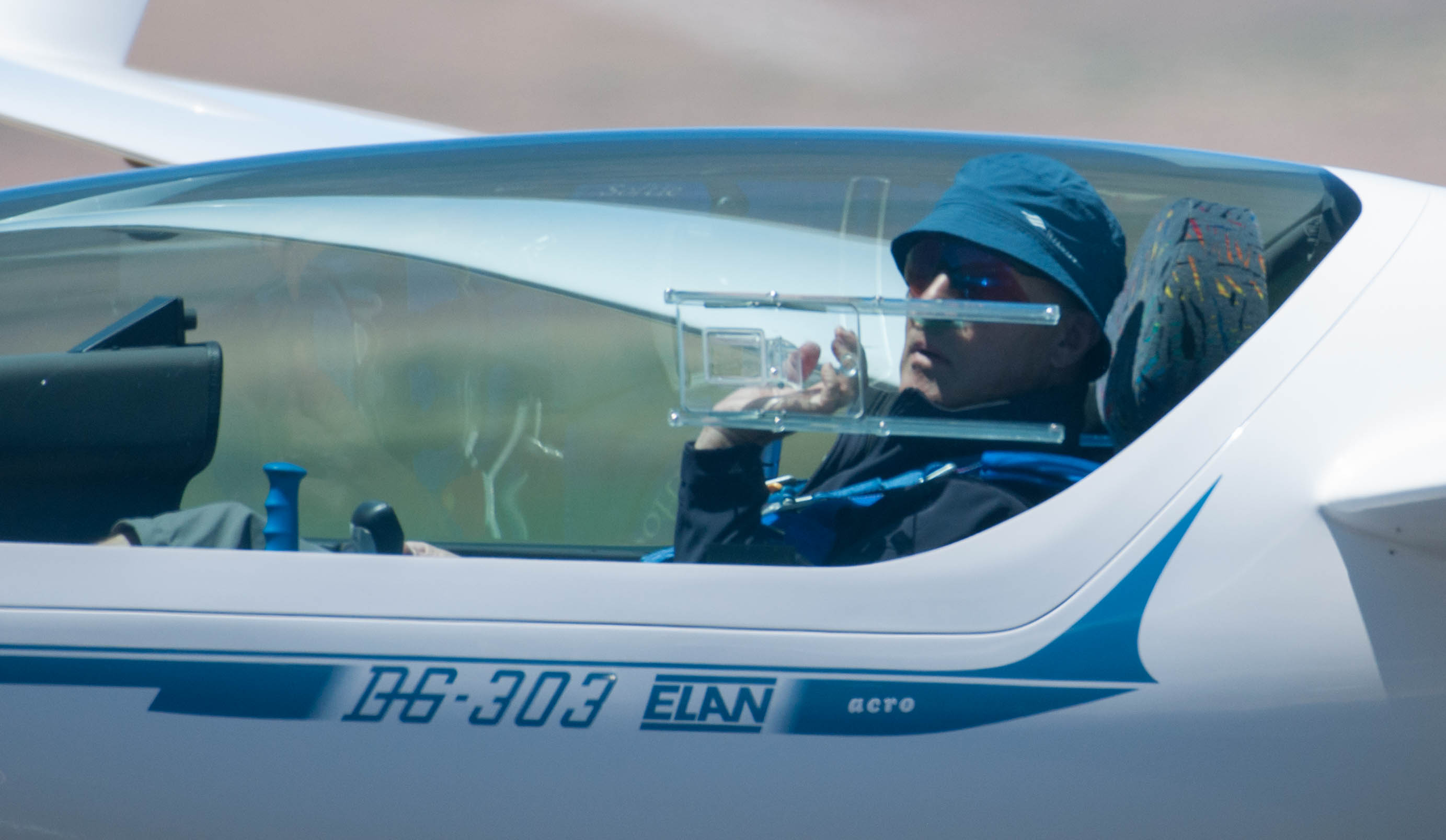
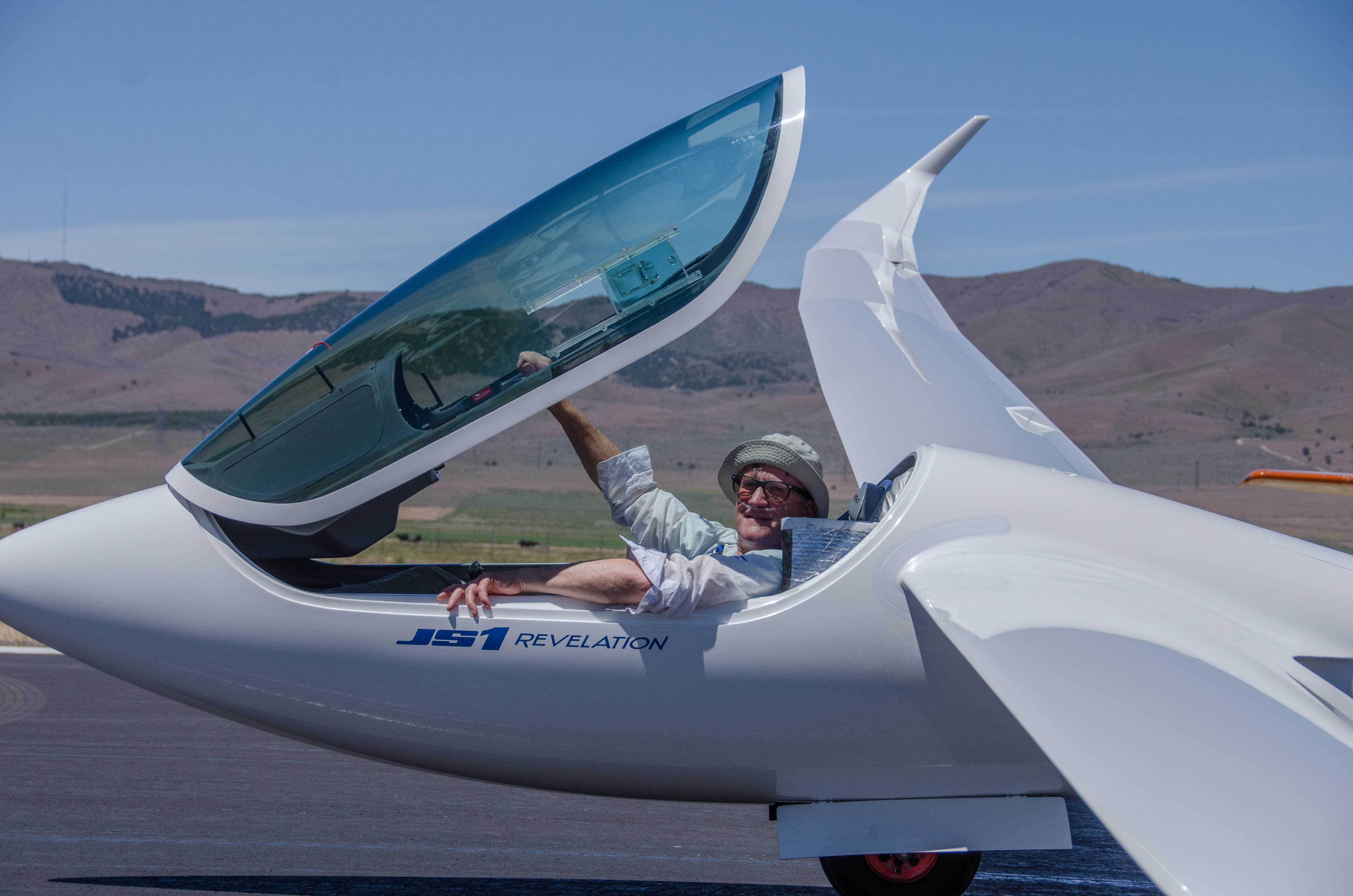
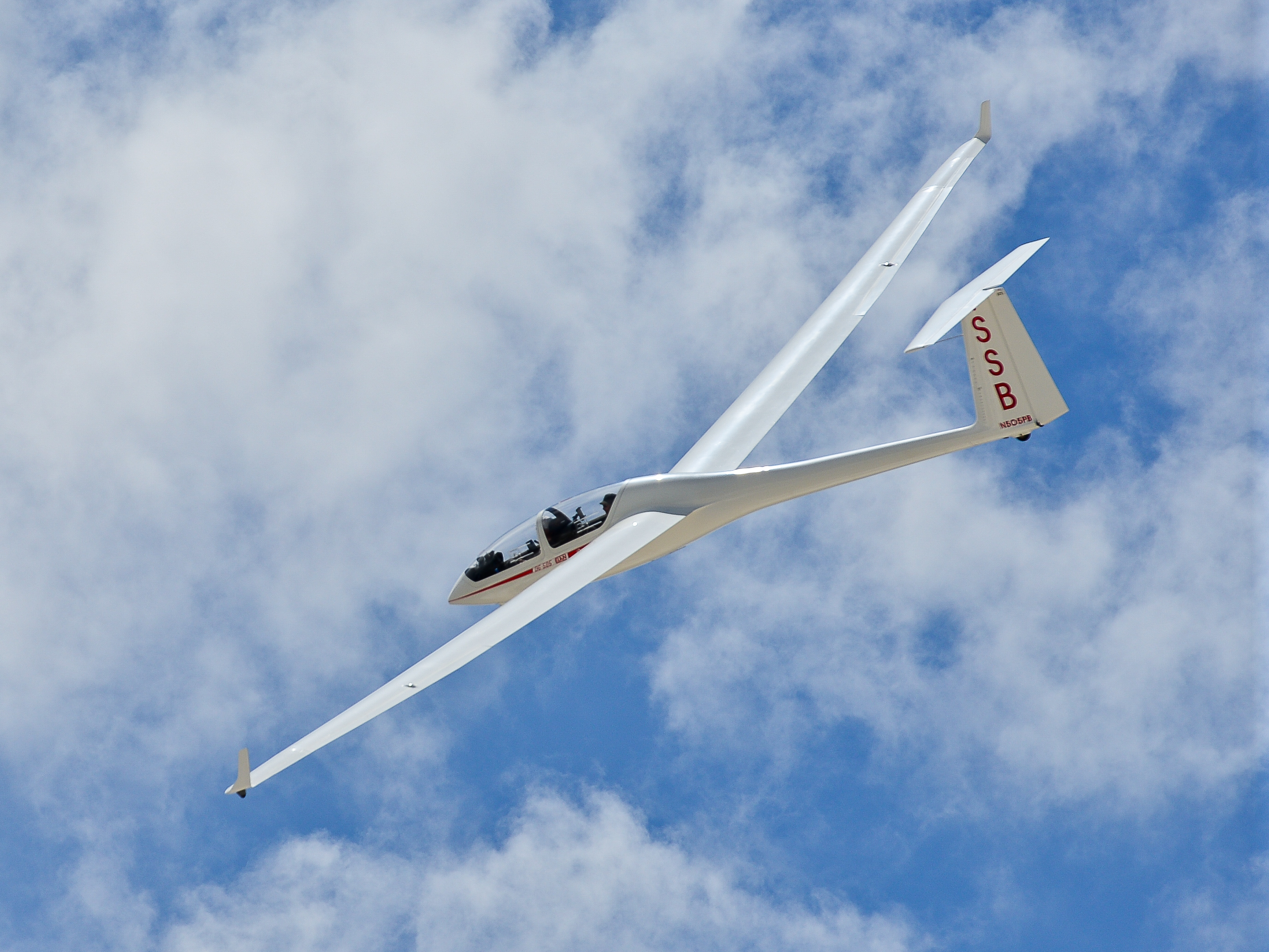
Thanks to my club, the Soaring Society of Boulder, I was able to fly from June 26 to July 6 in Nephi, UT at the 2019 OLC camp organized by Bruno Vassel and the Utah Soaring Organization. Five club members, Al Godman, Jack Knopinski, Andy Wereley, Gregg Davis, and myself, shared two club gliders: our two-seat DG 505 “SSB”, and one of our club’s Disci, “SG”. Several additional club members attended with their own private ships. Including the pre-camp practice day, I was able to fly on seven days for a total of 31 hours in the air. Not bad! Three of my flights were in “SG” and the other four in “SSB”.
A lot happened over the course of the camp, and for my trip report I want to specifically focus on things that I learned during the entire experience.
What It’s Like to Fly At a Big Organized Event
This was the first time that I participated at an organized soaring event of this scale. Bruno and his team did an outstanding job. About 60 gliders came to fly at Nephi. Each had their own marked tie-down spot along the taxiway with access to water for ballasting if desired. At 9 am each morning, pilots came together in a large hangar for the daily briefing. This included a safety talk from one of the participants, a detailed weather briefing, and, on most days, the presentation of a suggested task for the day. (Pilots were free to fly the suggested task, plan their own task, or simply follow the best lift lines to maximize OLC points.) On some days, guest speakers came to talk about important aspects of flying in Utah. E.g., a team of air traffic controllers in charge of the nearby Military Operations Area explained how to stay safe in the vicinity of military aircraft.
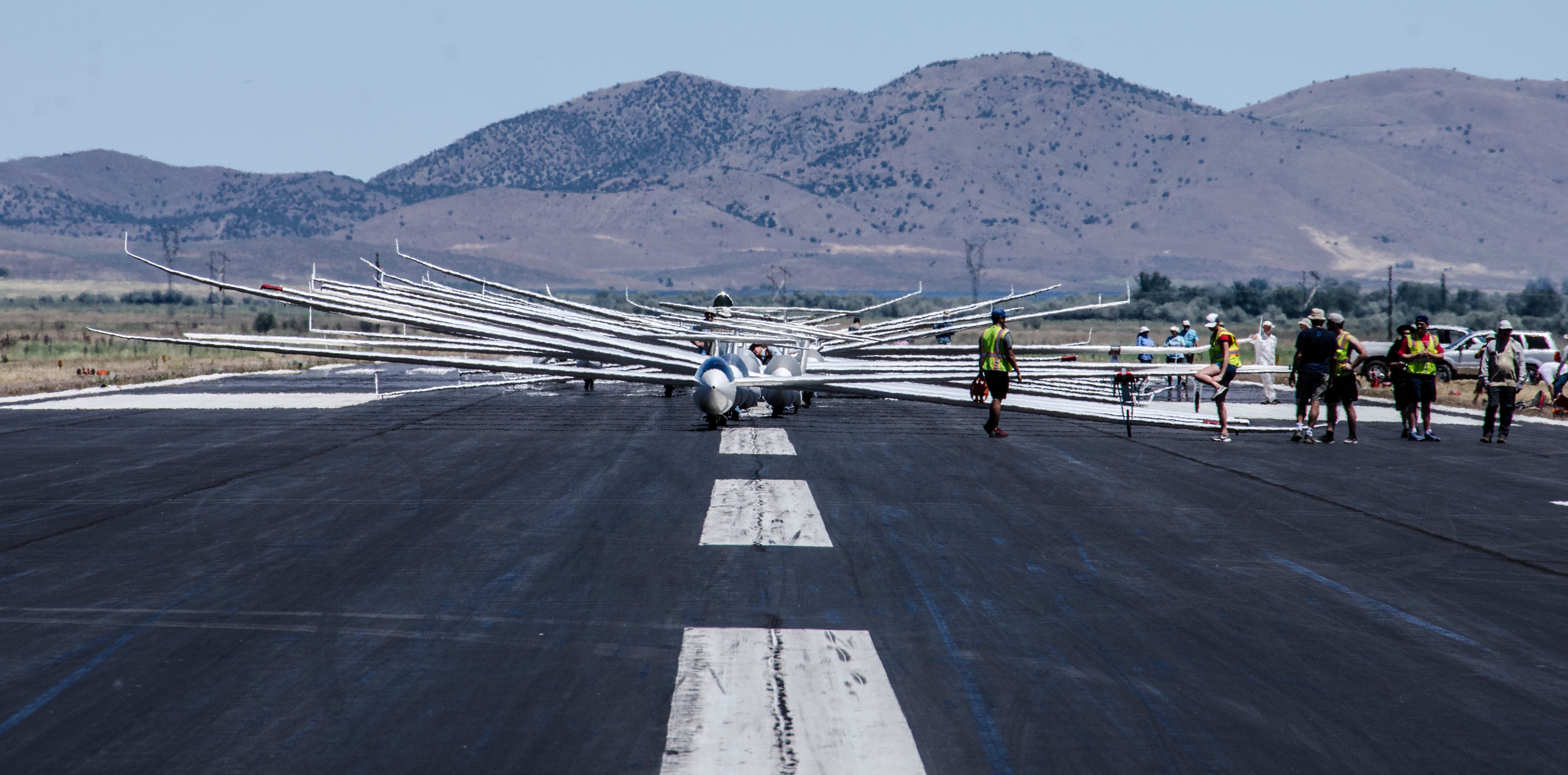
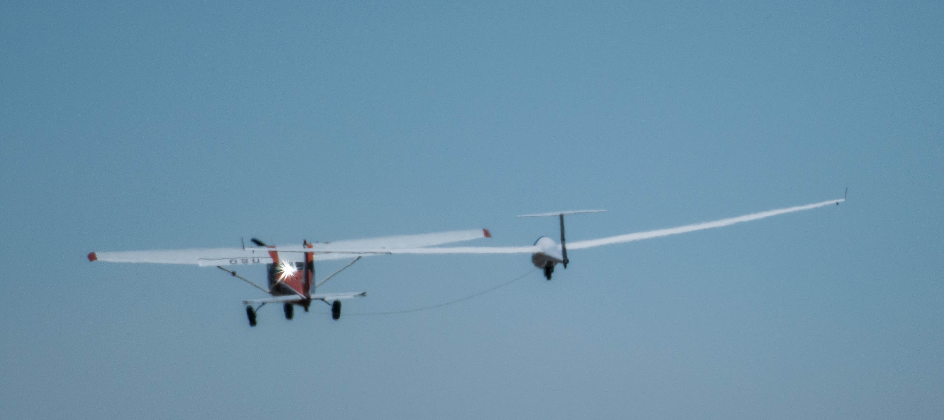
At the end of each pilot’s meeting a grid time was announced and grid numbers were handed out. These determined the order of takeoff. (Pilots could decide if they wanted to be in Group 1 or in Group 2 and the launch order within each group was determined at random.) The airport was closed for all non-glider traffic at 10 am each morning to allow the sailplanes to be staged along both sides of the runway. Staging had to be completed at least 30 minutes before the first launch. At that time “compression” would start, i.e. all gliders were moved onto the runway and pushed back towards the end to allow for maximum takeoff distance. As soon as this was accomplished, the pilots at the front of the grid would ready their gliders, complete their pre-takeoff checks, and get into their ships, set for launch.
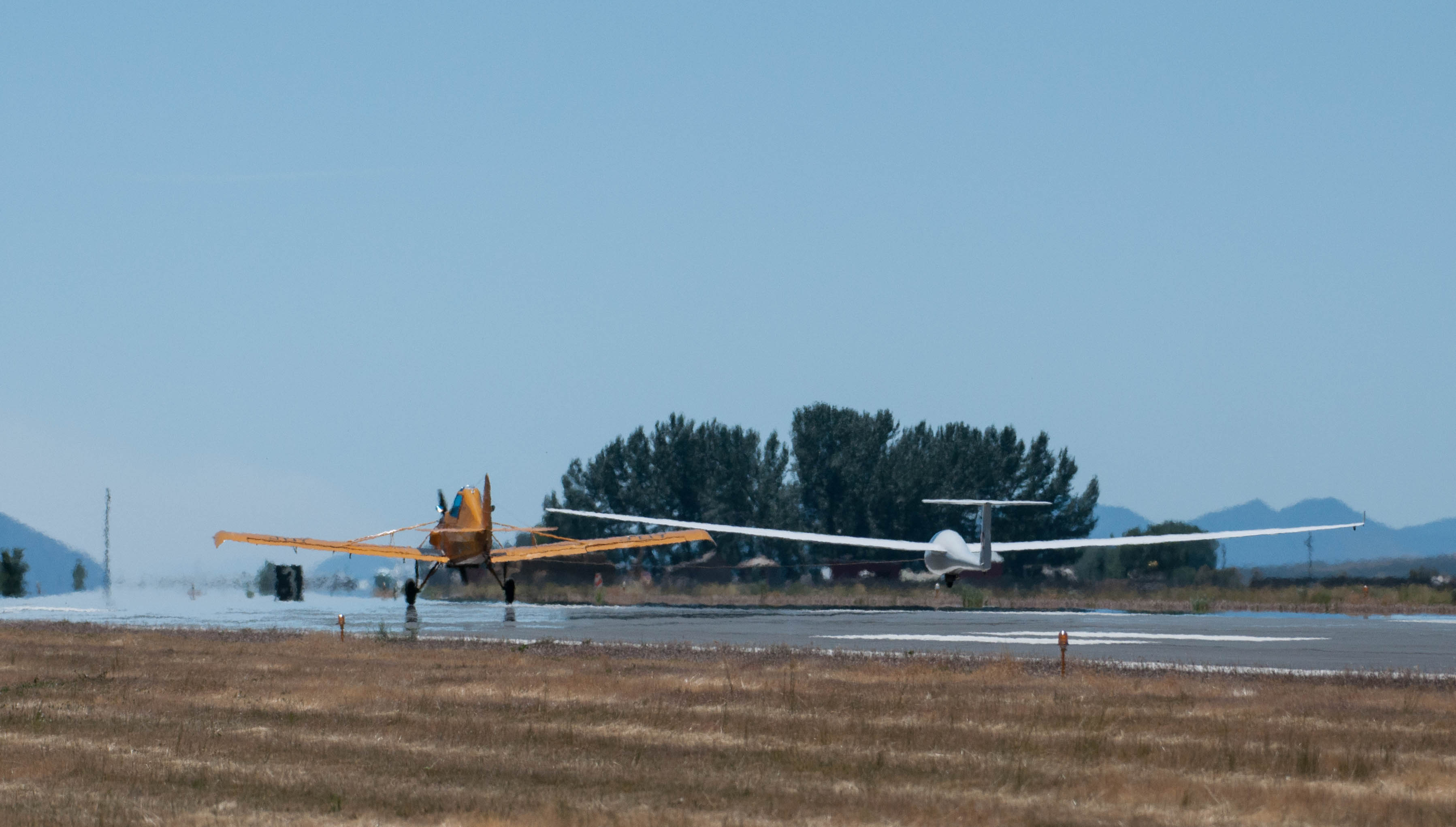
Even with five towplanes, it takes some time to get 60 gliders up into the air. To avoid slowing the operation down, it was imperative that pilots had all checks completed before their gliders reached the front of the line. This way a tow plane could pull up, the tow rope hooked up, and the launch commence without delay.
At the end of the day, each pilot had to check back in with the “Retrieve Desk” to make sure everyone was accounted for. A retrieve party would be sent on it’s way to pick anyone up who might have landed in a field. This only happened once during the week. A few pilots landed at nearby airports from where an aero-tow retrieve could be arranged. The majority of pilots came without a dedicated crew and signed up to help retrieve anyone else who would land out.
Attending this camp gave me a great idea what it would be like to fly at an official contest as most of the operational processes are identical. As such, this camp is an ideal way to become familiar with the concept of contest flying but without the psychological pressure of a competition. I imagine that the main difference at an official contest is the mandatory nature of the daily tasks and the aggregation of the daily scores into an overall contest performance.
Nephi Airport
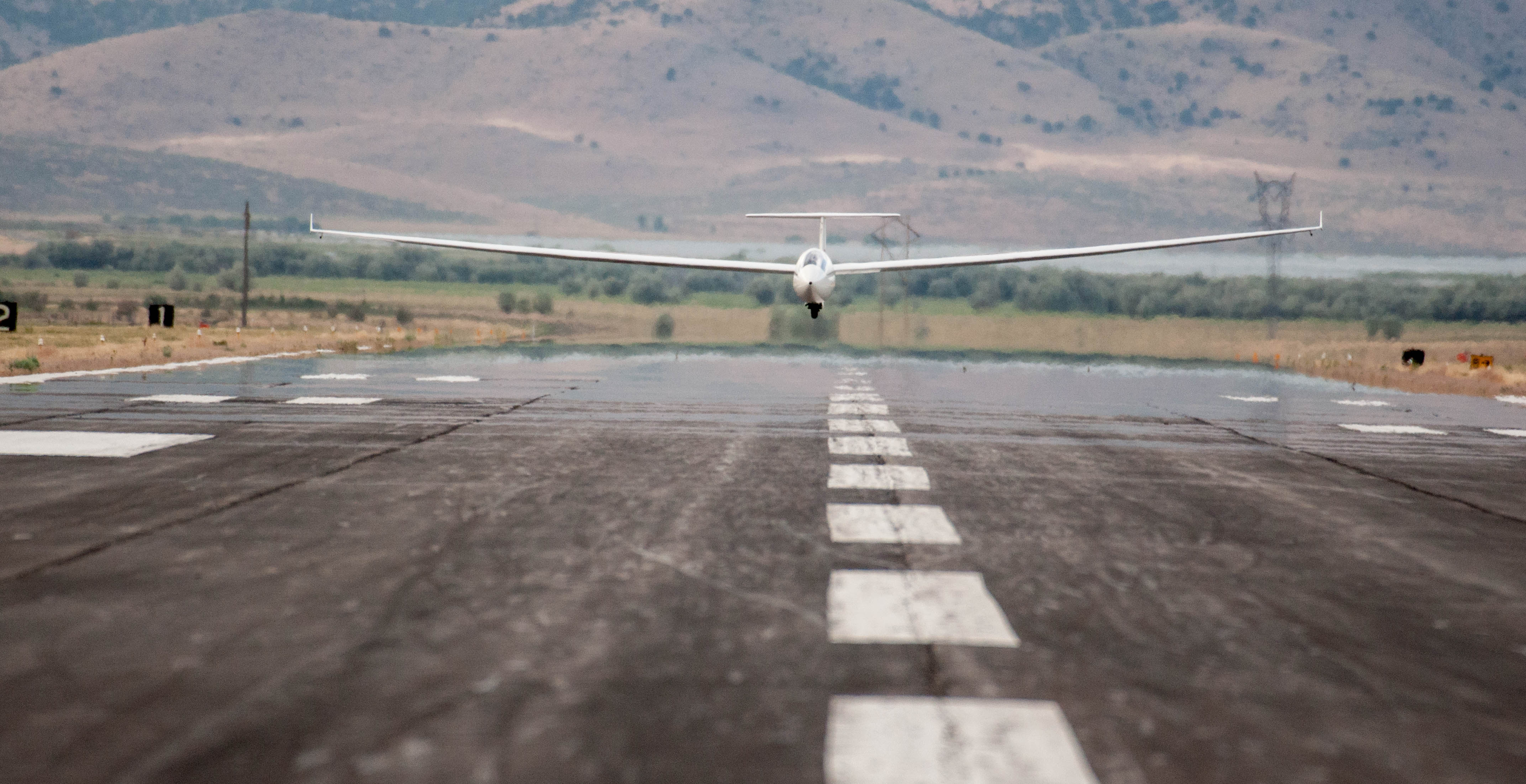
Nephi’s airport is impressive and extremely well suited to host big glider events. The runway is 6,000 foot long and 100 foot wide and is in immaculate condition. The main problem seems to be that pilots can underestimate its size and land short. A very nice problem to have! A turn to final close to mid-field was perfectly adequate as you didn’t want to touch down until about 1,500 feet before the end of the runway. In addition to the main runway, gliders could also land in the grass next to it or on a cross-wind strip at the north-end of the field. It greatly helps that there is a lot of space when several gliders return at more or less the same time at the end of their flight. The normal procedure during the event was to land long on the main runway and stop at the very end where your vehicle and tow-out gear was already waiting thanks to half a dozen volunteers who helped keep the operation running like clockwork. Oftentimes one of the volunteers would catch your wing at the end of the rollout while another was ready with the tail dolly. Seconds after you climbed out of the cockpit the ship was already off the runway.

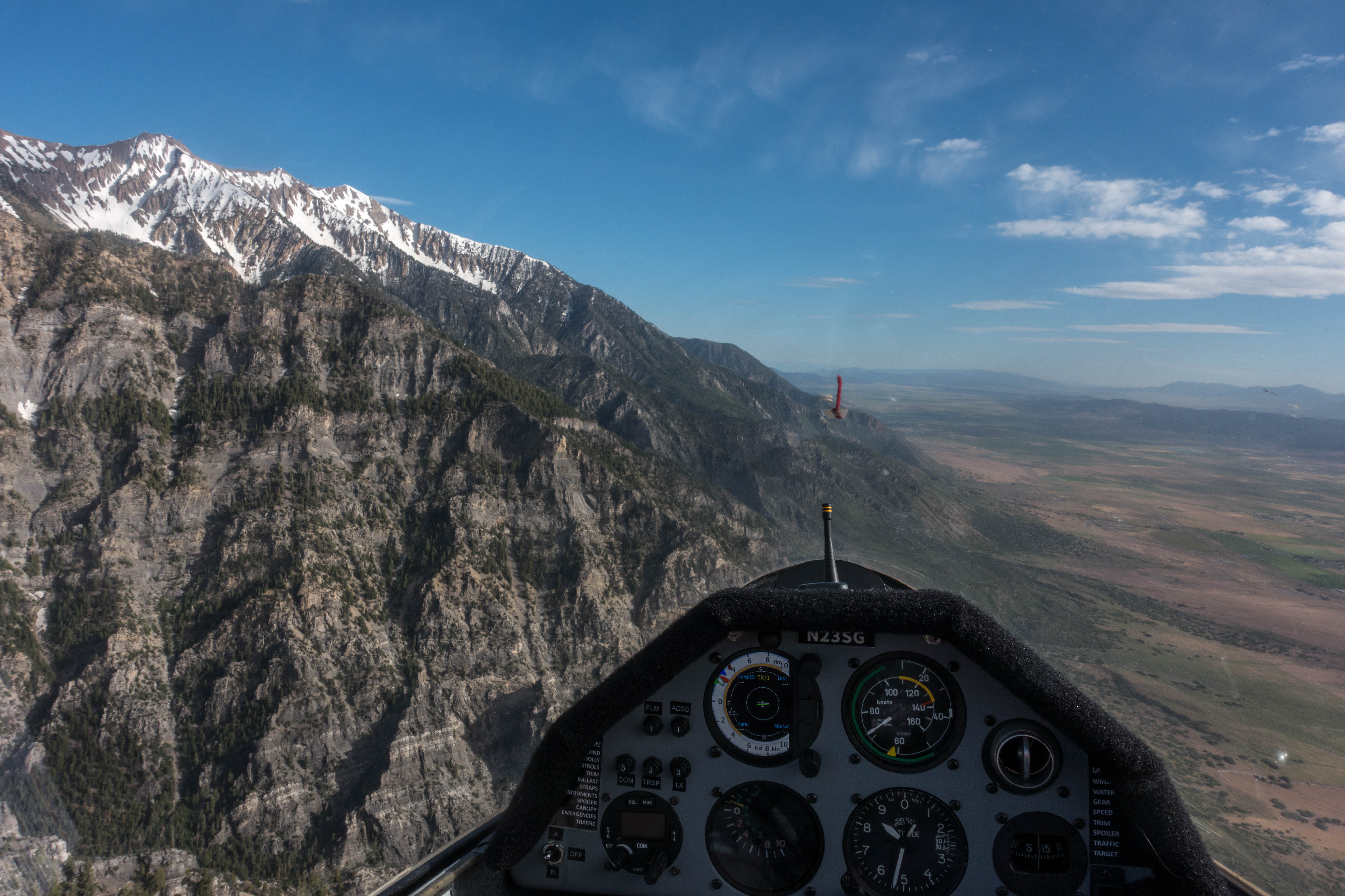
In addition to several gliders from the Utah Soaring Association, the airport is home to a skydiving operation and a few powered aircraft. Compared to Boulder there is hardly any air traffic. A few miles to the west is an east-facing ridge, about 1,500 ft tall, which basks in the morning sun and serves as a great release point. The prevailing winds in the morning are south-westerly, which puts the foot of the ridge in the wind shadow, and thus it was able to spawn very reliable morning thermals. On most days, a 2,000 ft AGL release height was sufficient to get into lift and climb out.

Terrain of Southern Utah
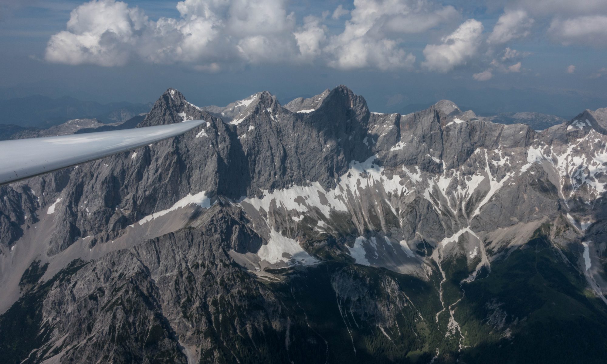
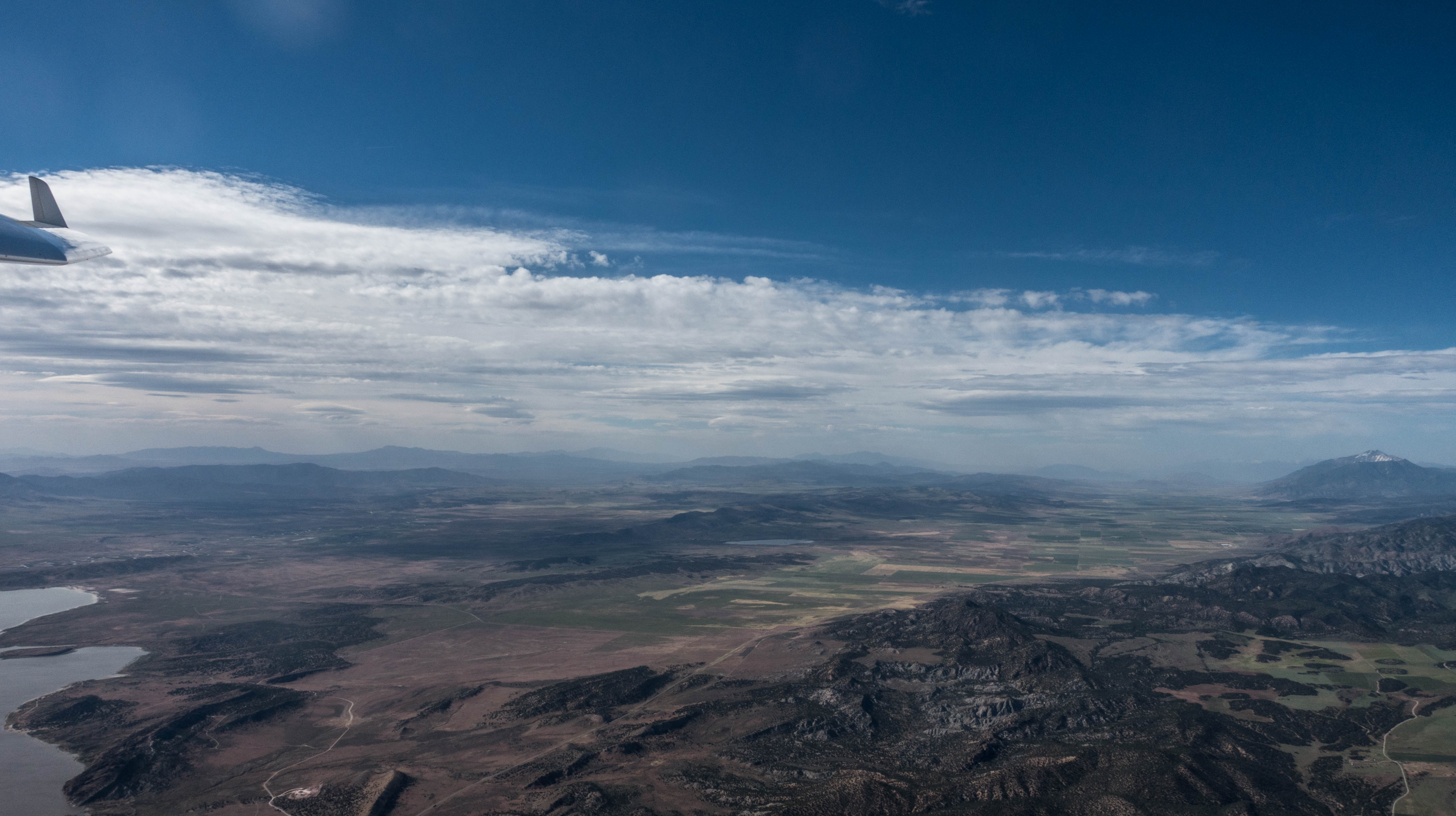
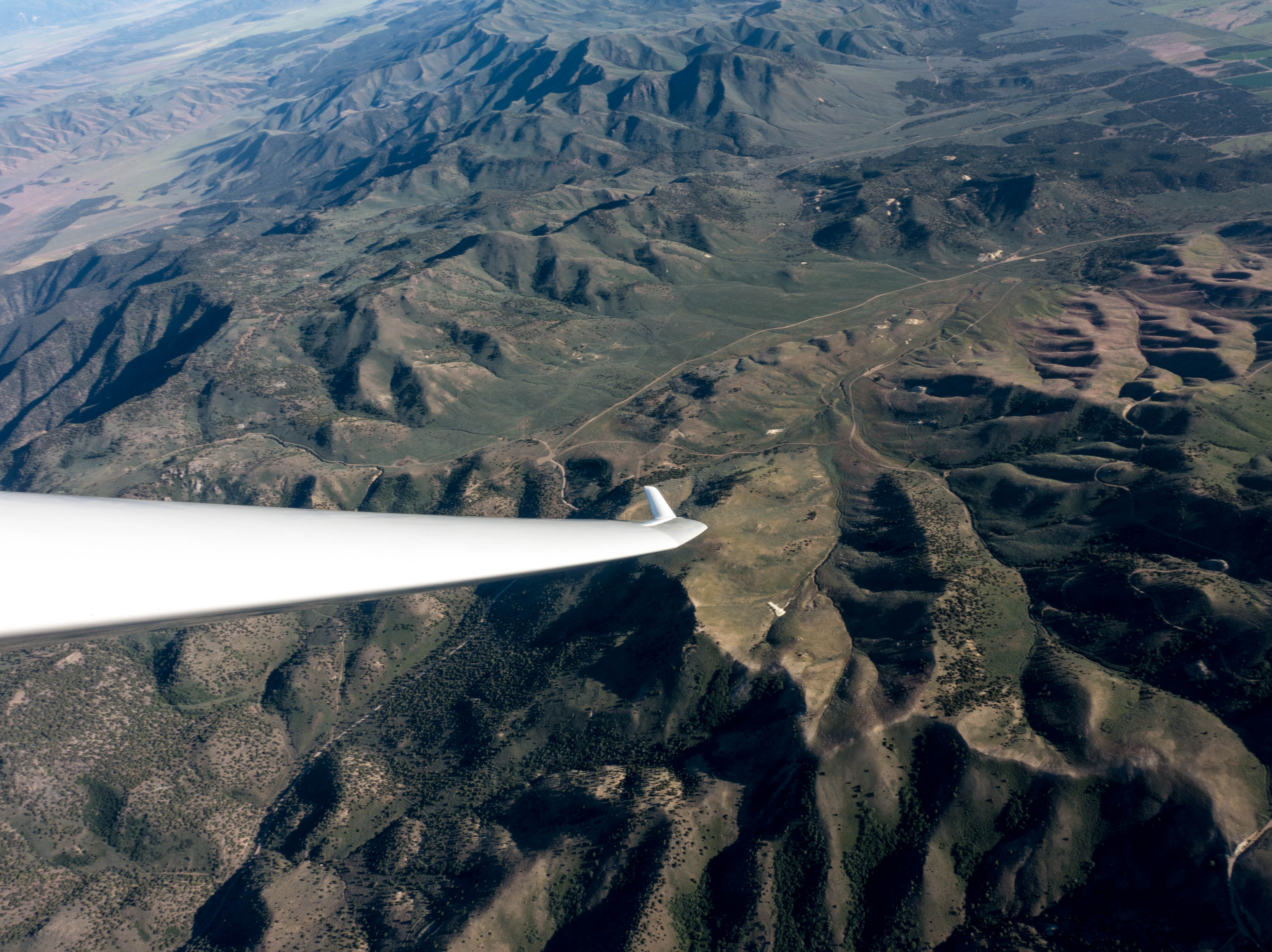
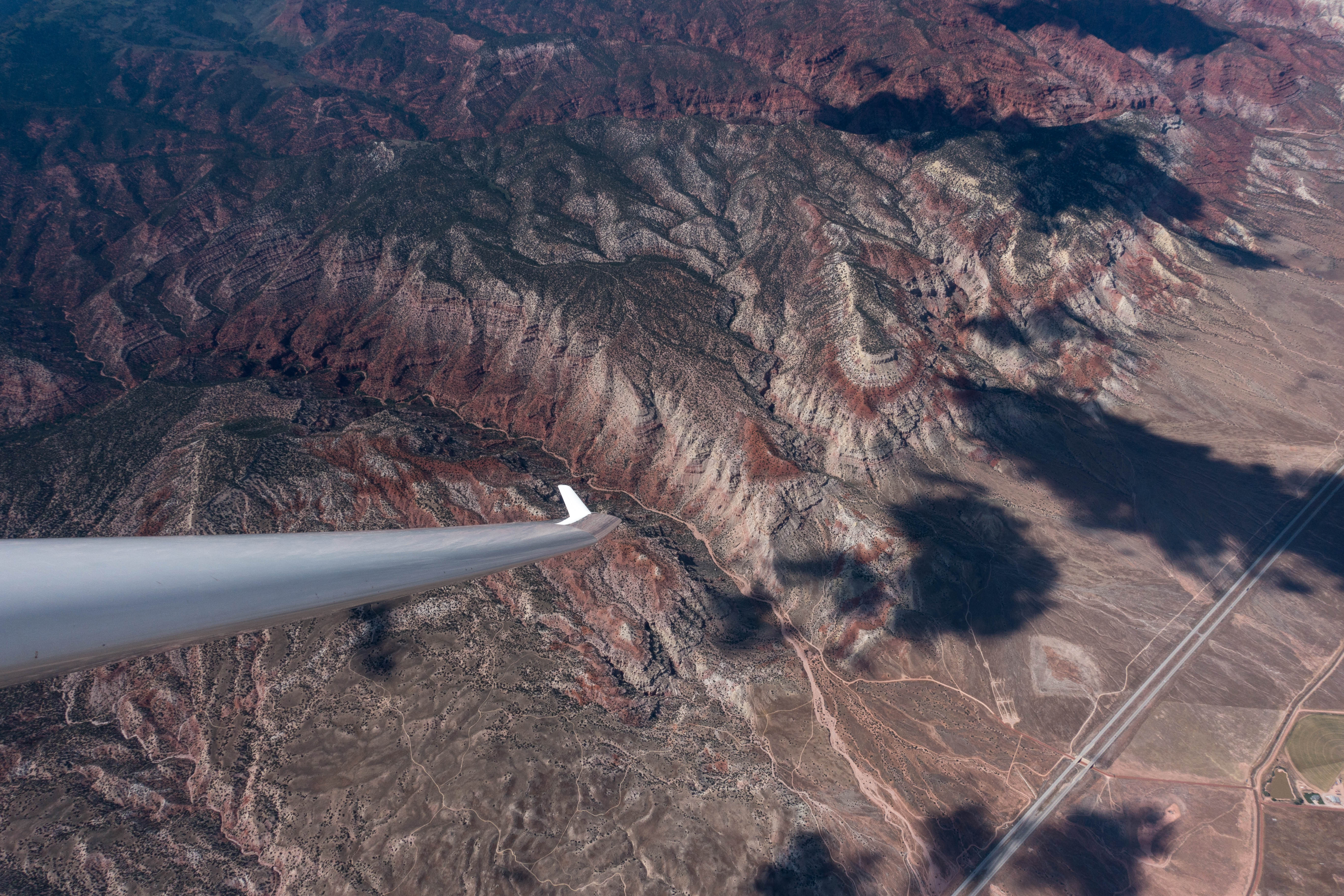
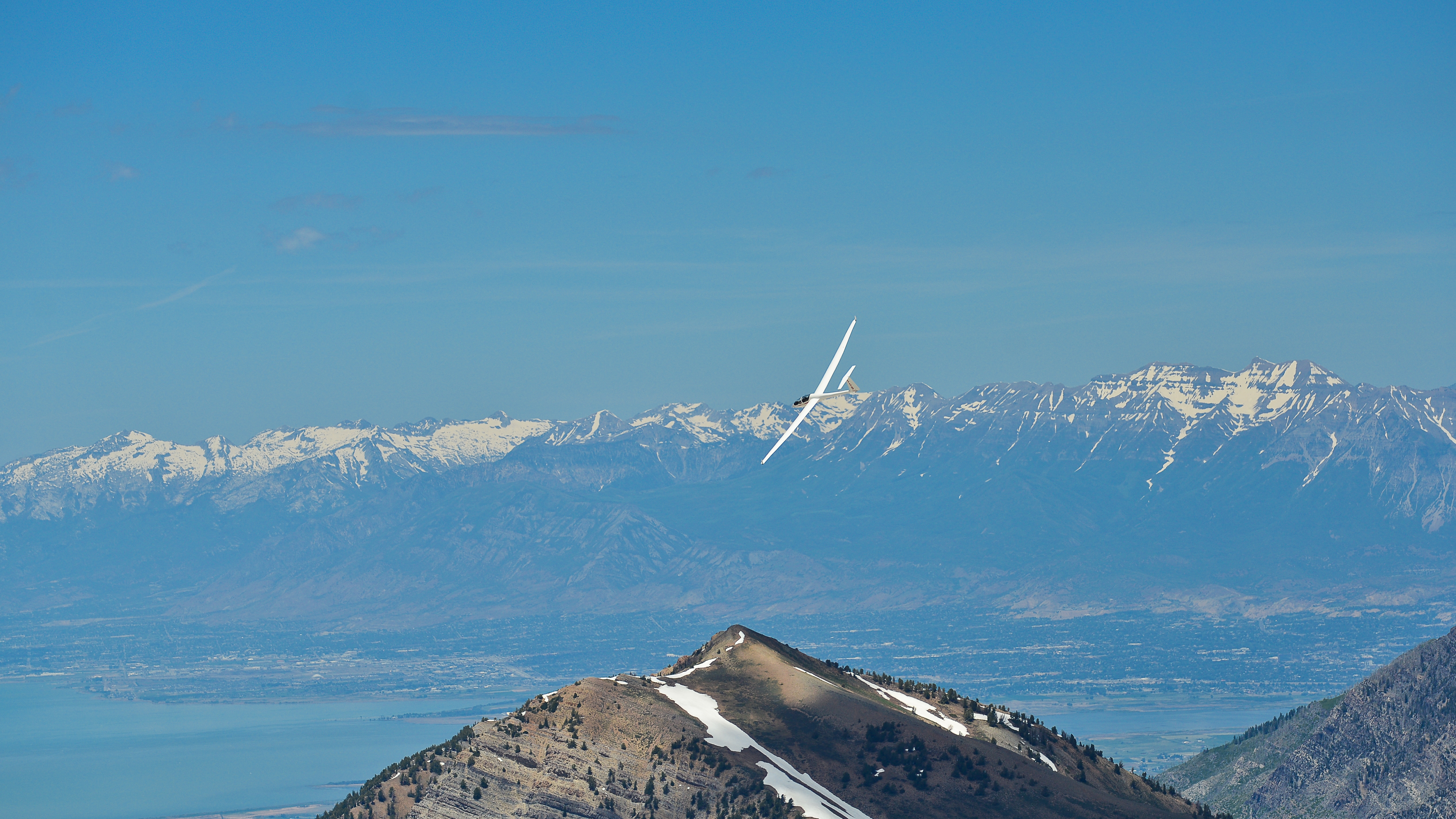
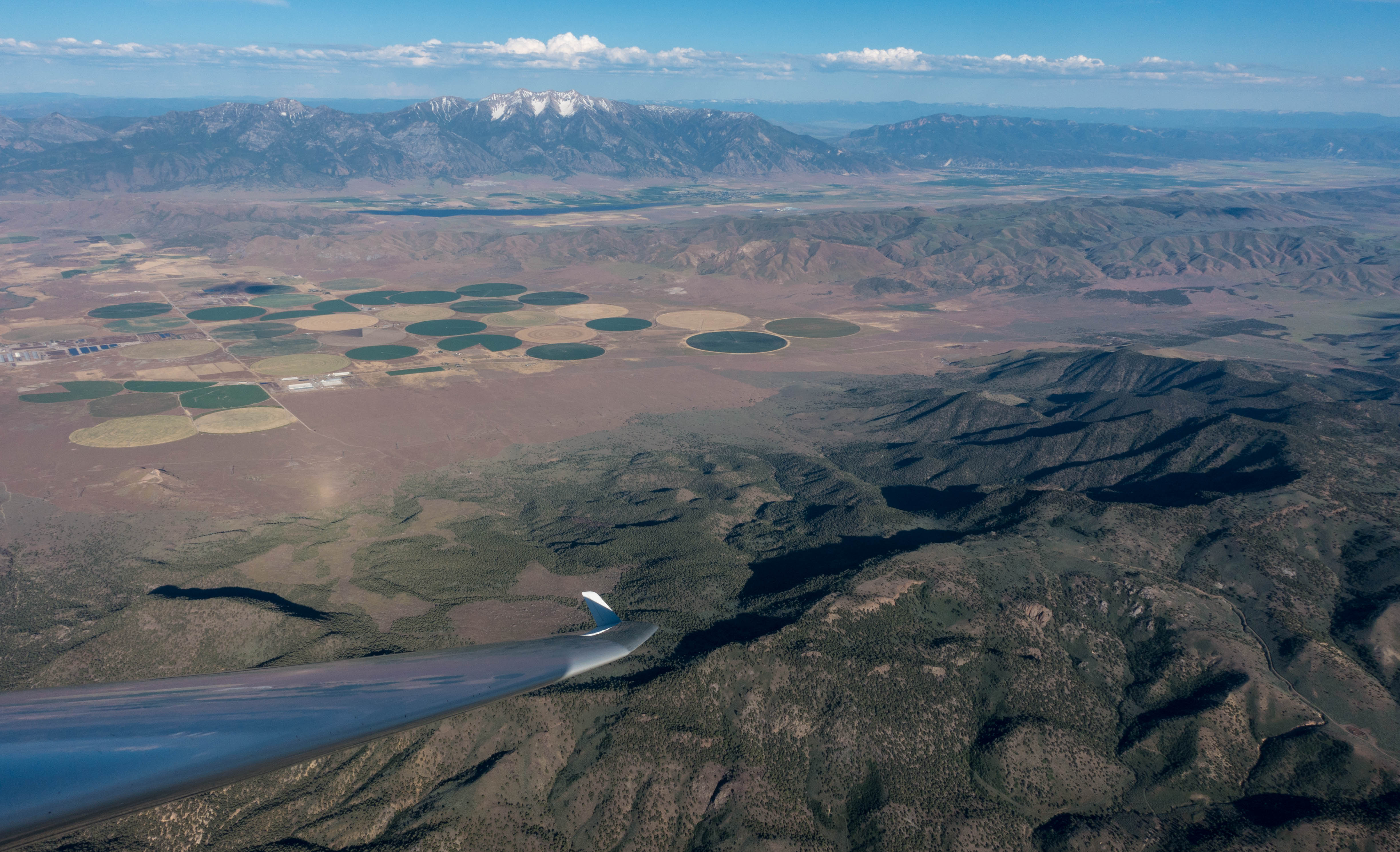
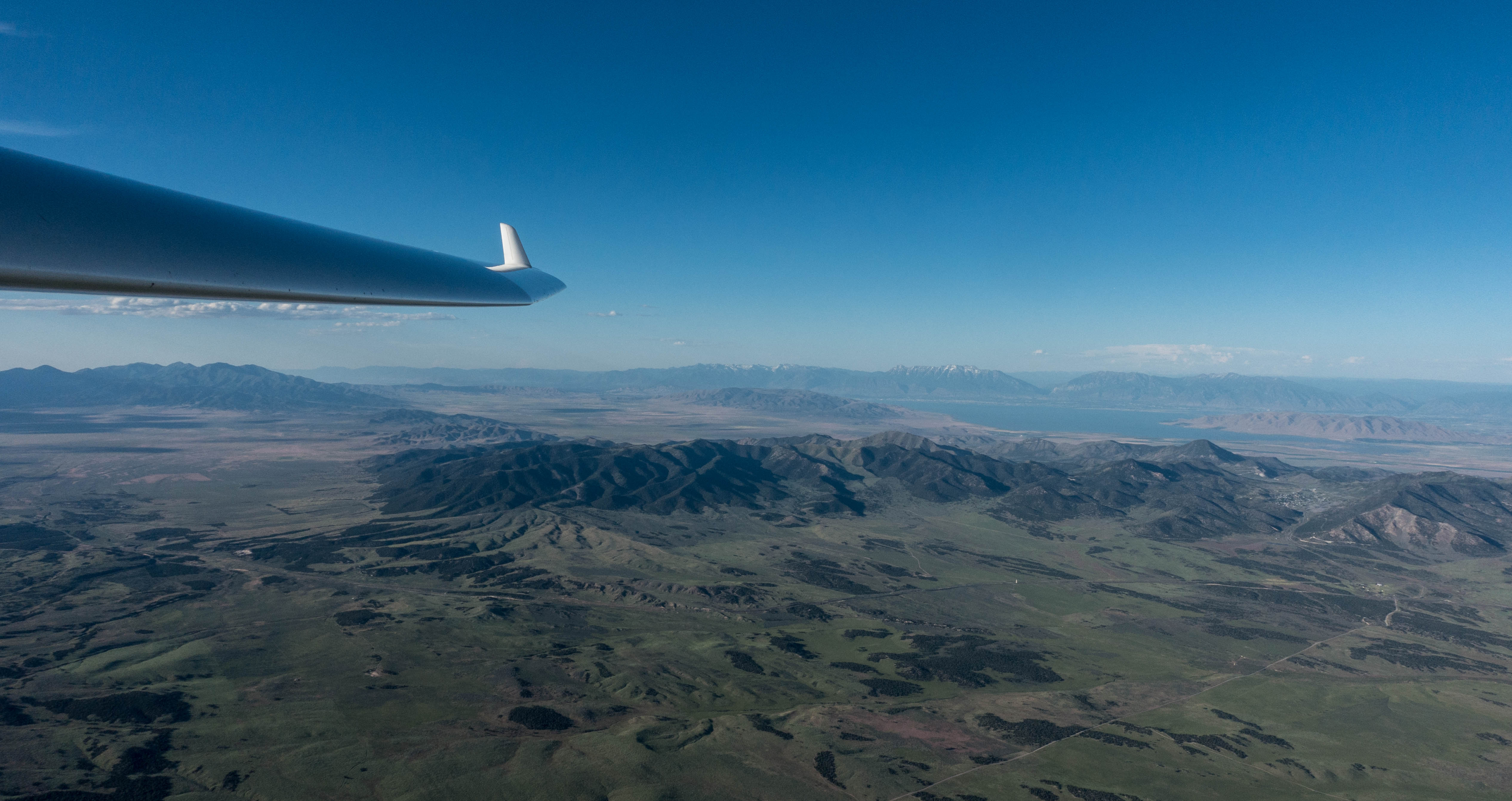
The soaring terrain to the south, east, and south-west of Nephi is outstanding. The only real limitations are to the north and north-west due to the busy Class B Airspace of Salt Lake City International. There is also an area of Restricted Airspace 20 miles or so to the west-north-west that is also off-limits to gliders. Several factors make the terrain so attractive: first, it is extremely varied: there are big mountains to the east and north-east including the Wasatch Plateau and the Uintas, and of course, Mount Nebo, the local mountain, just a few miles north-east of the field. There are several lower mountain ranges to the south; and there is the vast dry desert to the southwest, stretching into Nevada. Second, the scenery is simply stunning to watch from the air. Wooded mountain slopes give way to the famous red rocks of the south-west starting just a few miles south of the airport ultimately culminating in the famous National Parks that are within reach on good soaring days: Capitol Reef, Bryce Canyon, Zion Canyon, and even Grand Canyon further south. The desert boasts sand dunes (“Little Sahara”), several lower mountain ranges, and (mostly) dry salt lakes. Third, between the mountain ranges to the south lie fertile valleys that are not only home to several small airports, but also provide plenty of large cultivated fields should a land-out become necessary.
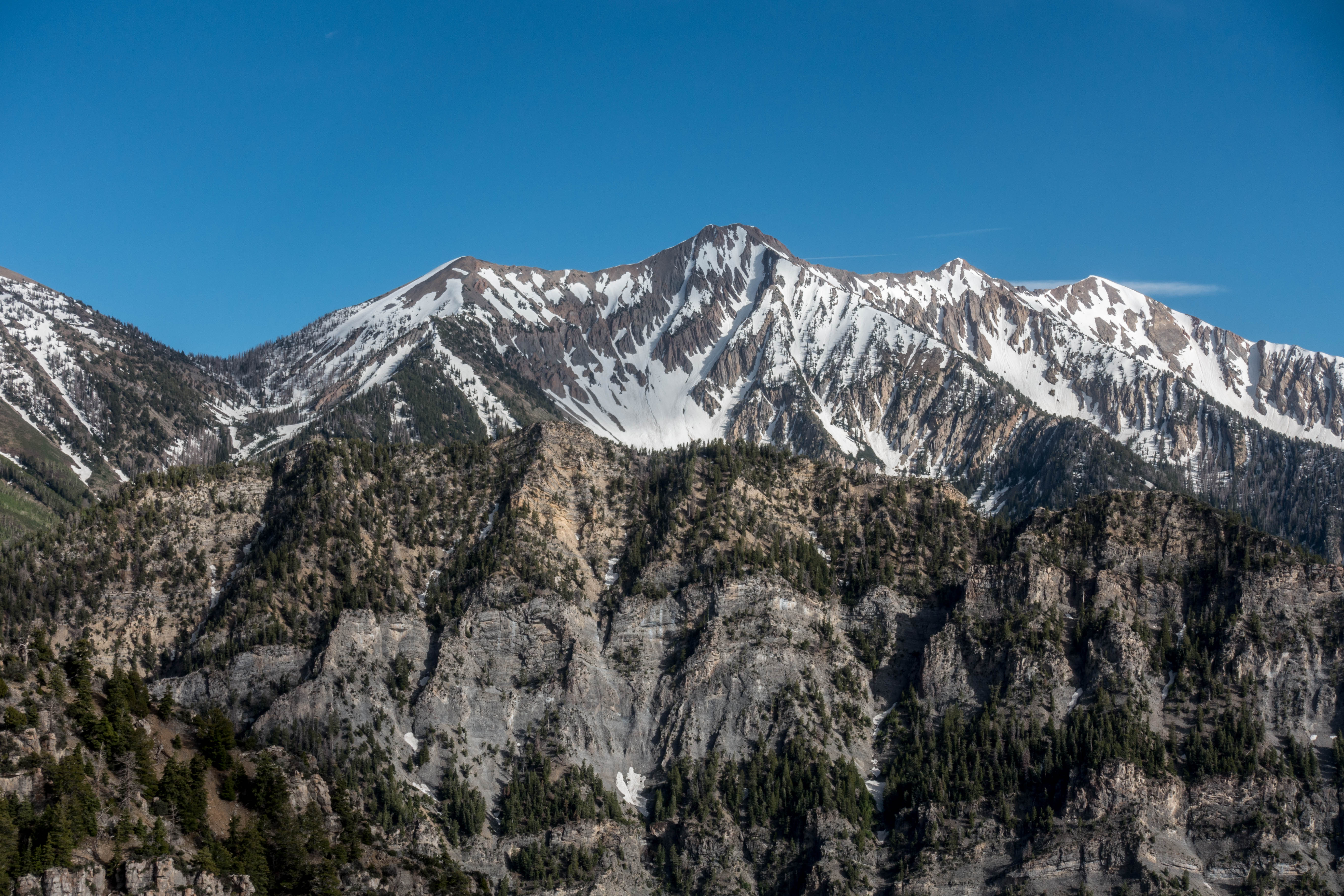
The varied terrain provides excellent soaring opportunities: there are strong thermals with typically high cloud bases in the summer, there is good ridge lift, especially in west-wind conditions, and there can also be usable wave lift in the lee of the mountains. Strong convergence lines tend to form over the mountain ranges or parallel to them over the valleys, helping to organize the lift into long energy lines. Particularly strong lift lines seem to form along the edges of the Wasatch Plateau where the moister mountain air mass above the plateau meets the drier desert air masses on either side. On days with low moisture content, clouds still tend to form over the Wasatch Plateau even when the sky everywhere else is blue. If the moisture content is high, the mountains are prone to overdevelopment but the dry desert will often still produce excellent soaring conditions.
Camp Weather
Apparently the weather was less ideal than what would be typical at this time of year. This was my first time in Nephi and so I couldn’t tell. Soaring flights of 500 or more kilometers were possible on the majority of days so what’s not to like? Of 10 days, only one was declared a rain day. Several days were characterized by a moderately strong wind from south to southwest, which caused thermals to be somewhat narrow, windblown and challenging to center. Thermal tops were mostly in the 13-17k foot range. Certainly good enough for XC flights even though many had hoped for 18k+. Several days had blue conditions although the Wasatch Plateau was almost always topped by nice cumuli. The most challenging day was one that followed the arrival of a cold front with northerly winds that brought cool air from the Great Salt Lake basin and made getting away in the morning quite challenging. Nevertheless, good thermals could be found on all soaring days. Ridge soaring was fun, especially when the wind had a significant westerly component. Good convergence lines could be found if you knew where to look. Even entry into wave was possible on one or two days. Some pilots achieved flights of more than 750km. Obviously this meant that the conditions were strong enough to support it. Maybe the weather wasn’t typical, ideal or easy but it certainly wasn’t bad and I was not disappointed.
My Flights
My first flight was late in the afternoon on the pre-camp practice day (June 26) after we had assembled our gliders. Gregg Davis and I went up in the club’s DG 505, call sign “SSB”. We had no trouble climbing off tow, crossing the valley to Mount Nebo, flying south along the San Pitch Mountains, climbing to 17,000 feet, and exploring the area towards the south-west, which we imagined would be a typical final glide route in the evenings. Getting as high as we did gave us a very nice overview of the entire terrain with sweeping views across the various mountain ranges and the western desert. Forming a mental picture of the terrain, and the locations of nearby airports and land-out fields, was a good way to get prepared for the days ahead.
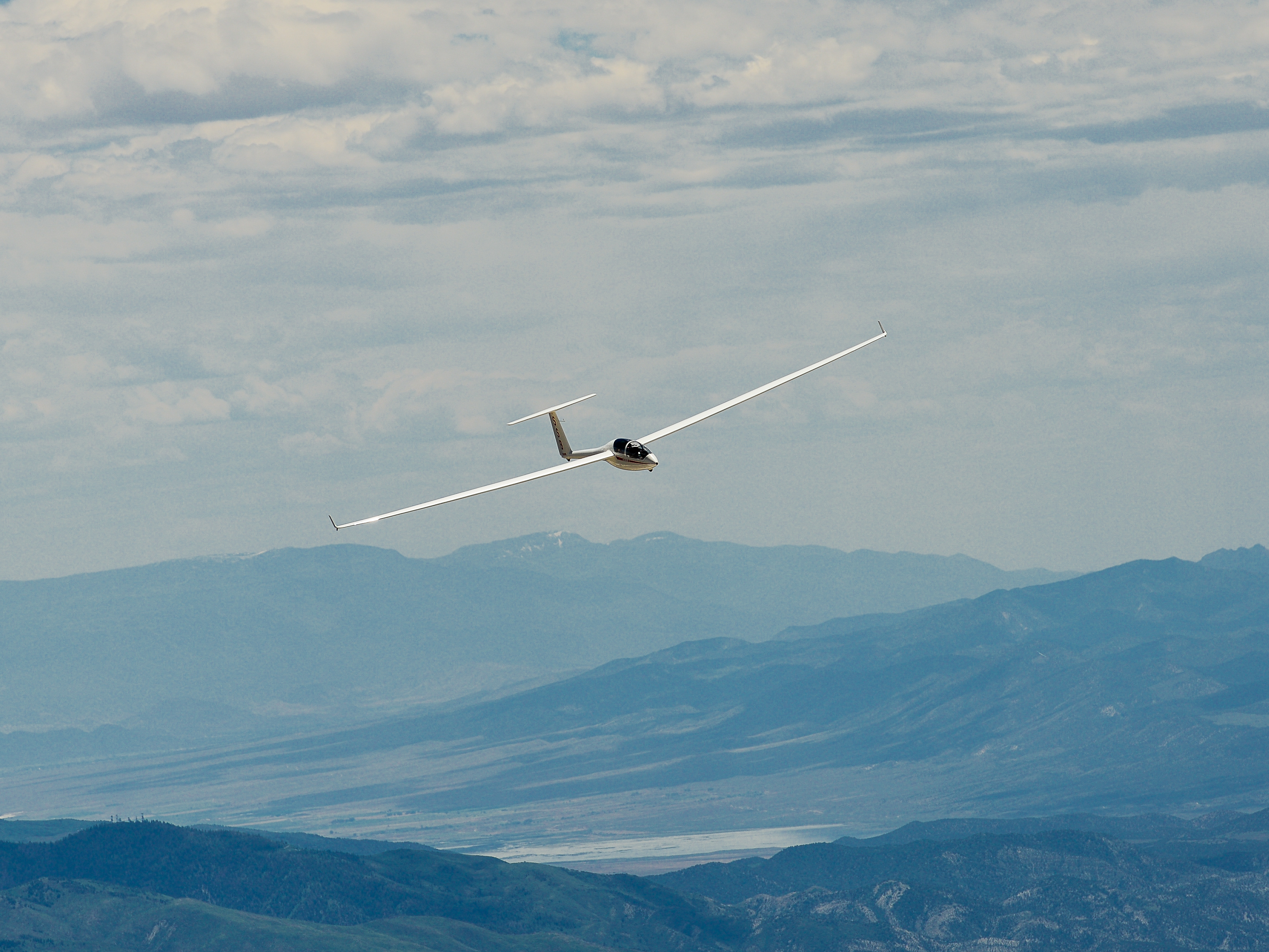
The first camp day (June 27) illustrated the benefits of our orientation flight. I was flying our club’s Discus “SG”. Strong winds caused thermals to be windblown and difficult to center, and capped at about 13k feet, which isn’t particularly high for the American West. Lenticular clouds aloft indicated the presence of wave. I later found out that one pilot actually managed to connect with it. For the first time I was able to fly with a downloaded weather forecast from Skysight on my flight computer (an Oudie IGC). This showed me the predicted location of the convergence lines and made me go to places I would not have otherwise chosen, such as the middle of the valley between the San Pitch Mountains and the Wasatch Plateau. The convergence wasn’t very strong but it was definitely there and helped me cover more miles than I would otherwise have been able to. The best part of my flight came at the end when the wind, which had been blowing from the south, turned a little more westerly and allowed me to ridge soar along the San Pitch Mountains and Mount Nebo. When I uploaded my flight to OLC, I was quite surprised to discover that my 326 km were farther that anyone else had flown that day.
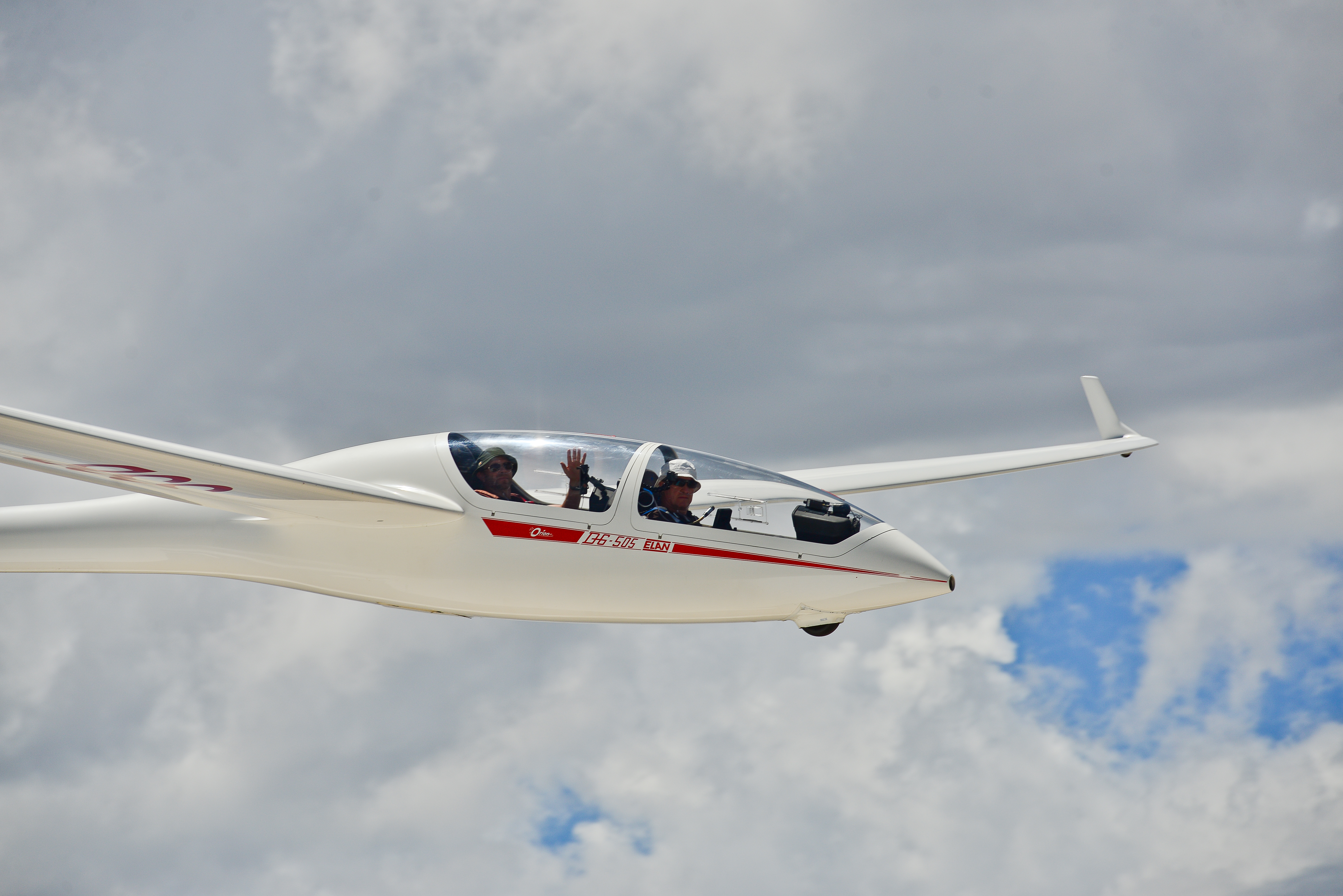
After serving as crew on June 28, my next flight was on June 29. Once again I flew with Gregg Davis in the DG 505. The sky looked better with cumulus clouds indicating lift but the soaring wasn’t any easier. We wanted to fly the day’s task with the first turn point (Browns Peak) located on the Wasatch Plateau. Strong winds limited the attainable climb altitude and for a long time we struggled to climb much above the top of Mount Nebo – too low for comfort to cross the valley in it’s lee and get onto the Plateau. When we finally were able to reach 15,000 feet, almost two hours into our flight, a line of virga had moved between us and the first turn-point and firmly put an end to our efforts to complete the task. Our accomplishment of the day was a great fly-by along the top of Mount Nebo where a professional photographer took pictures of the various gliders. We managed to get into an optimal position for a high-speed pass right at mountain top level. The reward is a series of great pictures of “SSB” for our club.
June 30 turned out to be overcast with some rain showers and was declared a rest day and July 1 was another crew day for me. My next flying day was on July 2. It looked to be a promising day and I declared a 500km task around three turn points in an attempt to fly the Discus to Diamond distance. Unfortunately, I completely botched the start and fell out of the sky. For about an hour I scratched around in the vicinity of the airport. Just when I decided that I would come back for a relight I was able to pull off a low save directly next to the airport and finally got going. I had lost so much time that it was already 4:30pm when I reached Monroe Peak, my southern turn point. Unfortunately, by then the route on task had turned completely blue and I realized that I had squandered my opportunity. Lift had become very scarce and it took all my efforts to make it back to Nephi. Ridge lift helped me climb Mount Nebo and I ultimately added a fun excursion to the west where I found smooth lift over the desert in the beautiful evening light. I ended up flying for 6.5 hours but wasn’t able to complete my task.

After crewing again on July 3 my next planned flight was with Al Godman on Independence Day in the DG505. We had completed our flight checks and were ready to launch when the launch crew noticed that the main tire of our ship had gone flat. We moved the glider off the runway and spent the next two hours replacing the tube and tire – not an easy thing to do! Just as the bulk of pilots were starting to return from their flights we decided to give the task a late attempt. We made the first turn point but then decided to scratch the next leg to the west due to a cold front moving in from the north. The winds on the ground picked up to 30kts with gusts to 38. We hung out over the airport for about an hour, waiting for the winds to calm down. This didn’t really happen and we had to land anyway. Fortunately the wind was blowing straight down the runway. The final approach was exciting and turbulent but the landing ultimately safe and uneventful. The flight track is here.
Al and I got another chance to fly together the next day, July 5. It was quite a difficult day as effects of the cold front from the prior day were still lingering around. Winds at takeoff were from the north – not a good sign at Nephi because northerly winds bring cool air from the Great Salt Lake into the Nephi Valley and suppress thermal development. The air was inverted and a large percentage of gliders were unable to stay up and came back to land. We fought for over an hour in the vicinity of the airport before the inversion had sufficiently burned off and were finally able to climb and head out south. However, the thermals remained exceedingly narrow and often required 50+ degrees of bank to stay centered in lift. This is hard work in the DG505, which is not the most nimble of gliders. Lots of g-force in tight turns made for a tiring day and massive sink between the climbs quickly evaporated the hard-earned gains. Only towards the end of the day were we able to locate a nice convergence line (once again with help from Skysight on my Oudie) and climb in straight flight along the edge where the dry and warmer desert air met the cooler air from the Salt Lake basin.
July 6 was the last camp day and I had another opportunity to fly the Discus and declare a Diamond Distance attempt. My first turnpoint was Delano Peak, the tallest point of the Tushar Mountains, followed by Tintic Mountain to the northwest of Nephi, and Tracks, a turnpoint in the Military Operations Area out in the western desert. I picked this westerly task based on forecast energy lines and due to projected overdevelopment above the Wasatch Plateau. I had a great start with a 7-8 kt climb right off tow and was able to get on task right away. Nice clouds showed the way and I was determined to make speed and not run out of time again.
Unfortunately, my initial climb and the alluring cloud street ahead had made me greedy and over-confident. I passed up one or two perfectly good 5-6 kt climbs, convinced that I could do better. And then I reached the end of the cloud street and there was no climb to be had at all. This forced me to backtrack and watch other gliders, who I thought I had left behind, cruise ahead well above. Painful! Eventually I found a climb and got back on course only to once again run into trouble near Richfield when three clouds in a row did not work. For a while I was torn and waffled: there were great looking clouds right on course to the south but I wasn’t sure if I had sufficient altitude to connect. If that didn’t work I would have to backtrack again and a land-out in Richfield was going to be likely. There were a few other, less attractive looking, clouds near Richfield that were 90 degrees off track but seemed a safer bet. What to do? My inability to make a clear decision and stick with it was painful and obvious to me even in the moment, and yet I was unable to commit one way or another. For a few, very long, minutes I was flying around almost aimlessly, squandering altitude and not going anywhere. This only made me angry with myself and did not put me in the best frame of mind. Clarity only came when I was finally so low that the direct route to the south was obviously no longer an option, and my mind focused on finding a climb while staying within glide range to Richfield. The red rocks west of Richfield are very beautiful and had basked in the sun all morning. They simply had to produce some thermals. It took me a while to find it but clearly they did and I was able to climb out and gain sufficient altitude to head to Delano.
Right at the turn point above the peak I was rewarded with the strongest climb of the day, catapulting me to cloud base at just under 18,000 feet. I realized it had taken me almost three hours to cover the 150 km to get there and I would have to dramatically increase my cruising speed if I stood any chance of completing my task. But now the wind was in my back and I was firmly connected with the clouds. The next leg was going to be fast! And it was: one hour and 20 minutes later I had covered another 160 km and was back past Nephi, rounding Tintic Mountain, my second turnpoint. But it was already 5:30pm. My next leg would be once again into the wind and the clouds were all gone. There was also no sign of the predicted convergence line. My only hope was that I would find some good climbs in the blue, most likely above the high terrain that lay on course. Two strong climbs to 17,000 feet would be enough. The desert had worked well late in the afternoons on prior days. Would it deliver again? All I could do was try. Unfortunately, the head wind picked up to 25 kts, compounding the challenge, and I had to put the nose down and fly fast. I found a climb but it was only 2-3 kts and I was quickly drifting backwards. Not good enough. I pushed on. I found another one but it delivered only 1-2kts. Onwards! Finally: 6kts. If I could get above 17,000 feet it might be enough to complete the task. I had to try.
I made every effort to keep the thermal perfectly centered, knowing I was not just flying against the wind but also against the end of the day. This might be the last opportunity. Unfortunately the climb topped out at 14,000 feet. Enough to reach the last turn point and most likely enough to get back from there to the airport in Delta, but nowhere near enough to get back to Nephi. It was the last night of the camp. Everyone wanted to pack up and get on the road the next morning. I did not want to land in Delta. And so, painful as it was, I decided to turn around and fly back to Nephi, which I comfortably had in final glide. Making the decision was agonizing. But once it was made, I felt relieved. There would be plenty of other opportunities to complete my 500k. And they would probably be a easier than this one had been. For me it was a worthy attempt and a good end to the camp. The flight trace is here.
A Word about Nephi, the Town
Nephi is located about 80 miles south of Salt Lake City and about 40 miles south of Provo. It is a small country town with a population of just under 6,000 people. The local economy seems to be mainly based on two legs: farming and the location along I-15. Nephi has no fewer than three exits along the Interstate, and there are several motels, gas stations, and truck stops predominantly catering to overnight visitors. The pilots attending Bruno’s annual gliding events seem to be the only group of visitors who stay for an extended period of time. You will spend a lot of your time at the airport. The Internet is faster than anywhere else and every other night there is a catered dinner for pilots and crew members in the hangar. On the other nights you will find yourself alternating among the handful restaurants in town that serve inexpensive comfort food. I found JC Mickelson (good burgers) and El Dorado (authentic Mexican) to be the relatively best options. If you like a beer with your meal, head to Lisa’s Country Kitchen, it is probably the only place in town with an alcohol license. That shouldn’t be a concern as you’re better off skipping the alcohol anyway it you’re flying the next day. The area around Nephi is very scenic and offers good opportunities for hiking and trail running so you won’t get bored if there are any rest days.
In Memoriam of John Weber and Tom Bjork
As difficult as it still is, I must acknowledge the tragic accident of John Weber and Tom Bjork on July 1 while participating in this event. Both pilots died when John Weber’s Arcus M impacted terrain near Ephraim. The cause of the accident is not known at this point and the NTSB is investigating. But it is fair to remind myself and anyone else that soaring is an inherently dangerous activity, albeit one where pilots have a high degree of control over how much risk they are prepared to assume. Gliders are very well built and sturdy and it is extremely rare that mechanical issues are the direct cause of an accident. In mountain flying, accidents frequently happen when pilots fly – perhaps too slowly – in close proximity to terrain and mother nature throws something at them that they did not anticipate. This could be a gust from behind that causes a stall and sudden loss of altitude; it could be a thermal breaking off from a rock face below that lifts one wing and turns the glider into terrain; it could be lee-side sink, rotor turbulence above a plateau, or a sudden gust that pushes the glider closer to the rocks than expected. It could also be a second of inattention, or an unintentional pull-up that causes the glider to stall and spin-in. I don’t know what caused this particular accident, and it is possible that there was no human error involved at all. Maybe we will find out based on the flight log, and maybe we won’t. But irrespective of the actual cause in this particular case, the key lesson for me is crystal clear: whenever you fly in proximity to terrain, you must keep enough distance and enough airspeed to prevent an impact with the ground no matter what mother nature might throw at you. It is also helpful to remember Habituated Action Theory. This theory tells us that engaging in high-risk behavior many times without a negative outcome often decreases the perceived risk associated with this behavior and makes us more likely to assume the risky behavior again. We must avoid this fallacy: just because nothing bad happened previously when flying close (and slow) to terrain does in no way mean that it won’t happen in the future! The only way to stay safe is to not do it. May John and Tom rest in peace.
Lessons Learned
- Be prepared. If you plan on attending an organized soaring event, make sure you are well prepared before you get there. Here are a few things that are really important to do in advance: (1) Know how to use your flight computer and make sure you have all the necessary airspace and waypoint files installed. Your flight computer is much more important when you fly in unfamiliar terrain. (2) Make sure that your glider and its trailer are in great shape and that everything is working before you leave from home. E.g., we discovered that the batteries for the DG 505 were in bad shape. We got lucky and one of the camp’s attendees had one for sale. Bring a spare tire and tube – we needed it! (3) Have a pee system and know how to use it. (4) Familiarize yourself with the terrain you will be flying in. Look up flights from local pilots on OLC. What routes do they fly? Where are the go-to thermals? Where do they find ridge lift? If you have Condor, fly in a local scenery and use tasks from past events at that location. This helped me tremendously.
- Weather in the cockpit is nice. This was the first time I had Skysight’s forecast on my Oudie. This was really handy, especially with respect to convergence lines. But forecasts can be wrong and soaring is not a computer game. If there are clouds, they still rule!
- Flying into a strong headwind makes you slow. There can be a lot of wind and I underestimated how long it would take me to penetrate upwind. I also noticed that ballasted gliders had a big advantage. I must really learn to fly with water ballast.
- Be careful in gaggles. And don’t rely on others following the rules. E.g., one rule in Nephi was to only use left turns within 5 miles of the airport. Not everyone will remember. I just got established in a thermal off tow when another glider released in the same thermal 300 feet below and started to turn to the right. Not cool! Also, don’t follow another glider so closely that they can’t see you. It is super irritating (and dangerous) if you know someone is right behind you, at more or less the same altitude, and you can’t see them at all. Don’t be the pilot that irritates others or puts them in danger. Practicing gaggle flying in Condor multi-player races is super helpful as well.
- Practice final glides using the flight computer. Don’t blindly rely on your flight computer to calculate final glides. Know the impact of your MC setting and experiment at your home airfield where you are more familiar with the land-out options.
- Practice Turn Area Tasks using the flight computer. TATs are the most common tasks at soaring events and you really have to know how to use your flight computer to fly them effectively. There’s a great tutorial to set up the Oudie for Turn Area Tasks and it was super helpful having practiced this with Condor.
- Stay safe and have fun. Do not take excessive risks. It is not worth it.
Great Blog!