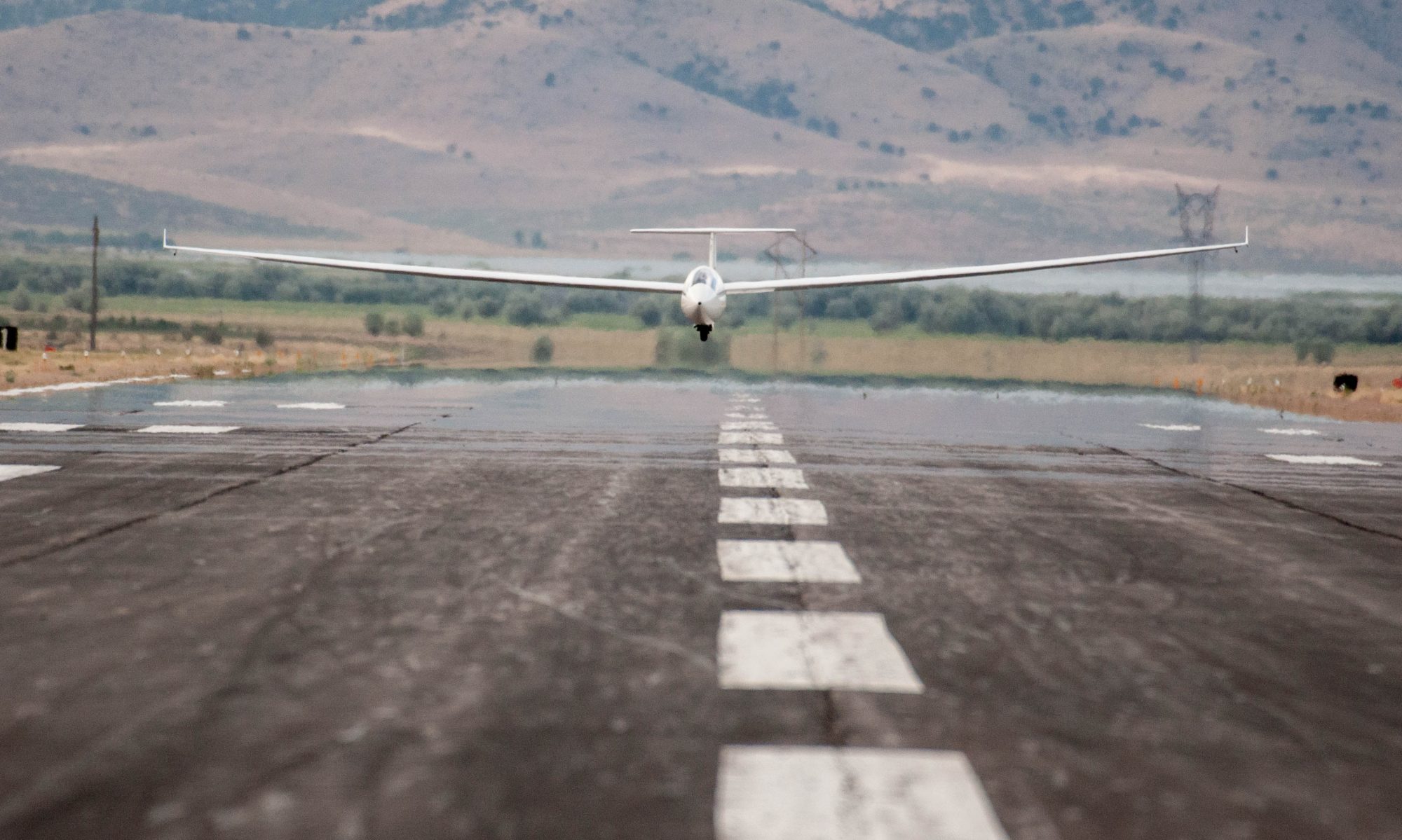
On August 7, I successfully earned my 750k Diplome by completing a pre-declared 757 km task with three turn-points. It was my eight attempt at such a task. Here is the flight track. I’ve documented the flight in detail in the following video.
In this article I will NOT focus on the successful flight but instead on the seven failed attempts that preceded it. I want to examine exactly what went wrong, when, and why. And most importantly: what did I learn from these failed attempts?
Attempt #1 – You’ve Got to Take This More Seriously!
On May 5, 2020 I declared the following task:
- Start/Finish: Gross Reservoir Dam
- TP1: Morton Pass, Wyoming (42 km north of Laramie) – 189 km
- TP2: Lake George (30km northwest of Pikes Peak) – 296 km
- TP3: Rustic (35 km north of Estes Park) – 191 km
- Finish: Gross Reservoir Dam – 85 km
Task Distance: 762 km
I launched at 12:39 pm, released in the pattern, and spent about 45 minutes getting connected. The launch itself had probably been too late already and when I finally was ready to get on task it was clearly too late for such an endeavor. I realized this at the time and didn’t even bother to head south to cross my start line at Gross Reservoir.
In retrospect, I am not sure I should even call this an “attempt” since I did not even get a valid start. I went on to have a nice flight: 561 km at an average speed of 120 kph based on OLC plus rules was fun but a serious effort to achieve a declared 750 km task it was clearly not.
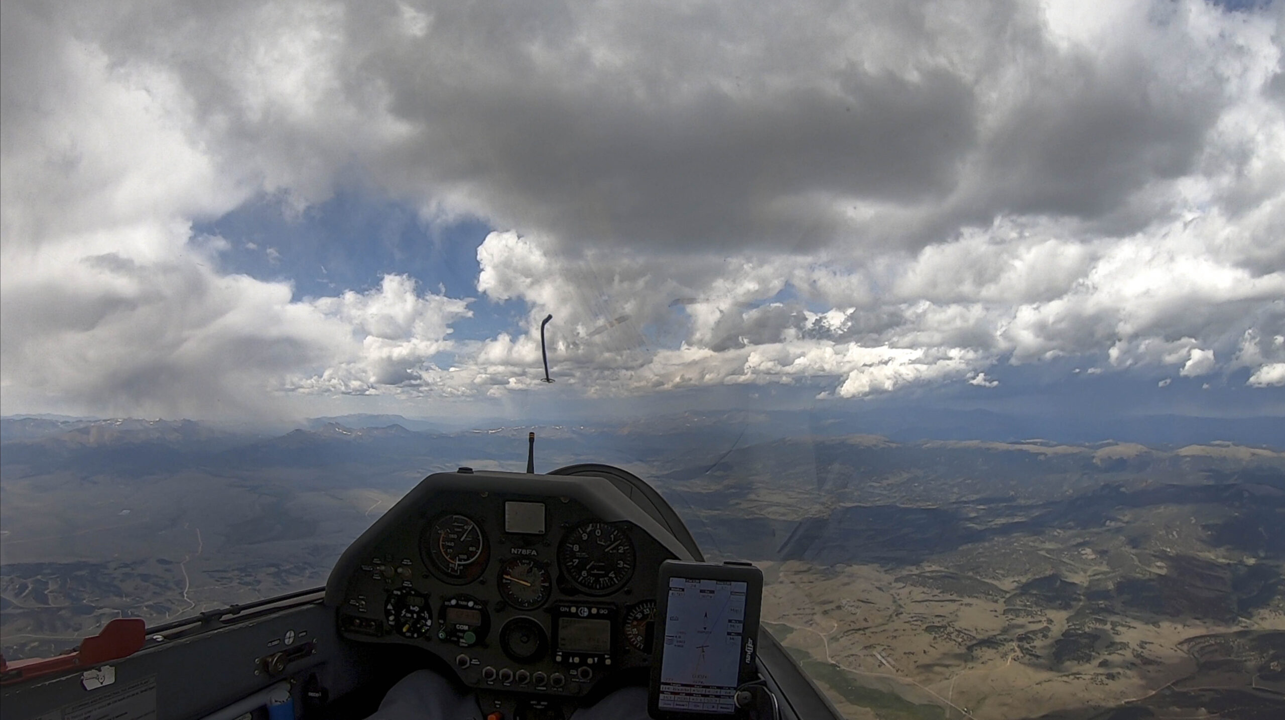
Another question is: could it have worked had I started earlier? The honest answer is, “I don’t know”. The day was fairly strong with a well-working convergence line. I can’t be certain that the convergence would have worked all the way to my first turn point because I only flew north until Crystal Lakes and did not try to get further north from there. However, a line of clouds indicated the location of the convergence and it seemed to be in the right direction albeit with a lower cloud base.
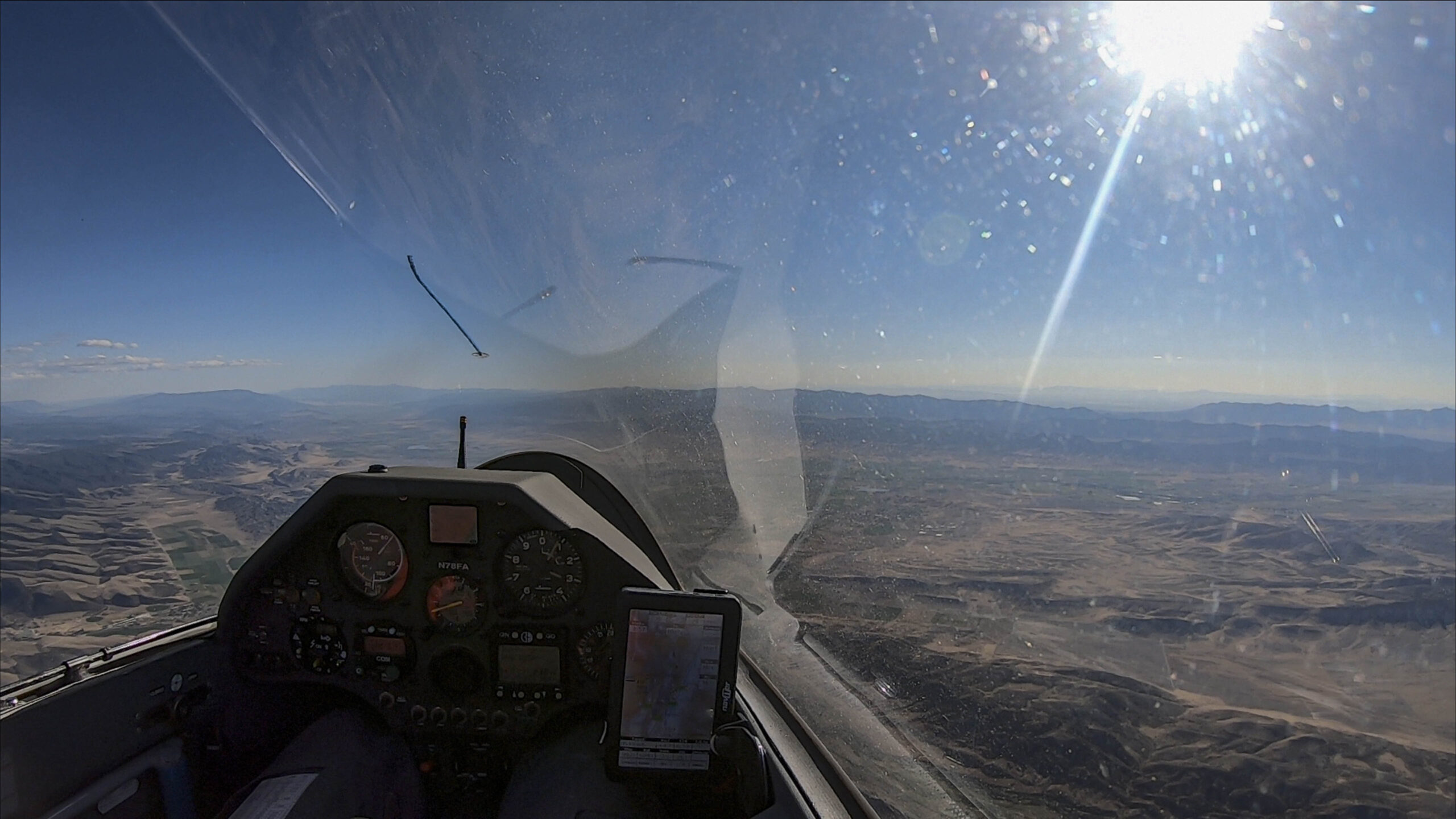
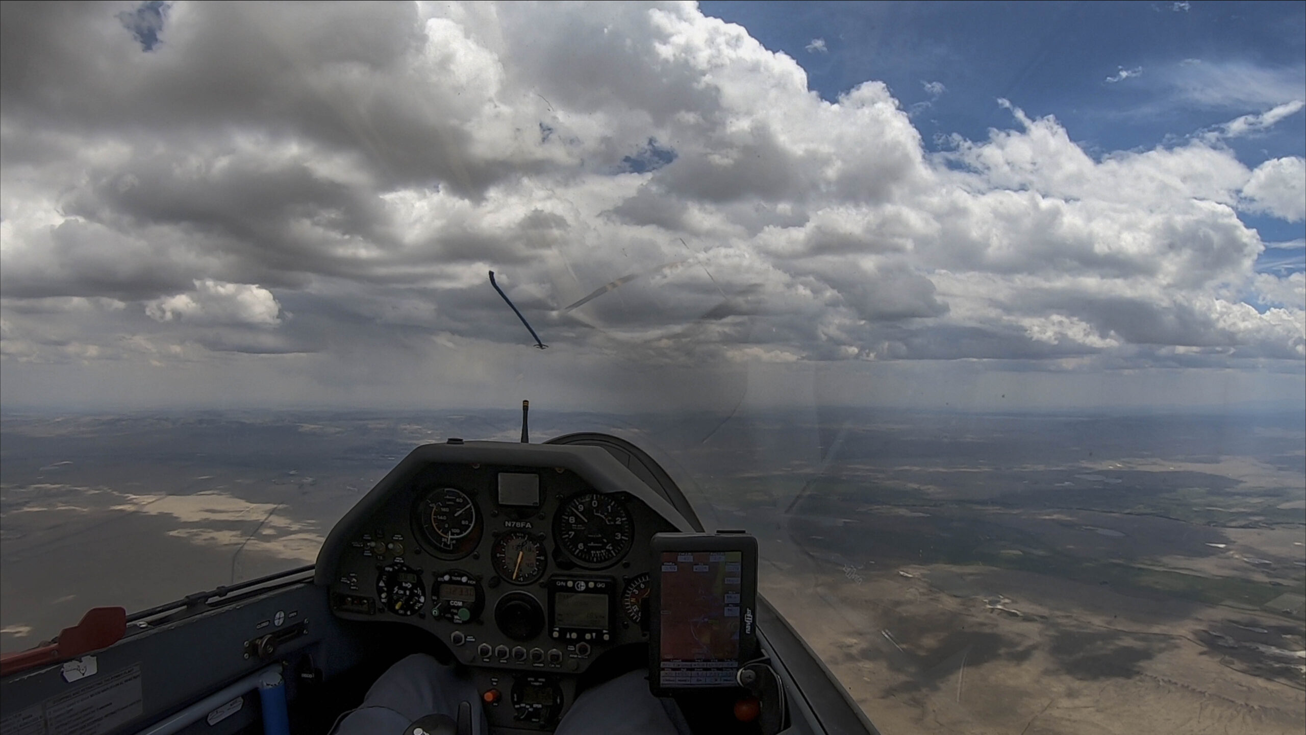
The following picture shows my location over Crystal Lakes looking north towards Laramie just before turning back south.
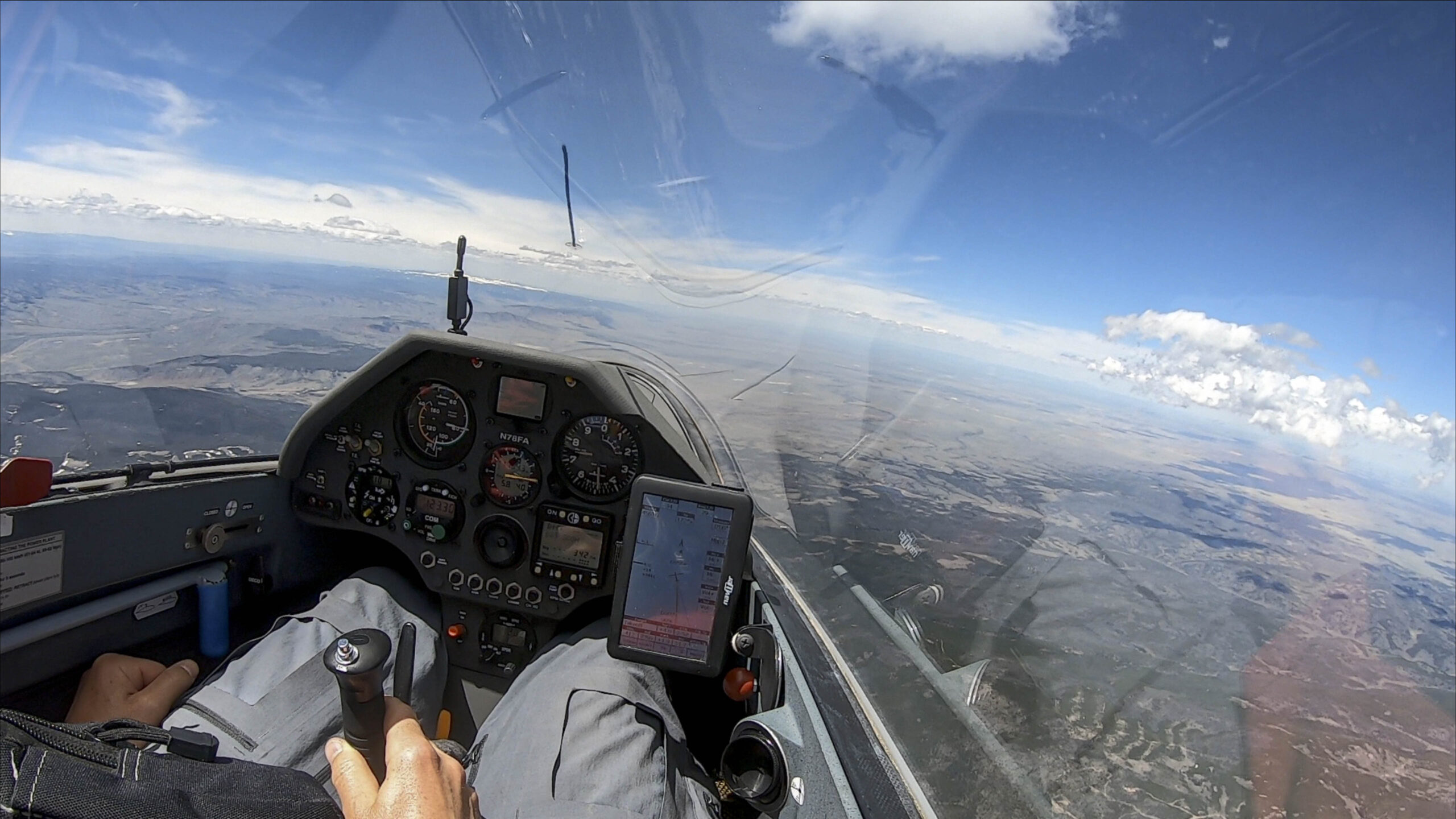
The image suggests that it probably would have been possible to follow the convergence to the north – although maybe not at the same speed as the rest of my flight. But by the time I got there it was already too late in the day. What would the same location looked like two hours earlier? Did the convergence exist at that time? Was it marked? These questions are of course impossible to answer in retrospect.
Bob Faris and John Seaborn had the longest flights from Boulder that day with just under 600 km and no-one flew faster than my 120 kph average. These stats suggest that the day may not have been strong enough to accomplish a 750 km flight.
Overall, I think the key lesson to learn from this flight is this: if I really want to accomplish a 750 km task, I have to take it more seriously. A 750 km flight requires a different approach than a 500 km flight. In particular, I have to start early enough to have enough time in the soaring day.
Attempt #2 – Don’t Waste Time to Get Going!
On June 11 came my second attempt:
- Start: Bighorn Mountain (2 km east of Gold Hill)
- TP1: Greenhorn Mountain (60 km south of Cañon City)- 245 km
- TP2: Crystal Lakes (15 km south of the CO/WY border) – 334 km
- TP3: Squaw Mountain (7 km south of Idaho Springs) – 130 km
- Finish: Bighorn Mountain – 43 km
Task Distance: 752 km
This time I launched at 12:14 – about half an hour earlier. However, I made the same mistake of releasing in the pattern on a convergence day. I spent almost 50 minutes below 9,000 feet before I finally managed to break free of the inversion and got into convergence lift.
To my credit I went to get a valid start and made an attempt to reach my first turn point. However, I knew that conditions would have to be extraordinarily strong to complete the task before the end of the soaring day. I made good progress into a southerly headwind until I got to the town of Victor (south-west of Pikes Peak) where I decided to give up because the remaining 90 km to Greenhorn Mountain were devoid of any clouds. Instead, a beautiful cloud street beckoned across South Park and so I decided to head west into the Mosquito Range. I had a nice flight of 533 km and flew above Mt. Bross, my last remaining 14er of the Mosquito Range.
Could it have worked in hindsight? It’s impossible to say. John Seaborn had the longest flight from Boulder on that day with 869 km. This is proof that long flights were definitely possible. John launched 1:15 hours before me and managed to connect at 11:43 am, 1:30 hours earlier than I did. As far as I can tell, no pilot flew into the Wet Mountains that day where my first turn point was located. Skysight had predicted some clouds that day over the Wet Mountains and that forecast had not come to pass.
The lessons on this flight are similar to those on my first attempt. To accomplish a 750k task it is critical to start earlier and to not waste time trying to connect. An earlier and deeper mountain tow may be necessary, especially on convergence days with a strong inversion over the plains.
Attempt #3 – Plan the Final Turn Point More Wisely
Flying out of Nephi, Utah, my third attempt was on July 2:
- Start: 04 SE Start
- TP1: 47 King’s Peak (High Uintas) – 171 km
- TP2: 73 Salina Canyon (along I-70) – 235 km
- TP3: 52 Mirror Lake (High Uintas) – 211 km
- Finish: 04 SE Start – 137 km
Task Distance: 753 km
I launched at 12:14 pm (which is fairly early for Nephi – about the equivalent of 11:45 am in Boulder due to Nephi’s westerly longitude) and climbed quickly to 12,000 feet. I left the climb to cross the start line relatively low. Unfortunately, I fell out of the band at that point and wasted about 20 minutes to reconnect. By the time I went out on task it was 1 pm.
My first turn point, King’s Peak (part of the High Uintas), is the tallest mountain in Utah and it turned out to be a real challenge. While conditions were great up to Strawberry Reservoir, thermals became narrow and windblown further to the north and only one in three clouds produced climbable lift. I managed to turn King’s Peak at 2:28 pm but this stretch had been hard work and even with a tail wind, I had only averaged 98 kph.
Conditions improved once I was back at Strawberry Reservoir and able to connect with the convergence line above the Wasatch Plateau. My second leg of the flight was into a headwind but I picked up the pace and averaged 110 kph rounding my southern turn point at Salida Canyon at 4:37pm.
The third leg started out really fast (160 kph average with a tailwind) but as I approached Strawberry Reservoir for the second time it was 5:20 pm and I had another 90 km to go to Mirror Lake. My memories of the difficulties of flying into the High Uintas from earlier in the day were still very much on my mind. As I considered flying into that terrain again at the end of the day I got cold feet – especially considering that I would then have to face a stiff headwind back to Nephi for the final 137 km.
Could it have worked? Who knows… Several pilots flew into the High Uintas that day but no one went there so late in the afternoon. And that is the key lesson of this flight: do not plan the last turn point such that it is over difficult terrain, far away from home, and facing a headwind on final glide. Any of these three aspects (difficulty of terrain, distance from home, and headwind on final) can become a problem by itself – all three combined is asking for trouble. I am glad that I made the prudent decision to give up on this task when I did. I might have been able to finish, but I might also have landed out at Heber or Thunder Ridge Airpark, running out of lift and unable to get back home.
I took some encouragement from the fact that I had achieved my first two turn points on a challenging 750 km attempt. My total flight distance that day was 667 km based on OLC plus rules.
Attempt #4 – Detour To Follow the Clouds!
Once again flying out of Nephi, my fourth attempt was on July 5.
- Start: 04 SE Start
- TP1: xPfeiler Ranch (10 km north of Panguitch) – 198 km
- TP2: 80 Strawberry Dam (50 km east of Provo) – 269 km
- TP3: 87 Whiskey Knoll (35 km southwest of Richfield) – 180 km
- Finish: 04 SE Start – 117 km
Task Distance: 767 km
I launched at 12:13 pm, which should have been early enough for this task, and I had no problem climbing off tow. The direct route south was blocked by a fire TFR and so I had to go around on the east side of the San Pitch Mountains where I struggled to get up to cloud base and didn’t make good time. Better conditions along the Pavani Range past Richfield and then slow going again past Mt Delano towards my southern turn point. A mediocre average climb rate of just over 4 kts didn’t support more than 100 kph on that first leg.
A tailwind on the long second leg should have made the going much faster but the air above the Wasatch Plateau had dried earlier than predicted and much of my route was in the blue. The only visible cloud street was the convergence line east of the Wasatch Plateau, which I (erroneously) believed to be too far off course. Intent on staying high without thermal markers I took a lot of weak climbs such that my average climb rate dropped even slightly below 4 kts. Even with a tail wind, I did not make more than 110 kph on the way north to Strawberry Reservoir.
More blue skies on the way back south against a headwind and my average speed dropped to 91 kph. This is just way to slow to complete a 750k flight. Around 6pm the last wisps were gone and it became clear that the soaring day was over. I made it to the vicinity of Mount Baldy and had to acknowledge that the remaining 50 km to Whiskey Knoll were no longer feasible.
Crossing the Manti Valley I even dropped below glide range to Nephi but the sun-baked rocks along the San Pitch Mountains provided sustaining lift and ultimately I had no problem getting back home.
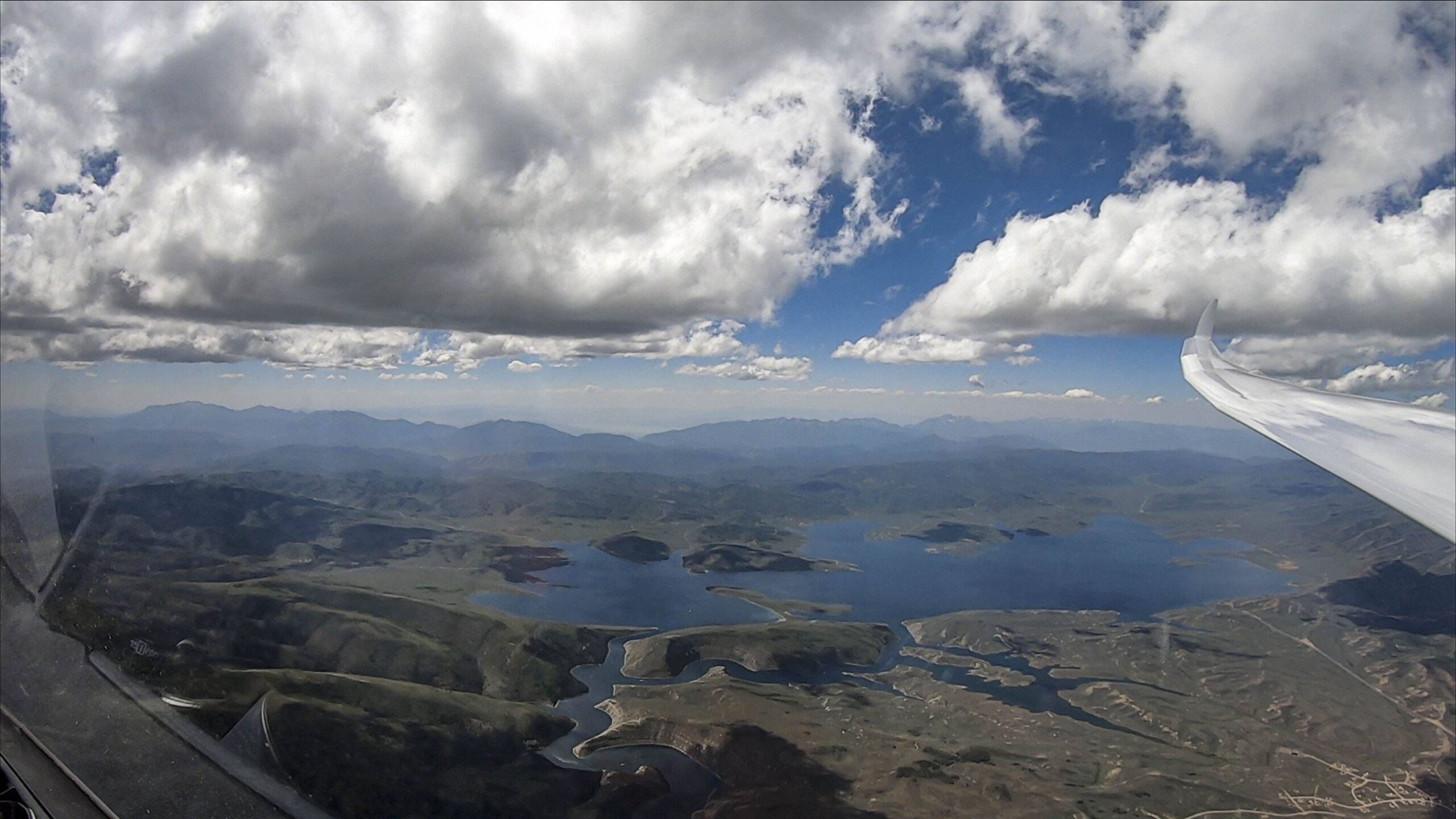
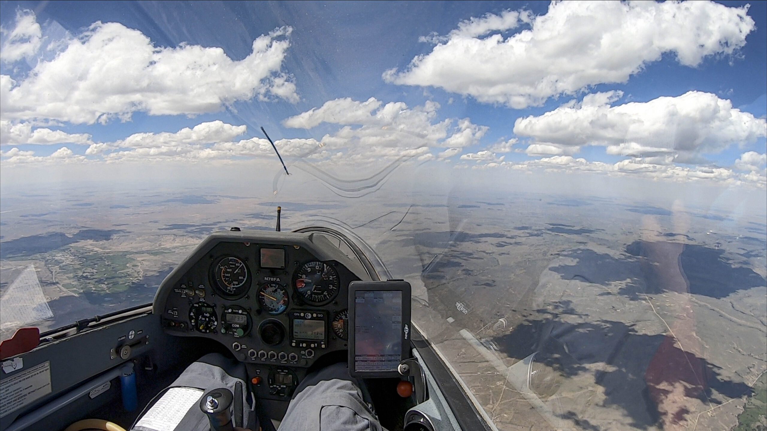
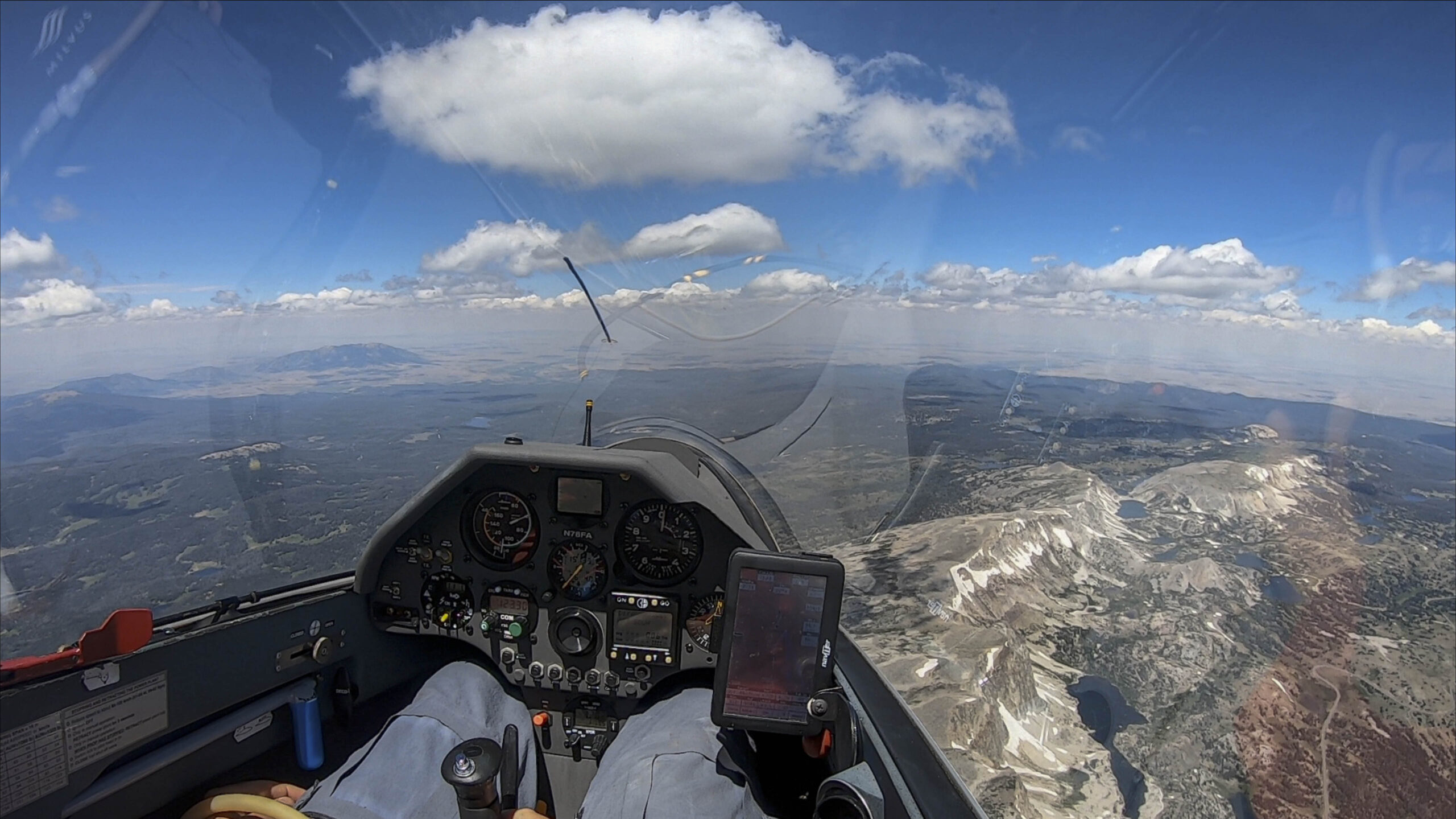
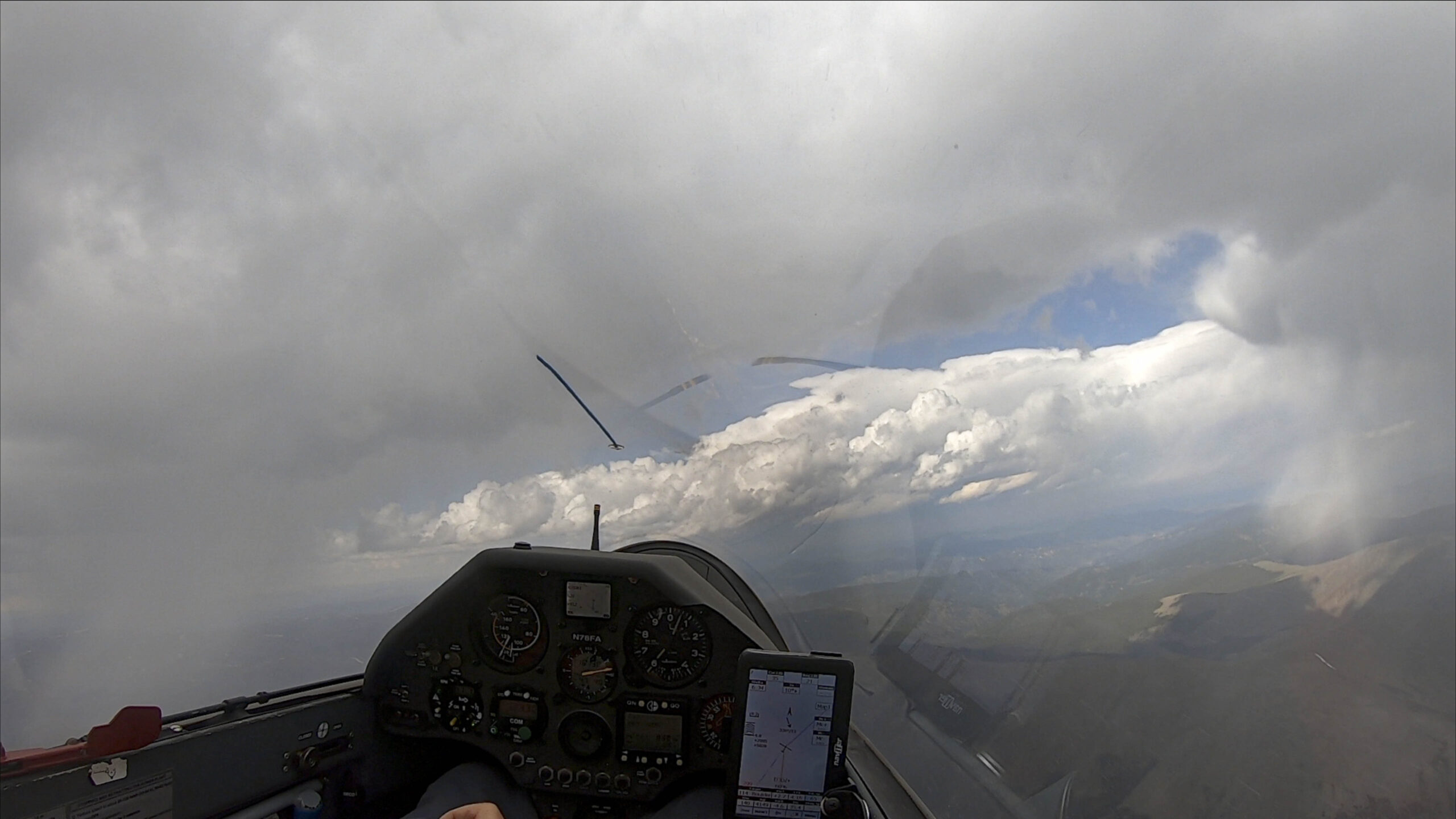
In hindsight I should have flown along the convergence that set up over the desert east of the Wasatch Plateau. I had judged the street to be too far east but looking at others’ flight traces for the day it would have worked very well, supporting speeds of over 160kph and only being a minor detour. In my assessment during the flight I judged the street too far east and had been concerned about making it back from there to the west side of the plateau.
John Seaborn and Bruno Vassel followed that convergence line all the way to the Grand Canyon and back. John’s distance of almost 1100 km flown at an average speed of more than 150 kph was truly humbling!
The key lesson was that I should have taken the detour to follow the very well marked convergence line where much faster average speeds were obtainable. (The picture above makes this really obvious.)
I managed to fly 709 km that day (based on OLC plus), which was my longest flight up to this date. Once again I had made the first two turn points and then ran out of time. I started to feel increasingly confident that it was just a matter of time until it would work.
Attempt #5 – Misaligned Cycle Times and Detours
My 5th attempt was back in Boulder on July 9:
- Start: Ward
- TP1: Dixon, Wyoming – 200 km
- TP2: Thunder Butte (10 km south of Deckers, CO) – 285 km
- TP3: Crystal Lakes (15 km south of CO/WY border) – 190 km
- Finish: Ward – 88 km
Task Distance: 763 km
This was a cool task because I hadn’t been to the northwest before. I launched at noon and caught a 10 kt climb right off tow to 17,000 feet. By 12:30 I had crossed the start line and was underway.
The first leg went quite well and I averaged 100 kph against a solid headwind of 15-20 kts, turning Dixon at 2:30 pm.
A tailwind and flying during the peak time of the day should have made my second leg much faster. However, I got caught in a down-cycle and cloud after cloud dissolved before I got there. The crossing of North Park was particularly slow going and I took several weak climbs and detours to stay in glide range of Walden. While my average climb rate had been almost 7 kts on the outbound leg, it dropped to 4 kts on the return resulting in a XC speed of only 105 kph, very poor considering the tailwind.
I returned to the Front Range near Mummy Mountain north of Estes Park and found the convergence line in perfect working order. Finally I was able to go straight with minimal circling. Over the following 115 km I averaged 150 kph with convergence lift supporting an effective glide ratio of 117:1.
Turnpoint 2 was to the east of the convergence and harder to get to due to over-development, causing another slow down until I had turned it at 5:15pm. From there I detoured back to the convergence, reaching it by 5:25pm.
By the time I got back to the Continental Divide past Mount Evans it was 5:50pm and the area to the north towards Crystal Lakes was completely over-developed with overcast and rain.
A notable feature of the day were the different characteristics of the various air masses. The air to the east of the Front Range convergence was quite humid and prone to over-development and showers, whereas the western air was much drier with nice cus, although not always conveniently aligned with my task.
Eight pilots were flying cross-country from Boulder that day and my 685 km flight was considerably longer than anyone else’s. The Cache la Poudre area (where my third turn point was located) was already overdeveloped by 4 pm, meaning that a faster speed on leg two would not have made much difference.
Overall, I believe that a 750 km task was not obtainable that day. The main lesson to take away is the realization that some great-looking days may simply not last long enough to complete such a long task.
Attempt #6 – When OD Gets Too Much
My 6th attempt was in Boulder on July 17:
- Start: Boulder (KBDU)
- TP 1: Centennial, Wyoming (45 km west of Laramie) – 160 km
- TP2: Scottsbluff, Nebraska – 221 km
- TP3: Mount Evans – 307 km
- Finish: Boulder (KBDU) – 61 km
Task Distance: 750 km
I was very excited about the possibilities of this task. Not only was it a 750 km task, it was also a >650 km FAI triangle with start and finish on the same leg. And it would take me across three states – Colorado, Wyoming, and Nebraska. The cloud bases were projected to be somewhat lower than what I prefer but with much of the task over the eastern plains flying really high was not going to be critical.
The forecast supported an unusually early launch at 10:30 am. The air was highly unstable. Cumulus clouds had started to form before 10 am and when I released from tow above the Flatirons at 10:45 am, the first rain drops hit my canopy.
I quickly climbed to 14,000 ft and crossed the start line above Boulder at 11:04 am. I already had significant doubts about the viability of the task but thought I would give it a try. Over-development is often confined to the mountains and most of my second and third leg would be over the eastern plains.
At 12:41 I rounded my first turn point at the foot of Medicine Bow Peak. At 100 kph my average speed wasn’t particularly high but I had been flying into a headwind and it was still early in the day.
Turning eastward it was obvious that the direct route to Scottsbluff was blocked by a big rain cell sitting above the hills east of Laramie. The shorter detour seemed to be on the northern side but I had not prepared for such a northerly route and wasn’t familiar with the landing areas. So I decided to try a southerly detour, which would keep me in glide range of Cheyenne and Owl Canyon.
South-east of Cheyenne I had made it past the rain cell and could see a street towards Scottsbluff. However, looking back towards Boulder, the foothills west of Fort Collins were already heavily overdeveloped with lots of dark clouds and it was only 1:30pm. Virga and rain had also started to fall from some of the clouds over the plains.
I did not want to tempt land-out fate and decided to give up on the task and make my way back towards Boulder while heavy rain fell over the foothills west of Carter Lake. Slightly drier conditions to the south allowed me to continue past Boulder and almost reach Mount Evans before returning back home, landing at 3:20pm.
Would a completion of my task have been possible? I am confident that the answer is no. Overall there was no new lesson to be learned. Completing a 750 km flight requires the whole soaring day and if the day gets cut short by heavy over-development there simply isn’t enough time to finish the task.
With 528 km my flight was the longest from Boulder on that day. My flight track is here.
Attempt #7 – Don’t Take Safety Risks!
Attempt # 7 was on July 31, 2020:
- Start: Ward
- TP1: Medicine Bow Peak – 159 km
- TP2: xBuffalo Drive (south of Hartsel) – 274 km
- TP3: Colorado/Wyoming Border – 229 km
- Finish: Ward – 104 km
Task Distance: 766 km
July 31 was a convergence day with a strong ground inversion over the prairie. I launched at 11:15 am and crossed the start line at Ward at 11:51 am at 12,000 ft. While some other pilots struggled to get connected I felt lucky to get underway relatively quickly.
Cloud bases were still somewhat low and conditions relatively soft but I made steady progress, crossing from Trail Ridge Road into the Never Summer Range. Cloud bases dropped below 16,000 as I headed north but the line of lift was well-marked. At 1:30 pm I rounded my northern-most turn point above Medicine Bow Peak.
As I began to head back south, some clouds already showed signs of significant vertical development, which did not bode well for the conditions later that afternoon. But for the moment I enjoyed strong lift of 6 kt average and a glide ratio of 113:1 as much of my leg to the south followed the convergence line along the Front Range and into South Park. My average speed on this leg was almost 150 kph.
By the time I reached Mount Evans, the clouds had begun to darken with clear signs of over-development. However, the sky ahead into South Park still looked promising and the convergence line extended ahead, fairly well-aligned with my route to turn point 2 south of Hartsel.
The prudent thing to do would have been to give up at the task at this point. However, the allure of a quick line towards TP2 was very strong. Having a clear path towards the airport of Salida gave me the confidence to continue.
I rounded turn point 2 at 3:18 pm and turned back north. The clouds had continued to build up but there was a well-marked way back towards Mount Evans and so I took it.
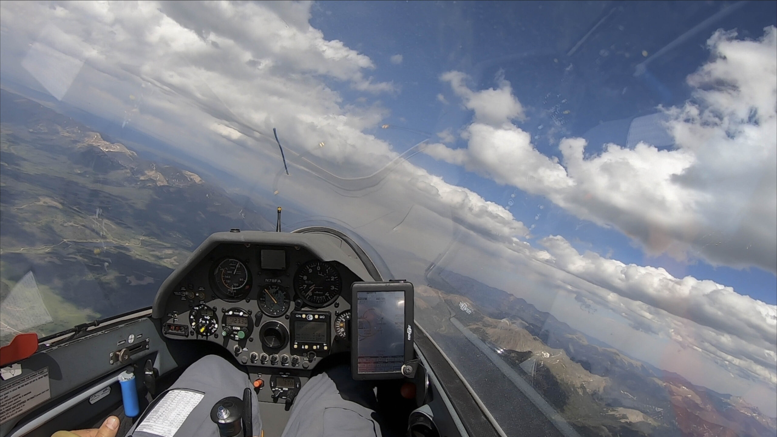
As I got closer to Mount Evans I could see sunshine beyond the virga line ahead.
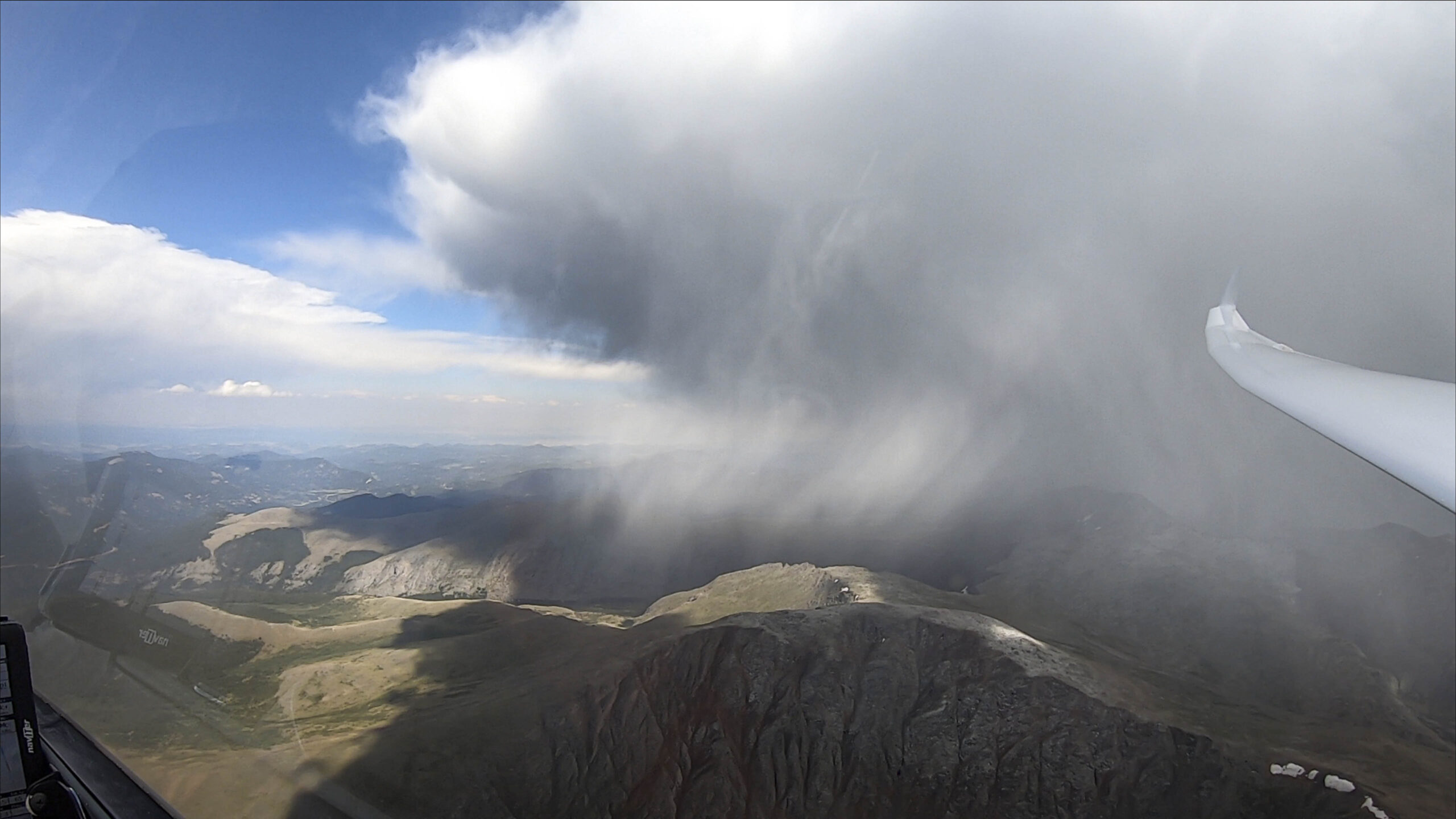
At this point it was more than evident that there was no safe way to continue to turn point 3 at the Colorado / Wyoming border. Heavy over-development and storms blocked the way to the north and I abandoned my task.
At this point my only question was whether to head back to Boulder or to land at Granby, west of the Continental Divide. After intense radio communications with other pilots I opted for a return to Boulder where the winds were still calm.
However, the final approach towards Boulder was more exciting than I had imagined. The big cell above Boulder had evolved into a thunder cloud and it’s full extent was difficult to see from my location. But once I had committed to Boulder there was no longer an alternative. I had to cross below the virga line that marked the storm front.

Fortunately there wasn’t much turbulence below the virga line. I reached Boulder safely and there was little wind on the ground at the time of my landing. However, I clearly learned a vital lesson: it is absolutely not worth taking safety risks to achieve a sporting challenge. More specifically: I should have turned back to Boulder an hour earlier – before passing Mount Evans and flying into South Park when I could already have anticipated the possibility of the storm that developed.
Conclusion
What did I learn from these failed attempts ultimately preparing me for a successful run:
- A 750k is not just a little longer than Diamond distance (500 km). To succeed you need to take it seriously – in planning, and in execution. A declared 750k is also a lot harder than an OLC plus 750k; in my opinion it is roughly on par with a 900-1000k OLC plus flight.
- You will most likely need the whole soaring day. This means you have to start as soon as possible and well before the lift is great. You will also still be flying when the lift is no longer great.
- Take a higher tow if it allows you to get on task quickly. If you waste 30-45 minutes trying to connect, chances are that you will come to regret it at the end of the day.
- You need a long soaring day. This means conditions should allow for an early launch – ideally before 11am – and last into the evening. May through August will normally be the only months where such a task is possible, with the best opportunities in June and July – close to summer solstice.
- You need a day with reliable weather. The weather obviously can’t be too stable for the lift wouldn’t be good. But it also can’t be so unstable for there to be widespread overdevelopment, virga, and rain. Ideally you want a high cloud base and just enough moisture to generate nice cus wherever you plan your task.
- Stay away from days when there is a risk of thunderstorms. You can fly around localized showers but you should not try to attempt a long task where you may have to fly through lightning, hail, and storm outflows. Do not take safety risk to achieve a sporting goal. It is not worth it!
- Days with light winds are much better than days with strong winds.
- Out and returns or triangle tasks are most demanding but tasks with three turn points give you the best chance to succeed. If you plan a 3 turn point flight the first turn point should be furthest away from the start and turn points two and three should be planned in such a way that the last ~200 km of the flight is relatively close to home. This greatly reduces your stress level and will encourage you to keep trying until the end. If the last TP is outside of glide range from your home airfield, you may have to give up early even if there is still a chance to be successful. This is especially true if you are flying above unlandable terrain.
- Align the task with the best weather. Some pilots like to design a few tasks at the beginning of the season and then pick the one that seems best suited for the given day. The mental exercise of designing tasks upfront can be helpful but you should remain flexible and willing to design a custom task the night before the flight, possibly revising it in the morning to be most aligned with the latest weather forecast. Take full advantage of the features of modern weather forecasts – especially make sure to use the time slider to determine what parts of the task area are best early, during peak hours, and late in the day. (Forecasts are obviously not always accurate but that’s not a good reason to ignore them!)
- Account for the wind when planning your task: ideally use the best part of the day to fly into the wind, and make sure that you’re not fighting a headwind on the final glide home. If there are significant differences in wind speed and direction within the task area, consider them in your task planning.
- Be careful to ensure your task complies with all FAI sporting rules (1 km start line, 45 degree turn sectors, valid flight declaration in a valid flight recorder, finish no more than 1000m below the start, etc.) and make sure you observe all air space restrictions including TFRs.
- Once underway you must make good forward progress to not run out of time. Understand what contributes most to a high average speed: (1) continuing forward on task, (2) flying in lift (e.g. along ridges, convergences, cloud streets, or other energy lines – even if it involves taking small to medium detours) and (3) avoiding weak climbs. Boomer thermals with 10+ kts help but they are not essential. 5-6kt thermals are perfectly fine. Just try not to put yourself in too many situations where you have to take 1-2 kt climbs. On a 750k task you will do a lot of circling – 80,000 feet if your average glide ratio is 30:1. A pilot who always takes 5 kt climbs is much faster than one who alternates between 1 kt and 10 kt climbs. Do the math of how long it takes to climb 80,000 feet at various different climb rates if you don’t understand why. If you do a great job following energy lines you may cut the necessary circling down to 50,000 or 60,000 ft – a big time savings!
- Make use of water ballast for you will be faster. Days where ballast is of no advantage are not suitable for 750k tasks to begin with.
- There will be segments along your flight where the conditions are not as strong as you expected. Try not to let that discourage or frustrate you and make the most of the hand you’re dealt with. While it is unlikely that you will succeed on your first attempt, you might never succeed if you wait for the perfect day when all stars remain aligned from beginning to end.
Congratulations!!! Thanks for the thorough write-up – invaluable info for us newbies. I can’t believe you captured the lightning on #7 – great pics and video overall! Hindsight is always 20/20. I trust the process of getting to the 750KM was fun and worthwhile.