The forecast had last Thursday pegged as another great soaring day in Colorado. High cloud bases (around 19-20k feet), strong thermals (up to 10+ kts), no significant risk of over-development, and nice CU clouds to mark the lift. What else could you want? Well, maybe less wind aloft. The forecast showed winds of > 20 kts from WNW – stronger to the north, a bit weaker to the south.

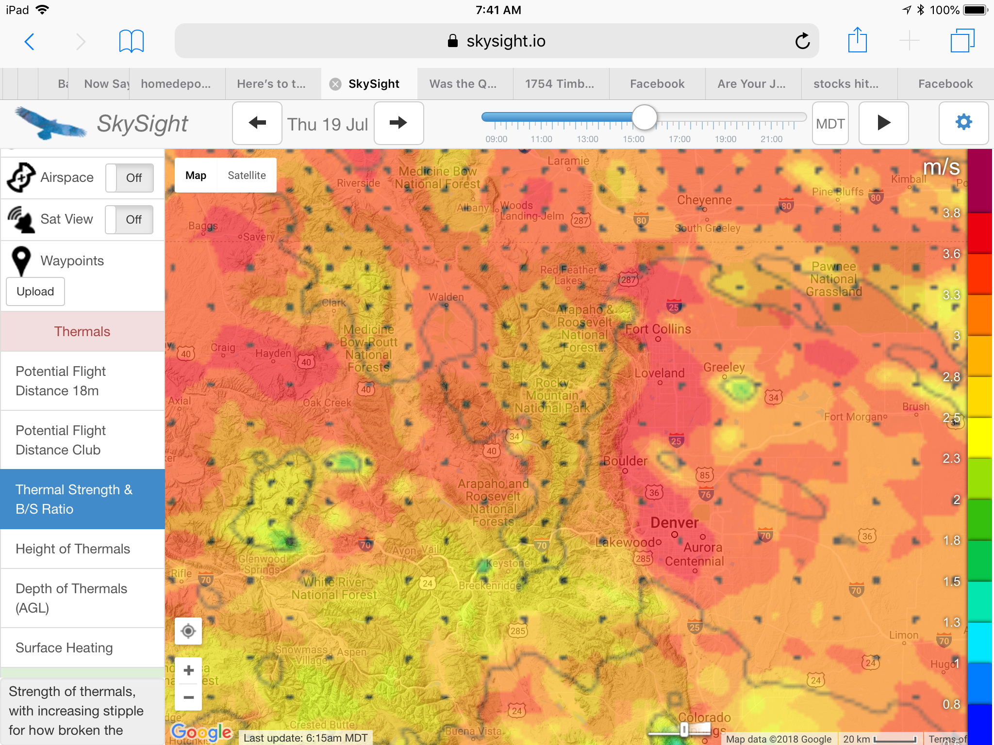
Since it was a weekday there was no reason to go fast to earn OLC points for the Speed-League (only flights on weekends count). Conditions were projected to be best along the lower foothills on the east side of the Divide but fairly strong across most of Colorado. With the winds being somewhat weaker to the south I felt it would be a good day to see of I could bag one or more 14ers in the Mosquito Range – a chain of mountains flanking the western edge of South Park, separating Fairplay from Leadville.
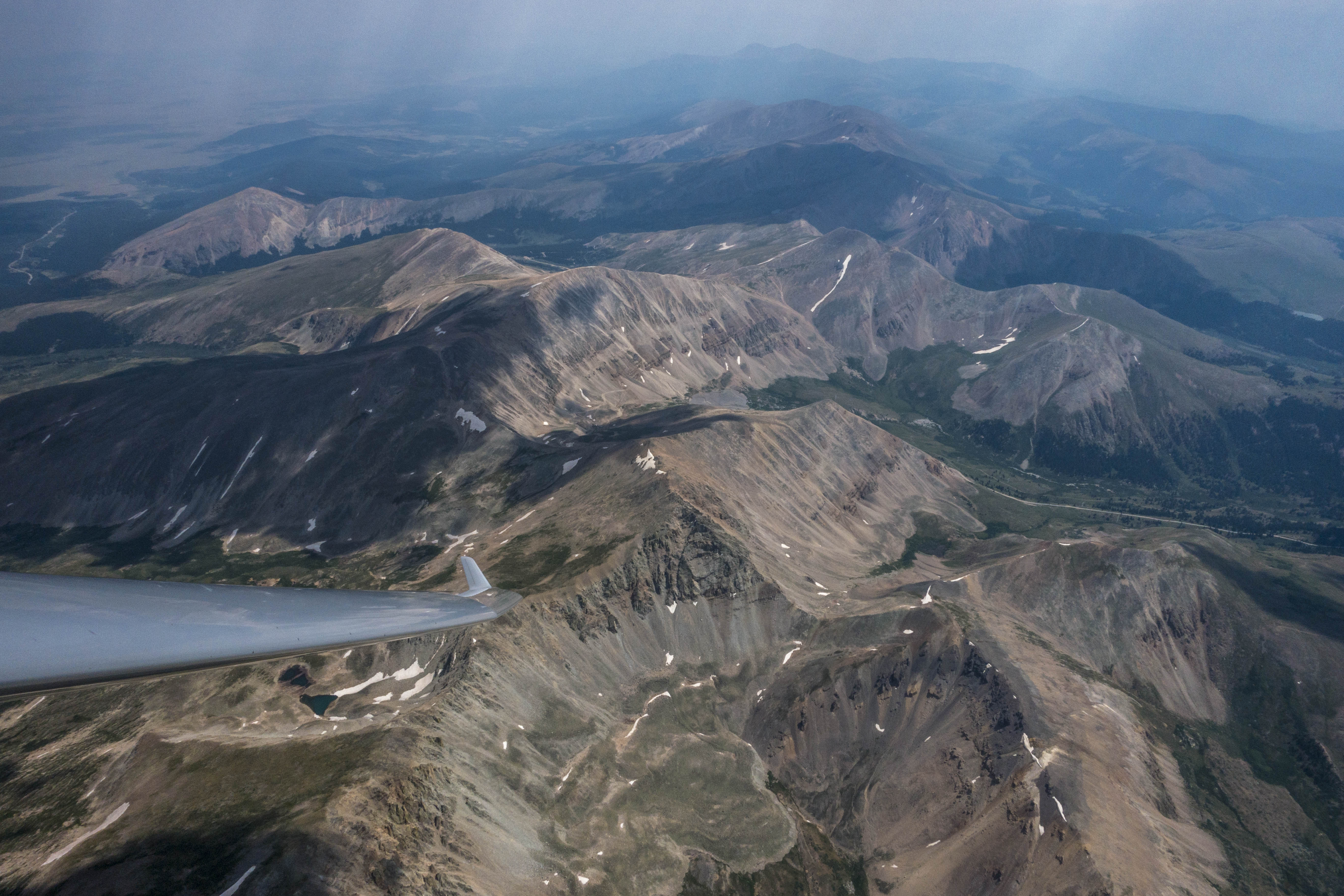
There are five 14ers in the Mosquito Range: Mt. Lincoln, Mt. Cameron, Mt. Bross, Mt. Democrat, and Mt. Sherman. I decided to pick Mt. Sherman, the one located furthest to the south and therefore farthest away from Boulder, as my targeted turn-point. I thought that if I could round Mt. Sherman I might be able to also pick off one or more of the others further to the north.
I also decided that it would be fun to follow up my previous pre-declared 300+ kilometer triangle with another one, and so I picked Lookout Mountain to the west of Ft. Collins as my second turn-point. Start and Finish would be at Bighorn Mountain, just east of the old mining village of Gold Hill. Bighorn Mountain is a great start location when towing to the NW from Boulder. It often produces good thermals early in the day coming off its charred south-east facing slope and it lies just within the 15km start cylinder for the Speed League. Total task distance: 325 kilometers.
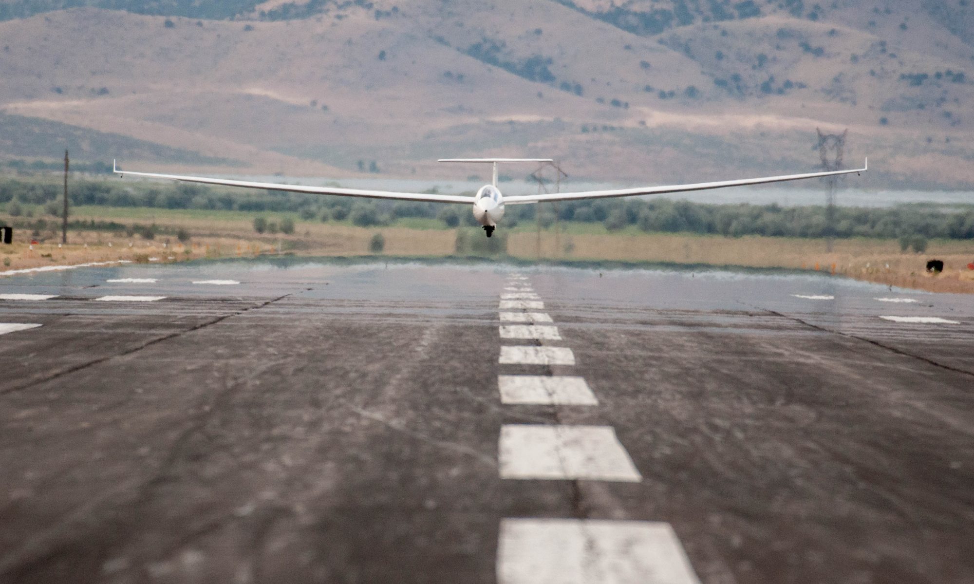
My forecast had the day start around 10:30AM. However, the westerly wind had produced a thin lenticular cloud on the east side of the divide and so I decided to wait until after noon to get going even though two other Boulder pilots took off (and stayed up) considerably earlier.
The tow into the foothills was very choppy and characterized by significant rotor turbulence. I got a lot of slack line recovery practice. 🙂 I released at just under 10k feet MSL, higher than I had intended. Even then it was hard work to get the first decent climb. There was a lot of rotor mixed in with the thermals: my first two climbs were very rough and uneven with strong lift and strong sink mixed on every turn, requiring constant corrections.
My first good climb that allowed me to gain 4,000 feet in 7 minutes came after I had struggled in middling lift for about 20 minutes following my release from tow. Funny enough it came directly off the south side of Bighorn Mountain just after I had passed through the Start Line.
From my new vantage point above 16,000 feet I could now see past Mount Evans into South Park. The cumulus clouds were still few, thin and sparse but it seemed that they were developing quickly and so I felt good about getting underway towards my first turn-point.
Climbs near Rollinsville and Idaho Springs – there always seems be be a thermal right over Idaho Springs – brought me close to 18,000 feet, allowing me to fly past Mount Evans into South Park. Thanks to decent climbs every 10-15 miles I continued to make good progress along the course and reached Fairplay less than an hour after leaving Bighorn Mountain. Up until this point my average speed was around 100 kph despite a cross-wind of almost 20 kts.
Mount Sherman, my targeted turn-point was about twelve miles straight ahead. But the question was: how do I get there. Just before Fairplay I started to feel the effects of the lee-side sink from the mountains in front of me. I flew directly under the last remaining cloud near Alma Junction. If I could climb back up to just under 18,000 feet I would likely be high enough to glide the last seven miles directly to the top of Mt. Sherman even if it meant pushing into sink. However, there was no lift to be had under this cloud. Despite trying to climb for about seven minutes I was only able to maintain my altitude of 15,400 feet – definitely too low to fly straight to Mt. Sherman and back.
As I circled in vain I was debating between two options: 1) there was a nice looking cloud eight miles to the SE over Reinecker Ridge but that would take me much further away from my target and my distance would further increase with the wind drift. I might get back to 18,000 feet but then what? 2) there was a promising looking ridge on the NNW side of Silverheels Mountain, about five miles north. The wind seemed to be blowing right onto the ridge and the entire mountain was in the sun. If I could get a climb off that ridge I would have a much shorter distance to transition onto the top of the Mosquito Range, albeit several miles north of my target.
From the perspective of reaching my target the ridge was clearly the better option. But what if it didn’t work? There were other mountains further upwind so there was a considerable risk that the ridge would be in their lee and instead of lift I might only find turbulence and sink. What would I do then?
I glanced at my flight computer and confirmed what I knew anyway: my nearest decent land-out field was on the east side of Elkhorn Road, just east of Como. If the Silverheels ridge didn’t work I would escape in that direction along Little Baldy Mountain with the wind in my back. There was another cloud between Silverheels and Como. Chances were good that I would be able to find a climb there. And if not, Elkhorn Road was definitely within glide range. If it became necessary I would be able to land parallel to the road and almost directly into the wind. I estimated the risk of having to land out at less than 20% and I had a plan B and a plan C. With those thoughts in mind I decided to go for the ridge.
As expected I had to cross more sink as I pushed into the wind to get to the northern ridge of Silverheels, and when I got there my altitude had dropped to 13,600 feet – right on the ridge and just below the level of the summit. And voila, the ridge worked! Not very well, but it did. Phew! I flew a few turns in figure eight loops until I was well above the ridge line. Given that I was fairly close to terrain I also made a conscious effort to maintain extra airspeed for added safety. I was able to gain some altitude back but unfortunately the lift did not extend more than about 600 feet above the summit.
Just as I was contemplating my options again I noticed a new cloud forming two miles southeast next to the summit of Little Baldy Mountain. It was in the opposite direction of where I wanted to go but it was clearly the best choice. I headed straight to the cloud, losing all the altitude I had just gained on the ridge in the process and finally I found decent lift. Eight minutes later I was back up at 17,500 feet and the world looked a lot friendlier.
To my delight there were two additional new clouds between my position and the Mosquito Range so it was time for a second attempt. I pushed back into the wind and managed to get onto the Mosquito Range without losing much altitude. The route south towards Mt. Sherman did not look great but Quandary Peak, another 14er – though technically part of the Ten Mile Range and not the Mosquito Range, was just two miles to the north. It was a peak I was definitely able to reach without taking any risks so I went for it.
One down. After rounding Quandary Peak I started to head back south along the ridge, glancing at my flight computer to locate the exact positions of the other 14ers between Quandary Peak and Mt. Sherman. Unfortunately I hit a lot of sink and quickly dropped back down to 15,500 feet. I wasn’t too keen on ridge soaring again so I made a quick decision to head back east under the cloud over Silverheels.
After “refueling” back to almost 18,000 feet, I decided to make my third and final attempt for the day to get to Mt. Sherman. I headed straight back to the Mosquito Range and was able to pass directly over Mt. Lincoln, Mt. Cameron, and Mt. Democrat – three additional 14ers directly along the same ridge line. (Unfortunately I missed Mt. Bross by less than a mile.)

From Mt. Democrat I still had 8 miles to go to get to Mt Sherman. I followed the ridge line, hoping that the combination of northwesterly wind and sunshine hitting the western slope would carry me along. Unfortunately that wasn’t the case and my altitude kept dropping again. There was a nice looking cloud two miles west of the ridge (directly east of the town of Leadville) so I decided to seek another climb under that cloud before going to Mt. Sherman. That was plan A.
There’s always a risk that a cloud won’t work so having a plan B was important because I was now on the west side of the Mosquito Range and potentially unable to cross back to the east side. Fortunately, coming up with plan B was simple. With the wind from the northwest I would fly on the upwind side of the ridges to the south and eventually land at the airport in Buena Vista should I be unable to find a climb before then. I considered this a very remote possibility but felt good about knowing exactly what to do if plan A did not work.
There was indeed no need for plan B. The cloud east of Leadville offered a quick and easy climb to 17,800 feet. The top of Mt. Sherman was now only three miles to the southeast and more than 3,500 feet below. Rounding it felt almost anticlimactic after all the work that it took to get there: the final seven miles to get from Alma Junction to Mt. Sherman had taken me more than one hour and ten minutes!
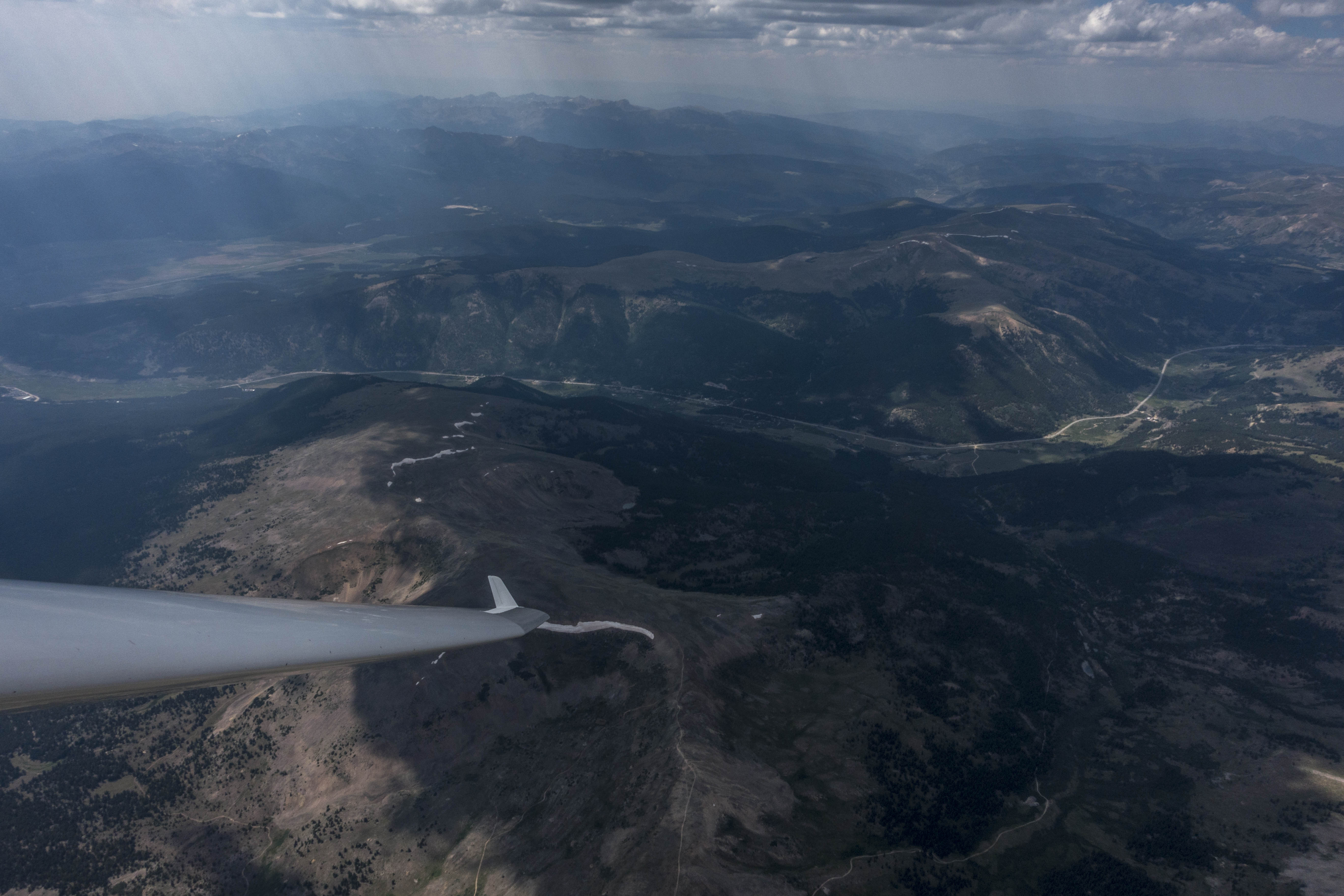
With the wind at my back and no mountain to climb in front I was back at Alma Junction in less than five minutes and on route towards Lookout Mountain, my second turn point, 100 miles NNE.
There were two reasonably looking ways to get there. 1) A more direct route following the spine of the Continental Divide; and 2) A longer and more easterly route along the lower foothills via Conifer, Golden, Jamestown and Estes Park.
The longer route looked a lot easier: there were several nice looking clouds between Como and Conifer and then a continuous line of – likely convergence induced – clouds all along the lower foothills to the north. I had already flown this route in similar conditions and have seen it work extremely well.
The direct route had fewer compelling clouds but I thought it would benefit from the afternoon sun hitting the westerly slopes of the mountains and the northwesterly winds blowing up along the divide. And it was shorter.
I opted to go for the direct route. Initially I made reasonable progress via Boreas Mountain, Geneva Peak, and Grays and Torreys Peak. But from there this choice of route turned out to be a big mistake. The further north I got the stronger the wind became. And as the wind got stronger the thermals became weaker, more turbulent, and less organized. Weak climbs meant I had to spend a long time working my way up, and while I did that, I was subjected to major wind drift. What I thought would be a shorter route, actually ended up being a longer one if you add up all the miles that I had to push back into the cross wind.
The worst section was north of Longs Peak when my turn-point was no more than 20 miles away. I was just one good climb away from making my final turn point and the good climb just never came. I spent way too much time in weak wind-blown lift, hanging on to my poor route choice for no apparent reason. In retrospect, I would have been much faster had I simply departed from the divide and flown along the convergence at the base of the foothills. The last 20 miles to TP2 took me 45 minutes – a ridiculous amount of time given that I did not have a major peak to climb.
After I finally rounded TP2 it took me a while to understand how easy the line along the foothills would have been. My brain was so conditioned to the poor conditions along the divide that I instinctively took the first climb I could find along the foothills, spending another 10 minutes in weak lift to work my way up to final glide altitude of 13,000 feet.
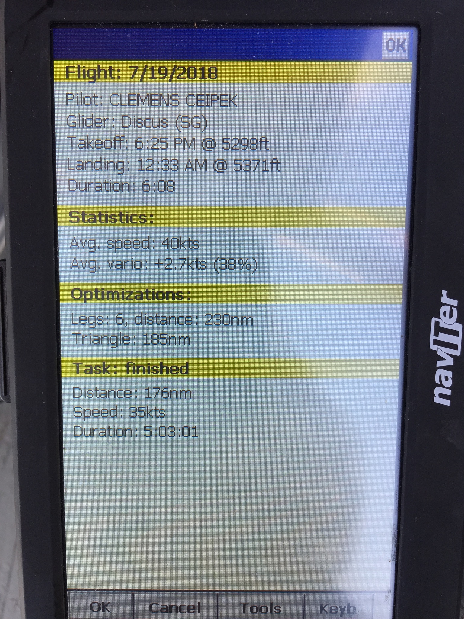
Only then did I realize how easy this line could have been. I flew the next 20 miles to the Finish Line without another circle and without losing any altitude, finally reaching Bighorn Mountain five hours and three minutes after I had started my 325km task from there.
Since flying was now so easy I continued for another 20 miles straight to Golden before turning around to come back to Boulder where I landed after having been in the air for six hours total.
This was a difficult flight (which I made a lot more difficult than it should have been) but with some nice accomplishments: I bagged five additional Fouteeners (Quandary Peak, Mt Lincoln, Mt. Cameron, Mt. Democrat, and Mt. Sherman) and I completed my second pre-declared 300+ kilometer triangle flight (i.e. Diamond Goal). My flight track is here.
However, it is truly humbling when I put these accomplishments next to the flight of another Boulder pilot, Pedja Bogdanovich, on the same day: Pedja covered 1,163 kilometers including a 916km FAI triangle. His average speed: 131 kph! Pedja’s flight track is here. So much to learn!
Lessons Learned
- Don’t pick a high mountain top as a turn-point unless you really, really want it. Rounding Mt. Sherman took me 1 hour and 10 minutes. That is fine (and perhaps even necessary) if the primary objective of the flight is to reach that specific TP. (Would I have tried so hard to get a Fourteener had I picked Fairplay as my TP?). But if the primary goal is to complete a pre-set task, pick an easier TP and try to achieve a secondary goal (such as a nearby 14er) along the way.
- Don’t expect to find good thermals on the upwind side of slopes if the wind is strong. Strong wind wreaks havoc with thermals: a) the air cannot cling to the ground long enough to warm up sufficiently (hence the thermals are weaker); and b) rising thermals can be so wind-blown that it’s almost impossible to fly a full circle in lift. On very windy days the best thermals may be further downwind of mountain ranges where they are protected from the wind; – especially if the wind is forced to slow down by another airmass and a convergence line forms (like on Thursday along the foothills).
- If you pick a poor line, correct it (if you can). Don’t stick to a decision if it can be easily corrected. I had plenty of evidence that the line along the divide did not work and the amazing-looking cloud street along the foothills was in plain view and at all times easily reachable. I should have course-corrected when I found out that my line was clearly sub-optimal.
- Always have a plan B (and plan C if appropriate). I felt I was appropriately disciplined on Thursday whenever there was a risk of getting low. I did not decide to approach the Silverheels Ridge without a clear escape plan and a viable land-out spot picked. I did not cross into the Leadville Valley without having a clear plan of where to land and how to get there if needed.
- Don’t base your expectations on your last experience if you transition to a different area. On Thursday, I intuitively felt that the thermals along the Continental Divide would be as good as those that I had used on my outbound leg to TP1. That was a mistake. I should have anticipated that the strong wind would weaken and blow out those thermals. Likewise, my experience with the poor lift along the divide clouded my judgement with respect to the conditions when I returned to the base of the foothills at the end of the day. Different areas will likely mean different conditions – different thermal strength, different wind characteristics, etc. I have to get better taking this into account when transitioning from one area to another.
One Reply to “Into the Mosquito Range – Three Tries Is The Charm…”