
Europe is enduring a pro-longed heat wave with near record high temperatures from Portugal to Austria. That means the nicest place to be is right at cloud-base where the temps are much more comfortable.
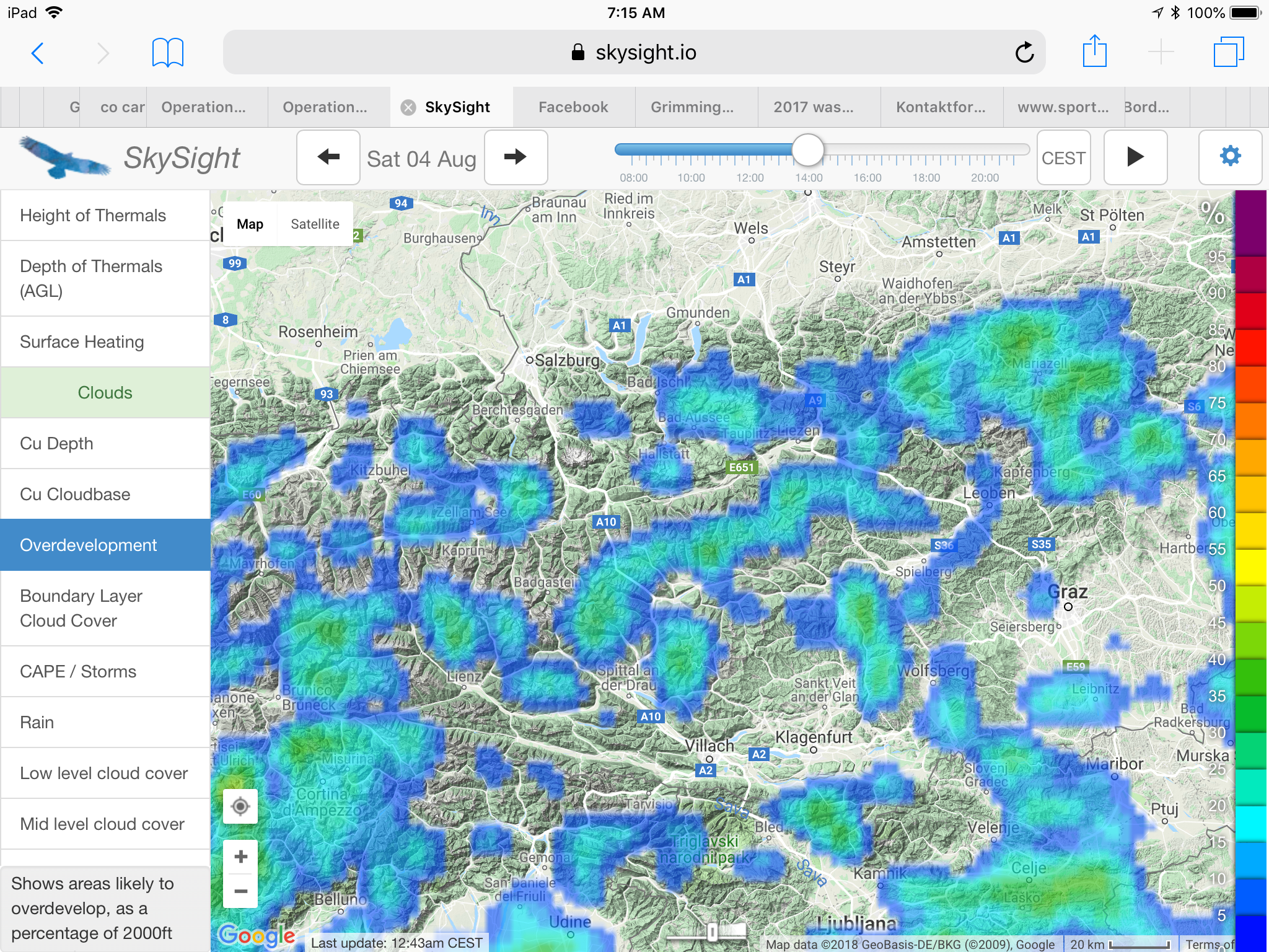
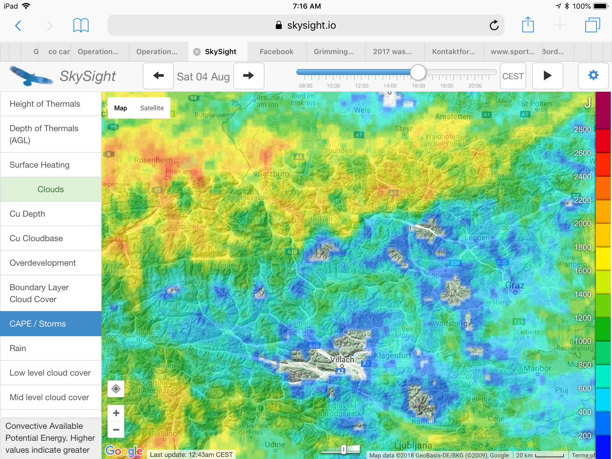
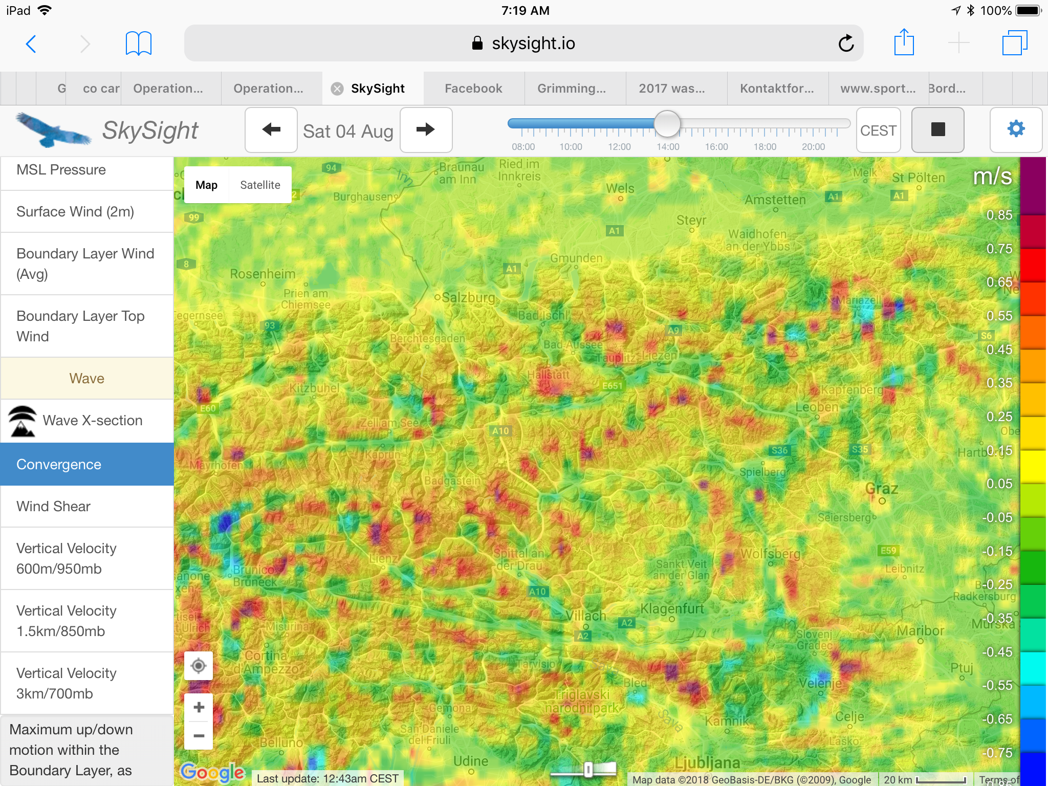
This past Saturday promised nice soaring conditions in Central Austria:
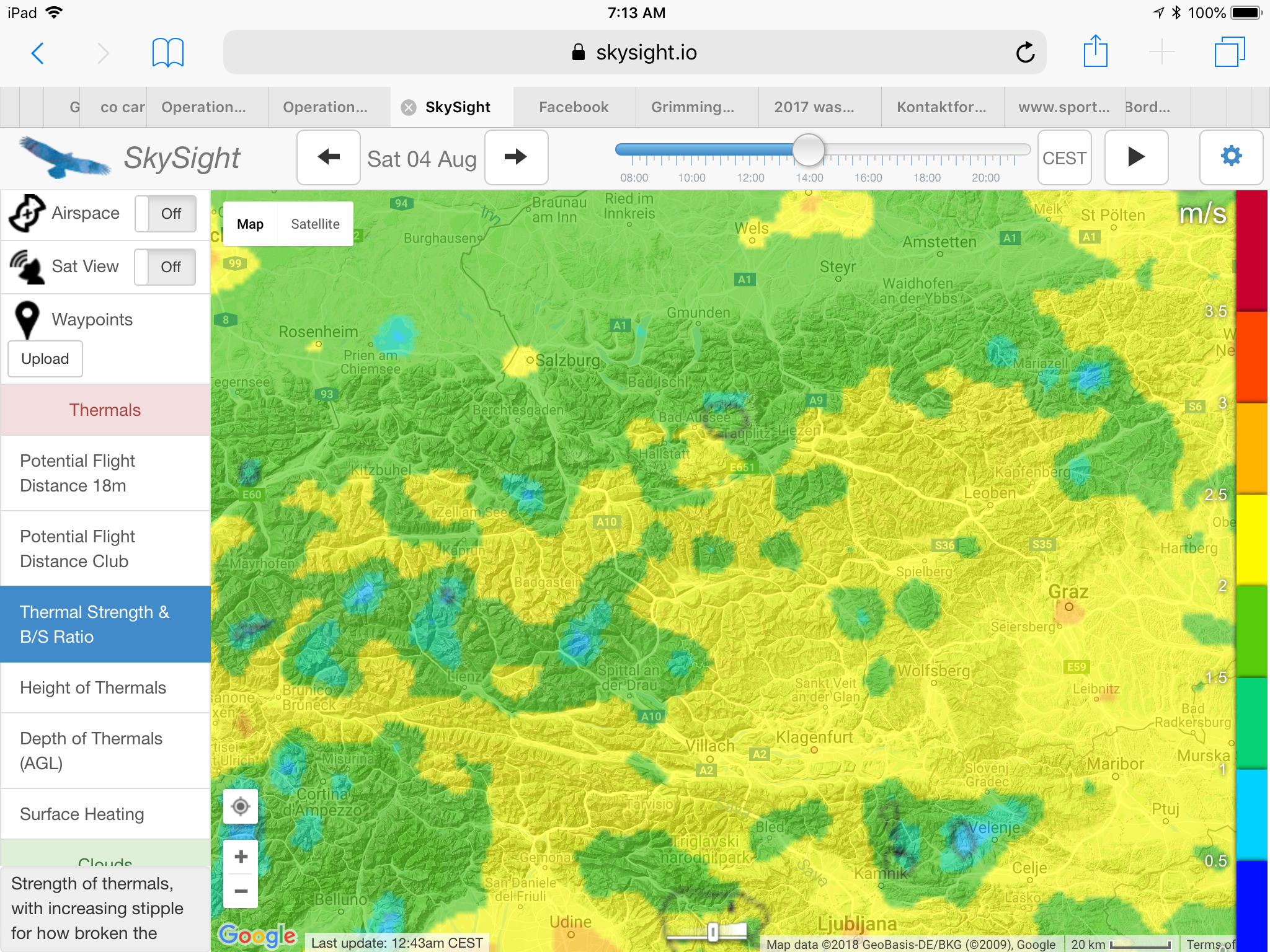
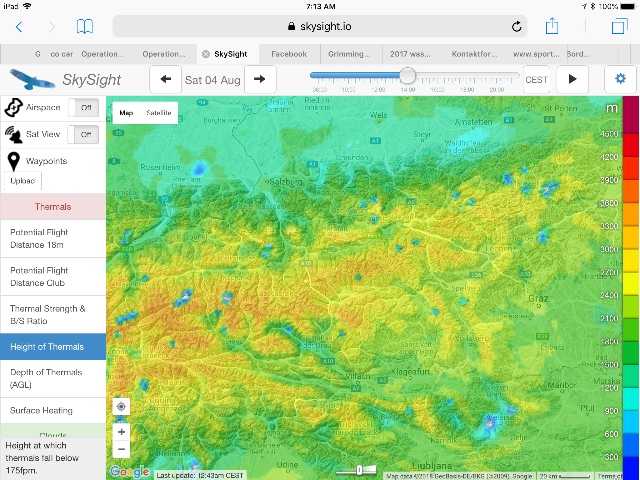
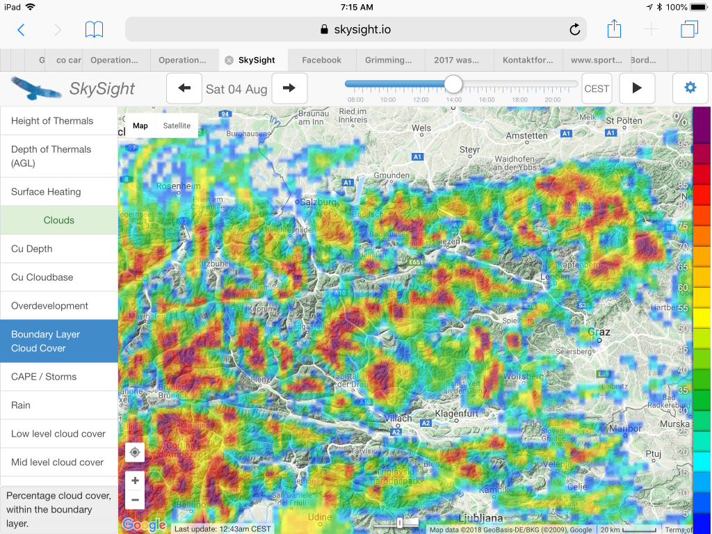


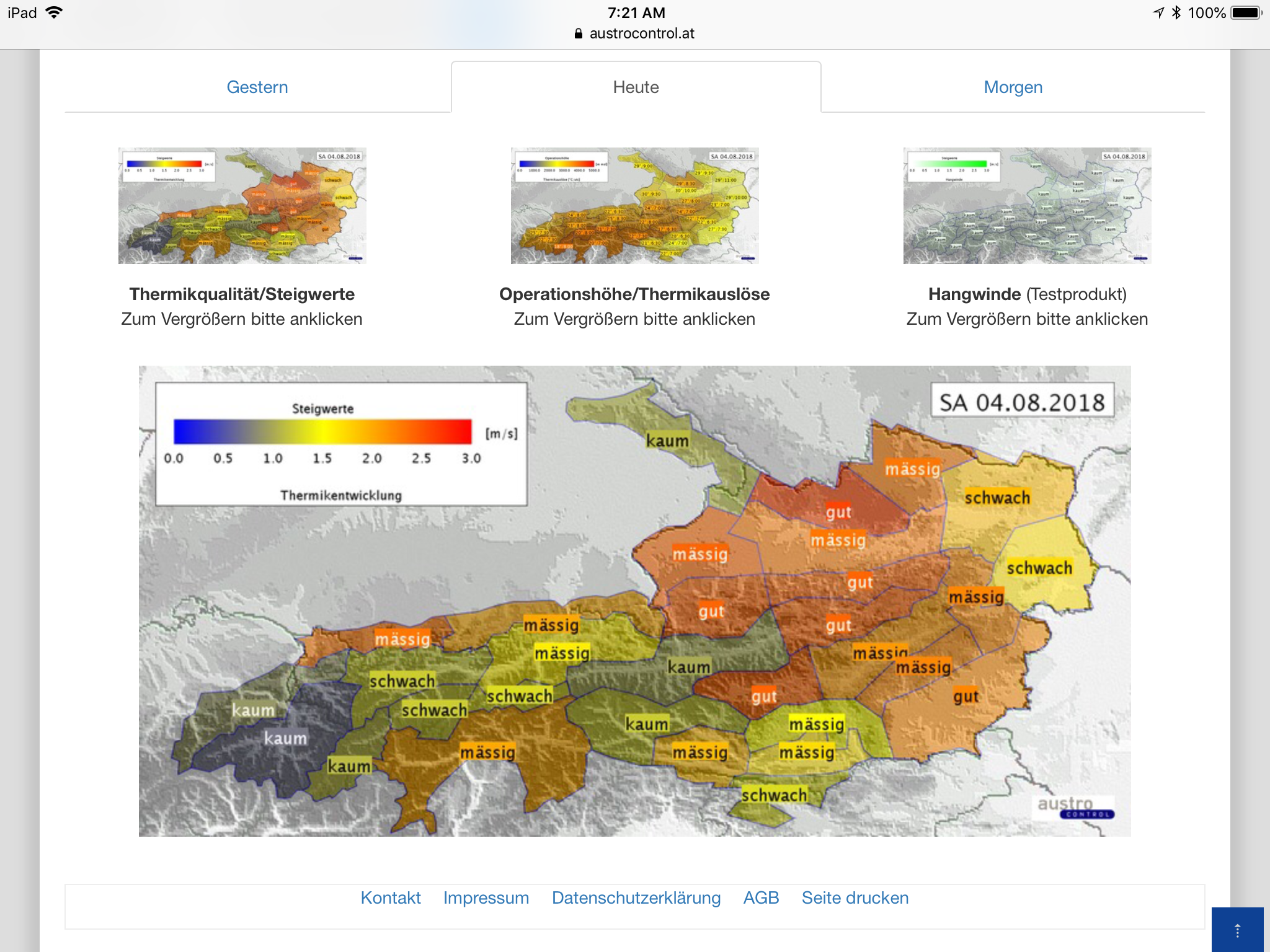
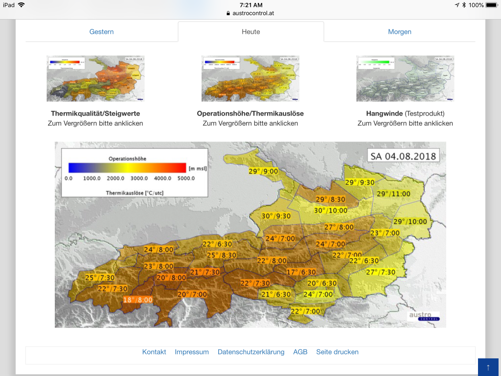
Skysight’s predictions were also confirmed by the local soaring forecast from Austrocontrol, which projected:
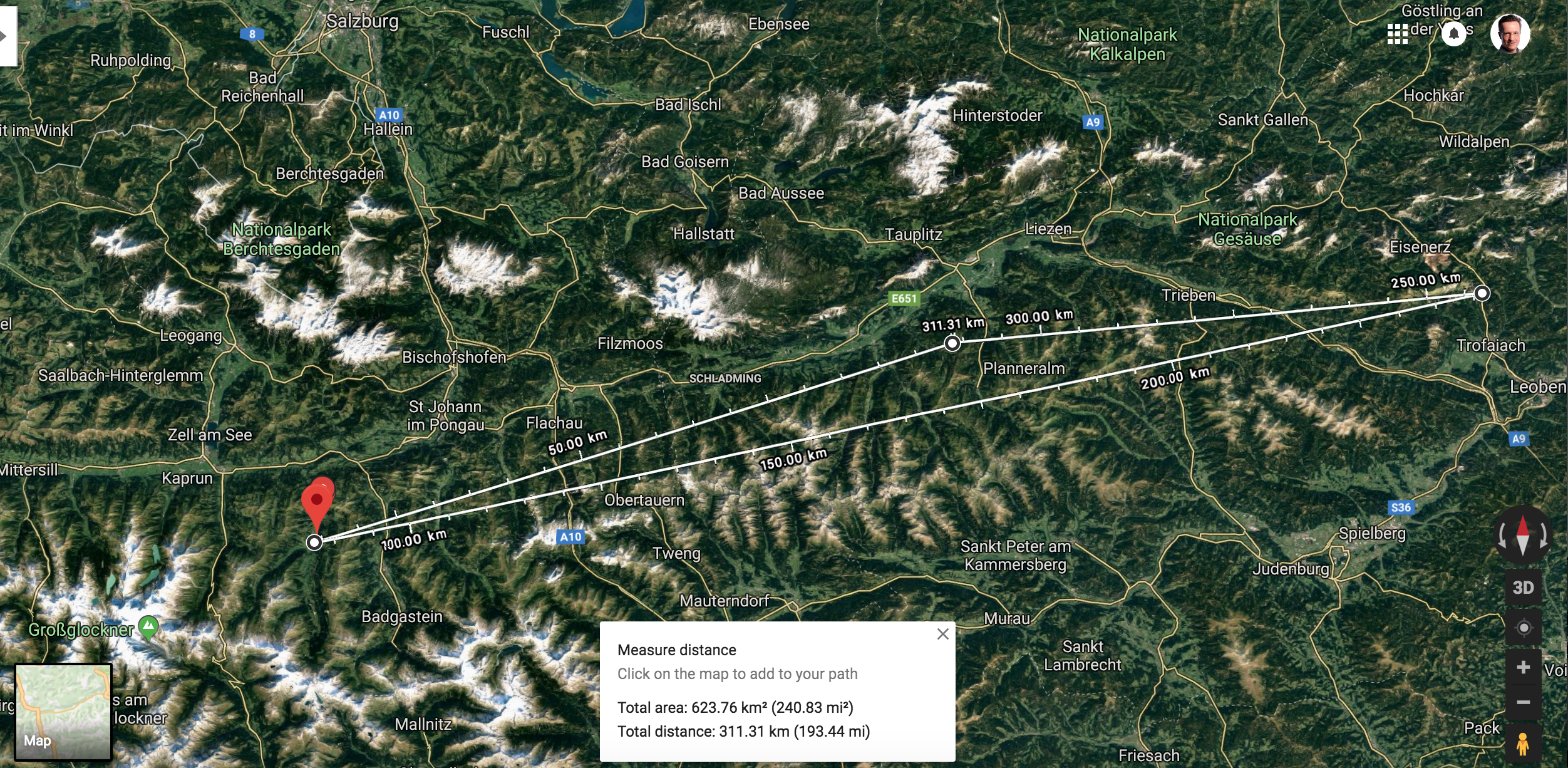
Considering the consistency of both forecasts, I thought it appropriate to plan my first pre-declared 300km triangle in the Alps:
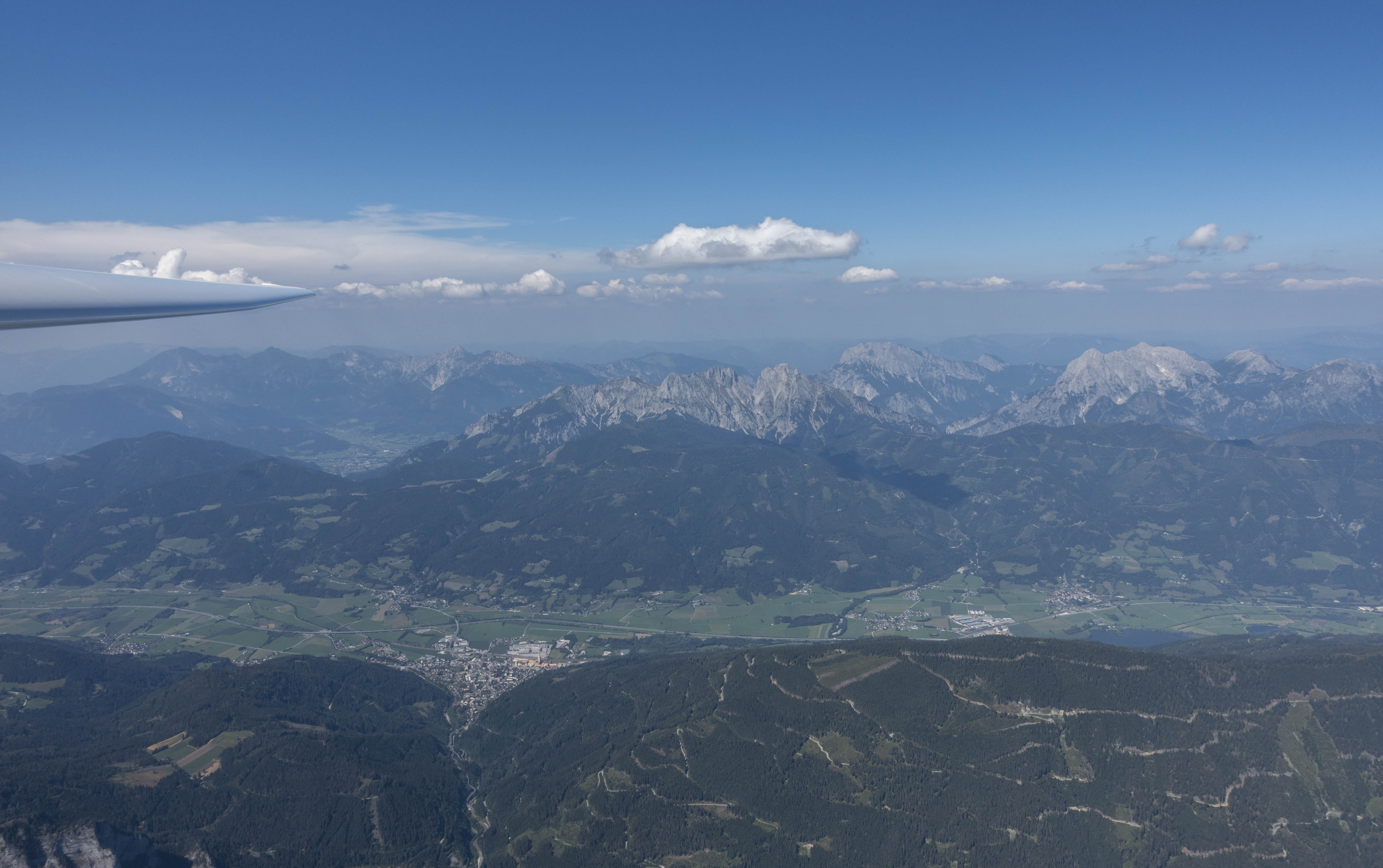
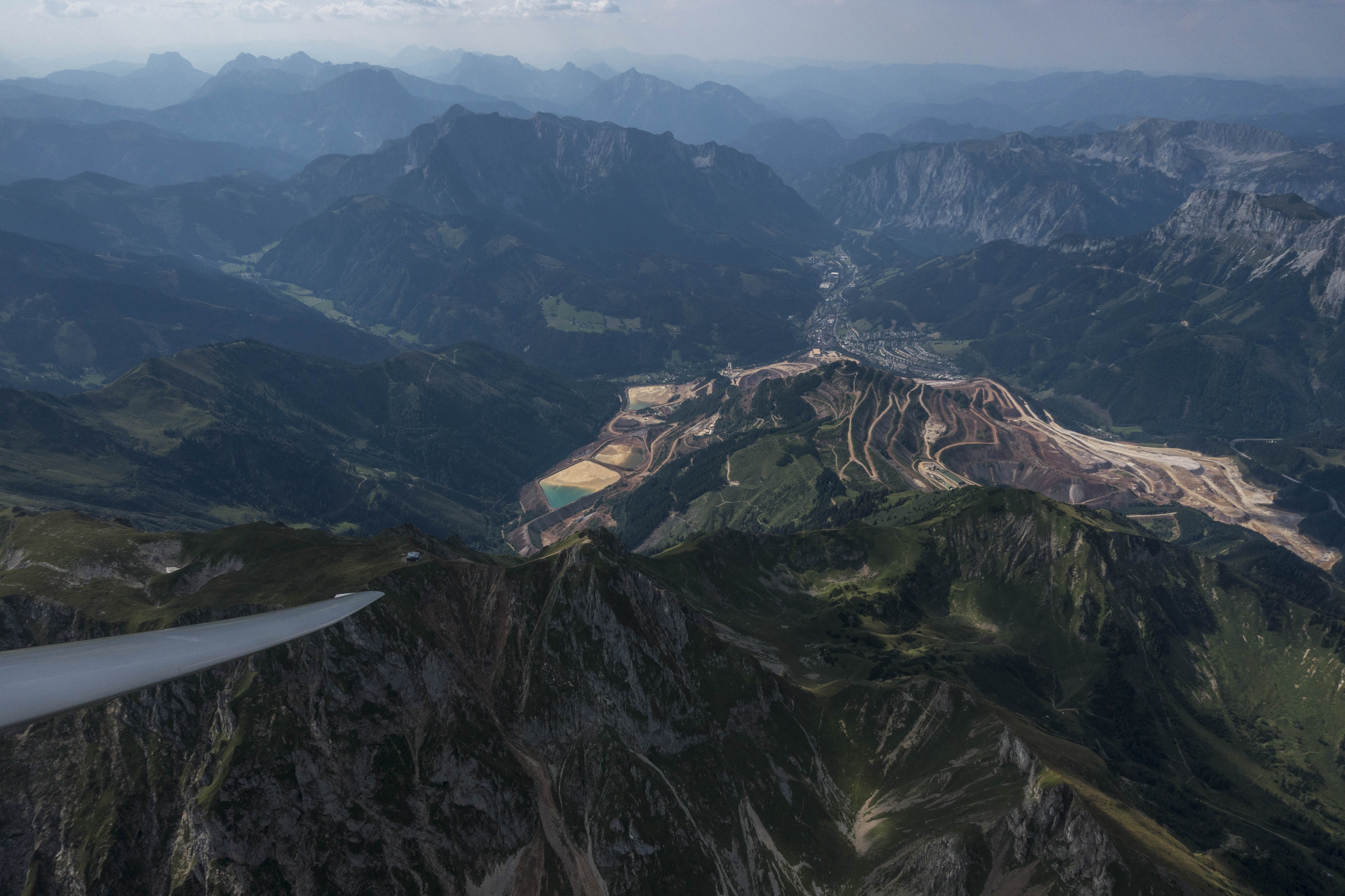
- Start above Karlspitz, approx. 7 km south of my launch point at LOGO (Niederöblarn airport). This is the location of one of the “house-thermals” and a frequent release point for gliders flying from LOGO. From there I would head 85 km westward towards …
- … TP1 near the village of Wörth in the province of Salzburg at the foot of Austria’s tallest mountain, the Grossglockner. The peak of Grossglockner (3,798 m or 12,461 ft) was well above the projected thermal height and likely unattainable. A second eastbound leg of 156 km would take me to …
- … TP2 above the village of Vordernberg, in the province of Styria near the town of Leoben. And from there it would be 69 km to the …
- … finish line, once again above Karlspitz. Total task distance: 311 km.
I had reserved the LS4b of the fleet of Niederöblarn. It’s a very comfortable club class ship with a performance slightly worse than that of the Discus that I’m usually flying from Boulder. Since I had not flown in Austria in more than 12 months I had to take two brief check-rides in the DG 1000 with a local instructor. This was a nice opportunity to refresh my spin training (a lot of fun!) but it meant that I wouldn’t be able to launch on my own before noon. Given my relatively late start, the 300km task distance seemed appropriate.
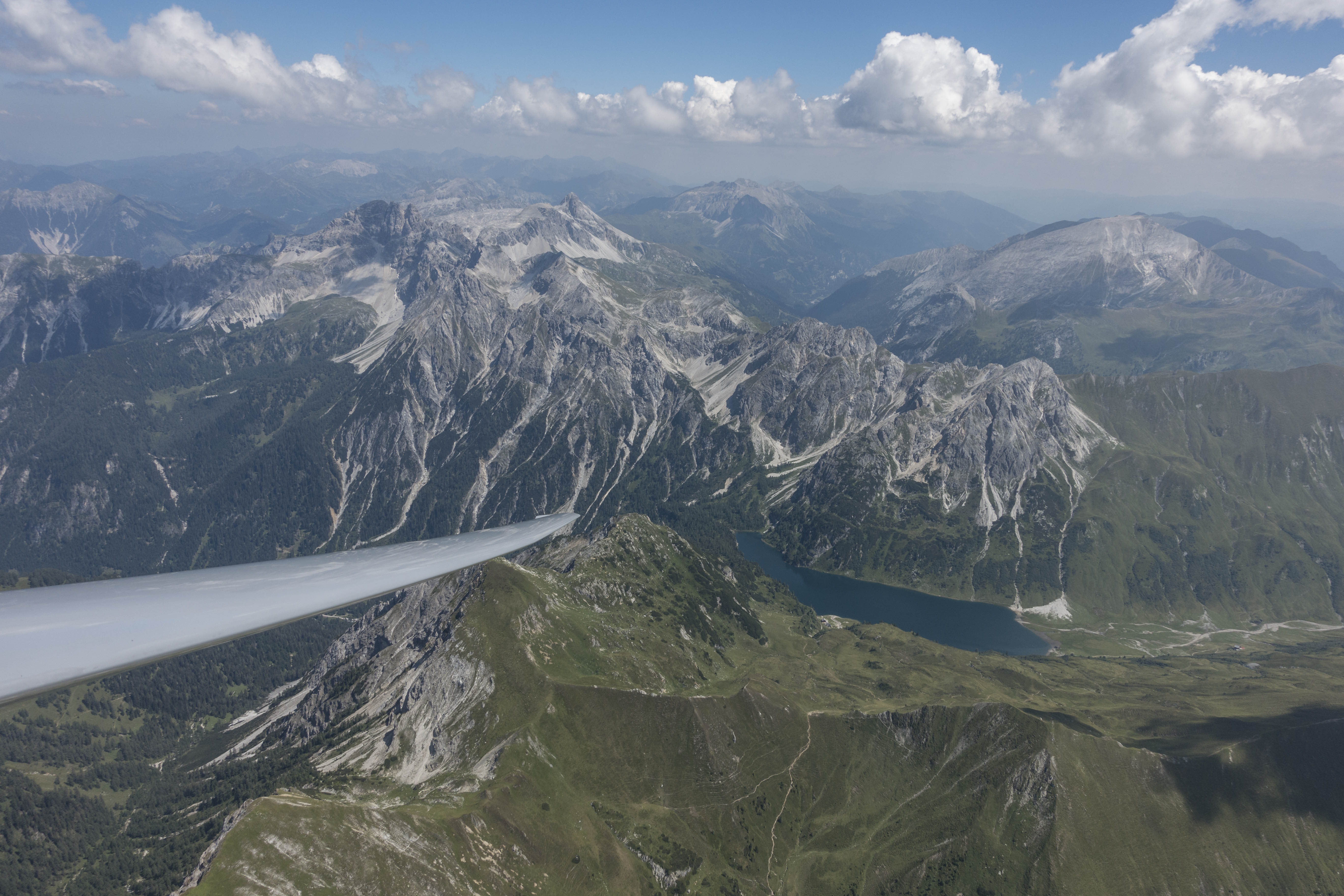
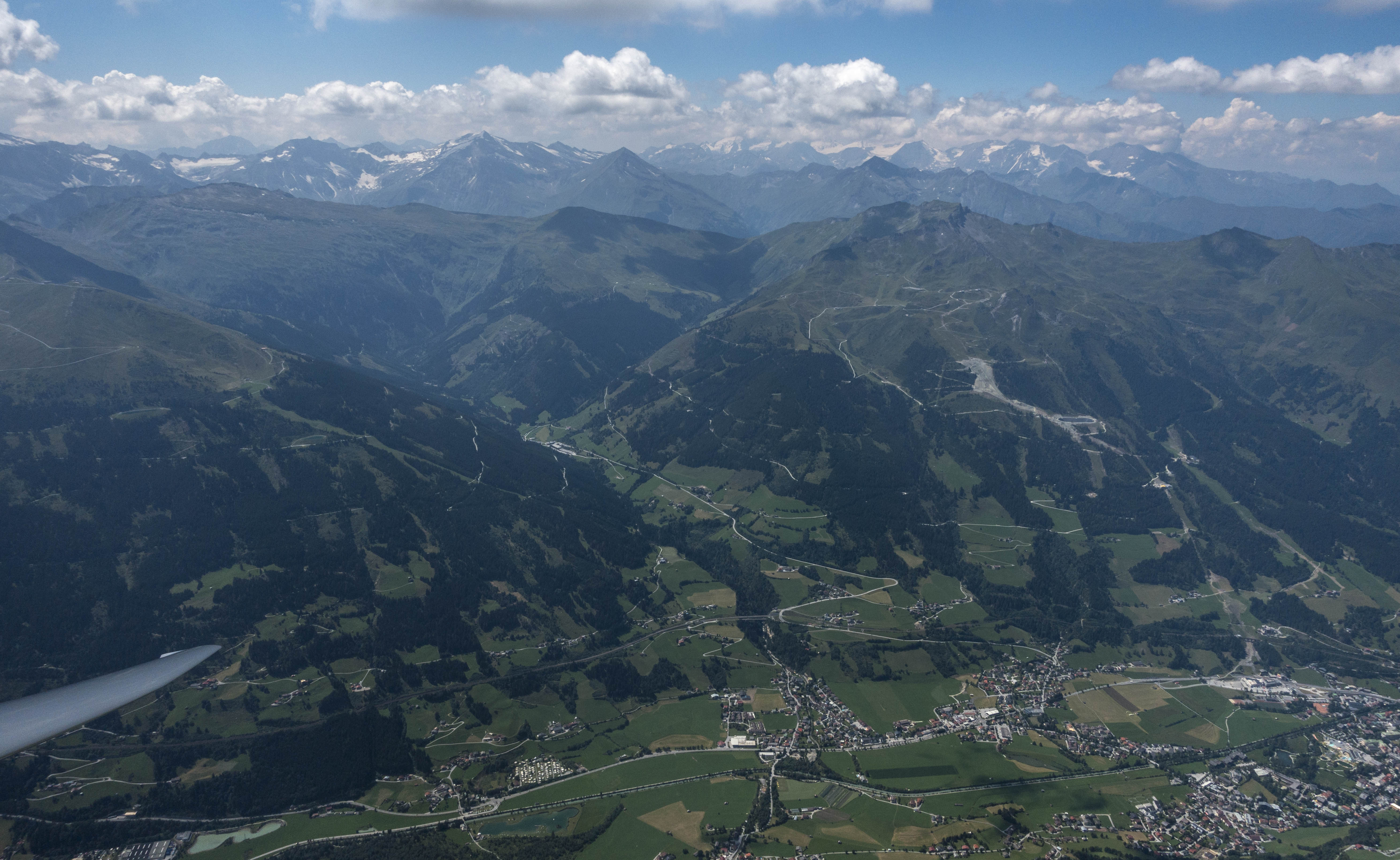
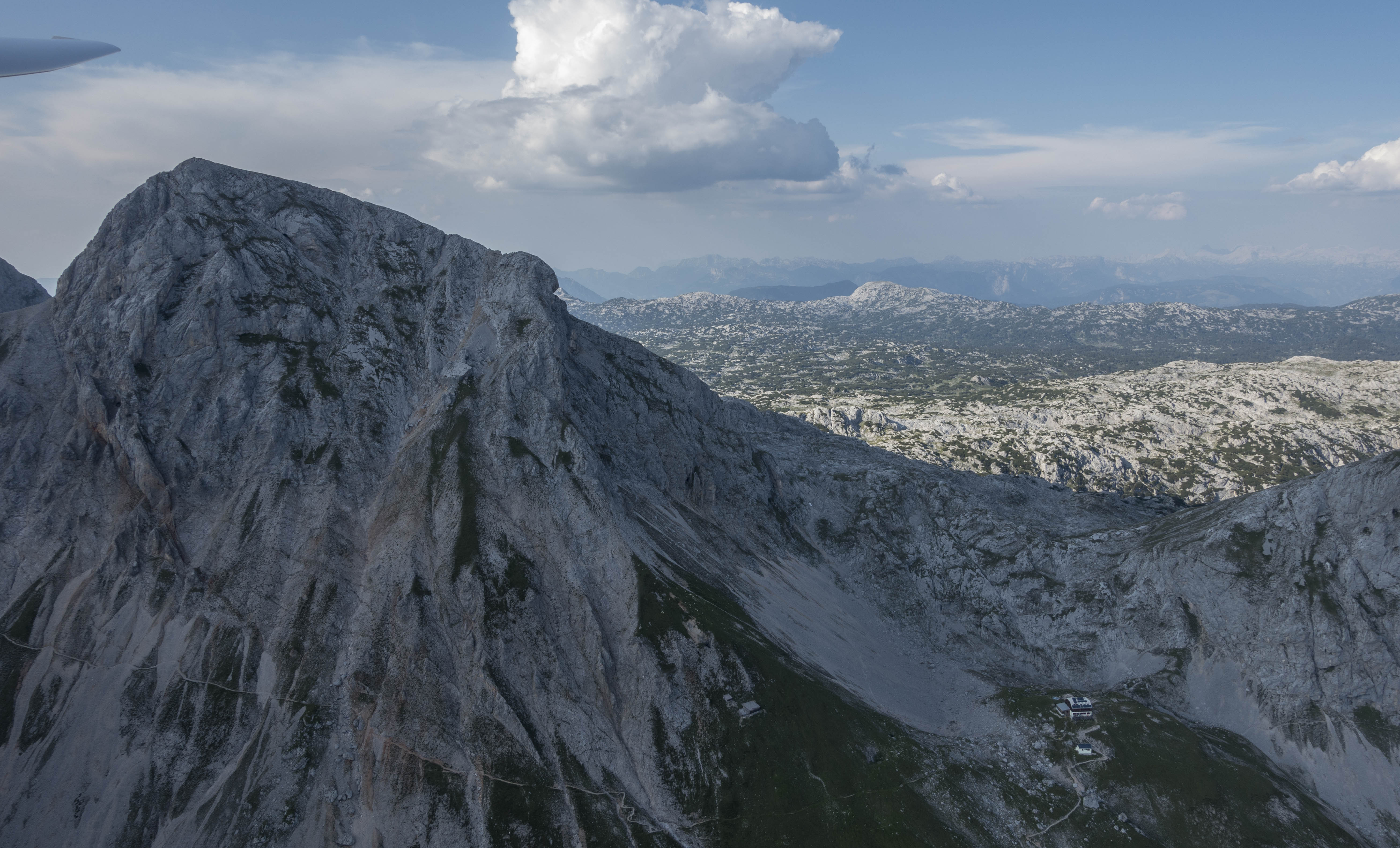
I released near Karlspitz a few minutes past noon and rounded the start sector above the peak four minutes later at an altitude of 2,200m MSL. I followed the ridge line to the SSW to further gain altitude. One of the great phenomena of flying in the Alps is the amazing predictability of thermal lift directly above the ridge lines, especially in low-wind conditions and in the middle of the day when the sun heats both slopes equally: warm air rises up along either side of the ridge and when it reaches the top of the ridge line, both streams converge and the air has no place to go but up.
The lift is not necessarily consistent, but it often averages 1-3 kts, which is usually sufficient to maintain or even slightly gain altitude as long as one flies directly above the top of a ridge. Thermals will then break off the ridge line as well, usually above distinctive peaks.

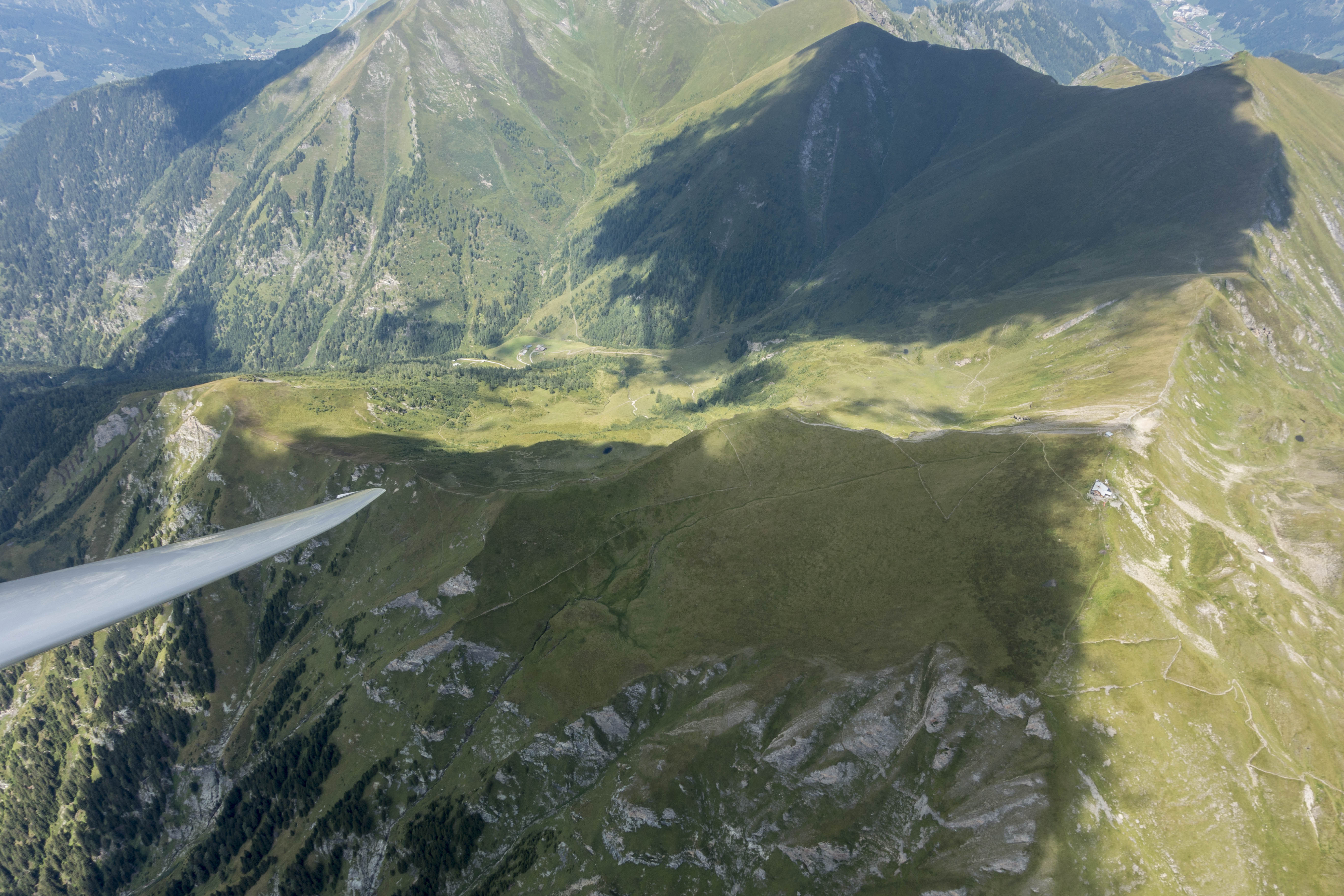
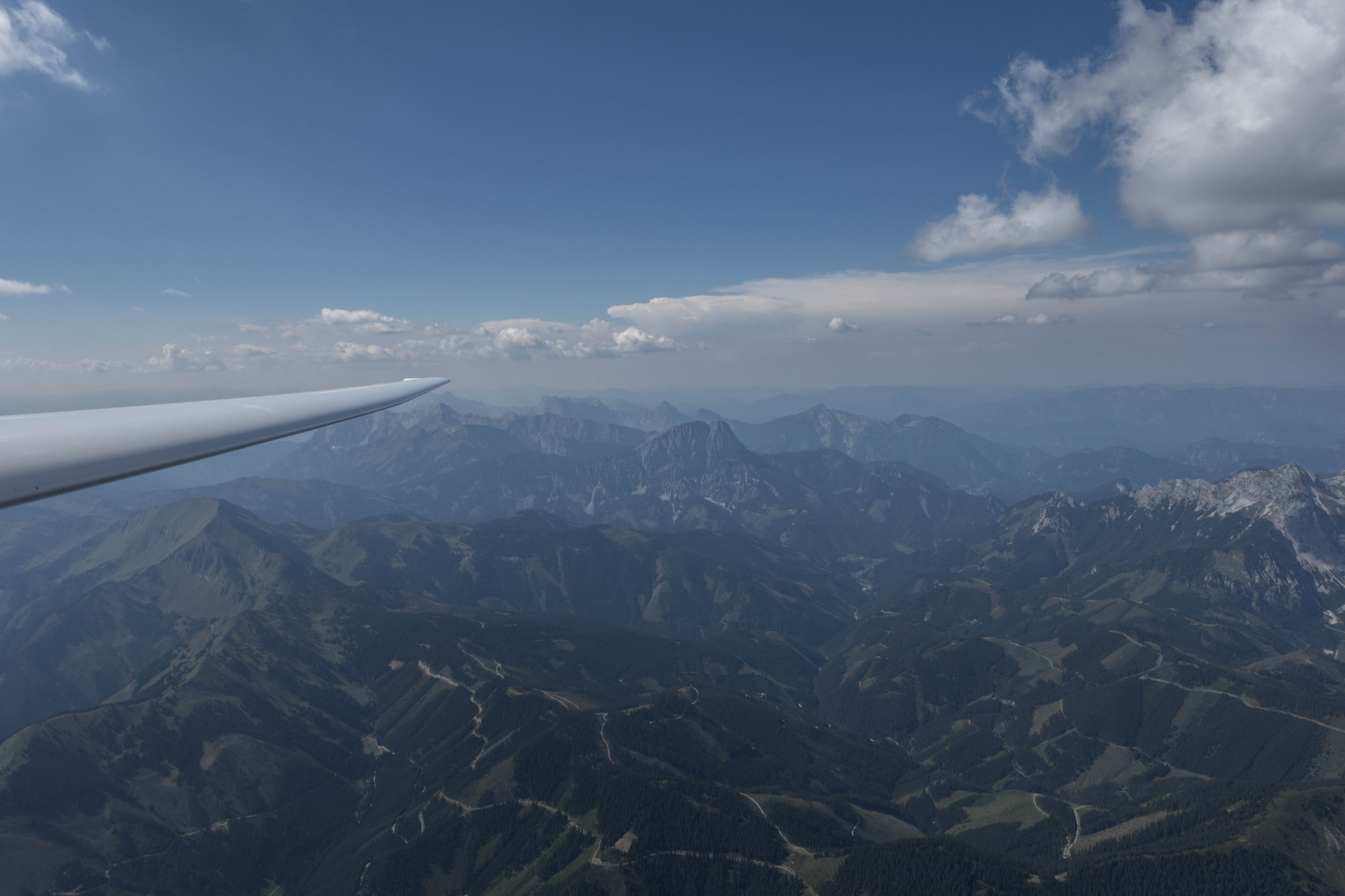
The main spine of the Alps resembles a giant fishbone. The spine itself is the ridge line in the center, which is in the direction from west to east. On either side of this main ridge are individual ridges (i.e. individual “bones”) protruding north and south with steep and narrow valleys in-between. Soaring usually involves a series of valley crossings as you’re flying from one of these bones to the next. More often than not, the valley crossings involve significant sink, while the lift is concentrated above the bones.
Cloud-bases tend to be much lower than in the western United States and are often not far above the ridge line. Arriving below a ridge line can mean trouble (because usable lift is sometimes only available above the ridge-tops), so the safest strategy is to ensure that you’re high enough before leaving a ridge and heading through the sink to the next. Depending on the height of the cloud base and the performance of the glider it is often possible to skip one, two or several ridges before taking and centering another climb.
In the western US my cross-country flight path is predominantly determined by the location of the clouds (and the terrain is often secondary – especially if it is many thousand feet below), whereas in the Alps, the terrain plays a much more prominent role in determining the optimal flight route. Obviously, that doesn’t diminish the importance of clouds as a marker of thermals. However, I have found that clouds that have formed directly above the ridges but have drifted away with the wind are often no longer marking usable lift. The ridge itself, on the other hand, is often still producing lift even if no cloud has yet formed to mark it.
Just before TP1 I found myself circling with three raptors – possibly small eagles – at an altitude close to 3,000m (10,000 ft). One of the raptors must not have attended flight school as it changed the direction of turn and started to circle in the opposite direction. I saw the bird coming straight at me and remember watching it to see how it would react to my presence. Fractions of a second later, just when I was surprised that it would dare come so close, I felt a bang as it collided directly with my left wing. My Oudie flight computer, which was only attached to the canopy via suction cup, fell off on impact and landed in my lap. My adrenaline rushed and my first reaction was a mix of empathy for the bird, which must have lost its life, and concern for the integrity of the glider and my own safety. I looked out at the wing and saw to my relief that it was still in one piece and that there was no obvious damage. I tested the controls and confirmed that the glider reacted just as I expected it to. Where the bird had struck, approx. 3m (10 feet) from the root of the wing, I saw a shiny spot on top of the leading edge of the wing. But there did not appear to be any dent or some other form of damage. Not knowing what else to do, I kept circling for another few turns, while I tried to decide whether to cut my flight short. After inspecting the wing as best I could and confirming again that everything was working just fine, I ultimately decided that there was no reason to change my flight plan, and thus I continued on route.

I reached TP1 70 minutes after leaving the start line 85km earlier. The average speed of 72 kph was not particularly high but – except for the bird strike – my flight had been stress-free despite the relative lack of land out opportunities.
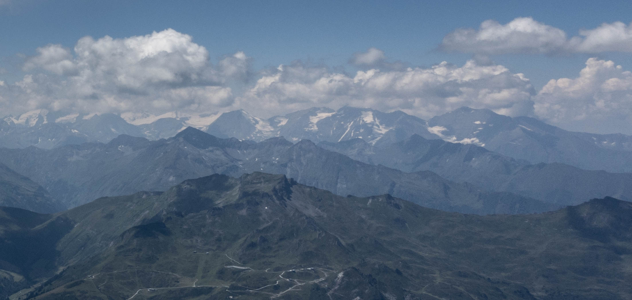
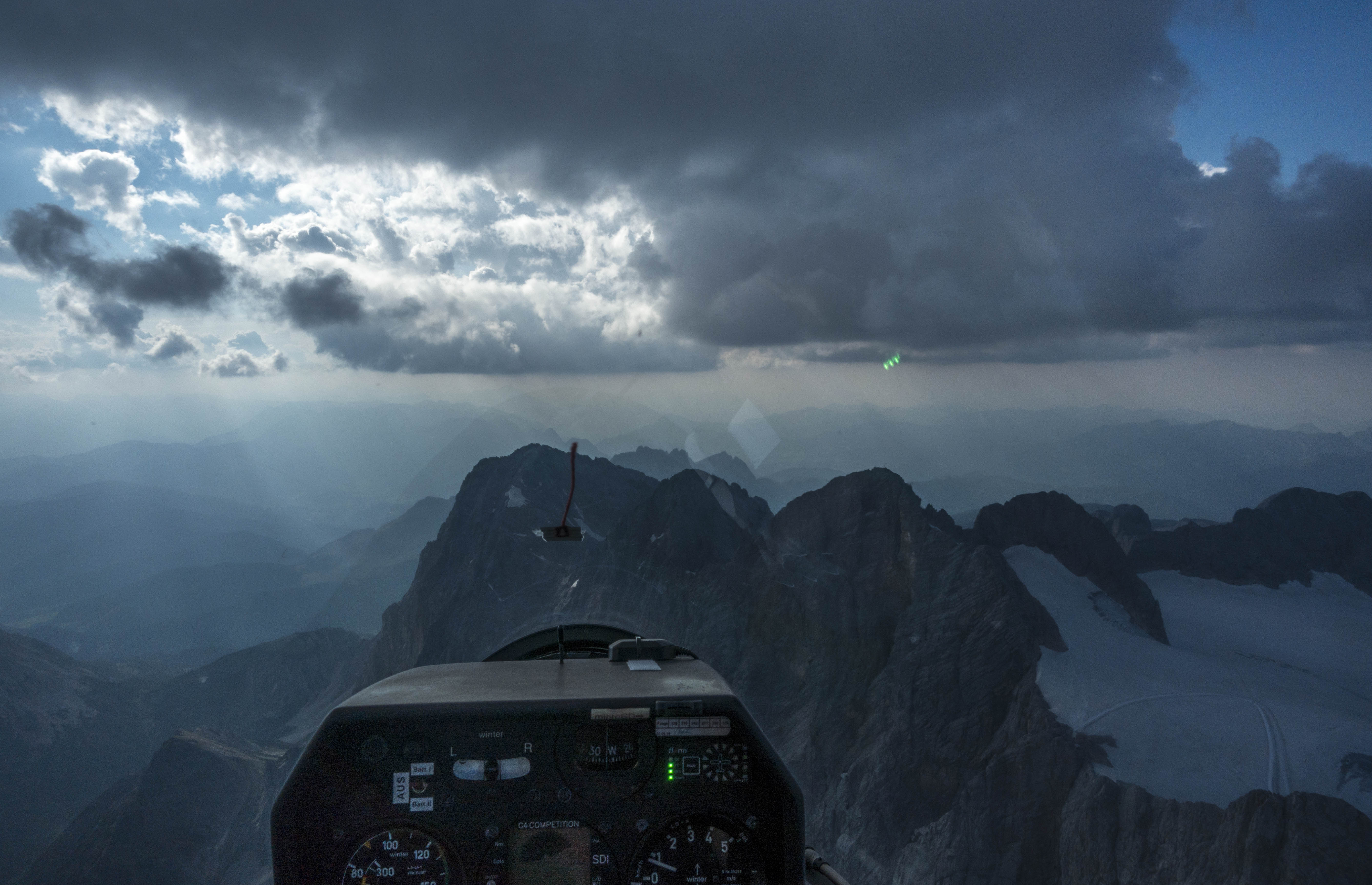
TP1 was only 25km northeast of Austria’s tallest peak, Grossglockner, 3,798 m (12,460 ft) high. Cloud-bases at my location were around 10,000 feet. Even though the bottom of the cumuli was someone higher to the southwest, Grossglockner was obscured by clouds and appeared to be unattainable. There was a chance that the cloud base would lift later in the day but I decided to turn around and continue on task.
Looking at the sky ahead of me I had to make a decision: should I continue on the north side of the central spine of the Alps (essentially retracing my flight path), or should I follow an almost continuous line of clouds that were perhaps 15-20 km further to the south. The southern route looked much faster and easier but I had not researched the land-out fields to the south (except for the airport of Mauterndorf where I obtained my winch training back in 1984). There was also a military air space around Zeltweg that I suspected to be inactive on the weekend, but I did not know the proper radio frequency to verify this. Looking at the clouds I could not tell for sure if I would be able to follow this line without encroaching on the military airspace. Thus I decided to fly on the north side. The main challenge was that the cloud coverage in this area had become very scattered with large blue holes on course. Well aware that my average speed would suffer, I decided to maintain my strategy of staying high and keeping known airfields and land out spots within glide range at all times.
The execution of the plan worked as expected. I found practically all the climbs directly above one of the ridges, usually above one of the mountain peaks. There was a major variability in climb rates. Sometimes I would average 3-4 m/s (6-8 kts), sometimes as little as 1 m/s (2 kts) or even less. With mainly blue skies ahead of me there was no way of knowing how strong the next climb would turn out to be. My conservative strategy worked but my progress was predictably slow.
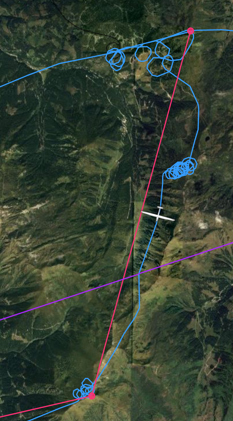
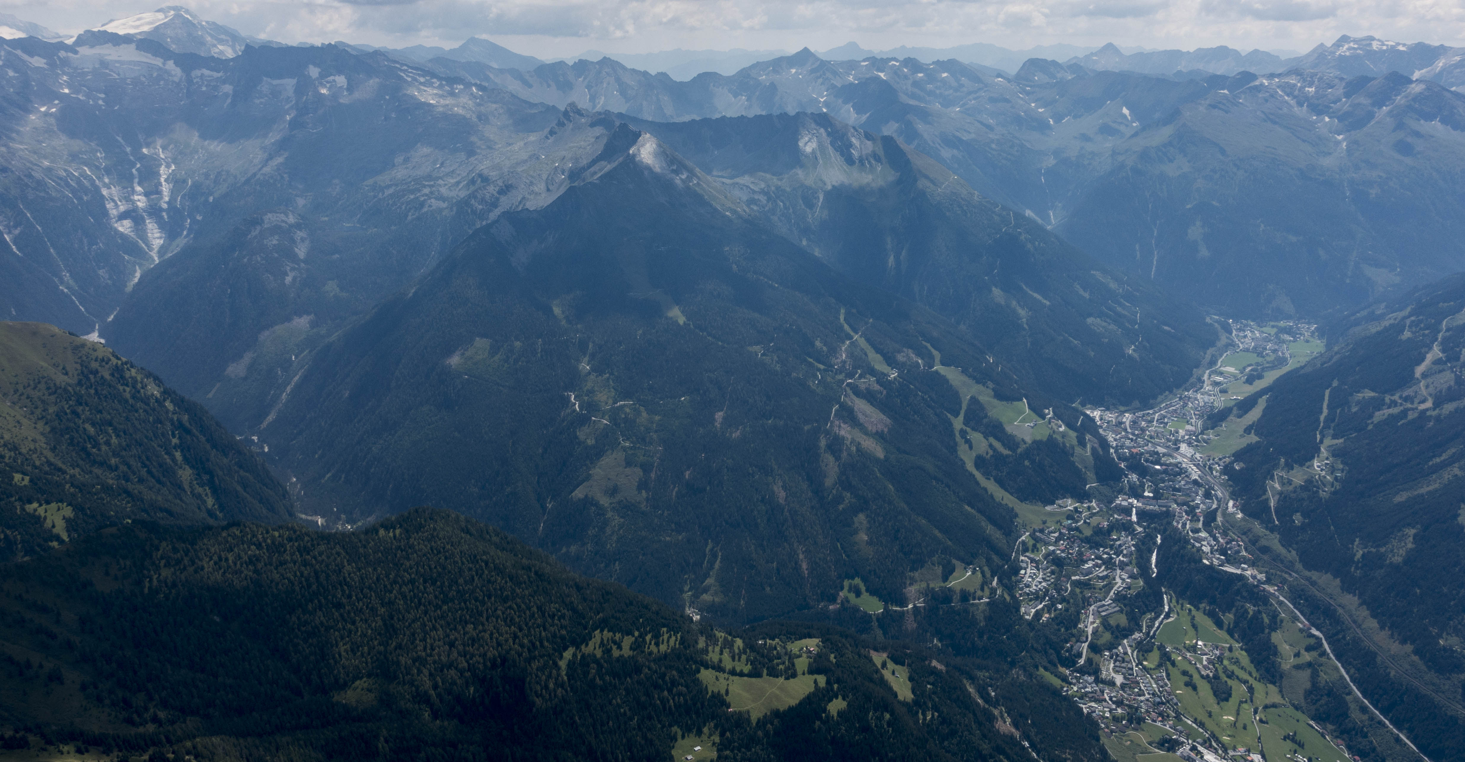
Another obstacle on course was the crossing of the Liesing-Palten Valley. As I approached the valley I noticed a nice cloud right at the top of the divide at Wald am Schoberpass. However, as I got closer, the cloud was dissolving and I decided to stay on the west side, gain additional altitude, and cross further to the south.
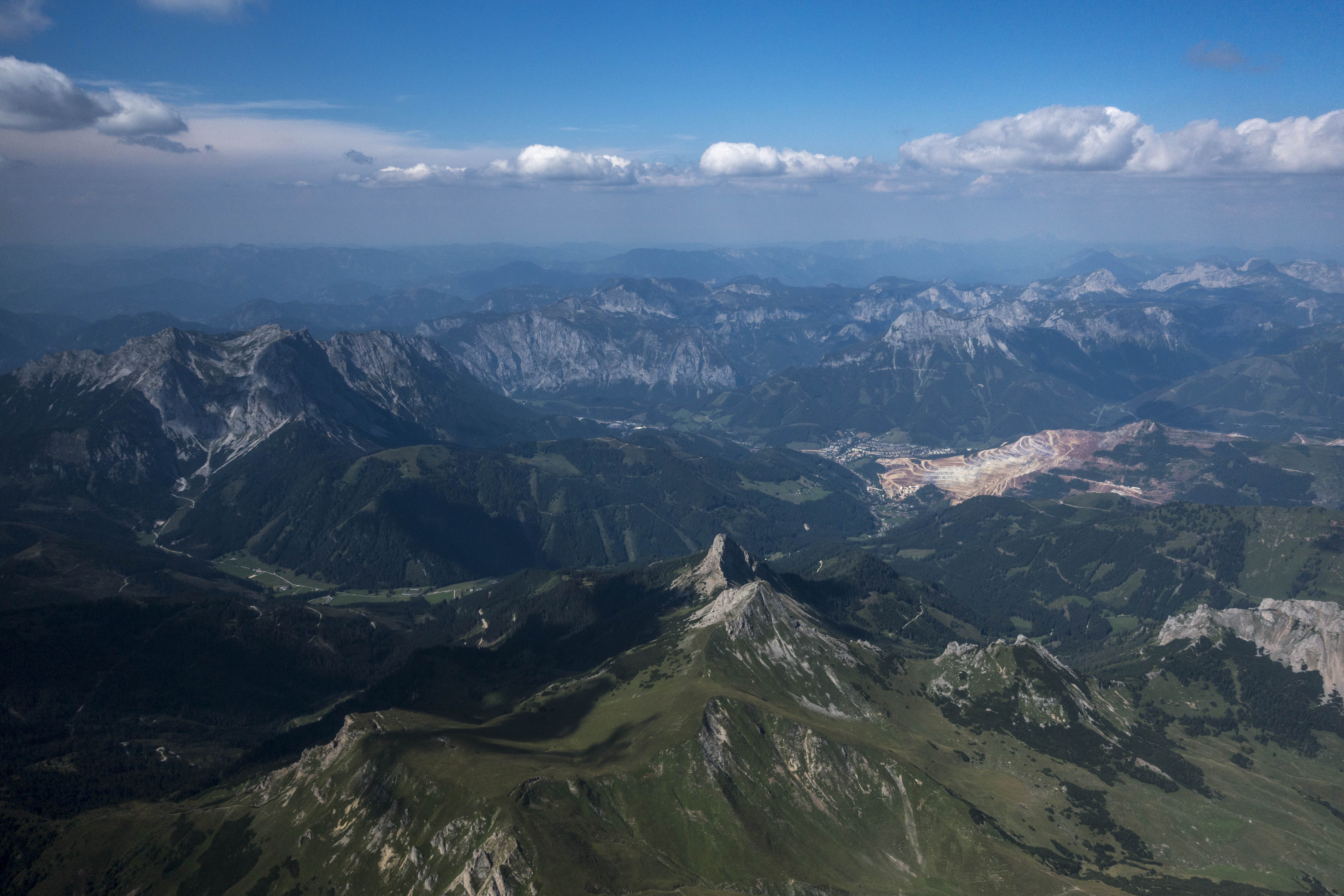
The crossing was uneventful. I ended up loosing less altitude than I had expected. But there was a lot of traffic in this area. I encountered seven or eight other gliders as well as hang gliders and paragliders. Most gliders in Europe are equipped with Flarm systems but hang gliders and paragliders are not. Traffic density in the Alps is orders of magnitude higher than in the American Rockies. Paying close attention is paramount at all times.

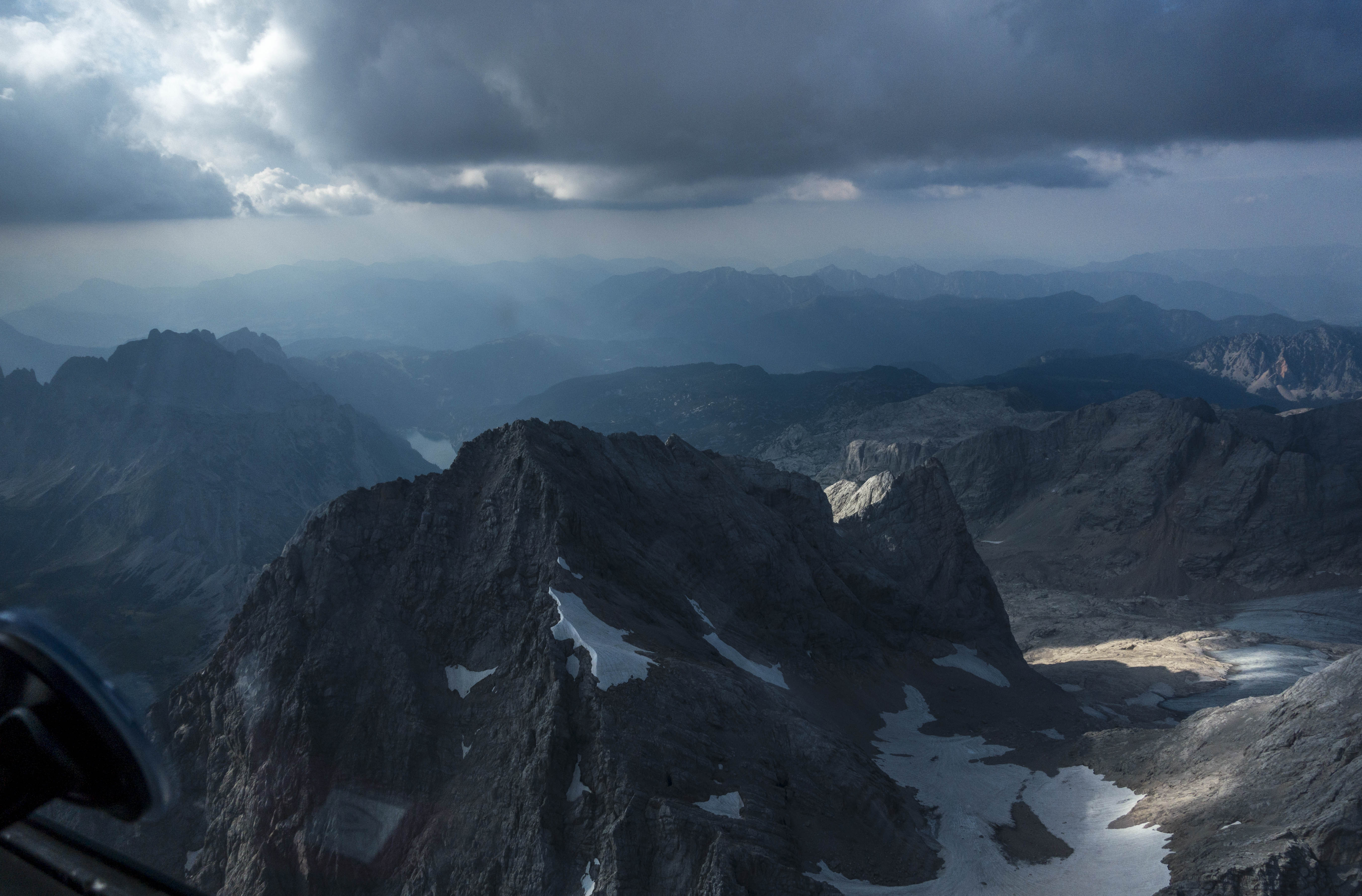
TP2 turned out to be well-picked as the sky further east was significantly overdeveloped with some emerging storms. I rounded it just before 3PM in the afternoon.
Cloud bases on the east side of the Liesing valley were significantly lower and now I had to transition back to the west side. Concerned about arriving too low I ended up wasting more time in weak lift before crossing the valley again. Again, my hesitation turned out to be overly conservative. After the crossing I quickly regained my altitude and was back at cloud base. I was also on final glide even though I had almost 50km in front of me.
With my goal already made, I finally started to fly less conservatively. I flew 170 instead of 140 kph in-between thermals, skipped several ridges, and only took the strongest climbs. This strategy would likely have worked for much of the entire flight and would have resulted in a significantly higher average speed.
I finally reached the finish line after 4 hours and 40 minutes with an average task speed of 67 kph. Slow, but stress free, and happy to have completed my third pre-declared 300km goal flight and my first in the Alps. 🙂
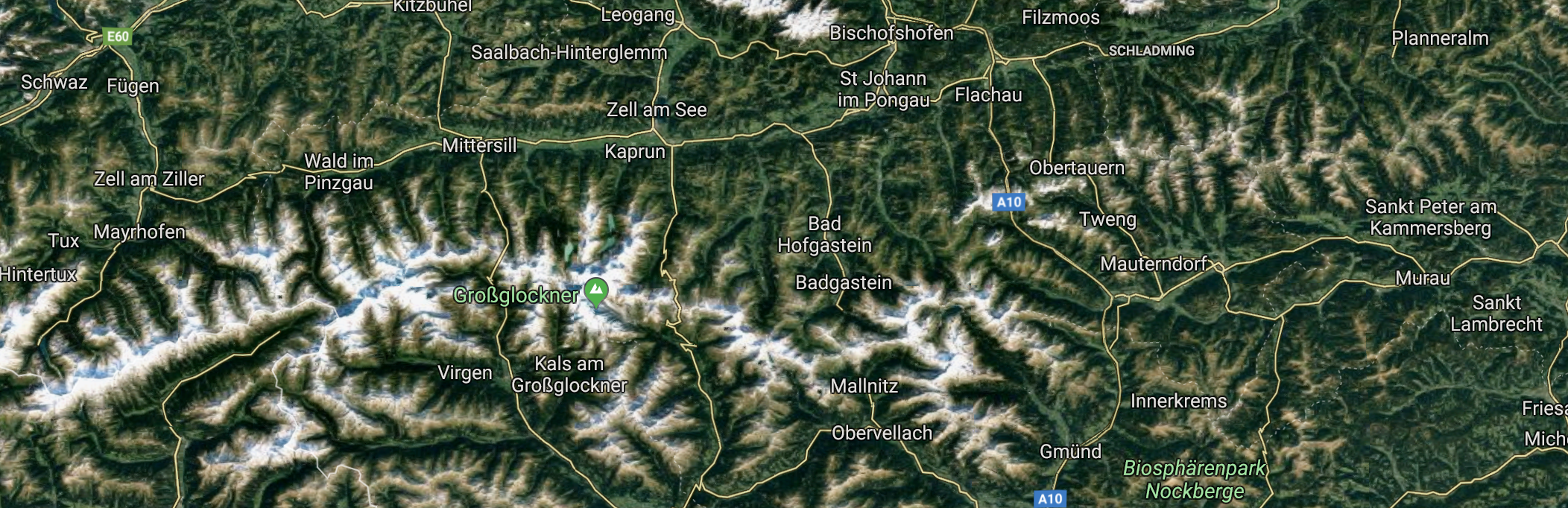
After completing the task I took another climb and decided to add some sight seeing on the northern side of the Enns Valley.
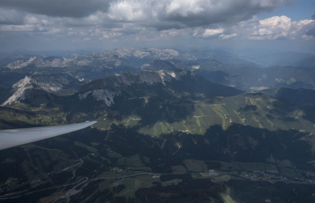
I crossed to the Kammspitze, climbed again and headed west over the Scheichenspitze, the Hohe Dachstein (the highest peak of the day at 3,004m or 10,000 feet), and the picturesque Bischofsmütze. From there I retraced my flight path below the level of the peaks.

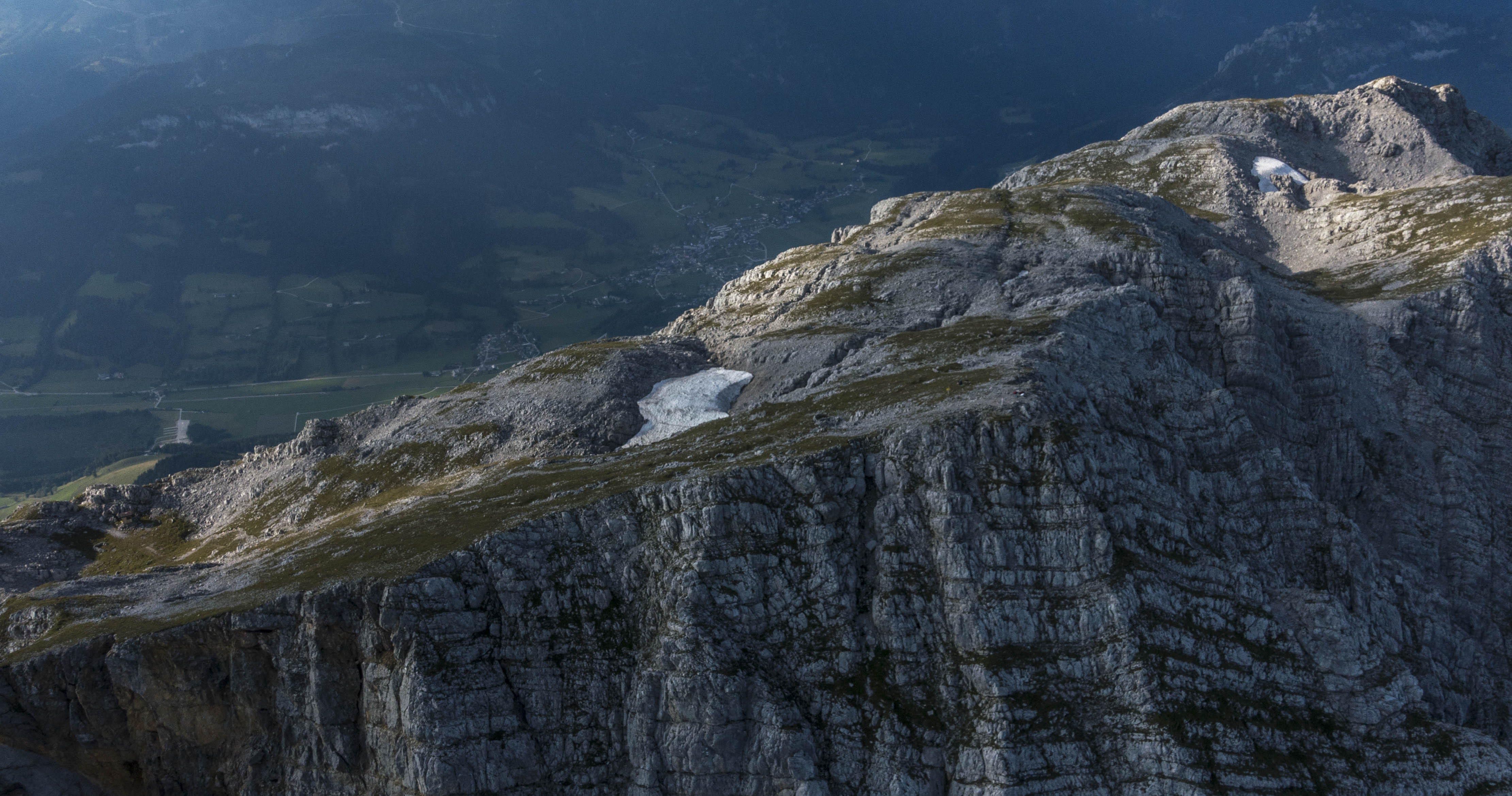
This final section turned out to be the most scenic and enjoyable part of the flight. I was flying along the steep south-facing cliffs of the Northern Limestone Range (Nördliche Kalkalpen).
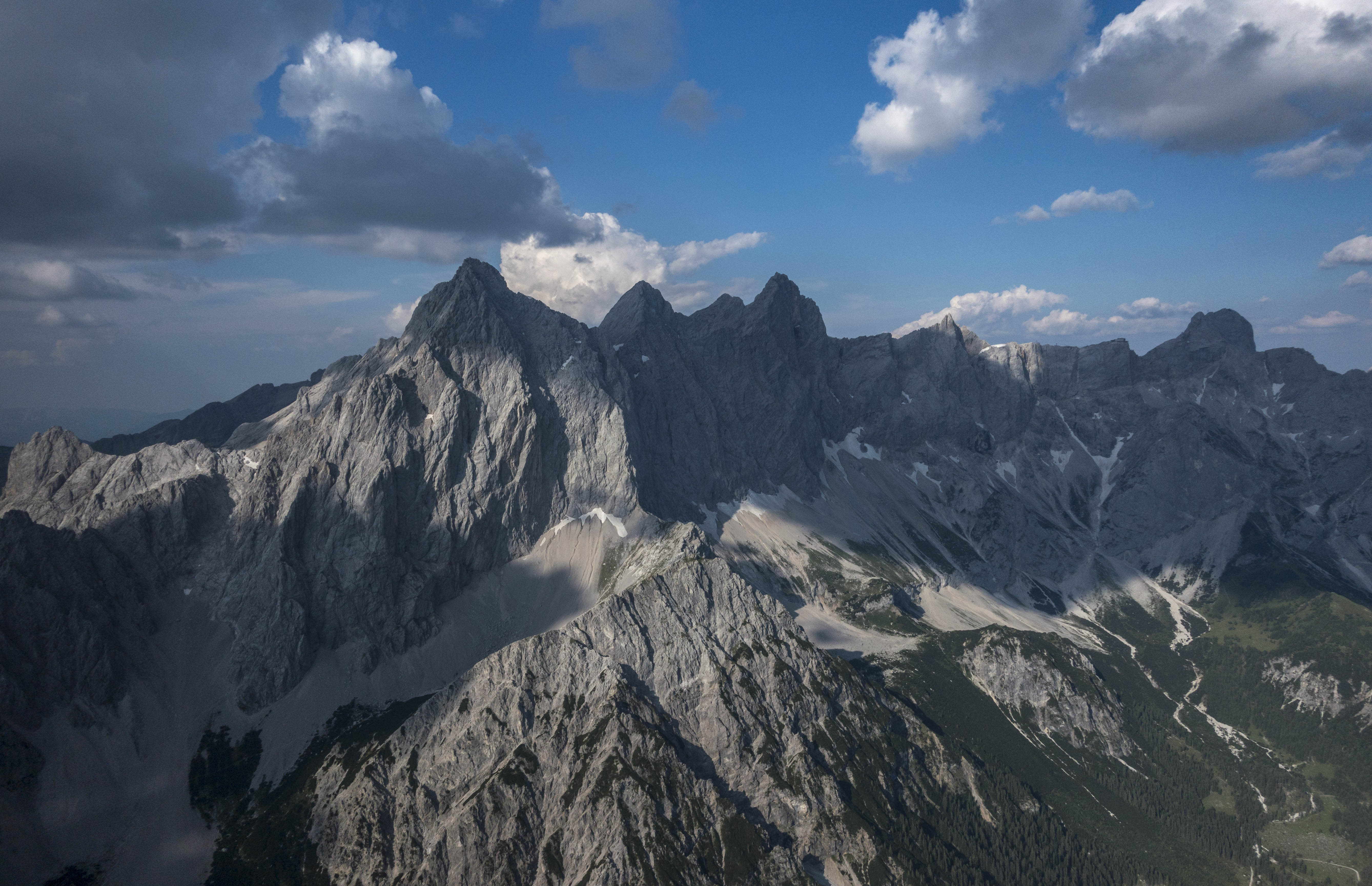
These cliffs had been exposed to the sun for the entire day and were radiating heat that caused the air to ascend along the slopes at 1-2 m/s allowing me to fly along the entire range at about 130-140 kph without loosing altitude. I even ended up climbing above the top of the Grimming, all in straight flight for about 50 km.
Unfortunately, this last section did not count for the OLC Speed League because I omitted climbing back another 300-400 feet at the end (which had been my low point earlier). There’s no doubt that the final 2 1/2 hours were easily the fastest of the entire flight (probably averaging more than 100 kph).
Overall, I had a very nice and relaxed flight in good conditions. I’m happy with the result especially considering my conservative tactics and the fact that my speed was right in line with that of others flying in this area on the same day. My flight track is here.
Lessons Learned
- Follow the ridge lines whenever possible. When the sun heats the slopes on both sides of a ridge, warm air will ascend and converge right at the top. The best thermals will also almost always break away from the top of the ridges, usually above prominent peaks rising above the ridge line.
- Lower may actually be faster. You may be able to fly directly along the top of a ridge line without losing altitude. This type of lift works best in relative proximity to the terrain, i.e. a few hundred feet above the ridge, but not several thousand feet above. This means you are likely to fly faster if you fly lower. This is at first counterintuitive because you can’t take advantage of the fact that the delta between IAS and True Airspeed increases the higher you fly. (This is a big contributing factor to the high average speeds in the American West.) Obviously, flying low above the ridges is mentally demanding and implies a reduced glide range requiring great situational awareness with respect to land-out fields and any terrain obstacles that may get in the way.
- Arrive well above the ridge top when flying from “bone to bone”. The fishbone structure of the Alps makes constant crossings of narrow valleys inevitable if you want to get anywhere. Thermals almost always break away from the ridge tops and it may be difficult to find lift if you drop below ridge-line. So don’t, especially if the wind is insufficient to produce usable ridge lift helping you work your way back up.
- Terrain is at least as important as clouds. Sunny ridge lines are constantly generating lift and new thermals will periodically break off from the ridge tops. These thermals can drift away with the wind and I have found that they often are no longer working once they have moved away from the ridge that spawned them. You are more likely to find lift in the blue above a ridge line than under an aging cloud drifting away from a ridge.
- Rocks store heat extremely well. The south facing cliffs along the northern limestone range stored a ton of heat energy throughout the day. Flying in constant lift along the face of the cliffs at the end of the day was an amazing experience. However, remember that whenever you get close to terrain it is paramount to fly at a safe speed and to know the locations of cable cars and similar obstructions as they are very difficult to see from the air.
- Birds can be stupid. I have always admired birds for their maneuverability and I never thought that a bird would be so stupid as to directly collide with a glider. But apparently that can happen. It’s a good thing that gliders are pretty sturdy. However, I hate to imagine what would have happened if the bird had collided straight with the canopy or the horizontal stabilizer.
- Traffic! The air along the spine of the Alps is very busy – especially compared to the empty skies above the Rockies. During my flight I encountered at least two or three dozen other gliders in addition to para gliders and hang gliders. Especially the latter are not equipped with Flarm systems and it’s critical to keep your eyes outside the cockpit at all times and pay close attention to other traffic.
- Mind the altitude rule for the OLC Speed League. The last 100 km of my flight were by far the fastest of my entire flight but they did not count for the OLC Speed League because I didn’t climb back to my previous low point during the flight. I would have scored considerably better had I climbed back another few hundred feet towards the end before coming back down to land. It is actually beneficial to have more altitude variability throughout the flight as this allows for more opportunities to calculate the fastest 2 1/2 hour segment of the flight. Something to remember.