Rotor Bruises

Soaring is not exactly a contact sport.  I always thought the only time you could get hurt is when making contact with the ground (or, very rarely, another object in the sky). Well, today I learned there is also another way.

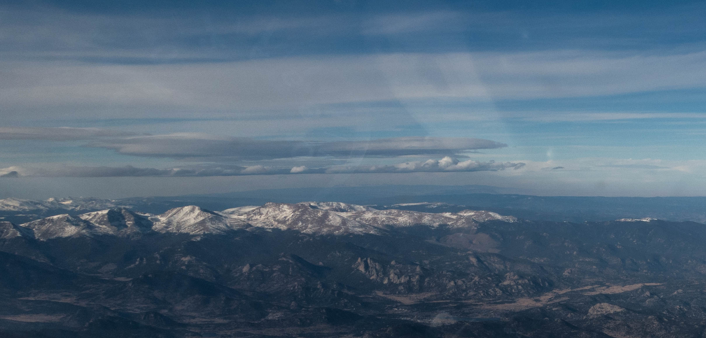
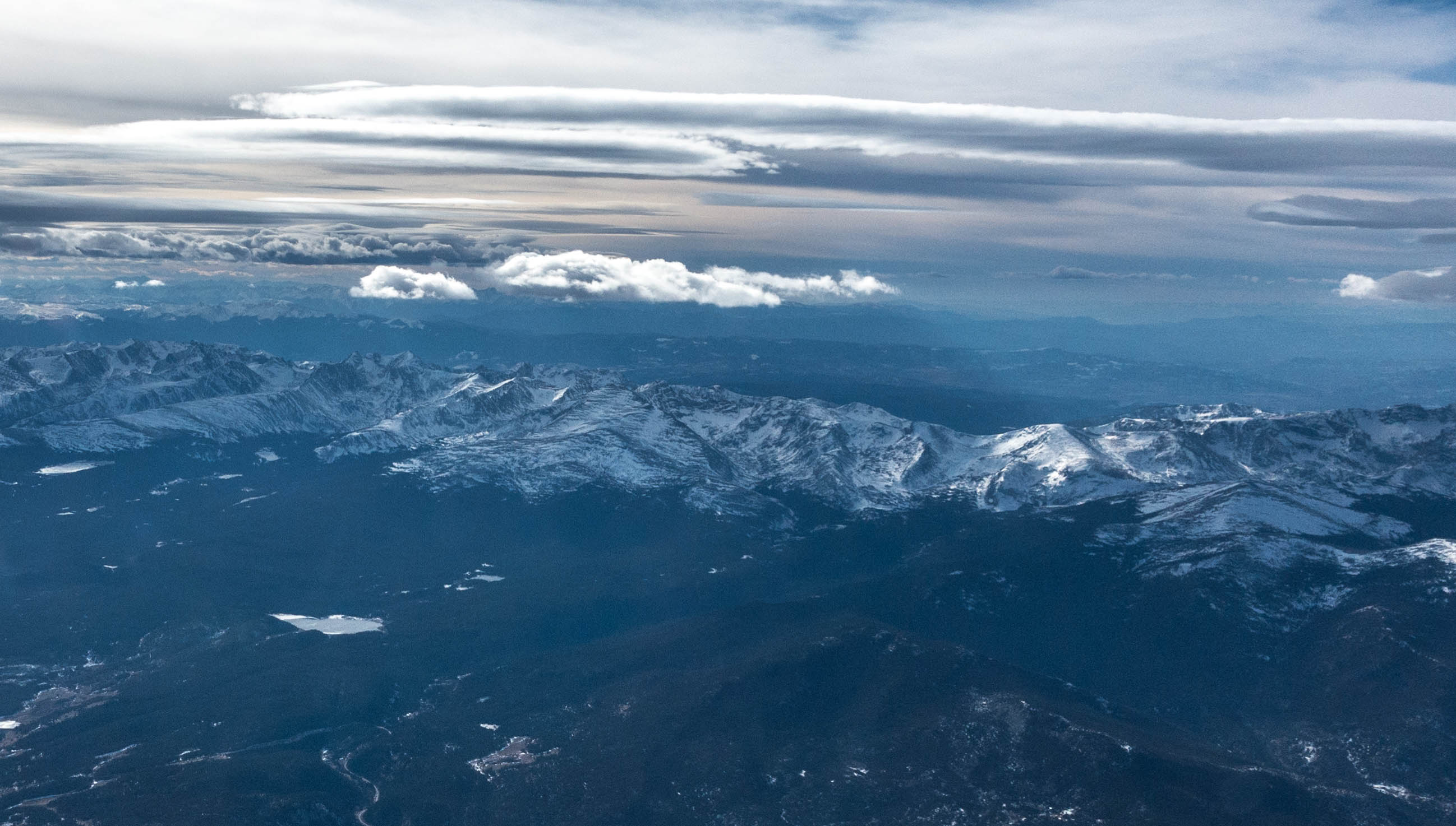
But first things first: my last flight on Monday taught me not to trust the wave forecast but instead to rely on observing the sky.  When I woke up this morning, this is what I saw: a whole sky full of wave.

Beautiful sunrise from our porch.

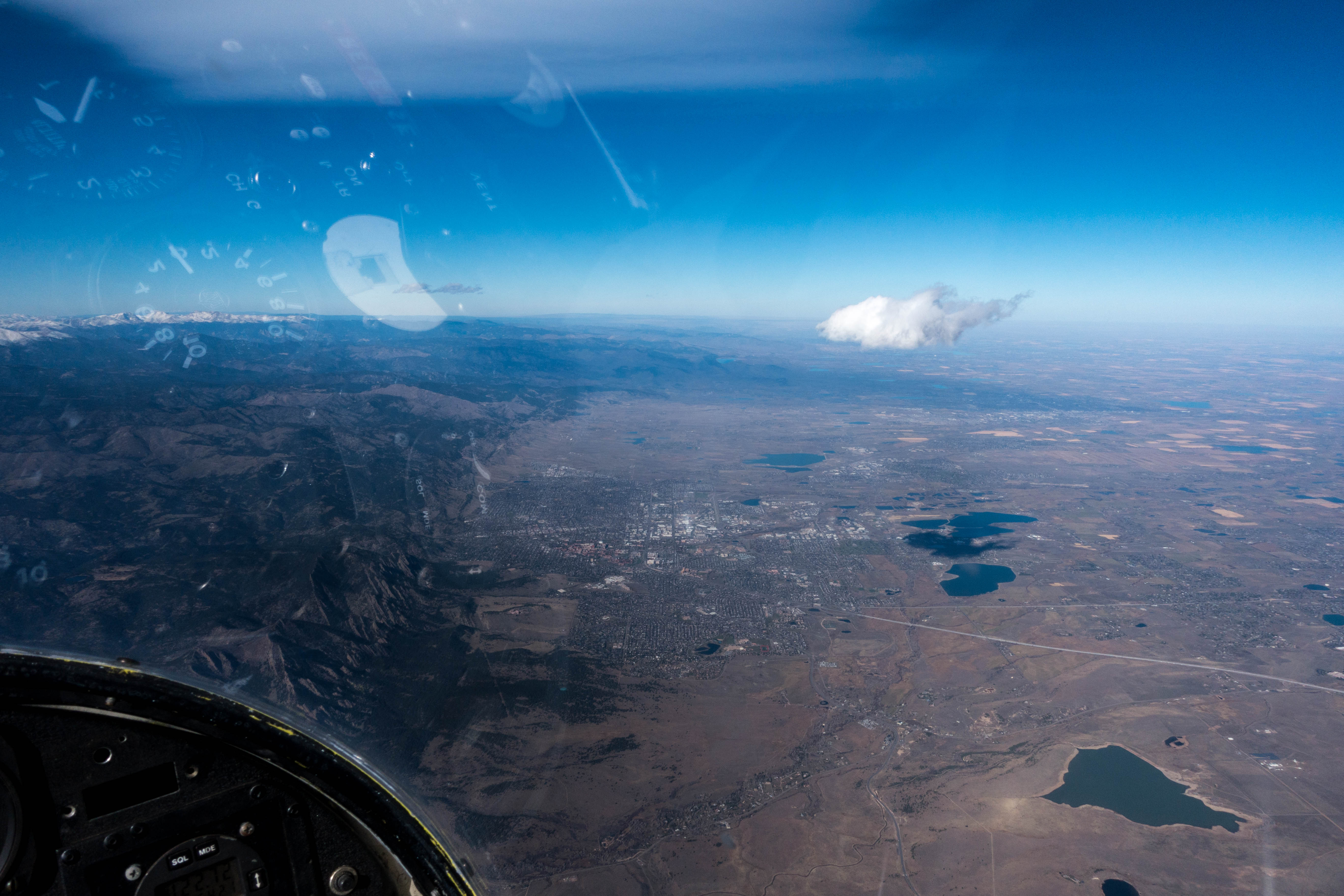
There was even this little, frazzled-looking, rotor cloud right above our house in the foothills:

The obscurely shaped gray cloud is the rotor. It is much lower than the cirrus clouds far above.

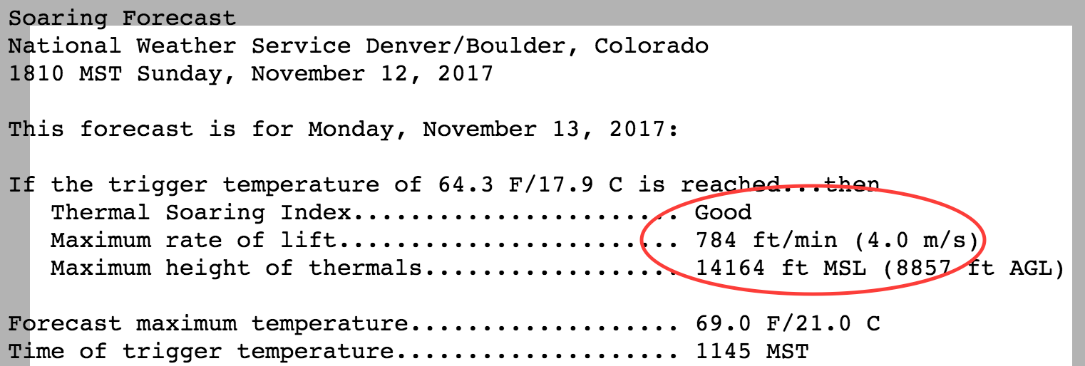
This made it easy for me to ignore the National Weather Service, which, once again predicted “poor wave”, and “good thermal” conditions.  A glance at the sky at 6:15am, and I already knew better than that. (Of course that’s not quite true: as always, I did look at a sounding, the winds aloft, the thermal projections from topmeteo.com and meteoblue.com, and the distance of the next front that was projected for Friday.)

Line of small rotor clouds far out into the plains in the rising sun.

So off to the airport I went. And I wasn’t the only one. Other pilots had put their own reading of the sky ahead of the forecast as well.

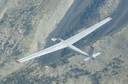
Once again, I got the Tin Can ready. As I filled the oxygen tank I talked to the tow pilot who had just come back from his third tow of the day. He gave me a taste of what to expect: rotor turbulence “bordering on violent”. He said this with a big grin on his face, so apparently it was also going to be fun. He advised on where he suggested to tow, and explained that he would speed up to dive through an area of heavy sink. He would slow down before we would hit the heaviest turbulence.  Or, rather, he said he would try: for neither of us could be sure that it would still be at the same place as before.

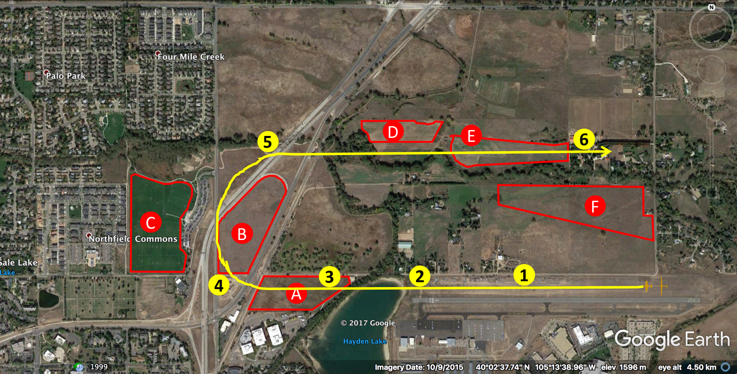
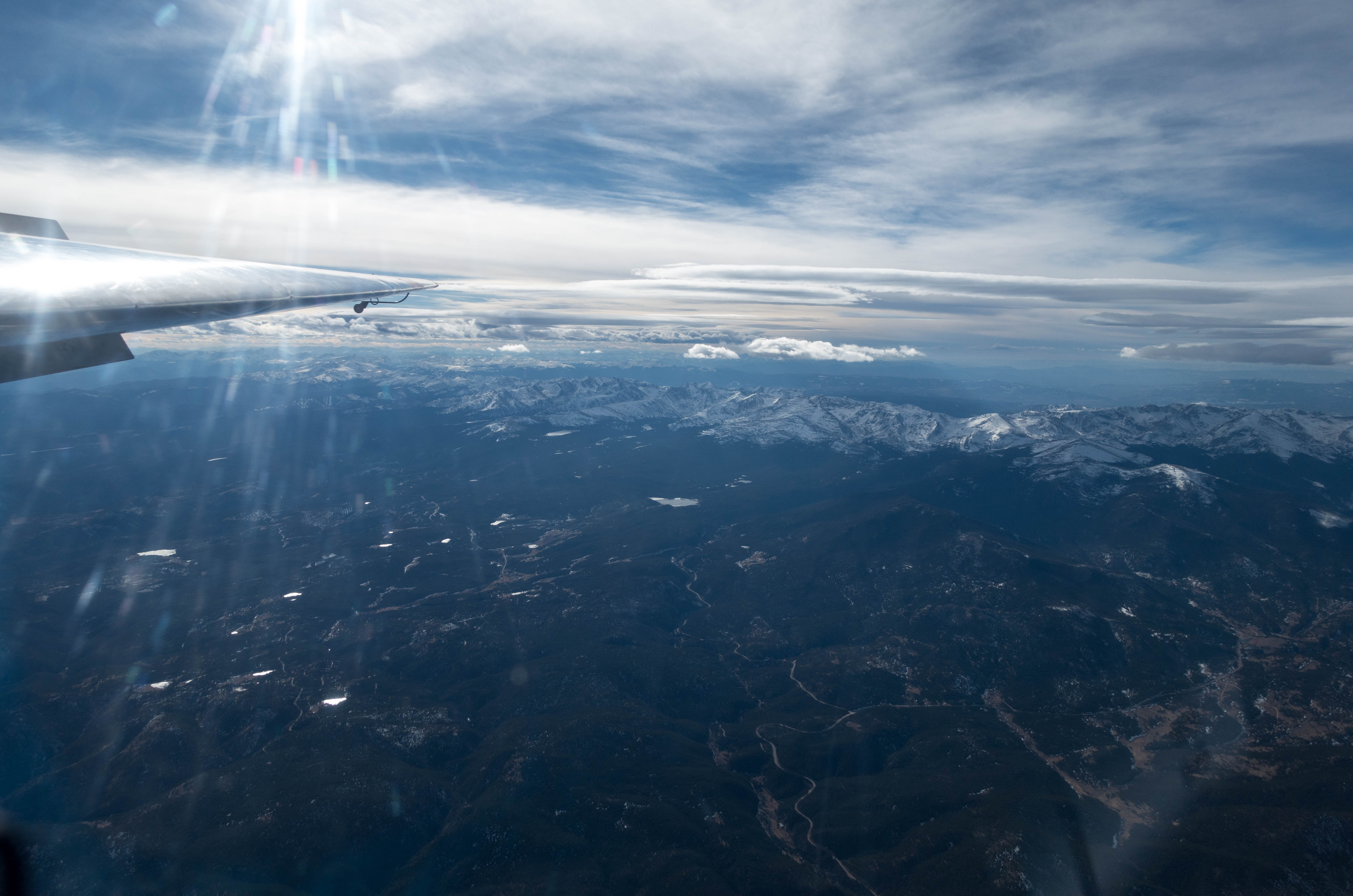
I climbed into the cockpit, secured all loose items, fastened the straps as tight as they would go, looked through the checklist again, and off we went. (You can see the flight track here.) Takeoff was relatively smooth although we didn’t climb much until the end of the runway. Then came the first bump. Suddenly it went up at 8-10kts but it was still surprisingly smooth.  At about 1,000 feet above ground we entered the wind shear zone. The wind at the ground had been 5-8 kts from the northeast but now the wind shifted to the strong westerly flow above.

Appropriately dressed for a wave-flight today. The chemical foot warmers in my boots were perfect.

The towplane in front of me started to jolt around: sometimes it would drop all of a sudden, sometimes it would bank to one side or the other, sometimes it would rise straight up.  Any of these erratic motions were also an indication as to what would happen to my glider about two seconds later, for that’s about how long it took for the glider to reach the air that the tow plane had just passed through. “Compared to the tow pilot I’m really lucky”, I thought, “Unlike him, I know exactly what to expect.”

The tow pilot turned west and dove through the sink just as per our briefing.  I followed right behind, mentally preparing for the heaviest jolts that were yet to come when we would hit the next rotor. Glancing back at the airport I felt reassured by our altitude: if the tow-rope would snap or if I was forced to release, I felt certain that I could make it back on my own. Just after I had finished that thought, my glider was tossed down in a sudden down-draft.  The tight straps kept me in my seat but my legs were out of control: inertia wanted them to be 20 feet higher but they only had a few inches to move up until they hit the instrument panel. Bang! Then, a split second later, I was firmly pushed down into my seat as the plane was lifted up again and my feet regained contact with the rudder pedals.

This up and down, left and right, had lasted for maybe 20-30 seconds when the vario indicated strong lift. Just as I moved my hands towards the release knob, the tow pilot came on the radio to say that this is where the other pilots had released as well. A quick pull and off I was.

At just under 18,000 feet over the foothills. Spoilers are open to prevent an inadvertent climb above 18,000 while taking pictures…

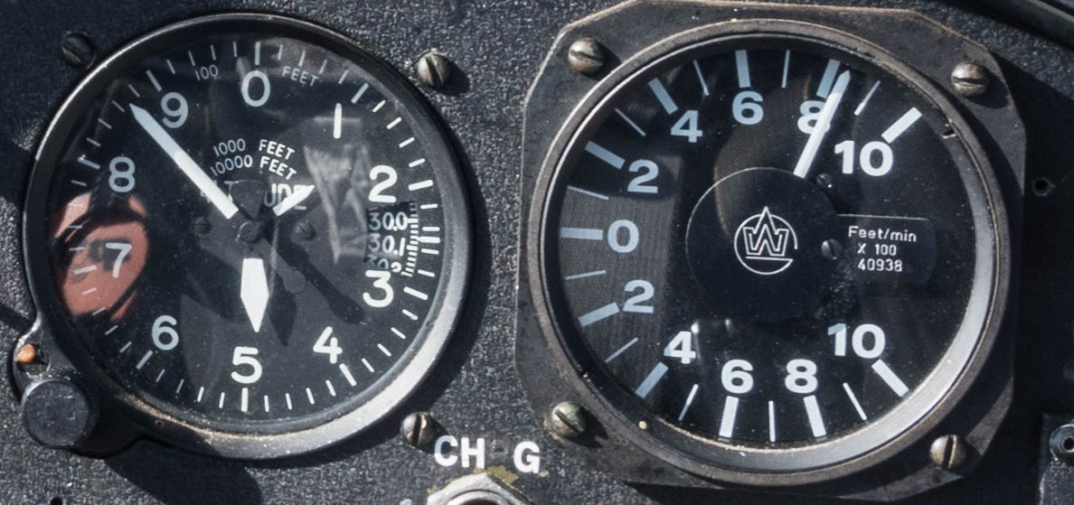
From there I worked the front side of the rotor to about 13,000 feet when I pushed into the laminar flow of the secondary wave. The wind was so strong, blowing at about 50-60 mph, all I really had to do was point the nose into the wind and rise, stationary above the ground.

The strength of the wind made it difficult to fly sideways along the wave bar.  To maintain the same velocity into the westerly wind while also moving north or south, I had to speed up, which resulted in a greater sink rate.  Also, I noticed that the lift was less consistent than during my flight this past Monday. Several times I returned to an area where there had been strong lift only to find myself in sink.

I was just a few miles northwest of the airport when I decided to attempt a push into the primary. I started at well above 17,000 feet knowing that I would have to fly very fast and loose a lot of altitude while penetrating through an area of heavy sink. Determined to keep the airport within reach at all times, I resolved to turn around if I would not get to the primary at an altitude of at least 12,000 feet.

I put the nose down, increased my indicated airspeed to 110 mph, and flew straight into the wind. As expected, the needle of the altimeter began to spin backwards and the surface got visibly closer. When I got down to 13,000 feet I began to wonder it it would work. Just as I prepared to turn and make a quick escape towards the airport, I entered the rotor zone behind the primary.  I quickly reduced my air speed to 80mph (the maximum for rough air in this glider) and continued to push into the wind.  The sink rate slowed but I wasn’t out of the woods just yet.

Estes Park right in front below. Stormy Peaks, appropriately named, behind.

As before, the plane got tossed around by heavy turbulence. My legs were loose sticks again, and I couldn’t keep my feet on the rudder pedals even though I tried. A few more bangs against the instrument panel and finally: I started to climb again.  At the low point I was down to 11,500 feet, a bit lower than I wanted to be, although still high enough to make it back to the airport. (I lost almost 6,000 feet during the transition into a 50-60 mph headwind. I estimate that a backward transition with the wind at my tail would have cost at most 2,000 feet in altitude, probably less. That would have put me at 9,500 feet into the rotor zone of the secondary – roughly at the same spot where I released from the tow plane and definitely within reach of the airport.)

After a short climb in the rotor I was back in laminar flow: I had made it into the primary! I climbed back up to 17,000 feet and began to explore along the wave bar flying between Longs Peak and just west-southwest of Boulder.  Just as I had experienced in the secondary, the strength and location of the lift was inconsistent.  Within 20 minutes, regions with strong lift turned into regions with modest sink.  E.g., in an area to the west of Lee Hill I had found strong lift on my first leg to the south.  On my second leg, I only found moderate sink at the same spot.  I explored back and forth along a few streamlines but wasn’t able to find any lift that would carry me back up.

Continental Divide. Beaver Reservoir in the foreground. The illuminated peak center-right is Mt. Audubon.

From there I retreated closer to the airport, all the while expecting to get into massive rotor turbulence again. However, the air stayed surprisingly smooth as I gradually drifted back towards town.  Whenever I noticed some lift, I would turn into the wind and remain stationary over the ground, trying to climb. But in all cases the lift evaporated after a minute or two, and I finally decided to return to the airport to land.

Then, just as I arrived directly south of the airport, I found strong and unexpectedly smooth lift right next to the runway.  I pointed the nose into the wind and, without doing anything, climbed back up from 8,000 feet to over 13,000 feet within about 13 minutes.

Observing the curls of water on the surface of the nearby lakes, I noticed the wind on the ground now also blowing straight from the west, and it appeared to be getting stronger.  So after leveling off at 13,200 feet, I took advantage of the Tin Can’s terminal velocity dive breaks to begin a rapid descent to 7,500 feet.  Now, just 2,200 feet above ground, the wind was still blowing at almost 50mph.

Still signs of wave at sunset tonight.

I crossed the runway at 2,000 feet above ground and flew a close pattern to Runway G26 with a very steep and fast descent against the strong headwind.  Once in ground effect, calmness enveloped the plane and I touched down smoothly at a very low ground speed.

Lessons Learned

  • You can get bruised while in flight.  Even very tightly worn straps cannot prevent your legs and feet from flying around the cockpit and hitting the instrument panel. (It’s not as bad as it sounds, though. The fun factor was definitely greater than the pain from the small bruises. Playing soccer is definitely more hazardous for your shins.)
  • Slack-line training is not for naught. It’s impossible to prevent slack-line while towing through rotor turbulence, all you can do is correct it when it happens.
  • Forward wave transitions cost a lot of altitude. 6,000 feet in my case today.  Always keep a safe escape route – ideally to the airport.
  • Wave lift is not always stationary to the ground. During my flight on Monday it stayed reliably in place.  Today, I frequently encountered situations where strong lift was replaced by moderate sink within minutes.
  • Wave lift can be where you don’t expect it. The smooth climb right next to the Boulder airfield today is a good example.  (I’m not sure if it was from the secondary or the tertiary.)
  • Rotor turbulence can happen at very high altitudes. As I flew in the secondary today above 17,500 feet I ran into rotor turbulence that I had not expected at that height.  This is a safety consideration as one might be flying well above rough-air speed at this level.
  • Progress along a wave bar can get really difficult in very strong winds. Today, most of the plane’s forward motion was needed to not drift backwards. To fly along the wave bar required high air speeds corresponding to sink rates that at times consumed more than the available lift.
  • More moderate wind speeds are preferable to very high wind speeds: they are better for XC flying (smaller crab angle required), and the rotor turbulence will be less severe.


Do I Stay or Do I Go?

When you see this you no longer ask: do I stay or do I go?

Yesterday, as so often, I began the day by looking at the weather forecast.  This is what I saw:

NWS Soaring Forecast for Nov 13, 2017 for Denver/Boulder

Really?  Good thermal soaring with 4 m/s lift up to 14k feet in the middle of November? Sure, it was going to be an unseasonably warm day with highs around 70 degrees F.  But 4 m/s seemed way too good to be true.  So I took a look at some other sources:

Source: topmeteo.com. Location forecast for Boulder Nov 13, 2017

Now that seemed more likely: thermal climb rates of 1.8 kts (0.9 m/s) up to 9,500 feet – more realistic given the season but barely enough to stay up in a glider with a minimum sink rate of ~1.5 kts.

The Thermal Updraft Velocity chart provided by soarbfss.org was just slightly more optimistic than topmeteo.com about the thermal projections: max. climb rates between 200 and 300 feet/minute (1 – 1.5 m/s) with the strongest updrafts just south of Boulder (over the Flatirons).

Source: soarbfss.org, Thermal Updraft Velocity for the Colorado Front Range; the circle highlights the area around Boulder

Which of these thermal forecasts should I believe?

And if thermals wouldn’t work, would there be wave?  The wind forecast looked fairly favorable: 29 kts from WNW at 13,000 feet increasing in strength to 38 kts at 18,000 feet with no change in direction.

Source: topmeteo.com. Location forecast for Boulder Nov 13, 2017

The cross-section chart for Boulder suggested a strong primary (climb rates of 5 m/s and more) and a weak secondary (climb rates around 1 m/s).  The main problem with that outlook is that the secondary would be too weak to climb in, and getting into the primary would require a very long and high tow deep into the mountains crossing through the area of sink between the secondary and the primary.

Source: soarbfss.org, 270 cross-section for Boulder

The sounding for Boulder confirmed the wind forecast but did not show the presence of a stable layer at the relevant altitude (between 11k and 15k feet – the height of the Continental Divide that would trigger the wave).  The theory says that wave will not form without a stable layer around the tops of the mountains because only a stable airmass will have the tendency to bounce back after it is forced to descend and warm up on the lee side.

The wide gap between the temperature line (red) and the dew point line (blue) suggested blue skies (no clouds) at all altitudes.

Source: soarbfss.org, Sounding for Boulder

The National Weather Service (NWS) was even more pessimistic than these charts suggested:

Source: NWS. Soaring Forecast for Denver/Boulder Nov 13 2017

So the usual question arose: do I go, or do I stay? The NWS said there would be great thermals but I did not believe their projections. And despite favorable winds aloft, none of the wave forecasts looked particularly promising.

So, what did I do?

Blue Wave over the Colorado Foothills. The yaw string points straight at Longs Peak. The flight track, however, is parallel to the mountains in front. Climbing through 15,000 feet at 8kts (and the lift kept improving).

I went.  Why? Not because I suddenly thought the NWS’s amazing thermal forecast of 4 m/s might be true after all but because I looked at the sky: there was a small, but beautifully formed, lenticular cloud standing right above Boulder.  There were also some small rotor clouds. These were clear signs of wave.

I prepared the “Tin Can” (aka the Schweitzer 1-34), installed my new toy (an Oudie IGC flight computer), checked the oxygen level in the tank and off I went.

Takeoff was easy with a few knots of wind from the east on the ground.  That quickly changed at about 1,000 feet AGL when the wind direction switched to the West and the ride through the rotor began. The tow was very bumpy, frequently requiring full control deflections, but I didn’t find it too hard to follow right behind the towplane.  Only a few times did I have to correct for a developing slack line.

At just around 9,000 feet MSL we entered the first strong rotor climb just at the entrance to the Left Hand Canyon.  After the lift held out for several seconds I released without hesitation (that’s good because at times I waver and stay on for much longer than really necessary).

Yesterday’s flight track was directly along the line where the foothills end and the plain begins. The flatirons are right in front below the plane. The city of Boulder is in the center. A thin lenticular cloud is above. A small lonesome rotor cloud – likely fueled by moisture from Gross Reservoir (which is in front and slightly to the left of the plane) – is below to the right.

The wind was quite strong and I knew I had to stay in the area of lift, otherwise I might drift back into sink and end up on the ground again in no time. That’s were the moving map from the Oudie came in extremely handy. The flight trace showed where I was climbing and where I was sinking and all I really had to do was stay more or less stationary to the ground to remain in an area of overall lift.  It was rough with short upward bursts being followed by short downward bursts, but overall it went up at a good clip.  Within a few minutes I climbed through 10,000 feet, 11,000, then 12,000.  Suddenly the air went still and I had reached the laminar flow. The wild high and low beeps from the acoustic vario were now replaced by a happy sound with a constant pitch.  Initially the climb rate was not particularly strong but it was consistent and smooth.  I moved the trim back to reduce the speed to just over 40 mph and flew in shallow S-turns into the wind, maintaining my position over the ground.

Whenever the climb rate decreased I would first probe into the wind to see if the lift would strengthen and if that did not work I would just let the plane drift back and invariable the climb rate improved again.  It was actually quite simple and I just did what the theory of wave flying had taught me to do.  Once I had climbed above 14,000 feet I began to explore along the wave bar and just as I had expected, I was able to continue to climb as I began to fly north, parallel to the mountain range which was about 16-18 miles to the west.

I looked into the direction of the wind to identify as well as possible where along the mountain range the particular streamline I was flying in had been triggered so that I could follow the topography and anticipate potential shifts in the location of the best areas of lift as I moved north or south.

I also noticed that I had to adjust the crab angle based on the speed I was flying at: the faster I would fly the less of a crab angle was needed to stay in the best zone of lift and when I slowed down I had to move the nose towards the wind again.  It was actually all surprisingly easy and I even understood why some pilots think that wave flying can be a bit boring.

Within no time at all I was at 17,000 feet and the climb rate actually kept improving.  I had not called the Denver Center to request the opening of the wave window so I had to stay below 18,000 feet.  I increased the airspeed to 100 mph (when the Schweitzer’s sink rate is 3 meters per second) and I was still climbing at 2 m/s.  Also, the faster I flew the colder it got.  The cockpit of the Tin Can is not exactly well insulated from the outside and while the sun was shining the outside temperature was well below zero.

So I pulled the airbrakes and slowed down.  Now I had a better way to manage my altitude without freezing my toes off. At slow speeds the plane climbed even with the airbrakes fully extended.  But I just had to speed up a little bit to force to plane to descend.

Once I had figured it out I kept yo-yoing along the foothills between White Ranch Park to the south and Lyons to the north.  On my second leg flying south over the Flatirons I looked out to the left and saw a Boing 737 about 2-3 miles ahead to the southeast and about 2000 feet below. It was climbing in westerly direction and definitely getting closer.  I checked that my transponder was still on (which it was) and wondered why ATC had not kept us further apart.  While we were certainly not in danger of colliding I still felt this was too close for comfort, so I held my position for 30 seconds or so until the jet had passed before I continued my flight to the south.

After about an hour above 17,000 feet I was getting uncomfortably cold despite flying a good amount with open spoilers, so I decided it was better to return to the airfield.  I flew into the wind until I was right in the middle of the sink between the primary and the secondary wave and used it as a downward elevator.  It was fun watching the altimeter quickly turn backwards and the ground coming closer while still flying in perfectly smooth air.

Continental Divide from 17,600 feet. I was flying with the spoilers completely open so I could take pictures without inadvertently climbing into Class A airspace (above 18,000 feet).

Remembering that I would have to return to a more turbulent zone, I was about to pack away my camera when – at about 13,000 feet – I got still surprised by the sudden violent jolt upon reentering the rotor.  Despite being strapped in fairly tightly, my head hit the top of the canopy; my Oudie’s suction cup gave way and the Oudie as well as my camera flew through the cockpit. I felt thankful for the sturdiness of the sailplane and that I didn’t get hit by anything.

The turbulence stayed with me all the way to the ground.  Remembering my prior experience with massive sink in the landing pattern, I made sure to arrive over the airport with ample height. I flew a few circles to get rid of excessive altitude and took note of the distribution of lift and sink near the airfield. I entered the pattern at about 1,600 feet AGL and stayed high along the downwind leg before flying a steep and fast final approach.  As expected, conditions smoothened considerably at about 30 feet above the ground and the landing was gentle and right on target.

During my flight I had stayed in the secondary wave the entire time and it provided great and consistent lift of up to 10kts (5m/s).  Two other Boulder pilots penetrated into the primary where the lift was probably even stronger.  Their flights are here and here.  A third pilot tried to get into the primary but reverted back to the secondary when his height evaporated during the attempt. His flight is here. My northern and southern turn points were at locations where I felt the lift getting weaker and I wasn’t confident about continuing given the increasing distance to the airfield. The other pilots proved that the wave lift extended much further north and south but you had to adjust the flight path.

Lessons Learned

  1. Read the weather forecast but don’t trust it.  It is no substitute for looking out the window and forming your own judgement.  [Especially the NWS forecast was completely off: there were no thermals to speak of (NWS had predicted thermal lift of 4 m/s); however, wave conditions turned out to be excellent (NWS had predicted “poor”).]
  2. The wave flying theory really works in practice.  Yesterday was actually very easy, I’m wondering if it was unusually easy.
  3. Seeing my flight trace on the moving map is invaluable. My new toy (Oudie) worked great but it needs a better mount (which I ordered already). The suction cup does not hold up to turbulence (and it probably isn’t great for the canopy either).
  4. Pack your stuff away before beginning to descend.  I was already half-way down and got surprised by the violent re-entry into the rotor zone.
  5. Dress even more warmly.  Warmer gloves and chemical foot warmers in my hiking boots would have been great. It was 22 degrees C in Boulder, 0 degrees C at 12,000 feet, and -15 degrees C at 18,000 feet.  It could have been much colder. Also: the faster you fly the colder it gets.
  6. Keep a good lookout, even with a transponder.  Commercial jets taking off from Denver towards the West will still be significantly lower than 18,000 feet over the foothills.
  7. Where do the (few) clouds come from? If you see a few rotor clouds even though the sounding suggests there should not be any because the air is so dry, they are likely fueled by the moisture of one of the lakes in the foothills.
  8. Experiment more when you think you’re at the end of a wave bar.  A slight change in course direction would have allowed greater distances.


Boulder Soaring Season(s)

After nine months living in Boulder I have learned that the weather in Colorado is generally nice, but also fickle and variable: one day you experience 80 degree heat and brilliant sunshine and the next morning you wake up to a foot of snow on the ground … which melts at an astonishing rate such that you might return to the tennis court in shorts on the same afternoon. Nobody seems to store their winter or their summer wardrobe for it’s not unusual to need t-shirts and snowshoes in the same week.

However, although warm and cold days can happen in any season, the differences between summer and winter are still profound: the length of daylight, the level of humidity, the location of the jet stream (and hence the direction and strength of the prevailing winds) are highly seasonal.

Local soaring pilots will tell you: summer is monsoon season, winter is wave season. You can fly all year round.  The best soaring is often in late Spring or early Fall.

But what exactly does this mean? I wanted to take a look at some data. How many days per month can you go soaring?  When are the longest distances flown? When can you go cross-country? Fortunately, Boulder pilots have been pretty good about uploading their flights to the OLC website. There is a treasure trove of information: more than 10 years of data, in fact. That’s almost 3,500 flights that were uploaded to OLC.

So here is what I learned:

Source: OLC; all flights from Boulder from 2007 to 2016. Soaring Days are defined as days when at least one flight was over one hour in length; XC days are defined as days when at least one flight was longer than 200 kilometers.

So, it’s easy to see that, yes, one can fly in every month of the year.  From May to September roughly every other day is soarable.  However, in the winter months this is true for only about one day in six.

(Important caveat: I suspect that there were good soaring days when nobody had time to go soaring.  It’s also possible that on some soaring days no-one uploaded their flights to the OLC.  If either or both of that is true, the implication is that many more days may be soarable throughout the year.)

Source: OLC; all flights from Boulder from 2007 to 2016.

From March through November it is usually not a problem to stay up: the vast majority of flights  in these months (ranging from 81%-85%) exceeded one hour in length (defined in the chart as “Soaring Flights”).  Not so from December through February: not only are far fewer flights attempted in these months, one third of the time the flight duration ends up being less than one hour (and that is only for flights that were uploaded to OLC).

The contrast is even starker if you look at the percentage of cross country flights.  From April through September about 50% of flights are longer than 200 kilometers, whereas in December and January that percentage drops to well below 10%.

Source: OLC; all flights from Boulder from 2007 to 2016.

This is also reflected in the attainable flight distance: flights exceeding 1,000 kilometers have been achieved from May through August with April and September not far behind. The average flight distance of all uploaded flights exceeded 200 kilometers in each month from April through September.

Not surprisingly, the attainable flight distance is shortest from December through February with the average being below 100 kilometer.

Source: OLC; all flights from Boulder from 2007 to 2016.

Summary

Based on this analysis the soaring year in Boulder can be grouped into three seasons:

  • The “Peak Soaring Season” from May through the end of September (five months)

– About 50% of all days are soarable

– Staying up is usually not a problem (more than 80% of flights exceeded one hour)

– The average flight distance was well above 200km and 50% of flights were longer than 200km

– More than two thirds of all soaring flights and almost 80% of all XC flights were in these five months

  • The “Low Season” from November through March (five months).  Flying is possible in every month. However, November through March (and especially December and January) tend to be the most difficult.

– Only 4-8 days per month were soarable (i.e. flights of more than one hour were attained)

– Approx. 30% of flights uploaded to the OLC lasted less than one hour.

– While a few XC flights were achieved, the average flight distance was below 100 kilometers.

– 16% of all soaring flights and only 7% of all XC flights were in these five months.

  • The “Shoulder Season” comprised of the two months April and October in-between the Peak Season and the Low Season

– Approx. one in three days is soarable

– Staying up on these days is usually not a problem (more than 80% of flights were longer than one hour)

– Going cross-country is definitely possible on good days.  The average flight distance was over 200km for April and 150km for October.

– 16% of all soaring flights and 14% of all XC flights were in these two months.


Ready to Wave

My club, the Soaring Society of Boulder, has a designated plane for wave flights above 18,000 feet: an old Schweitzer SGS 1-34.  Yesterday I got checked out in it. The plane looks old because it is:  built in 1978 it has already experienced a lot.

Schweitzer SGS 1-34 of the Soaring Society of Boulder

A few things make it particularly well-suited for wave flights:

First, it is made of aluminum. There is no sensitive gel-coat that could crack when you’re descending from 35,000 feet where air temperatures might be 50 or 60 degrees Celsius below zero. A side benefit is that the plane can park assembled outside all year long and doesn’t even need covers (except for the canopy). Just get rid of any snow and fly!

Second, it has terminal velocity dive breaks: that means if you need to come down fast (e.g. if the oxygen system should malfunction), you can.  Just point the nose straight to the ground, pull the dive breaks out and you won’t exceed the maximum allowed airspeed. That sounds wild but it will get the job done if you need to breath.

Third, it is very well equipped for wave flights: not only does it have a transponder that will make it visible to Air Traffic Control (after all you might be flying at altitudes normally reserved for commercial jet traffic), it even has two oxygen systems including a pressure demand system certified for flights up to 45,000 feet.  Wow!  I wouldn’t go nearly that high even if I could.  I don’t know if there’s anything on my body that wouldn’t freeze off at that altitude! Also, it really is seriously dangerous to do so in a non-pressurized cabin.

  • West Wind Takeoff

Flying in wave at Boulder likely means contending with west wind takeoffs.  A few weeks ago I did a separate check out for those because they can be quite tricky.

The airfield in Boulder is less than 3 miles away from the Foothills. The westerly winds that trigger the wave flow down the slope of the mountains. This means that just to the West of the Boulder airport their could be nothing but massive sink. This could be made worse by potentially severe rotor turbulence, which can quickly put an end to an aero-tow: tow plane and glider could easily get so out of position that either is forced to release, or the tow rope may simply break.  (A local tale tells of a towplane getting inverted in rotor turbulence where the pilot was able to roll back while the glider was hanging on…  Another tells of a glider releasing in massive turbulence a few hundred feet above the ground and being able to circle away in rotor lift…)  Needless to say that if any of these things happen right after takeoff, you can quickly find yourself in an emergency where you have to pick the next field and land because returning to the airport might be impossible.

Adding to the challenge is the lack of good fields should you find yourself in this situation. Just to be clear: there are fields around and it is very likely that you will be able to reach one of them but you may have to decide immediately what to do (within a second or two) and most of them are not great for landing. I want to be prepared if such a situation ever arises and I have therefore created the following map with potential out-landing fields and key decision points.

West wind takeoff at Boulder Municipal airport.

The potential landing fields are marked A through F.  Key decision points are marked 1 through 6.

At Boulder, the default runway is 08 – i.e. takeoff to the East.  West wind takeoff (i.e. runway 26) is normally only used if there is considerable wind from the West (min 5-8 knots or more, which would make a tail-wind takeoff to the East too risky or impossible).

For a West wind take-off, gliders are moved all the way to the East, one tow-rope length (200 feet) beyond the end of the asphalt strip. The graph above shows a stylized image of a tow-plane and glider in staging position.  Club policy requires the use of a powerful tow-plane for West wind takeoffs.

Once the towplane starts moving, the first decision point comes up very quickly:  if the tow-plane is not air-born just after the middle of the runway, it is time to release and abort:  there is still enough runway ahead to land the glider safely while the tow-plane takes off on its own and flies a pattern.

After decision point 1 the next landing possibility is Field A.  It is located behind a row of trees at the West side of the little lake. The trees can create significant turbulence in their wake.  If the glider is forced to release at an altitude insufficient to clear the trees (usually somewhere between point 1 and point 2), the best bet is still to land straight ahead, even if it might mean running out of runway and ending up in the lake.

At point 2 it is very likely that the glider can clear the trees ahead and at this point the best option is to land in Field A.  The field is about 1,200 feet long, which is not a lot because you have to first fly over the trees, but it should be sufficient, especially if the headwind is fairly strong. The surface is fairly rough with a lot of holes from prairie dogs and there is a small tree to avoid.

At point 3, the default option should be Field B. It is equally rough as Field A but it is long enough (1,500 feet) and the obstacles in it should be avoidable. Field C (Pleasant View Soccer Fields) may or may not be an option: it is obviously flat and in great condition but there may be people in it or the movable goal posts may be arranged in a way that prevents a save landing.  Only chose it over Field B if you’re certain that you can land safely without endangering anyone.  (There may be no time to decide, which is why the default option is Field B.)

At point 4, the best plan depends on your altitude:  if you’re very low and descending fast, Field B may still be an option.  If you’re already fairly high, it might even be possible to return to the airport.  If it’s somewhere in between, then Field D may be the best option.  It’s 1,100 feet long and you have to clear bushes and trees but it should be doable.

At point 5, you should already have multiple options, depending on your altitude.  A downwind landing on runway 8 may be possible.  And if not, Fields D, E, and F should be within reach.   At point 6, a safe return to the airport (and landing to the West on runway 26) should be possible.

As always, it is good practice during takeoff, to call out the field(s) that you would be landing at should the tow be terminated at that point for any reason.  This way you already know what the decision is should anything happen and can concentrate on executing your plan rather than waste precious seconds (and altitude) in formulating one.

  • Opening the Wave Window

The airspace above 17,999 feet is designated Class A airspace in the US.  Flying above this level requires special permission from air traffic control.  Therefore, the final piece to flying high in wave at Boulder is the procedure to open the Arapahoe Peaks Soaring Area wave window.  It is as follows:

Before the flight, call the Denver Flight Desk at 303-651-4247.  You will talk to the “Mission Desk at the Air Traffic Control Center”. They will ask for the following information:

– Your name
– Name of the Airspace: “Arapahoe Peak Soaring Area”
– The requested altitude expressed as “Flight Level”, e.g. 30,000 feet is FL300
– The time frame (in UTC, i.e. “Zulu Time”) for when you would like the window to be opened.
– The aircraft registration (N number)
– Tell them that the aircraft is equipped with a transponder.  They will tell you a squawk code to use instead of 1202.

Calling them is just a pre-notification!  Once air-born you will still have to call the Denver Center on the radio at frequency 128.65 MHz (or another frequency that may be assigned to you) for your aircraft to be cleared into the Airspace.

Also, remember that above 18,000 feet = FL180 (the “transition altitude”) you must set your altimeter to 1013.25 hectopascals (millibars) or 29.92 inches of mercury.

While flying above FL 180 you must remain in radio contact with the Denver Center and follow all instructions.

Once below 18,000 feet you must contact Denver Center at 128.65 MHz (or on the phone) that the Airspace is no longer needed.  Also, after exiting the wave window and calling the Denver Center, re-adjust your transponder back to squawk code 1202.