
Yesterday was supposed to be a really good day for my first thermal flight of the year. I now use several soaring forecasts to see which ones are most reliable in Colorado. However, this tends to be more pain than boon and can be quite confusing because these forecasts rarely agree with one another.
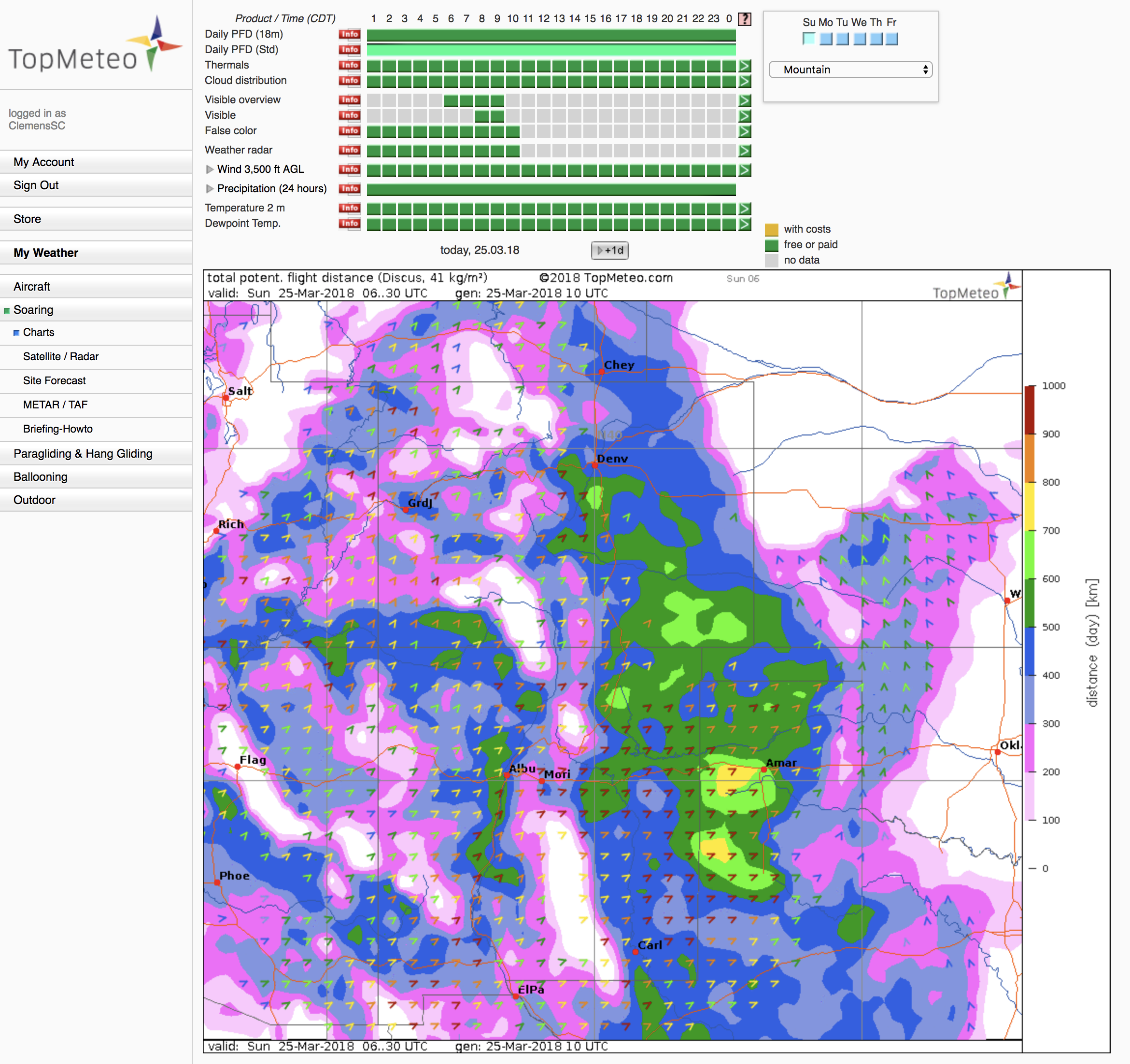
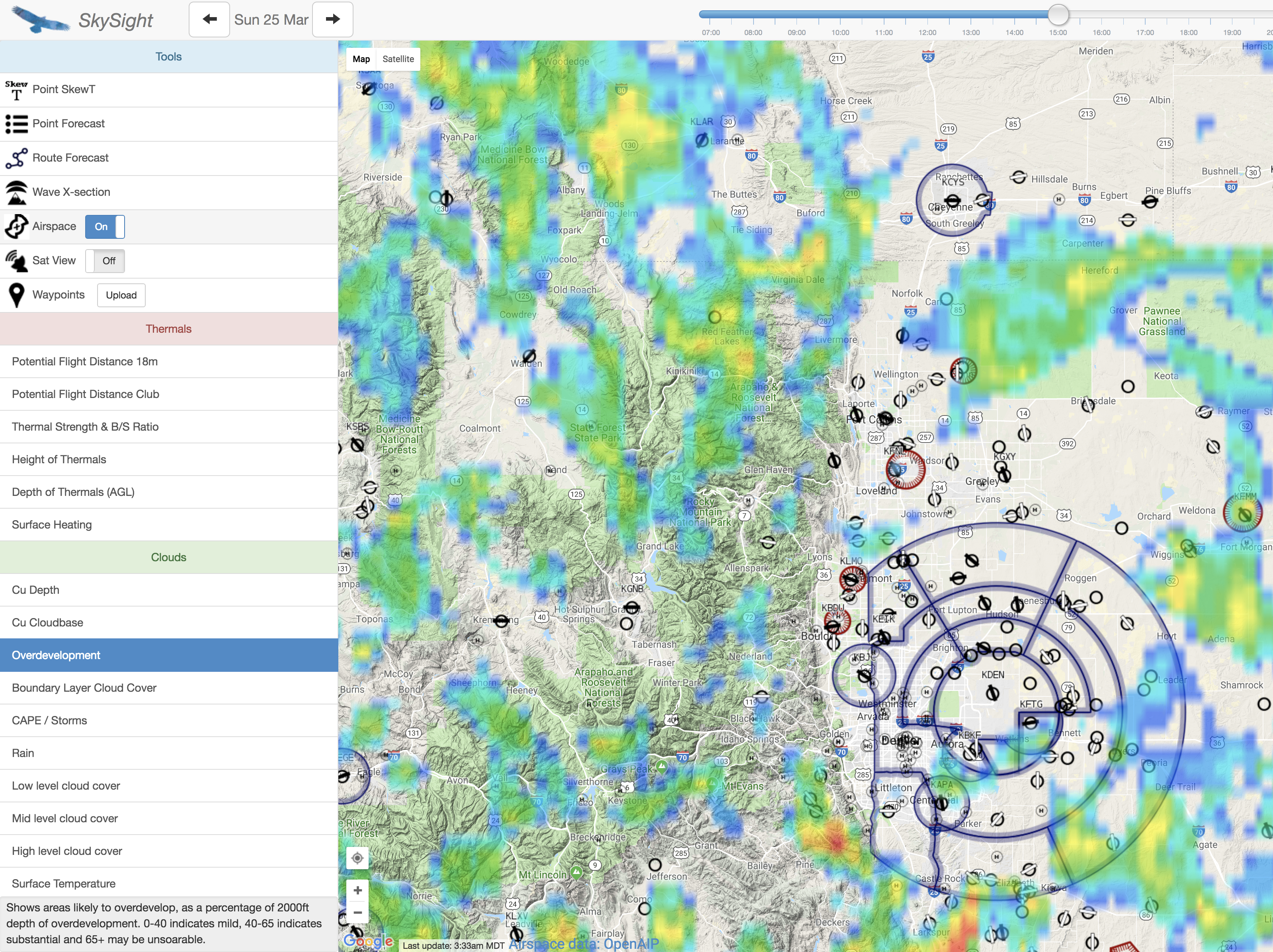
To my amazement, yesterday they all pretty much lined up, forecasting moderately strong thermals between 11:30AM and 5PM MDT, attractive attainable flight distances, no risk of overdevelopment, and an amazing 100+ mile convergence line all along the foothills.


The thin cirrus shield above the plains soon dissolved after sunrise and the day started out under cloudless blue skies.
I planned on a takeoff around 12:30PM MDT. When I arrived at the airport around 11 AM the sky looked just like the forecast. A long line of cumulus clouds had already formed to the west of the Boulder airport, stretching from Golden, CO to the north as far as the eye could see.
I hadn’t rigged a plane in more than four months and things went slower than I had expected. There was also a lot of activity at the airfield as many pilots had turned out for their spring checks and by the time I was ready to get in the air it was already past 1PM.
In the meantime the clouds had developed much faster than projected and when I finally took off around 1:20PM, the sky had become completely overcast.
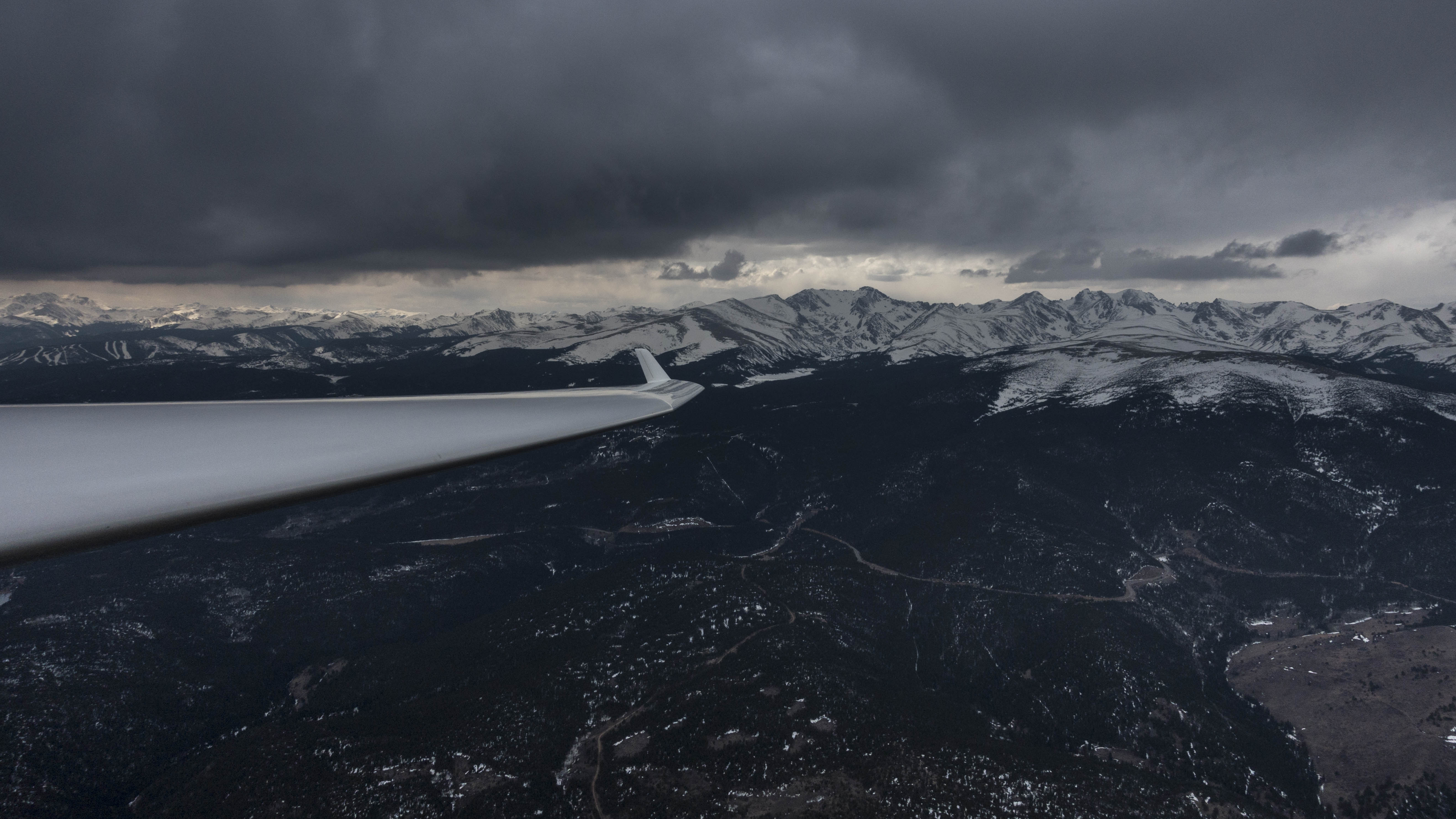
There wasn’t much lift as I followed the towplane into the foothills where I hoped to find rising air from the convergence. The clouds were dense and grey and I could not discern where the best lift was likely to be. With my hand on the release I followed the tuck for a long time and finally set myself free in weak lift over the mountain hamlet of Ward at an altitude of 11,000 feet.
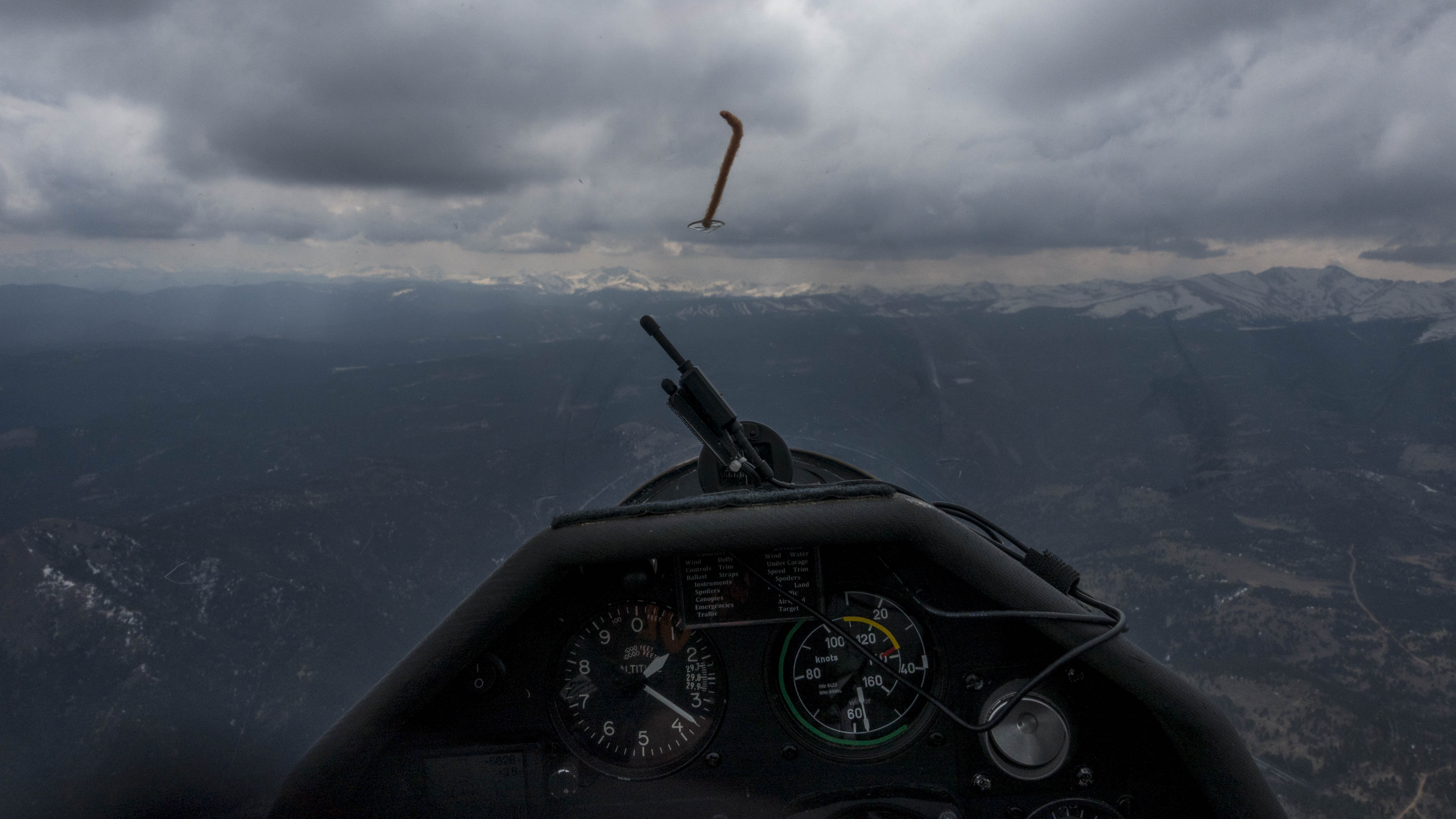
I looked all over the sky around me and still detected very little movement in the clouds. I was able to hold my altitude in the narrow, broken lift and was basically just buying time to see if the conditions would change. I was also at the bottom of a wind shear layer and had to pay attention not to stall each time when I turned into the direction of the wind.
After more than 10 minutes of parking in the sky I saw than the sun had broken through the clouds a few miles further to the east, directly warming a south facing slope. I held my position for another five minutes to give the slope some time to warm the air before making my move.
By the time I got there the slope was already in the shade again and I was doubtful that five minutes of sunshine could have made much of a difference. However, to my surprise the slope actually worked. The lift wasn’t strong but I managed to climb about 1,000 feet in six minutes before the energy was exhausted. In the absence of clear indications in the clouds, the same strategy helped me locate my next lift as well.
Then the weather changed. The clouds over the plains started to dissolve and once again I headed for the area that was in the sun. I followed the first row of foothills where the canyons open up towards the plains. There are several bowls into which an easterly wind from the plains gets funneled. Yesterday there was a light wind from the southeast at the lower levels. Combined with the afternoon sun (shining from the southwest) I was hoping to find lift above one of these bowls.
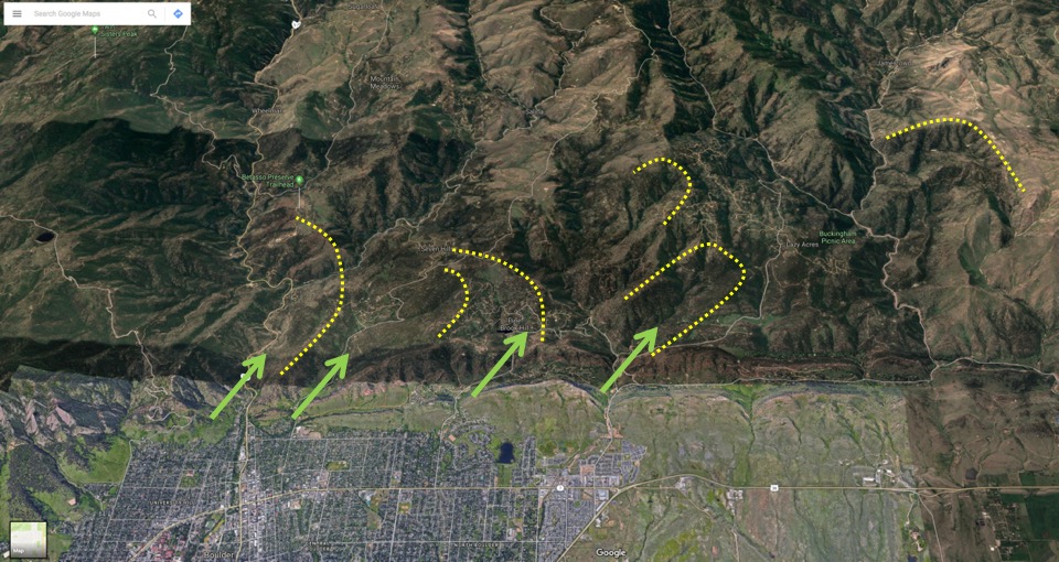
I crossed over these bowls flying from north to south (from right to left on the map above) and found my best climb of the day in the Seven Hills area (the second such indicated bowl from the left) allowing me to climb from 7,500 to 10,500 feet in about 12 minutes.
As I was climbing, dark clouds began to rapidly form once again. Unlike earlier in the day they were much better organized and provided much clearer indications of the areas of lift. I followed a cloud street a few miles north where I effortlessly climbed to cloud-base. Then I pushed south-west under another row of dark clouds where I finally topped out at 12,000 feet, my highest altitude on this flight.
Once again, the sky had completely overdeveloped. Heavy snow showers had engulfed the peaks around Rocky Mountains National Park, about 25 miles north of my position. With the sun completely shielded off, the thermals rapidly weakened once again. Even under the completely closed ceiling there was still enough lift to stay in the air. However, climbing was slow and after a while I lost interest in flying holding circles and decided to return to the airfield.
Here’s a link to the flight track.
Lessons Learned
- Five minutes of sunshine can be enough for thermals to form. If the temperature profile is right (i.e. the air is sufficiently unstable), it doesn’t take long for the sun to heat the ground for thermals to develop. The sun at the end of March is already quite powerful.
- When the clouds don’t tell you much, the ground can. For the first 90 minutes of today’s flight I was unable to read the clouds for indications of lift. Observing areas where the sun broke through the clouds to warm the slopes, and overlaying my understanding of the direction of the wind helped me identify areas of lift.
- Weak thermals can even persist in a completely overcast sky. Thermals definitely weakened when the sky was completely grey and overcast but there was still enough lift to stay airborne.
- Parking in weak lift can pay off. When the sky over-develops and the thermals dramatically weaken it may pay off to hold on to a spot with weak lift where you can hold your position and wait for conditions to change. Had I not done this, I would have landed within 40 minutes of releasing. I just waited long enough for the sun to break through the clouds and warm certain areas long enough for new thermals to form.
- Stalls can happen very quickly when thermaling in wind-shear conditions. Finding the best speed to fly when circling in narrow, broken lift can be quite tricky. At my first climb of the day staying in lift required steep circles flown just above minimum speed. I was coming up to a wind shear layer and once in three circles or so I was hit by a gust from behind that was sufficiently strong for my flying speed to drop below stall. Small, hard-fought altitude gains can quickly be lost in a stall and then the slow and steep thermaling technique becomes quite inefficient. At one point my inside wing dropped and I had to quickly correct with opposite rudder. Flying so slow is definitely a no-no when close to the ground (I was at least 2,000 feet AGL and there were no other gliders around so safety was not an issue.)
- The weather forecast can be wrong even when all forecasts agree. I learned that I cannot rely on the forecast even when all forecasting tools say the same thing. None of the forecasts for yesterday predicted any over-development. Forecasts are still far from perfect even when based on data collected just a few hours before the flight.