In the past 15 years three National Championships were held in Montague, CA. These events were always held between the middle of June and early July, so the conditions should be more or less representative of what to expect in 2020.
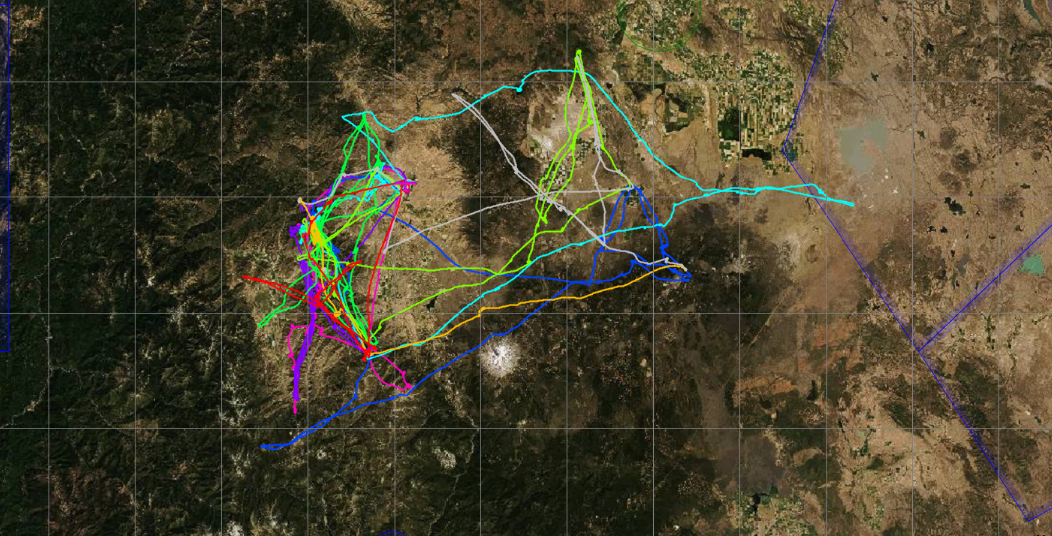
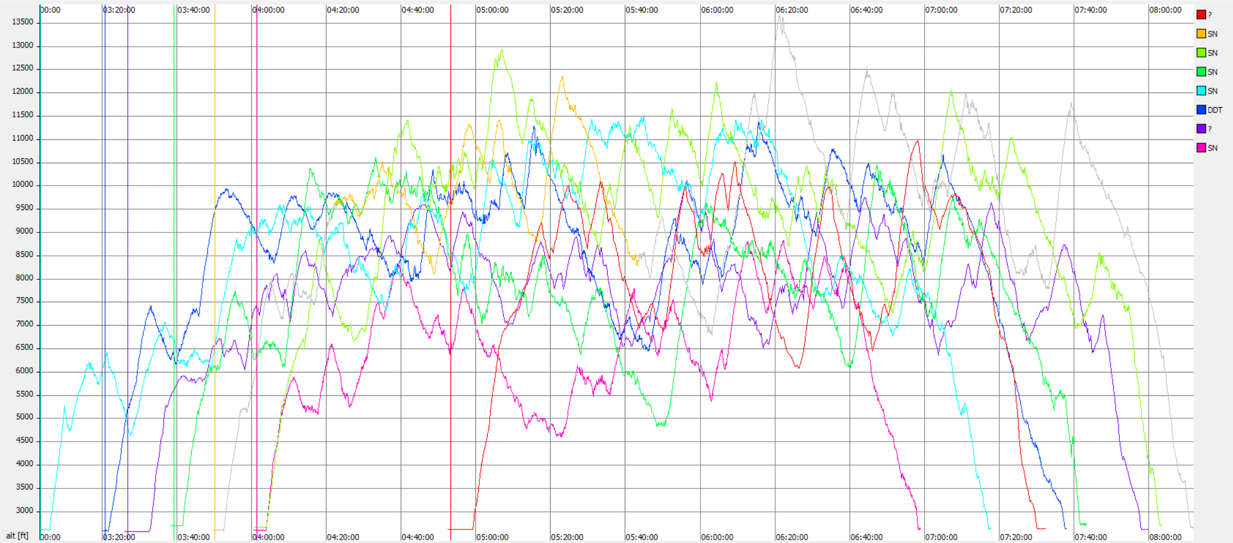
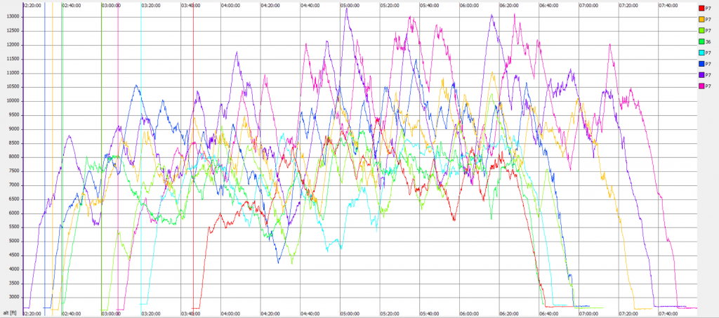
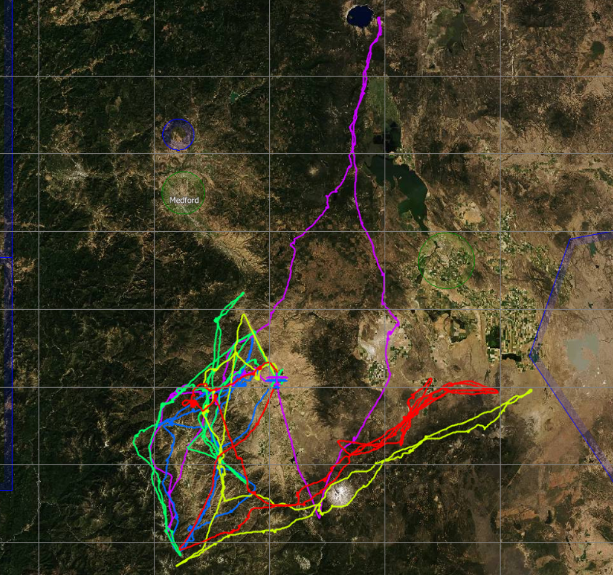
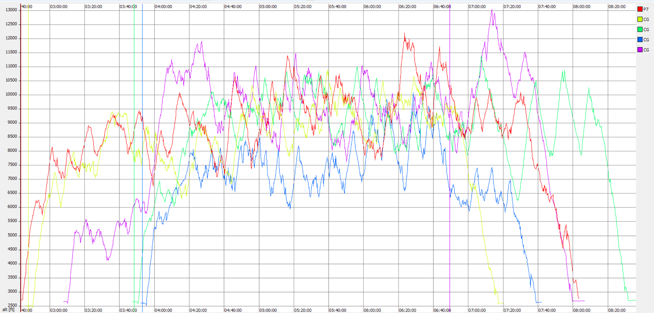
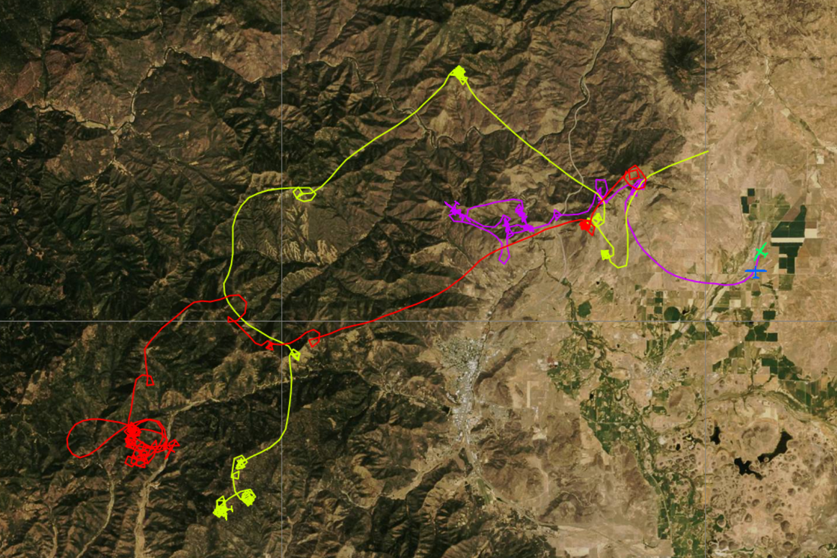
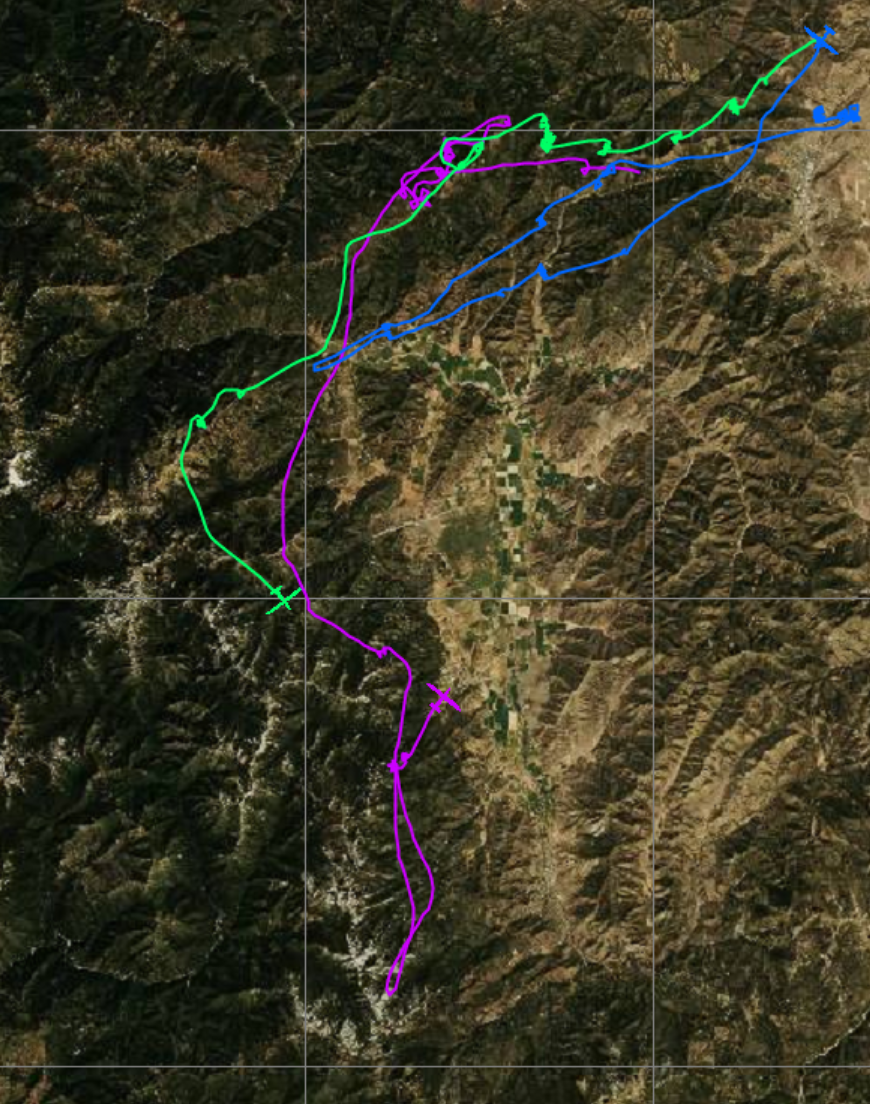
Illustrated below are the flight traces of the day’s winners from each of these events followed by an altitude chart, grouped per contest. I.e., each of the images depicts multiple flight traces. Each of the traces is from a different soaring day. There is only one trace shown per day. In most instances this is the trace of the day’s winner. (If the file of the winner was unavailable, I included a trace from one of the top finishers instead.)
The purpose of these charts is to illustrate the flight routes that were flown on each of the different contest days by the winner of the contest day. In aggregate, this provides a good indication of the typical task area when flying from Siskiyou County airport, located in Shasta Valley north of Montague, CA. The traces also provide a good indication of typical lift lines and give a sense of what areas to avoid (typically the valleys).
Sports Class Nationals 2008
Standard Class Nationals 2009
18m Nationals 2012
Overall Insights and Observations
The following comments are synthesized based on the analysis of the flight traces above:
- Whether the launch is to the north or to the south, the typical tow route in the morning is to the northwest of the airport with the first climbs found above the hills 4-5 miles northwest of the airport (see below)
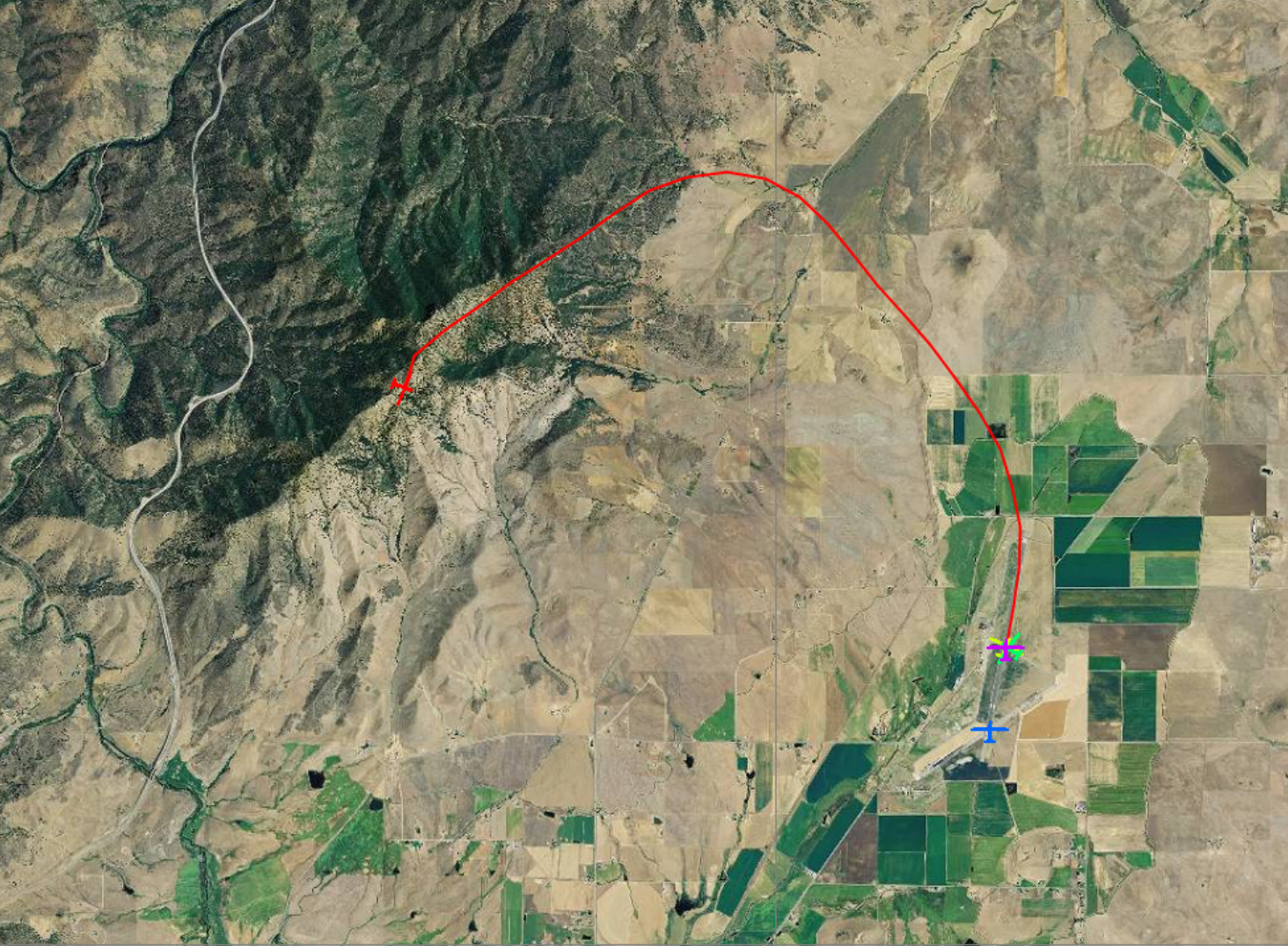
- From there, pilots transition to higher terrain further west, northwest, or southwest (see below). The first climbs can be fairly limited with altitudes sometimes capped as low as 5500 – 6500 feet until pilots are able to get above the higher terrain where morning climbs tend to top out between 7000 and 9000 feet.
- Tasks tend to start above the high terrain west of the airport. The first task legs tend to be either south (along the mountain range to the west of the Shasta Valley), or west-south-west (following the mountains north of the Scott Valley)

- If cloud bases are relatively low, task setters tend to select tasks that route pilots to the west along the mountains north of the Scott Valley, then frequently going south along the mountains to the west of the Scott Valley (see image).
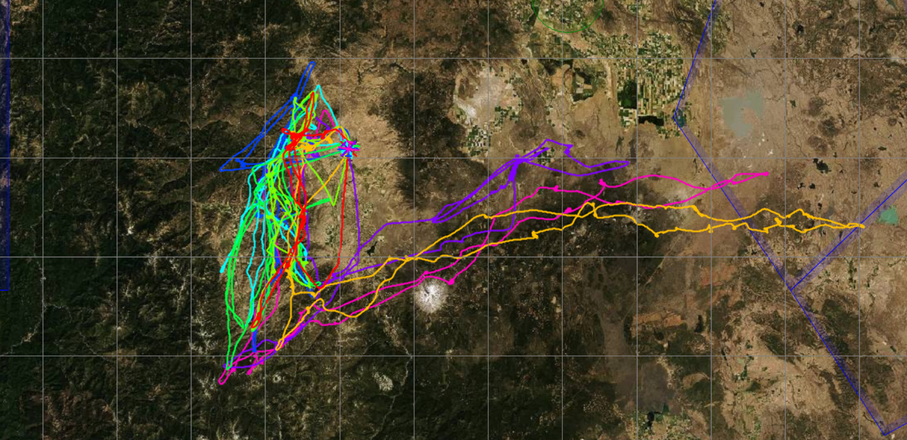
- The following chart shows all winning flights from all three competitions combined. If conditions are particularly good, task setters like to set tasks going east. Notice that they almost all follow the same pattern of first heading south along the ridge line west of the Shasta Valley, then continue in east-north-easterly direction past Mount Shasta, and eventually backtracking along the same route west-south-west before heading home.
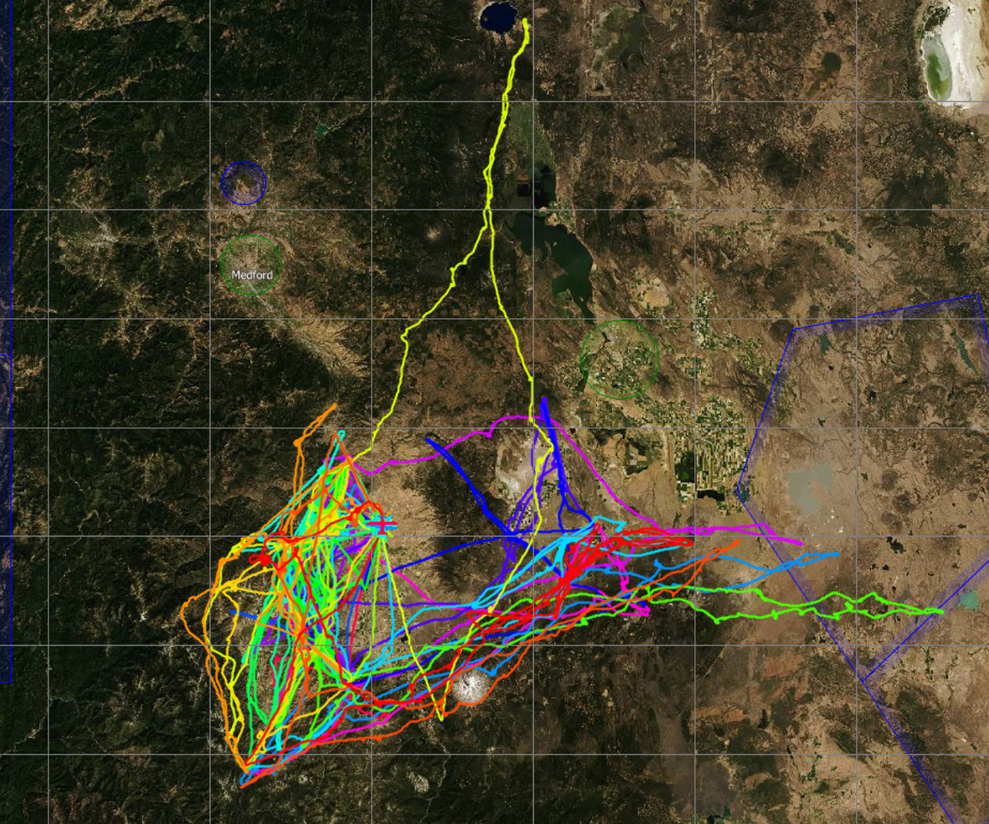
- Note from the chart above that almost all flight traces follow the high terrain. Pilots in particular avoid the Shasta Valley – the only traces that run through the valley are to either cross it (as demanded by the task), or when the pilot is on final glide. This indicates that the soaring conditions in the valley are likely very poor.
- Almost all crossings of the Shasta Valley are to the south between Mt. Eddy and Mt. Shasta.
- Most days in June seem to be soarable. The 2008 and 2009 contests could be completed without cancellations. In 2012 the weather was less favorable and 3 out of the 9 days had to be cancelled.
- Lift used by pilots is typically a mix of thermals and convergence. There can be wave lift in the lee of Mt. Shasta but it does not seem to be usable for XC flights.
- Cloud bases tend to be higher to the east than to the west. (However, this could be biased by selection, i.e. task setters tend to set easterly tasks when the conditions are strong and bases are higher anyway.)
- Strong winds were rarely a factor at these three contests. Winds were usually calm. Only on 4 out of 22 days were the winds occasionally stronger than 10kts. They never exceeded 20 kts. (Note however, that there was an accident at a prior Montague contest in 2001 when a Nimbus 3 flipped over when landing in 20kt westerly winds gusting to 30. The pilot was injured.)
- One of the biggest challenges when flying out of Siskiyou County Airport are the relatively low cloud bases. This means, one flies very often relatively close to mountainous terrain. Knowledge of landable places and maintaining a safe escape route at all times is critical.
In addition, the following insights are based on pilot comments on OLC.
- Crossing the Shasta Valley is very tricky when cloud bases are low.
- The lower slopes of Mt. Shasta do not work well (this seems to be due to the cold water run-off from the mountain with cool lakes and forests along the slopes). This means that is is particularly important to gain as much altitude as possible before crossing the Shasta Valley from the west to the east and arrive at the slopes along Mt. Shasta as high as possible.
- There seems to be some tricky (unlandable) terrain northeast of Mt. Shasta – do not get low there.
- Pilot reports give no indication of severe weather (i.e. thunderstorms). OD and rain showers were reported on some days. There were only one or two comments about blue conditions.